
GIS in Education - PowerPoint PPT Presentation
1 / 124
Title: GIS in Education
1
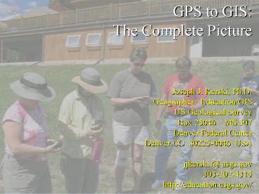
GPS to GIS The Complete Picture Joseph J.
Kerski, Ph.D. Geographer Education/GIS US
Geological Survey Box 25046 MS 507 Denver
Federal Center Denver CO 80225-0046
USA jjkerski _at_ usgs.gov 303-202-4315 http//educa
tion.usgs.gov/
2
- Presentation Goals
- What is Spatial Thinking?
- Why use GPS together with GIS?
- 3. How to bring in GPS coordinates
- and field data into mapping and GIS software
- so that they can be analyzed spatially.
3
- Joseph Kerskis Role
- Educational Partnerships
- Teaching 40 workshops annually
- Curriculum Development
- Advising and Technical Services
- Research in the Effectiveness and
- Implementation of GIS in Education
4
4 H-ers ... ROCK!
5
US Geological Survey Science for a Changing
World
6
(No Transcript)
7
(No Transcript)
8
(No Transcript)
9
I hate this job...not!
10
What is Spatial Thinking? The Whys of Where.
11
Name some issues of concern in Your
community Your region The World
why do
12
Why Spatial Thinking? SARS/West Nile Virus Fires
in California National Security Foot and Mouth
Disease Climate Change Urban Growth Sustainable
Agriculture Coastal Erosion Natural Hazards Water
Quality and Availability
why do
13
- 2004 US Secretary of Labor identifies
geospatial technology as one of the 3 most
important evolving fields. - Emily DeRocco, US Dept of Labor Employment and
Training Administration 2005 budget includes
1.6 billion for secondary, technical, and adult
education programs. - US Department of Labor High Growth Job Training
Initiative, by Secretary Chao.
14
But 3,000 to 4,000 annual USA shortfall of
individuals with an advanced level of GIS
edcuation Assistant US Secretary for Labor and
Training in US Dept of Labor indicates that 87
of geospatial providers had difficulty filling
positions. DOL investing 250 Million for
community college GIS programs.
15
High School Dropouts 20 are in the lowest ¼
income 3.5 are in the highest ¼ income 53
employed 14 unemployed 33 not in the labor force
16
How Big Is GIS? Sales of GIS hardware, software,
data, and services 5 Billion in USA
2006 Geospatial Technology Market 30
Billion 175,000 employees in geospatial in
USA 4 Million GIS users worldwide
17
Spatial Data Use and Awareness In Societies Is
Increasing
18
Spatial Data Use and Awareness In Society Is
Increasing
Used with Permission from Jeep Inc.
19
(No Transcript)
20
Hurricane Ivan 13 Sep 2004
21
(No Transcript)
22
- Presentation Goals
- What is Spatial Thinking?
- Why use GPS together with GIS?
- 3. How to bring in GPS coordinates
- and field data into mapping and GIS software
- so that they can be analyzed spatially.
23
GIS provides a means to look at issues
Population
Biodiversity
Geology
Land Use
Environmental Considerations
from multiple perspectives and disciplines
24
GIS and GPS are tools for implementing geographic
thinking.
Deciding
Measuring
- Multidisciplinary
- Integrated
- Holistic
Planning
Thinking
Analyzing
25
GIS provides new ways of visualizing data and
detecting patterns of human and environmental
interactions.
26
(No Transcript)
27
Context and Content Location - where is
it? Place what is it like?
- Seeing the Whole
- Managing Places
- Watersheds
- Communities
- Neighborhoods
- Ecosystems
- Patterns
- Linkages
- Trends
28
- GIS is a tool to enhance
- instruction because it is
- Multidisciplinary
- A real-world technology using real data
- Involves authentic tasks and assessments
- Encourages community connections
- Used at scales from local to global
- Tied to education standards
29
More reasons why
- Inquiry-based
- Team-based
- Problem-solving approach
- Project-based
- Engaging
Process is just as important as the
product (Constructivism)
30
Blooms Taxonomy
Evaluation
Synthesis
Analysis
3 Types of Learning Cognitive Affective Psychomo
tor
Application
Comprehension
Knowledge
31
GIS allows students to study local and global
phenomena and it can incorporate field
work. Last Child In the WoodsLouv
32
Thinking Spatially The Incorporation of GIS
Across the K-12 Curriculum The National Academy
of Sciences
33
Now more than ever, we need people who think
broadly and who understand systems, connections,
patterns, and root causes how to think in whole
systems, how to find connections, how to ask big
questions, and how to separate the trivial from
the important. --David W. Orr, Earth In Mind
On Education, Environment, and the Human
Prospect, 1994
34
- Presentation Goals
- What is Spatial Thinking?
- Why use GPS together with GIS?
- 3. How to bring in GPS coordinates
- and field data into mapping and GIS software so
that they can be analyzed spatially.
35
Base Mapping Data what you will plot your
coodinates and field data onto DRGs Digital
Raster Graphics scanned topographic maps DOQs
Digital Orthophotoquads scanned aerial
photographs DEMs Digital Elevation Models DLGs
Digital Line Graphs (roads, rivers, etc.) NHD
Hydrography networks, watersheds NLCD National
Land Cover Data SSURGO Soils Maps TIGER files
and Census Demographics Satellite Images and
MORE.
36
The FGDCs Geospatial One-Stop www.geodata.gov
37
The National Map Viewer nationalmap.gov
38
National Atlasnationalatlas.gov
20 Federal Agencies 175 Data Layers
39
TerraServer terraserver-usa.com
USGS 1m aerial photographs and 2m
topographic maps for viewing and for
downloading Into a GIS.
Keystone Colorado
40
Black Canyon National Park
DOQ
DRG
41
TerraServer Tool support.esri.com
Automated tools for downloading seamless DRGs and
DOQs for area displayed in ArcView 3 and ArcGIS 9.
Keystone Colorado
42
Two Main USGS Data Portals EDC FTP
Site http//eros.usgs.gov/pub/data/ Earth
Explorer http//earthexplorer.usgs.gov 1 888
ASK USGS
43
- Map Indexes
- (1) www.maplink.com
- (2) 24K, 100K, 250K .shp files indexes in
Lambert Projection - www.geocomm.com/faq/1.html
- (3) mapping.usgs.gov
- Then MapFinder
44
- Topographic Maps
- 3 coordinate systems lat/long, UTM, state plane
45
Obtaining Base Spatial Data from Commercial
Portals www.gisdatadepot.com www.mapmart.com
Note Some of the data on commercial sites is
free.
46
Obtaining Landsat Data Purchase earthexplorer.
usgs.gov or 1 888 ASK USGS Landsat Global
Viewer glovis.usgs.gov Useful Educational
Site earthshots.usgs.gov These are historical
Images of Landscape Change across the world,
including Aral Sea, Yellowstone, Brazil, Egypt,
Iran, and more.
47
- Obtaining Landsat
- Path and Row
- Landsat Global Viewer
- glovis.usgs.gov
- Graphic
- http//ltpwww.gsfc.nasa.gov/IAS/handbook/handbook_
htmls/ - chapter5/htmls/wrs_graphic.html
- 3) A converter from lat-long to path-row
- http//landsat7.usgs.gov/wrsconvert/index.html
48
Obtaining NHD 24K and 100K nhd.usgs.gov/data.h
tml There is also a back-up FTP site
here. Purchase Earthexplorer.usgs.gov or 1
888 ASK USGS
49
Obtaining NED seamless.usgs.gov Information
edcnts12.cr.usgs.gov/ned/ Purchase Earthexplo
rer.usgs.gov or 1 888 ASK USGS
50
Seamless Portals http//seamless.usgs.gov Acces
s to NED, SRTM, and NLCD by user-defined
box. http//gisdata.usgs.net Access to Global
Land Cover, NED, NHD, NLCD, and
more. http//geode.usgs.gov Geode displays all
types of geologic data including data sets from
each of the USGS Geologic Discipline's programs
including Coastal and Marine Geology, Earth
Surface Dynamics, Earthquake Hazards, Integrated
Natural Resource Sciences, Mineral Resources,
National Cooperative Geologic Mapping, Volcano
Hazards.
51
- USGS Data Via Other Portals
- NRCS Lighthouse Data Depository
- http//lighthouse.nrcs.usda.gov/gateway/gatewayhom
e.html - Critical Themes
- Orthoimagery
- Digital orthophoto quadrangles (DOQ)
- County mosaic of orthoimagery
- Satellite orthoimagery
- Soils
- Common Land Unit (CLU)
- Cultural and demographics
- Census tract boundaries
- Census of Population and Housing
- Census of Agriculture
- Economic census
- Non-Geospatial Data Themes
- Soils (NASIS)
- Plants (National Plants Database)
- Climate
52
- Non-Critical Themes
- Governmental units and place names
- State and county boundaries, Minor civil
divisions, Incorporated places and consolidated
cities - Indian lands, Geographic Names and Information
System (GNIS) - Elevation
- Hydrography
- Cadastral
- Public Land Survey System (PLSS)
- Military reservations, National forests, Bureau
of Land Management (BLM) lands, National parks - Transportation (Roads)
- Digital Raster Graphic (DRG) Scanned USGS quads
- Land cover/vegetation/plants
- Watershed boundaries (10-12 digit hydrologic
units) - Wetlands
- Wetland and floodplain easements
- Climate - precipitation and temperature
- Flood hazards
- USDA Office Information Profile (OIP)
53
Statewide and Regional GIS Data
Distributors University of Virginia http//fisher
.lib.virginia.edu/collections/giscoll/US_statelist
ings.html Spatial Data Sources http//ncl.sbs.oh
io-state.edu/5_sdata.html U.S. State and Local
GIS Data Resources http//sunsite.berkeley.edu/GI
S/gisdatas.html State GIS Data
Resources http//icg.harvard.edu/maps/hgis/hgis_
sta.htm InfoNet http//home.earthlink.net/rpmi
nfonet/spatial.html
54
Spatial Data From Other Organizations Land Cover
Characterization Program Links http//landcover.
usgs.gov/otherorganizations.asp
55
Other Base Spatial Resources
- TIGER/Demographic Files
- http//www.esri.com/data/download/
- census2000_tigerline/index.html
- Digital Soils Data
- http//www.ftw.nrcs.usda.gov/ssur_data.html
56
Other USGS Data
- Real-Time Earthquake Data
- wwwneic.cr.usgs.gov/neis/bulletin/bulletin.html
- Real-Time Hydrographic Data
- water.usgs.gov/nwis/rt
- On-line Educational Lessons
- rockyweb.cr.usgs.gov/public/outreach/
- education.usgs.gov
- National Geologic Maps Database
- ngmdb.usgs.gov
- Spatial Data about Energy Resources
- greenwood.cr.usgs.gov
- energy.cr.usgs.gov/oilgas/noga/index.htm
57
Training Resources
- On-line Educational Lessons
- rockyweb.cr.usgs.gov/outreach/
- and
- education.usgs.gov
- Online 10-Module GIS Course Assignments, Data,
Readings - rockyweb.cr.usgs.gov/outreach/sgu/sgugis.html
- GeoTech Colorado 2006 29 July 3 August 2006
Boulder, CO - Schedule of conferences and Workshops in which
the USGS Participates - rockyweb.cr.usgs.gov/outreach/calendar.html
58
- Methods of Bringing GPS Coordinates Into a
Spatial Analysis Environment - Methods
- A. Manual
- B. Automated, with cable
- via
- 1. Uploading Software Free and Licensed
- Web-Mapping Services
- Mapping Software Free and Licensed
- Virtual Globe Software Free and Licensed
- 5. GIS Software Free and Licensed
59
- Manual Method
- Collect points, write them down, and manually
enter into a Notepad file via a - text editor (Notepad, WordPad, SimpleText,
etc.) - or
- spreadsheet (Excel, ClarisWorks, etc.)
60
Automated Method Collect points, store inside
GPS unit, and with cable, upload the points into
the computer, into either a DBF or a TXT file, or
even as a GIS-ready file (such as a Shapefile
(SHP)).
61
Cautionary Note! Remember, no matter which
method you use, Youre not Done when you just
map the coordinates Map the field data that
occurs AT the coordinates! soil moisture, water
pH, air temperature, humidity, tree height,
pieces of litter, object name, animal species,
trail name
62
- Methods of Bringing GPS Coordinates Into a
Spatial Analysis Environment - Methods
- A. Manual
- B. Automated, with cable
- via
- 1. Uploading Software Free and Licensed
- Web-Mapping Services
- Mapping Software Free and Licensed
- Virtual Globe Software Free and Licensed
- 5. GIS Software Free and Licensed
63
Demonstration of Manual Method
64
Method 1 Text Editor Collect points and
attributes. In text editor, line 1 should be the
header line, such as "lat, long, pH, groundcover,
O2, etc". Line 2 begins your data, separated by
commas, such as "site1, 39.7022, -107.4832, 5.7,
grassland, 38" Save as Text such as "gps.txt".
65
Method 1 Spreadsheet Collect points and
attributes. In Excel, row 1 should be the header
line, such as "lat, long, pH, groundcover, O2,
etc". Row 2 begins your data, such as "site1,
39.70224, -107.48372, 5.7, grassland, 38" Make
sure you format the latitude and longitude
columns as numbers with at least 6 decimal
places. Save as DBF such as "gps.dbf".
66
- Methods of Bringing GPS Coordinates Into a
Spatial Analysis Environment - Methods
- A. Manual
- B. Automated, with cable
- via
- 1. Uploading Software Free and Licensed
- Web-Mapping Services
- Mapping Software Free and Licensed
- Virtual Globe Software Free and Licensed
- 5. GIS Software Free and Licensed
67
Automated Method Collect points, store inside
GPS unit, upload via cable into computer. This
method varies depending on the type of GPS
hardware you own. The following procedures work
with Garmin receivers. Use other software with
other GPS receivers. Why use automated method
versus manually collecting points and and
entering them into a text file? To (1) reduce
error in transcription and recording and (2)
to expedite the process, particularly if you are
collecting many points.
68
- Methods of Bringing GPS Coordinates Into a
Spatial Analysis Environment - Methods
- A. Manual
- B. Automated, with cable
- via
- 1. Uploading Software Free and Licensed
- Web-Mapping Services
- Mapping Software Free and Licensed
- Virtual Globe Software Free and Licensed
- 5. GIS Software Free and Licensed
69
- Methods of Bringing GPS Coordinates Into a
Spatial Analysis Environment - Methods
- A. Manual
- B. Automated, with cable
- via
- 1. Uploading Software Free and Licensed
- Web-Mapping Services
- Mapping Software Free and Licensed
- Virtual Globe Software Free and Licensed
- 5. GIS Software Free and Licensed
70
1. Clear previous waypoints on GPS unit. Make
sure interface says Garmin to Garmin. 2. Use
mark and save on GPS unit at each new point
collected. 3. Download and run the Garmin tool
from the Minnesota Department of Natural
Resources http//www.dnr.state.mn.us/mis/gis/tool
s/arcview/extensions/DNRGarmin/DNRGarmin.html 4.
Use serial or USB cable to connect your GPS unit
to your computer. Turn on your GPS unit.
71
5. Run MN DNR Garmin tool. Waypoints
Download. Tracks Download. Output shape file
Point (could use line or poly, too). Using
ArcGIS?
72
Demonstration of Uploading Tool Minnesota DNR
Garmin
73
- Methods of Bringing GPS Coordinates Into a
Spatial Analysis Environment - Methods
- A. Manual
- B. Automated, with cable
- via
- 1. Uploading Software Free and Licensed
- Web-Mapping Services
- Mapping Software Free and Licensed
- Virtual Globe Software Free and Licensed
- 5. GIS Software Free and Licensed
74
Demonstration of Web Mapping Services GPSvisual
izer.com
75
(No Transcript)
76
(No Transcript)
77
(No Transcript)
78
Other Mapping Tools Can be used for coordinate
query http//www.mapquest.com/maps/map.adp?latlo
ngtypedecimallatitude40longitude-105
79
Topozone www.topozone.com
80
- Methods of Bringing GPS Coordinates Into a
Spatial Analysis Environment - Methods
- A. Manual
- B. Automated, with cable
- via
- 1. Uploading Software Free and Licensed
- Web-Mapping Services
- Mapping Software Free and Licensed
- Virtual Globe Software Free and Licensed
- 5. GIS Software Free and Licensed
81
TopoGrafixs EasyGPS
Also ExpertGPS
82
- Methods of Bringing GPS Coordinates Into a
Spatial Analysis Environment - Methods
- A. Manual
- B. Automated, with cable
- via
- 1. Uploading Software Free and Licensed
- Web-Mapping Services
- Mapping Software Free and Licensed
- Virtual Globe Software Free and Licensed
- 5. GIS Software Free and Licensed
83
National Geographic TOPO!
84
(No Transcript)
85
Demonstration of TOPO!
86
MapTech Terrain Navigator Pro
87
DeLorme TopoUSA
88
TopoFusion
89
ExpertGPS
90
OziExplorer
91
Fugawi
92
- Methods of Bringing GPS Coordinates Into a
Spatial Analysis Environment - Methods
- A. Manual
- B. Automated, with cable
- via
- 1. Uploading Software Free and Licensed
- Web-Mapping Services
- Mapping Software Free and Licensed
- Virtual Globe Software Free and Licensed
- 5. GIS Software Free and Licensed
93
Virtual Globe Software Skyline Softwares
TerraExplorer NASAs WorldWind Googles
Google Earth ESRIs ArcGIS Explorer
most can read GPS coordinates and plot them on 3D
earth models that you can fly through.
94
(No Transcript)
95
- Methods of Bringing GPS Coordinates Into a
Spatial Analysis Environment - Methods
- A. Manual
- B. Automated, with cable
- via
- 1. Uploading Software Free and Licensed
- Web-Mapping Services
- Mapping Software Free and Licensed
- Virtual Globe Software Free and Licensed
- 5. GIS Software Free and Licensed
96
Demonstration of ArcExplorer Java Edition for
Education (AEJEE)
97
- Methods of Bringing GPS Coordinates Into a
Spatial Analysis Environment - Methods
- A. Manual
- B. Automated, with cable
- via
- 1. Uploading Software Free and Licensed
- Web-Mapping Services
- Mapping Software Free and Licensed
- Virtual Globe Software Free and Licensed
- 5. GIS Software Free and Licensed
98
Demonstration of ArcGIS
99
Access ArcView 3 Tables--gtAdd, Add your table
gps.txt as comma-delimited TXT. View. Add
event theme. Bring in your table as a point
theme. Access ArcGIS 9 ArcMap Tools--gt
Add XY coordinates. Add your table gps.txt as
text file. Bring in your table as a point layer.
Click on layer to make visible. Change legend
to make graduated symbol map based on attributes
you collected.
100
Access ArcView 3 Tables--gt Add, Add your table
gps.dbf as Dbase file. View --gt Add event
theme. Bring in your table as a point theme.
Access ArcGIS 9 ArcMap Tools--gt Add XY
coordinates. Add your table gps.dbf as Dbase
file. Bring in your table as a point layer.
Click on layer to make visible. Change legend
to make graduated symbol map based on attributes
you collected.
101
ArcView and ArcGIS Extensions Try the GPSi in
ArcGIS. Download from http//arcscripts.esri
.com/details.asp?dbid12749 GPSi (GPS Interface)
is an ArcMap Toolbar that allows users to
communicate with Garmin handheld GPS units. It
was developed to allow users to rapidly
download/upload data directly from ArcMap. The
software uses the Garmin protocol to communicate
with the GPS unit and will not function with
other GPS brands.
102
Additional Notes Be Aware of Datums I
collected in NAD 27 and placed the points on top
of a USGS DRG in NAD 27. Why were the points all
shifted to the west of where they should be? I
thought initially that I was wrong about the
datum of the DRGs I was using, but most of the
DRGs are indeed in NAD 27 unless theyre from
Terraserver. Here is what apparently caused
it In the Waypoint software itself, there is a
setting where the user must explicitly choose NAD
27. If you don't select this, it apparently
shifts the coordinates to NAD 83, even though
those I was training collected in NAD 27 on the
GPS unit! So, make sure you check this if you're
automatically uploading using WayPoint in the
future. When I did this, the points plotted
right where they were supposed to.
103
Also There IS a setting in Waypoint that allows
the points to be brought in as UTM, rather than
importing them in as Lat-Long. This will allow
you to view the points table (or lines or
polygons if you choose to bring them in as such)
as UTM, negating the need to change the view
properties to UTM in ArcView. Either collect in
latitude/longitude or UTM. If lat/long, and if
you use a USGS DRG or DOQ, you must change the
VIEW properties in order to view these correctly
on top of the base layers. If you collect in
UTM, no view properties setting is required.
104
Demonstration of Downloading Topographic Map and
Digital Orthophotoquad from Terraserver See
complete procedures, as well as new ESRI
Terraserver tool, on http//education.usgs.go
v/common/lessons/terraserver.html
105
(1) Visit www.terraserver-usa.com. Type in
a specific place and press Go. (2). First,
select a TOPOGRAPHIC MAP of the area you are
interested in. Continue zooming and panning
until the area you want is in the view. Make
the image size LARGE using the button above the
map. You can zoom in until the zoom factor is 2
meters. (3). Select DOWNLOAD in the upper
right hand corner of the image. Click on the
FREE DOWNLOAD arrow to redraw the image.
106
(4) After the image has redrawn, right-click on
the image and SAVE AS ltfilename_drggt.jpg For
example, oakcliff_drg.jpg (5) Click on the
WORLD FILE link to open the registration file for
the image in the browser window. Go to FILE gt
SAVE AS ltfilenamegt.jgw For example,
oakcliff_drg.jgw Be sure to save this as a TEXT
file, not HTML. Also, it must have the same
base name as your JPG file, above.
107
(6). Go back to the browser window where your
topographic map is (before you downloaded it).
Click on IMAGE to see a DOQ of that same area.
(Note92 of the country has images on
Terraserver at present). The procedures for the
DOQ are similar to that for the DRGs that you
followed above. Make sure the image is LARGE.
(7). Select DOWNLOAD in the upper right hand
corner of the image. You will see a screen
similar to that below. Click on the FREE
DOWNLOAD arrow to redraw the image. (8). After
the image has redrawn, right-click on the image
and SAVE AS ltfilename_doqgt.jpg For
example, oakcliff_doq.jpg. (9) Click on the
WORLD FILE link to open the registration file for
the image in the browser window. Go to FILE gt
SAVE AS ltfilenamegt.jgw. Be sure to save this
as a TEXT file, not HTML. For example,
oakcliff_doq.jgw Also, it must have the same
base name as your JPG file, above. (10). In
ArcView, turn on the JPG reader extension and add
your images as IMAGE THEMES. If they do not
appear, be sure to check your file names on your
system.
108
Had enough? Even easier is to use the ESRI
Terraserver tool, described on
http//education.usgs.gov/common/lessons/terrase
rver.html
109
Recommendations for Spatial Thinkers
110
Start with the basics.
111
GIS and GPS are not about making pretty
maps.They are about analyzing the Earth and
its people.
112
GIS is not plug and play.BUT, you do not
have to be an expert to use it.
113
GIS and GPS as a set of tools and methods are
not the End, but a MEANS to the End!
114
Not everyone will learn the same thing.
115
Dont do it just for the sake of doing it
digitally.
116
Literacy
I understand there are people who do not much
care for maps, and I find that hard to
believe. --Robert Louis Stevenson, Treasure Island
5x 3y 37 -8x 9y 66
Graphicacy
Numeracy
117
Argh! This is difficult to tackle
alone. Therefore, network! It is a group effort
! NCGE, NCSS, NSTA
118
The students WILL use GIS and GPS because they
can engage with it. However, the instructors
role is critical in framing inquiry-based
questions.
119
Use local problems and data Be as hands-on as
possible There ARE other toolsuse them!
120
Be aware of the limitations and cautions about
using technology. We drive the technologynot
the other way around. Have a back up
plan. Geotechnologies are no substitute for
fieldwork, critical thinking, etc. they are
aids to that end.
121
- The Approach
- Not How can we get GIS into the curriculum?
- But How can GIS help meet our curricular
goals?
122
What we see depends mainly on what we look
for. --John Lubbock
123
(No Transcript)
124
The trouble with education is that the best
teaching methods are in fact the most
difficult. --Piaget, Jean. 1929. The Childs
Conception of the World. London Routledge.
125
Let the students fly!
126
- Seek and nurture partnerships
- with K-12 schools,
- the community,
- universities,
- private companies,
- nonprofit organizations,
- government,
- professional societies, others
because One is the Loneliest Number
127
Challenge Link the concern about Earths
environment, hazards, cultures, politics to
geography and spatial thinking.
128
The Consequences If societies do not know how
to think spatially
129
Think.
130
(No Transcript)
131
Exactly
132
Spatial Thinking
Indeed !
133
Joseph J. Kerski Geographer USGS Box 25046 MS
507 Denver CO 80225-0046 USA jjkerski_at_usgs.gov h
ttp//education.usgs.gov 001-303-202-4315 001-303-
202-4137 Fax Ka Mutu The End
Recommended
CrystalGraphics Presentations


