
REVIEW: Glacier classification - PowerPoint PPT Presentation
1 / 86
Title:
REVIEW: Glacier classification
Description:
Rock drumlins have the profile of true drumlins (steeper end upglacier) but are ... Yosemite Striations. 3. What are the possible directions of glacial movement? ... – PowerPoint PPT presentation
Number of Views:111
Avg rating:3.0/5.0
Title: REVIEW: Glacier classification
1
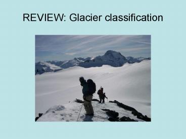
REVIEW Glacier classification
2
Major types of glaciers (morphological
classification)
- Cirque glaciers
- Mountain glaciers
- Form in amphitheater-shaped depressions (called
cirques!) - Size-few kilometers
- Valley glaciers
- Streams of ice that flow downvalley from a cirque
- 100s of km
- Piedmont glaciers
- Glaciers that discharge ice from mountains onto
broad lowlands - Ice becomes unconfined
- Ice sheets
- Bread ice masses not confined to valleys, massive
thicknesses of ice - 1000s of km
- Creates its own topography, creates isostatic
depression
3
Types of Glaciers Cirques
4
Cirque glacier
5
Little Ice age cirque of the Teton Glacier
6
Valley glaciers
7
valley glacier
8
Valley glacier
9
Valley glacier complex Denali NP
10
Valley glaciers
11
Ice sheet
12
Types of glaciers ice sheets
13
Ice caps on Iceland
14
Wet based (temparate) vs. cold based (polar)
glaciers
- Wet-based or temperate glaciers
- Glaciers at pressure melting point that slide on
a layer of liquid water (large component of basal
sliding) - Lots of meltwater, higher velocities, more
erosion - Cold-based or polar glaciers
- Glaciers are stuck to their bed. These glaciers
are characteristic of cold, polar areas. - No meltwater, minimal slippage along base, lower
velocity, less erosion, less geomorphic work
15
Glacial features cravasses
16
(No Transcript)
17
(No Transcript)
18
Calving Glaciers in Alaska
19
The Earths Climate Past, Present and Future
- Fall 2006
- 440-555PM TuTh
- GEOL 297/ GEOL 397/GEOG 397
20
Weird words in geomorphology!
- arete fishbone
- Roches moutonees rock sheep
- DrumlinGaelic druim the crest of a hill
- Paternoster our father in Latin. Lakes are
thought to resemble a rosary with alternating
beads and string (streams) inbetween them.
21
Glacial landforms erosion and deposition
- Glaciers ERODE landscapes by scraping underlying
bedrock, pushing debris along the sides and front
of a glacier, and carrying material on and within
the glacier
22
Glacial landforms erosion and deposition
- Glaciers DEPOSIT material that has been eroded on
the ground (till) along margins (moraines) and as
material reworked by streams (outwash)
23
Class presentations striations and chattermarks
24
Glacial erosional features
- Striations
- Scratches on rocks from debris at base of glaciers
25
Glacial ErosionAbrasion
- Grinding by transported grains of silt and
larger sizes. - Effects polish, striations, grooves.
- Embedded fragments shared these features as
well as facets.
Longitudinal glacier flow
Debris particle paths
Diverging ice flow
26
Glacial ErosionAbrasion
- Evidence
- Polish, striations, grooves, facets (on clasts)
- Done by different sizes of embedded debris
- Rock flour
- Seen as cloudiness or milkiness in glacial
meltwater. - Direct measurement
- Rates of a few mm/yr
- SLIDES
27
Glacial ErosionAbrasion
- Influencing Factors
- Adequate amount of basal debris
- Replenishment of basal debris
- High rate of basal sliding
- Adequate thickness to apply pressure
- Hardness of embedded debris
- Angularity and size of embedded fragments
28
Glacial ErosionAbrasion
- Replenishment of Debris
Longitudinal glacier flow
Movement towards glacier bed equal to amount
of basal melting
Path taken by particle
29
Glacial ErosionPlucking
- Fractures
- Created by theglacier by draggingembedded
fragmentschattermarks
30
Class presentations crevasses and bergschrunds
31
Glacial Cravasses
- Cravasses are cracks in the glacial ice
- perpendicular to direction of ice movement
- Often represent areas of extension in ice
32
Class presentations U-shaped valleys and
hanging valleys
33
Glacial erosional features
- Glacial valleys
- Steep U-shaped valleys eroded by glaciers
34
Glacial ErosionFeatures of Alpine Areas
- Glacial Troughs
- Transverse profiles are said to be U-shaped but
vary in actual shape.
V-shaped
ParabolaW/2Dlt1
Semi-circleW/2D1
W/2Dgt1
35
Glacial ErosionFeatures of Alpine Areas
- Features Associated with Troughs
- Truncated spurs
- Result of straightening valley.
- Hanging valleys
- Greater erosion in main valley leaves
discordant relationship. - Commonly marked with waterfall.
36
Valley glaciers and fjords
37
Class presentations cirques and tarns
38
Glacial ErosionAlpine Feature - Cirque
- Half-bowl shaped scoup just below highest
mountains.
Headwall
Snowline
Threshold
Basin
39
Glacial ErosionAlpine Areas - Cirques
- Probably originate as nivation hollows.
Protalus Rampart
40
Glacial ErosionAlpine Areas - Cirques
- Expand into cirque as glacier forms and advances.
Bergsrund
41
Glacial ErosionAlpine Areas - Cirques
- Cirque Aspect
- NE aspect in Northern Hemisphere favors
- 1) Protection from sun
- 2) Receives wind-driven snow
42
Class presentations horns and arrets
43
Glacial ErosionAlpine Features
- Aretes sharp-crested ridge dividing two
glaciated areas - Cols low areas through ridges such as
aretes often passes - Horns joining of 3 cirques
44
Class presentations moraines (lateral,
terminal, medial)
45
Glacial deposits
- Glacial moraines
- Ridges of sediment deposited on sides (lateral
moraines) and ends (terminal moraines) of
glaciers - Moraines form by glacier dumping material at the
same location over time (conveyor belt), and
pushing material in front of moving ice
(bulldozer) - Glacial deposits mark where a glacier has been in
the same place for a period of time.
46
How can you recognize a moraine in the field or
on a map?
- Topographic clues moraines are elongated ridges
- Moraines may dam lakes (valley glaciers)
- Depositional clues moraine deposits are
composed of till - Morphologic clues the slope of the moraine is
initially steep and becomes more subdued
(rounded) over time
47
(No Transcript)
48
(No Transcript)
49
Class presentations rouche moutonees and
whalebacks
50
Glacial ErosionPlucking (Quarrying)
- Pulling out large blocks of rock along fractures.
- May be dragged free or refrozen to base of
glacier (regelation).
GLACIER Flow
Preassure-induced Melting
Refreezing
51
Glacial ErosionFeatures Produced by Ice Sheets
- Whalebacks streamlined, abraded hills oriented
parallel to ice flow. Dimensions height 1 to
10 m length 1 m to several km. Surfaces often
striated.
52
Glacial ErosionFeatures Produced by Ice Sheets
- Formation of Whalebacks
Fast erosion
Flowing ice
Little erosion beneath stagnant or slowly moving
ice
53
Glacial ErosionFeatures Produced by Ice Sheets
- Roches moutonees are streamlined bedrock hills
with the steep end downglacier. - Polish and striations on upglacier side indicate
abrasion there. - Downglacier side eroded by plucking is steep and
irregular. - Dimensions are similar to those for whalebacks
and rock drumlins.
54
Glacial ErosionFeatures Produced by Ice Sheets
- Characteristics of Roche Moutonees
55
Class presentations paternosters lakes, glacial
longitudinal profiles (see figure 10.12)
56
Glacial ErosionFeatures of Alpine Areas
- Glacial Steps
Riegels
Riegels
Basins
Riegels
Basins
Basins
57
Glacial ErosionFeatures of Alpine Areas
- The largest and otherwise most significant
glacial landform of alpine areas is the glacial
trough. - Longitudinal profiles of glacial troughs are
steep in their upper parts and are also stepped
and are commonly stepped. - Paternoster lakes may occupy the floors of the
steps.
58
Class presentations till (non-stratified)
59
Till
- Till is a name for material transported and
deposited by a glacier - Moraines are made up of till
- Lodgement till (till at bottom of glacier)
60
Class presentations stratified drift
(fluvioglacial)
61
Class presentations sandurs and outwash plains
62
Glacial outwash (Knik glacier, AK)
63
Class presentations kame and kame terraces
64
Class presentations kettles and eskers
65
Glacial depositional features
66
Class presentations drumlins and fluted surfaces
67
Glacial ErosionFeatures Produced by Ice Sheets
- Rock drumlins have the profile of true drumlins
(steeper end upglacier) but are composed of
bedrock. Dimensions height up to 50 m length
up to several km
68
Glacial ErosionFeatures Produced by Ice Sheets
- Rock drumlins
- 1. May occur in drumlin fields with true
drumlins. - 2. May have survived because they are composed
of more resistant rocks. - 3. May have been preglacial hills overridden and
smoothed by glacier.
69
Geomorphic Mystery!
70
Glacial Erratics
- a glacial erratic is a boulder carried by glacial
ice and deposited some distance from its place of
origin.
71
Wallowa Lake, Oregon
- 4. What are the features shown by the arrows?
How were they formed?
72
Tan McArthur Rim, Oregon
73
Yosemite Striations
- 3. What are the possible directions of glacial
movement? Use compass directions below
74
Glaciers in the Tetons
Can you identify moraines on this photo? What
kind of glacier formed these moraines? (valley
glacier, ice sheet, cirque glacier, piedmont
glacier. . )
75
Glaciers in the Tetons
- Ice cap over Yellowstone
- Valley glaciers in Tetons
76
(No Transcript)
77
Periglacial processes and landforms
- Periglacial processes and landforms
characteristic of cold areas
78
Permafrost
- Permanently Frozen Ground (or at least frozen
more than one year). Mean annual ground
temperature is less than 0 Celsius. - Can be up to 1500 meters deep.
- Active layer top layer 1 to 3 meters thick.
This active layer thaws during the summer. - Geomorphic significance of permafrost
- confines water and frost to the active layer
between the permafrost table and the ground
surface - descent of the freezing plane from the surface
pressurizes the soil water, reducing the freezing
temperature and maintaining the thawed (active)
during fall freeze up - the growth and decay of segregated ground ice
causes heave and subsidence
79
Permafrost
Source Natural Resources Canada - Terrain
Sciences Division - National Permafrost Database).
80
Permafrost
Source Natural Resources Canada - Terrain
Sciences Division - National Permafrost Database).
81
Frost wedging
82
Frost wedging
83
Gelilfluction
84
Gelilfluction
85
Patterned ground
86
Rock Glaciers!
Recommended
CrystalGraphics Presentations


