
USGS Navajo Land-Use Planning Project - PowerPoint PPT Presentation
1 / 38
Title:
USGS Navajo Land-Use Planning Project
Description:
USGS Navajo LandUse Planning Project – PowerPoint PPT presentation
Number of Views:106
Avg rating:3.0/5.0
Title: USGS Navajo Land-Use Planning Project
1
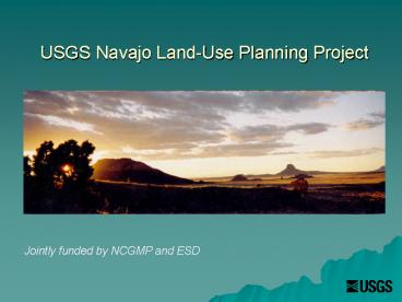
USGS Navajo Land-Use Planning Project
Jointly funded by NCGMP and ESD
2
Navajo Nation
- 72,000 km2
- 27,000 mi2
3
Project Participants
- USGS Margaret Hiza, George Billingsley, Debra
Block, Lee Amoroso, Kathryn Thomas (George Breit) - Arch Anthro Contractors Klara Kelley Harris
Francis, Ted Neff MNA (NNAD) - NAU Students- Leanna Begay (Purdue), Naomi
Yazzie-Translator, Delton Lester, Darren Begay - Navajo geobotanist- Arnold Clifford
- SOARS, U of A- Casey Thornbrugh
4
U.S. Geological Survey Mission
- The U.S.G.S. serves the Nation by providing
reliable scientific information to describe and
understand the Earth minimize loss of life and
property from natural disasters manage water,
biological, energy, and mineral resources and
enhance and protect our quality of life. - Multidisciplinary Geology, Hydrology, Biology,
Geography (Geospatial Data), Astrogeology
5
Geologic mapping related studies
- Bedrock and Surficial Mapping for land use
planning - Sand dune mobility and drought effects on native
and invasive plant species - LCR channel and floodplain evaluation
- Earthquake hazards from active faults
- Shallow groundwater resources- Pueblo Colorado
Wash - Road/Infrastructure mapping and surface-run-off
evaluation
6
(No Transcript)
7
Objectives and Strategies
- Bedrock Mapping Information for
- land use planning and urban development
- Structural stability of housing foundations
- Environmental impacts of landfills/septic systems
- Hydrologic Resources
- Landscape stability/surface erosion
8
Objectives and Strategies
- Surficial Mapping Information for land use
planning and urban development - Geologic Hazards
- Landscape changes in response to land use and
climate change - Drought mitigation
- Surface Erosion / Vegetation
9
Surficial Geology Little Colorado River channel
migration
1992
2006
10
Drought has reactivated dunes in NE Arizona.
Droughts are likely to become more severe with
climate change. Shifting sands inundate roads and
buildings and also affect vegetation and grazing.
11
Threatened Water Supplies Alluvial Aquifers
12
Changes in Average Annual Temperature
Location Historic (60s) Current (00-06)
Chinle, AZ 51.6 o F 55.5 o F
Farmington, NM 51.6 o F 53.9 o F
Lees Ferry, AZ 62.2 o F 64.0 o F
Tuba City, AZ 55.0 o F 58.1 o F
Shiprock, NM 53.3 o F 56.3 o F
Wupatki, AZ 57.3 o F 58.8 o F
13
Navajo Nation Average Annual Snowfall
14
Climate Change
- Models Large in scale, look at averages
- Storm Intensity likely to increase
- Storm frequency?
- Drought Severity likely to increase
- Less Snow/More Rain
- Thresholds CO2 in oceans, Fresh water input
15
Sand Dunes
- Sensitive indicators of climate change
- Overall Moisture Balance
- Degree of vegetation cover
- Wind circulation patterns
16
Inactive / Stable Sand Dunes
17
Largely Active Sand Dunes
18
Fully Active Dunes Tuba City
19
Climatic factors describing sand dune mobility
- Sand dune mobility (M) W/(P/PE)
- Sand transport potential (W) Percent of
time wind velocities are high enough to transport
sand grains - Effective precipitation (P/PE) Ratio of
total precipitation (P) over potential
evapotranspiration (PE)
20
Degree of Stability
21
May 20 Windstorm, Red Mesa, NN
22
(No Transcript)
23
(No Transcript)
24
(No Transcript)
25
NDVI
- Normalized Difference Vegetation Index
- Measures relative vegetation productivity from
AVHRR Satellite data - Applicable to various vegetation bio-types
- Used to assess vegetation response to
precipitation in US Great Plains, Chihuahuan
Desert, and Kalahari of Botswana
26
Comparison of calculated sand dune mobility and
NDVI
27
above normal AMJ temperatures (dotted bars)
concurrent with low NDVI particularly 2000-2004
28
Climate Change
- Need to look at variations, are averages/totals
meaningful? - Storm Intensity and frequency
- Are we able to clearly measure drought severity
- Thresholds
- Responses
29
Processes responsible for changes in the
ecosystem
30
Dune mobility destabilization
- Land Use
- Invasive Species
- Drought length
- Timing and Intensity of Precipitation
- Changes in sediment availability
31
Tons/Acre Erosion
32
Kayenta AZ, September 2003
33
Kayenta, AZ 2004
34
Redefine Drought
- Not simply a change in precipitation
- Includes relative impacts of types of
precipitation and storm intensity - Timing of precipitation events
- Temperature important factor
- How landscape interacts to changing conditions-
land use and climate
35
Traditional Knowledge and the Native Perspective
- Increases our ability to understand changing
environmental conditions - Promotes scientific inquiry within Native
Communities - Influences
- Strategies and
- Methods of
- Scientific Inquiry
36
NLUPP Endorsement
- Cliff Atleo- Clayoquot Sound Region Board, Tribal
Fisheries Representative of Canada - Ramona Bennett-former chairwoman Puyallup Tribe
- Alden Big Man- Crow Cultural Preservation/ LBHC
- Charlotte Black Elk and Kim Winkleman- Comanche
Nation College - Patricia Cochran- President Alaska Native Science
Commission - Phil Duran- Former Dean of Science NW Indian
College - Freda Porter Locklear- Lumbee Chairwoman/
President of Porter Environmental - James RattlingLeaf Sinte Gleska/Rosebud Sioux
- Verna Teller-Former Chairwoman Isleta Pueblo
- Oscar Kwageley-Founder Alaska Native Knowledge
Network - Sarah Young-Dull knife Memorial College
- Dan Wildcat- Haskell University
- Sarge Old Horn- Crow NRCS
- Arvin Trujillo- NN Division of Natural Resources
- Many other Navajo Nation Offices
37
Conclusions
- Navajo Nation and other portions of the Western
U.S. have and will experience magnified drought
conditions as a result of Climate Change - 1oC Warming 2 Rainfall lost to
Evapotranspiration - Rainfall is likely to occur less frequently, in
larger storm/flood events - Snowfall is decreasing/ which may result in a
decrease in water supplies - Invasive plants are opportunistic, and invade
areas where Native plants are stressed, which
results in a loss of culturally significant
plants and grazing land
38
(No Transcript)
Recommended
CrystalGraphics Presentations


