
Geomorphometry and Digital terrain analysis - PowerPoint PPT Presentation
1 / 22
Title:
Geomorphometry and Digital terrain analysis
Description:
TopAS is a program system for automatic evaluation of Digital Terrain Models ... By the use of modules of the program SISCAT, TopAS calculates and ... – PowerPoint PPT presentation
Number of Views:488
Avg rating:3.0/5.0
Title: Geomorphometry and Digital terrain analysis
1
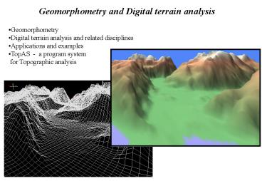
Geomorphometry and Digital terrain analysis
- Geomorphometry
- Digital terrain analysis and related disciplines
- Applications and examples
- TopAS - a program system
- for Topographic analysis
2
Geomorphometry land - surface quantification
Geomorphometry is the science of measuring and
depicting those parameters or attributes
necessary to describe the precise nature and
configuration of the earth topography, its
geographic relationships to the land mass and the
characteristics of geomorphologic processes.
These parameters include elevation and its
derivatives (slope, aspect, curvature)
geophysiographical characteristics, fractal
dimensions, statistical and geostatistical
measures. Two groups General geomorphometry Trea
ts continuos topography or landscapes. Specific
geomorphometry Treats discrete features, or
individual landforms
3
Topography or surface topography is defined as
the shape and geometry of the terrain surface.
Surface model is a digital representation of a
continuos phenomena DEM Digital Elevation
Model is frequently used to refer to any digital
representation of a topographic surface. It is,
however, most often used to refer specifically to
a raster or regular grid of spot heights. DTM
Digital Terrain Model is a surface model derived
from the DEM
Surface model
DEM
DTM
4
Related approaches to land-surface quantification
- Terrain analysis
- Quantitative geomorphology
- Terrain or surface modeling
Terrain analysis Meaning varies widely,
numerical quantification of terrain
features, partly qualitative, incorporating
attributes of landscape in addition to surface
geometry.
Quantitative geomorphology Interprets physical
processes that create discrete features or
orderly groups of them, such as drainage basins
and impact craters. Involve process modeling and
laboratory experiments.
Terrain modeling Spatial or geometric-topological
structuring of the terrain surface. The term is
not used for quantitative work.
5
Computer science
Earth science
Geomorphometry
Engineering Applied science
Mathematics Statistics
6
Today Most geomorphologists today are
concentrating on studying, measuring, and
modeling processes. Aim The eventual goal of
the geomorphometry is to link both form and
process--quantitatively--in a comprehensive
understanding of our physical environment.
How In order to accomplish this we must first
develop quantitative measures of form--and use
the capabilities of computers to move forward
from the fairly simplistic methods designed for
manual measurement in the field that exist today.
7
Objectives and applications of geomorphometry
1. Understand Natural Processes
A. Pure (preliminary) Earth sciences geomorpholog
y, geology, hydrology, geophysics, soil sciences,
etc B. Applied Sciences Evaluate natural
hazards reduce their effects Develop and
conserve natural resources
2. Support technological needs of society
A. Engineering, Transportation and public
works cultivation, navigation, planning and
siting of features, seafloor exploration B.
Military operations cross-country mobility,
weapons design and deployment, tactical and
strategic planning
8
- Analytical tools available for Geomorphometry
- roughness analysis
- visibility analysis
- network analysis
- slope-frequency statistics
- spectral and fractal analysis
- shape from shading
- topologic modeling
- signature analysis
- hypsometry
- volumetric analysis
- feature extraction
- pattern recognition
- mathematical morhometry
- geostatistics..
9
Example Slope and aspect calculation
Slope is a vector, i.e. it has a direction and
length. A common algorithm to calculate slope is
the one generating slope and aspect values from
its 'normal vector'
10
Example Drainage network
11
Flow direction- flow accumulation - critical
value ---gt Drainage network
12
Determining the watershed
13
VIP points
In many cases, sample points can only contribute
in a very limited way to describe the surface. A
and B are located in the middle of the slope or
in a flat area and therefore can be removed
without losing any information about the surface.
Some points, however, are more important since
they indicate the "turning points" of the
landform, such as ridges, basins, valleys, slope
change points (e.g. points C, D and E). Using a
GIS terminology, these "turning points" are
called Very Important Points or VIP.
14
(No Transcript)
15
TOPographic Analysis System (TopAS)
TopAS is a program system for automatic
evaluation of Digital Terrain Models (DTM) for
geoscientific applications. Apart from the
derivation and classification of morphometric
topographic parameters (e.g. altitude, slope
gradient), TopAS provides the possibility to
derive automatically morphographic topographic
units of geoscientific importance.
16
- Application areas of TopAS
- biotope mapping
- mapping of soils and potential risk of soil
erosion - geological mapping, seafloor mapping
- geomorphological mapping
- geoecological mapping
- hydrology, electric power
- climatology, evaporation
- landscape planning
- research for natural hazards, landslides
- nature conservation
- analysis of forest degradation
- military, engineering
- and more..
17
Data basis for TopAS Grid, raster and TIN based
Digital Terrain Models (DTM) are the basic data
for the relief analysis. For a grid based DTM
every grid cell corresponds with an elevation
value of the landscape surface. Any grid size
will do. In most countries over the world the
availability of DTM is increasing rapidly.
- Services provided by TopAS
- Calculation and Classification of
Geomorphometric Topographic Parameters - Automatic Derivation of Geomorphographic
Topographic Units - The Program Modules
- Output Interfaces
- The User Interface
18
- Calculation and Classification of morphometric
Topographic Parameters - By the use of modules of the program SISCAT,
TopAS calculates and - classifies for every grid cell the morphometric
parameters - slope gradient (rate of change of altitude)
- slope aspect (exposition of the slope)
- vertical curvature (rate of change of slope
gradient), differentiated into convex and concave
- horizontal curvature (rate of change of
slope aspect), differentiated into convex and
concave - size of drainage areas
19
- Automatic Derivation of morphographic Relief
Units - DTM and morphometric parameters are the basis for
definitions of descriptive topographic units,
which TopAS ascertains. - Linear Topographic Units
- Culminating lines (crest lines)
- Bottom lines (flow paths, stream lines)
- Convex and concave unsteadiness of the slope
gradient (more or less sharp breaks of slope,
cliffs) - Areal Topographic Units (3 classes)
- Class 1
- Summit areas (slightly inclined areas on
elevations with culminating lines in them and
generally bordered by a convex unsteadiness of
the slope gradient) - Closed depressions (comparable to valley grounds
with bottom lines in them and generally - bordered by a concave unsteadiness of the slope
gradient) - Closed depressions (hollows without outlet)
- Slope areas (the rest, after deduction of summit
areas and depressions)
20
- Class 2 - Cross Slope Division of Topography
- Convergent areas (areas with convergent runoff)
- Divergent areas (areas with divergent runoff)
- Intermediate areas (transitions between
convergent and divergent areas) - Class 3 - Down slope Division of Topography
- Relative steepening and flattenings (9 different
areal types, bordered by linear topographic
units) - The definitions of topographic units within TopAS
are independent of - relief types (mountains, plains etc.)
- scale of topographic forms
- grid sizes of the DTM
- mapping scales
- fixed threshold values and class boundaries
21
TopAS consists of 4 modules TopAS-DTA (TopAS
Digital Terrain Analysis) Import of Digital
Terrain Models from different file formats
Calculation of Geomorphometric topographic
parameters Creation of working files for
the programs TopAS-DTC and TopAS-DTS TopAS-DTC
(TopAS Digital Terrain Classification) Any
classification of the morphometric relief
parameters altitude, slope gradient, slope
aspect, slope curvature and size of drainage
areas TopAS-DTS (TopAS Digital Terrain
Synthesis) Automatic derivation of linear
topographic units Automatic derivation of
areal topographic units TopAS-MAP Overlay and
output of all by TopAS-DTC and TopAS-DTS derived
linear and areal relief units and classified
morphometric relief parameters for any section of
the mapped area.
22
TopAS-DTS, TopAS-DTC and TopAS-MAP include the
functions Interpolation and inscription
of contour lines of any vertical distance
Automatic generation of legends Automatic
cartography, with many possibilities for the
design of context and boundaries of the map