
CFS reanalysis design - PowerPoint PPT Presentation
Title:
CFS reanalysis design
Description:
Jack Woollen, Huug van den Dool, Catherine Thiaw and many others ... 37 Pressure (hPa) Levels: pgb, egy and diab (atmosphere) ... – PowerPoint PPT presentation
Number of Views:91
Avg rating:3.0/5.0
Title: CFS reanalysis design
1
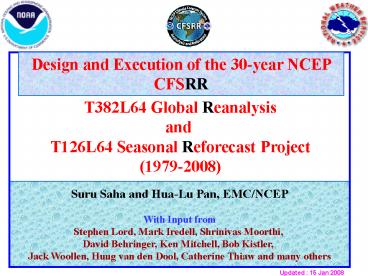
Design and Execution of the 30-year NCEP CFSRR
T382L64 Global Reanalysis and T126L64 Seasonal
Reforecast Project(1979-2008)
Suru Saha and Hua-Lu Pan, EMC/NCEP With Input
from Stephen Lord, Mark Iredell, Shrinivas
Moorthi, David Behringer, Ken Mitchell, Bob
Kistler, Jack Woollen, Huug van den Dool,
Catherine Thiaw and many others
Updated 15 Jan 2008
2
- CFSRR Advisory Board Members
- Chair Jeff Anderson (NCAR)
- Saki Uppala (ECMWF)
- Gabriel Lau (GFDL/NOAA)
- Eric Wood (U Princeton)
- Gil Compo (CDC/NOAA)
- Mark Serreze (U Colorado)
- Rick Rosen (CPO/NOAA)
- Huug van den Dool (CPC/NCEP)
- Jim Carton (U Maryland)
- Lars Peter Riishojgaard (JCSDA/NCEP)
3
For a new Climate Forecast System (CFS)
implementation Two essential components A new
Reanalysis of the atmosphere, ocean, seaice and
land over the 31-year period (1979-2009) is
required to provide consistent initial conditions
for A complete Reforecast of the new CFS over
the 28-year period (1982-2009), in order to
provide stable calibration and skill estimates of
the new system, for operational seasonal
prediction at NCEP
4
- For a new CFS implementation (contd)
- Analysis Systems Operational GDAS Atmosphe
ric (GADAS)-GSI Ocean-ice (GODAS)
and Land (GLDAS) - 2. Atmospheric Model Operational GFS
- 3. Ocean Model New MOM4 Ocean
- 4. Land Model Operational Noah Land Model
- 5. Sea Ice Model New Sea Ice Model
5
- An upgrade to the coupled atmosphere-ocean-seaice-
land - NCEP Climate Forecast System (CFS) is being
planned for 2010. - This upgrade involves changes to all components
of the CFS, namely - improvements to the data assimilation of the
atmosphere with the new NCEP Gridded Statistical
Interpolation Scheme (GSI) and major improvements
to the physics and dynamics of operational NCEP
Global Forecast System (GFS) - improvements to the data assimilation of the
ocean and ice with the NCEP Global Ocean Data
Assimilation System, (GODAS) and a new GFDL MOM4
Ocean Model - improvements to the data assimilation of the land
with the NCEP Global Land Data Assimilation
System, (GLDAS) and a new NCEP Noah Land model
6
- For a new CFS implementation (contd)
- An atmosphere at high horizontal resolution
(spectral T382, 38 km) and high vertical
resolution (64 sigma-pressure hybrid levels) - An interactive ocean with 40 levels in the
vertical, to a depth of 4737 m, and high
horizontal resolution of 0.25 degree at the
tropics, tapering to a global resolution of 0.5
degree northwards and southwards of 10N and 10S
respectively - An interactive sea-ice model
- An interactive land model with 4 soil levels
7
- There are three main differences with the earlier
two NCEP Global Reanalysis efforts - Much higher horizontal and vertical resolution
(T382L64) of the atmosphere (earlier efforts were
made with T62L28 resolution) - The guess forecast will be generated from a
coupled atmosphere ocean seaice - land
system - Radiance measurements from the historical
satellites will be assimilated in this Reanalysis - To conduct a Reanalysis with the atmosphere,
ocean, seaice and land coupled to each other will
be a novelty, and will hopefully address
important issues, such as the correlations
between sea surface temperatures and
precipitation in the global tropics, etc.
8
UPGRADES TO THE ATMOSHERIC MODEL
- Hybrid vertical coordinate (sigma-pressure)
- Noah Land Model 4 soil levels. Improved
treatment of snow and frozen soil - Sea Ice Model Fractional ice cover and depth
allowed - Sub grid scale mountain blocking
- Reduced vertical diffusion
- RRTM long wave radiation
- ESMF (3.0)
9
UPGRADES TO THE ATMOSHERIC MODEL
- Enthalpy
- AER RRTM Shortwave Radiation
- New Aerosol Treatment
- Inclusion of historical CO2, solar cycle and
volcanic aerosols
10
- 6 Simultaneous Streams
- Jan 1979 Dec 1985 7 years
- Nov 1985 Feb 1989 3 years
- Jan 1989 Feb 1994 5 years
- Jan 1994 Dec 1998 5 years
- Apr 1998 Dec 2004 6 years
- Apr 2004 Dec 2009 5 years
- Overlap for ocean and land spin ups
- Reanalysis to cover 31 years (1979-2009)
11
ONE DAY OF REANALYSIS
12Z GSI
18Z GSI
0Z GSI
6Z GSI
0Z GLDAS
12Z GODAS
18Z GODAS
0Z GODAS
6Z GODAS
9-hr coupled T382L64 forecast guess (GFS MOM4
Noah)
1 Jan 0Z
2 Jan 0Z
3 Jan 0Z
4 Jan 0Z
5 Jan 0Z
5-day T126L64 coupled forecast ( GFS MOM4
Noah )
12
ONE DAY OF REANALYSIS
- Atmospheric T382L64 (GSI) Analysis at 0,6,12 and
18Z, using radiance data from satellites, as well
as all conventional data - Ocean and Sea Ice Analysis (GODAS) at 0,6,12 and
18Z - From each of the 4 cycles, a 9-hour coupled
guess forecast (GFS at T382L64) is made with
hourly coupling to the ocean (MOM4 at 1/4o
equatorial, 1/2o global) - Land (GLDAS) Analysis using observed
precipitation with Noah Land Model at 0Z - Coupled 5-day forecast from initial conditions
from every 0Z cycle, will be made with the
T126L64 GFS with hourly coupling to the ocean
(MOM4 at 1/4o equatorial, 1/2o global) for sanity
check.
13
T382L64 CFS REANALYSIS AND 5-day T126L64 FORECASTS
IBM Power 5
Approximately 7 days of T382L64 Reanalysis, including a 5-day T126L64 forecast every cycle, for each of the 6 simultaneous streams 40 CFSR days in 1 calendar day with 82 nodes Will take 1 calendar year to complete 34 years (on HAZE upgrade)
Total Disk Space 104 TB
Total Mass Store (HPSS) Space 1.5 PB
14
Collaborators
- NOAA/CPC is actively involved in the monitoring
of the Reanalysis - NOAA/NCDC is actively involved in the design of
the data distribution of the Reanalysis
15
37 Pressure (hPa) Levels pgb, egy and diab
(atmosphere) 1000 975 950 925 900 875 850 825 800
775 750 700 650 600 550 500 450 400 350 300 250
225 200 175 150 125 100 70 50 30 20 10 7 5 3 2
1 40 Levels (depth in meters) ocn (ocean) 4478
3972 3483 3016 2579 2174 1807 1479 1193 949 747
584 459 366 303 262 238 225 215 205 195 185 175
165 155 145 135 125 115105 95 85 75 65 55 45 35
25 15 5 16 Isentropic Levels (K) ipv 270 280
290 300 310 320 330 350 400 450 550 650 850 1000
1250 1500
16
CDAS (R1) GFS AM (OPR)
Vertical coordinate Sigma Sigma/pressure
Spectral resolution T62 T382
Horizontal resolution 210 km 35 km
Vertical layers 28 64
Top level pressure 3 hPa 0.266 hPa
Layers above 100 hPa 7 24
Layers below 850 hPa 6 13
Lowest layer thickness 40 m 20 m
Analysis scheme SSI GSI
Satellite data NESDIS temperature retrievals Radiances
Moorthi, Nov 2007
17
- DATA STUDIES
- We have made 20 data impact studies (using T62L64
atmospheric-only data assimilation system) - We have tested SSU, ERS winds, JMA reprocessed
cloud track winds, and PAOBS - We have tested the new Reynolds ¼ degree SST for
the GODAS - We have tested the new 0.5 degree global CPC
precipitation product for the GLDAS - We have updated snow and sea ice
- We have collected tropical storm information from
ERA40 and from our own archive - We have done several satellite radiance bias spin
up experiments and are continuing to do them
18
- MONITORING
- Monitoring Web site has been built
- The CPC team has done an outstanding job of
monitoring the - Stratosphere
- Troposphere
- Surface
- Ocean
- EMC monitoring of data usage and verification of
the 5-day short range forecasts is also underway
19
OPR
20
CFSR
21
OPR
22
CFSR
23
(No Transcript)
24
(No Transcript)
25
(No Transcript)
26
5 day scores in CFSRR are better in NH than in SH
in 1979.
27
Increasing satellite data in later years have
made the scores in NH and SH more comparable
28
(No Transcript)
29
(No Transcript)
30
(No Transcript)
31
(No Transcript)
32
(No Transcript)
33
(No Transcript)
34
(No Transcript)
35
A QBO Problem
10 hPa ZONAL WIND RAWINDSONDE AT SINGAPORE OBS
(red), ANALYSIS (green) GUESS (blue)
36
After changes to the background error covariances
10 hPa ZONAL WIND RAWINDSONDE OBS AT SINGAPORE
(red), ANALYSIS (green) GUESS (blue)
37
SOME PROBLEMS FACED DURING THE SPIN UP PHASE OF
CFSR
- MANY BUG FIXES IN CODES AND SCRIPTS
- ADEQUATE COMPUTER RESOURCES NOT RECEIVED UNTIL
JULY 1. - ADEQUATE FUNDING NOT RECEIVED UNTIL JULY 1.
- DUE TO THIS, CFSR DELIVERY DATE HAS SLIPPED
- A QUARTER OF THE PROJECT IS DONE
38
THE HUMAN FACE OF CFSR
Diane Stokes Hui-ya Chuang Mark Iredell Jesse
Meng Ken Mitchell Russ Treadon Daryl Kliest Glenn
White Yu-Tai Hou Steve Lord Helin Wei Bob
Grumbine George Gayno Jun Wang Paul van Delst
Suru Saha Xingren Wu Jiande Wang Patrick
Tripp Sudhir Nadiga
CPC/EMC MONITORING
Hua-Lu Pan Shrinivas Moorthi Bob Kistler Jack
Woollen Haixia Liu Dave Behringer
39
CPC/EMC SCIENTISTS MONITORING CFSR
40
Issues
- Integrated Earth System Analysis
- Aerosol is in the plan for the operational data
assimilation system and will be available at the
next CFSRR - CO2 changes are already built in the current CFS
Reanalysis - 20-century type of CMIP runs indicates that the
CFS in the CFSRR system is capable of responding
to the CO2 changes - How can we accelerate the future CFSRR?
- Data assimilation combine satellite radiance
usage with the earth system modeling to address
atmosphere, ocean, land, ice, and biosphere - Improving both weather and climate signals in the
fully coupled models - Resource needed to do both
41
Email cfs_at_noaa.gov Website
http//cfs.ncep.noaa.gov
Recommended
CrystalGraphics Presentations


