
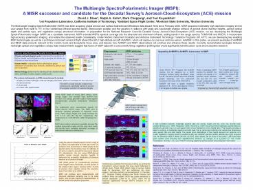
The Multiangle SpectroPolarimetric Imager (MSPI): - PowerPoint PPT Presentation
1 / 1
Title: The Multiangle SpectroPolarimetric Imager (MSPI):
1
The Multiangle SpectroPolarimetric Imager (MSPI)
A MISR successor and candidate for the Decadal
Surveys Aerosol-Cloud-Ecosystem (ACE) mission
David J. Diner1, Ralph A. Kahn2, Mark Chopping3,
and Yuri Knyazikhin4 1Jet Propulsion Laboratory,
California Institute of Technology, 2Goddard
Space Flight Center, 3Montclair State University,
4Boston University
The Multi-angle Imaging SpectroRadiometer (MISR)
has been acquiring global aerosol and surface
bidirectional reflectance data aboard Terra since
February 2000. MISR acquires moderately
high-resolution imagery at nine view angles from
nadir to 70º, in four visible/near-infrared
spectral bands. Stereoscopic parallax and the
variation in radiance with angle and wavelength
enables retrieval of aerosol plume injection
heights, aerosol optical depth and particle type,
and vegetation canopy structural information. In
preparation for the National Research Council's
Decadal Survey Aerosol-Cloud-Ecosystem (ACE)
mission, we are developing the Multiangle
SpectroPolarimetric Imager (MSPI) as a candidate
instrument. MSPI extends MISR's spectral coverage
into the ultraviolet and shortwave infrared,
adding bands in the range used by TOMS/OMI and
MODIS. It incorporates high-accuracy polarimetric
imaging, and widens the observed swath
considerably. Under NASA's Instrument Incubator
and Airborne Instrument Technology Transition
Programs (IIP, AITT), we are developing key
enabling MSPI technologies as well as a prototype
instrument aimed at flight aboard the ER-2
high-altitude aircraft (AirMSPI), which will
replace our previous airborne sensor, AirMISR. In
this poster, we present examples of AirMISR and
MISR data products relevant to the Carbon Cycle
and Ecosytems focus area, and discuss how AirMSPI
and MSPI observations will continue and enhance
these results. Currently demonstrated synergies
between multiangle optical and vegetation canopy
lidar measurements suggest that fusion of MSPI
data with a concurrently flying vegetation
profiling lidar would significantly benefit
carbon cycle and ecosystem research.
Requirement MSPI attributes
Moderately high spatial resolution 275 m - 1.1 km spatial resolution
Wide swath 750 km off-nadir 2000 km nadir
Multiple view angles 0º - 70º view angles
UV spectral response 355, 380 nm
VNIR spectral response 445, 470, 555, 660, 865 nm
SWIR spectral response 1610, 1880, 2130 nm
High polarimetric accuracy in selected bands (470, 660, 1610 nm) lt0.5 uncertainty in degree of linear polarization (DOLP)
Science objectives of the Decadal Survey ACE mission
Climate and hydrological cycle Understand the sensitivity of Earth's climate and hydrological cycle to aerosols and clouds, as a function of amount and type.
Human health Understand factors affecting the global distribution of boundary layer aerosols, classified by particle size and composition.
Marine biology Determine the standing stocks, transformation rates, and fates of marine organic carbon pools.
- The science instruments on ACE are envisioned to
include - A highly accurate multiangle, multi-wavelength
polarimeter. MSPI is a candidate for this
instrument - An advanced lidar
- A cloud radar
- An ocean color spectrometer
The MSPI concept includes multiple fixed cameras
and a gimbaled camera to provide fine angular
resolution for selected targets.
These MISR maps of woody plant canopy cover,
canopy height, and biomass were derived from
inversion of a canopy geometric-optics model
against atmospherically corrected bidirectional
reflectance factors. The scatterplots show
assessments against US Forest Service IW-FIA
maps. The RMS error in randomly sampled estimates
of fractional crown cover, mean canopy height,
and woody biomass are 0.12, 3.3 m, and 14.0 Mg
ha-1, respectively. The mapped area is gt 200,000
km2. (After Chopping et al., 2008) MSPI will
provide an enhanced capability because the
multiple along-track angles and the wide nadir
swath will provide more complete azimuthal
coverage of bidirectional reflectance
distributions.
MSPI global coverage time will be 4 days
(off-nadir) and 2 days (nadir).
Small
A high correlation between multiangle spectral
data and canopy height and tree cover has
recently been reported (Kimes et al., 2006
Heiskanen, 2006). Schull et al. (2007) have found
that multiangle spectral data are sensitive to
ground cover, LAI, and aspect ratio (crown
diameter to crown height ratio). This property
provides a basis for synergy of multiangle
spectral and lidar data that is, retrieving
horizontal and vertical tree dimensions using
aspect ratio and lidar height. The panels show
distributions of tree height derived from
airborne LVIS (Laser Vegetation Imaging Sensor)
waveforms (left) and AirMISR spectral surface
reflectances (right) acquired over the Howland
forest in Maine (45.43N, 68.35W). More details
can be found in the poster "Leaf Area Index Earth
System Data Records from Satellite-borne Sensors"
by Ganguly et al (Location ID 195, Poster
Presentation Monday 130-230). AirMSPI will
bring additional spectral bands and polarization
information.
S. America S. Africa
Medium
Using the GEOS-CHEM transport model, Leung et al.
(2007) concluded that at least half of the CO
emission from boreal fires in 1998 needed to be
injected above the boundary layer (to altitudes
of 3-5 km) in order to account for downwind
column CO abundances. We are using MISR-derived
wildfire smoke aerosol injection heights to
determine the probability distribution of
emission injection as a function of height. Left
MISR plume vs. model-derived boundary layer
heights above the terrain, for 664 plumes in the
Alaska-Yukon region, Summer 2004. 10-20 of
plumes show injection above the boundary layer.
From Kahn et al. (2008). MSPI will continue such
measurements with improved statistical sampling
due to its wider swath, and provide improved
characterization of smoke plume microphysical
properties.
References Chen, W.-T., R.A. Kahn, D. Nelson, K.
Yau, and J.H. Seinfeld (2008). Sensitivity of
multiangle imaging to the optical and
microphysical properties of biomass burning
aerosols. J. Geophys. Res., to appear. Chopping,
M., Moisen, G. Su, L., Laliberte, A., Rango, A.,
Martonchik, J.V., and Peters, D.P.C. (2008).
Large area mapping of southwestern forest crown
cover, canopy height, and biomass using MISR.
Rem. Sens. Environ. in press doi10.1016/j.rse.20
07.07.024. Heiskanen, J. (2006). Tree cover and
height estimation in the Fennoscandian
tundra-taiga transition zone using multiangular
MISR data. Rem. Sens. Environ. 103, 97-114. Kahn,
R., Y. Chen, D.L. Nelson, F.-Y. Leung, Q. Li,
D.J. Diner, and J.A. Logan (2008). Wildfire smoke
injection heights Two perspectives from space.
Geophys. Res. Lett. 35, L04809,
doi10.1029/2007GL032165. Kimes D.S., K.J.
Ranson, G. Sun, and J.B. Blair (2006). Predicting
lidar measured forest vertical structure from
multi-angle spectral data, Rem. Sens. Environ.
100, 503-511. Leung, F-Y., J.A. Logan, R. Park,
E. Hyer, E. Kasischke, D. Streets, and L.
Yurganov (2007). Impacts of enhanced biomass
burning in the boreal forests in 1998 on
tropospheric chemistry and the sensitivity of
model results to the injection height of
emissions. J. Geophys. Res. 112, D10313,
doi10.1029/2006JD008132. Schull, M.A., S.
Ganguly, A. Samanta, D. Huang, N.V. Shabanov,
J.P. Jenkins, J.C. Chiu, A. Marshak, J.B. Blair,
R.B. Myneni, and Y. Knyazikhin (2007). Physical
interpretation of the correlation between
multi-angle spectral data and canopy height.
Geophys. Res. Lett. 34, Art. No. L18405.
Large
Carbonaceous particles from biomass burning are
among the tropospheric aerosol species that pose
great challenges to climate study. These MISR
global maps of aerosol optical depth for
September 2007 are partitiioned into small,
medium, and large particles (acknowledgment S.
Paradise, JPL). Biomass burning particles over
South America and southern Africa are evident.
MISR has coarse sensitivity to aerosol absorption
(Chen et al., 2008), which will be improved
significantly through MSPIs inclusion of UV
channels.