
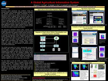
A Global Agriculture Information System - PowerPoint PPT Presentation
1 / 1
Title:
A Global Agriculture Information System
Description:
... provide accurate and timely information on global crop conditions. ... Data and analysis (e.g., maps, time series, animation, etc.) are available via AOVAS: ... – PowerPoint PPT presentation
Number of Views:30
Avg rating:3.0/5.0
Title: A Global Agriculture Information System
1
A Global Agriculture Information System
Zhong Liu1,4, W. Teng2,4, S. Kempler4, H.
Rui3,4, G. Leptoukh3 and E. Ocampo3,4
1 George Mason University, 2 RS Information
Systems, Inc., 3 ADNET Systems, Inc., 4
NASA/GSFC, NASA Goddard Earth Sciences (GES) Data
Information Services Center (DISC) , Code
610.2, NASA/GSFC , Maryland 20771, USA
Introduction Monitoring global agricultural crop
conditions during the growing season and
estimating potential seasonal production are
critically important for market development of
U.S. agricultural products and for global food
security. Two major operational users of
satellite remote sensing for global crop
monitoring are the USDA Foreign Agricultural
Service (FAS) and the U.N. World Food Program
(WFP). The primary goal of FAS is to improve
foreign market access for U.S. agricultural
products. The WFP allocates food to meet
emergency needs and to support economic and
social development. Both use global agricultural
decision support systems that can integrate and
synthesize a variety of data sources to provide
accurate and timely information on global crop
conditions. The Agricultural Information System
(AIS), currently under development, will provide
an one-stop-shop for easy accesses to data,
information and analysis of NASA remote sensing
and other products (e.g., rainfall, crop model
outputs) and services. In particular, the
Agriculture Online Visualization and Analysis
System (AOVAS) will allow users to obtain
customized data and analysis in their regions of
interest over the Internet and with few clicks of
mouse. AOVAS is based on the existing TRMM Online
Visualization and Analysis System (TOVAS) which
has been successfully providing global rainfall
information ranging from near-real-time to
historical archives over the past several years.
The AOVAS will enable the remote, interoperable
access to distributed data, by taking advantage
of the GrADS-DODS Server (GDS), a stable, secure
data server that provides subsetting and analysis
services across the Internet, for any
GrADS-readable data set. The subsetting
capability allows users to retrieve a specified
spatial region from a large data set, eliminating
the need to first download everything. The
analysis capability allows users to retrieve the
results of an operation applied to one or more
data sets on the server. The first release of
AIS will contain 1) Analysis of current
conditions that contains links to complete
product (rainfall, surface reflectance, etc.)
analysis maps for selected regions worldwide and
the conterminous United States 2) An Agriculture
Online Visualization and Analysis System (AOVAS)
that allows to access global, current and
historical data and analysis and generate
customized maps, time series, and digital data.
Agriculture Project Portal http//disc.gsfc.nasa.g
ov/agriculture/index.shtml
Agriculture Information System Diagram
Screen shots of the agriculture project portal
(left) and the Agriculture Information System
(right)
Examples of Agriculture Online Visualization and
Analysis System (AOVAS) http//agdisc.gsfc.nasa.go
v/Giovanni/aovas/
Diagram of Agriculture Online Visualization and
Analysis System (AOVAS)
Research products and archives are important for
case studies.
Process user inputs Handle input errors
Near-real-time products are important for
monitoring activities.
Execute Script and Generate image or ASCII
output
Prepare GrADS Script for reading And Processing
data
Remote Data GDS
Local data
GrADS lib and User Defined Function
Table 1 Standard Functions in AOVAS
Output type Description
Area Plot Area plot averaged or accumulated over any available data period within any rectangular area
Time Plot Time series averaged over any rectangular area
Hovmoller Plots Longitude-time or latitude-time plot
Animations Animations available for area plots
ASCII Output ASCII output, available for all plot types, suitable for feeding GIS or other applications
Times series plot for southern Mozambique showing
a decreasing trend in rainfall in recent years
(top). ASCII output can be used for further
analysis (bottom).
Hovemoller diagram (top) for central Mozambique
showing spatial and temporal distribution in
rainfall. Animation (bottom) shows the time
evolution.
- Existing Products
- Multi-Satellite 3-hourly rainfall (3B42RT)
- TRMM 3-hourly rainfall (3B42)
- TRMM monthly rainfall (3B43)
- Derived rainfall (daily, 10-day)
- Willmott monthly historical rainfall (station
data) - GPCC monthly historical rainfall (station data)
Future Plans
MODIS RGB Imagery
MODIS NDVI
Weather Forecast (Courtesy COLA)
Data integration is a key to ensure future
successes. To achieve this goal, we need to form
a solution network or an alliance to address
various issues.
Data and analysis (e.g., maps, time series,
animation, etc.) are available via
AOVAS http//agdisc.gsfc.nasa.gov/Giovanni/aovas/
Agriculture Project Portal http//disc.gsfc.nasa.
gov/agriculture/index.shtml AOVAS
http//agdisc.gsfc.nasa.gov/Giovanni/aovas/ TOVAS
http//disc2.nascom.nasa.gov/Giovanni/tovas/ TRMM
Products http//disc.sci.gsfc.nasa.gov/data/data
pool/TRMM/ Details about TRMM http//trmm.gsfc.na
sa.gov Questions and comments hydrology_at_disc.gsfc
.nasa.gov
Climate Forecast (Courtesy COLA)
Recommended
CrystalGraphics Presentations


