
Jason Mirtl - PowerPoint PPT Presentation
1 / 8
Title:
Jason Mirtl
Description:
In near future will be able to scan and link plats into GIS as they come in, ... Making a new naming convention for original scanned plats that was simple and ... – PowerPoint PPT presentation
Number of Views:30
Avg rating:3.0/5.0
Title: Jason Mirtl
1
(No Transcript)
2
Jason Mirtl
Monroe County Surveyors Office
Health Services Building 119 West 7th
Street Bloomington, IN 47404 Room 201
Phone 812.349.2977 Email jmirtl_at_co.monroe.in.us
3
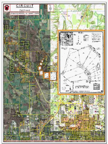
C.I.R.C.U.I.T
County Information Records Coordination
Unification Integration Team
- Established around 1994-1995.
- Through the Monroe County Planning, Auditors,
Recorders, and Assessors departments.
- In cooperation with the City of Bloomington
Indiana University.
- Working together utilizing GIS through current
future projects.
- Overall goal is to maintain the accuracy and
completeness of data sets through a functional
Geographic Information System. Synchronization
of departments is key.
- Thirty member committee currently meets once a
month.
4
Plat Maps
- Stored in the Recorders Office at the Monroe
County Courthouse.
- Five-and-one-half cabinets with four hundred
envelopes each.
- On average, approximately four scanned plats per
envelope.
- Making for approximately 8800 total scanned plat
maps.
- Still five surveyor plat books that need to be
scanned and more coming in weekly.
- 1560 linkable subdivisions, technology and
business parks and commercial properties in GIS
layer.
- In near future will be able to scan and link
plats into GIS as they come in, making the data
set as current as possible.
5
Plat
Planning Department
Highway Department
Auditors Office
Recorders Office
Assessors Office
Surveyors Office
6
Access and Benefits
- Access can easily be achieved via computer and
internet, through Monroe County GIS website.
- While being a very efficient way to look up
public plat records many users will find it very
useful.
- Users such as taxpayers who are extremely busy
working and raising families could find
information easier digitally opposed to
non-digitally.
- Monroe County Government and City of Bloomington
departments, major area utilities like gas and
electric, could also benefit.
- Currently no access through GIS website however
possible access achieved by end of February.
7
Challenges
- Making a new naming convention for original
scanned plats that was simple and easy to
implement in order to make the link into GIS.
- The finished number of hyperlink columns in
subdivision table. Currently eight hyperlink
columns.
- Creating a solution if hyperlink columns become
too cumbersome to navigate.
- Discrepancies between plat name and subdivision
table row name.
- Locating plat location in GIS if plat name does
not exist in subdivision table. Some data sets
may not be current, road layer, parcel layer,
subdivision layer for example. Making location
of plats at times a challenge.
8
Sam Allison Monroe County Recorder
Monroe County Recorders Office Monroe County
Courthouse 100 West 5th Street P.O. Box
1634 Bloomington, IN 47402 Room 122
Phone 812.349.2536 Email sallison_at_co.monroe.in.u
s
Recommended
CrystalGraphics Presentations


