
NASAs Earth Science Enterprise - PowerPoint PPT Presentation
1 / 51
Title:
NASAs Earth Science Enterprise
Description:
... launched five space observation missions: SAGE III, Jason-1, GRACE, ... Partnering with the National Park Service, the Girl Scouts, Earth & Sky Radio, ... – PowerPoint PPT presentation
Number of Views:141
Avg rating:3.0/5.0
Title: NASAs Earth Science Enterprise
1
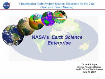
Presented to Earth System Science Education for
the 21st Century PI Team Meeting
- NASAs Earth Science Enterprise
Dr. Jack A. Kaye Director, Research Division NASA
Office of Earth Science June 13, 2003
2
The Earth is a Dynamic System...
That Changes on all Time Scales
3
Observing how urban areas are changing over time
due to human activities
Phoenix, AZ Landsat Composite 1973-1992
4
The NASA Vision
To improve life here, To extend life to
there, To find life beyond.
The NASA Mission
To understand and protect our home planet To
explore the universe and search for life To
inspire the next generation of explorers
as only NASA can.
5
Recent Milestones
- Enhance the science base
- Two decade record of solar irradiance and
atmospheric ozone concentration - Major discoveries in patterns of change in polar
ice caps and sea ice - First globally consistent 30m land cover data
sets based on 30 years of Landsat data - Two decade record of global temperature
humidity from satellites - First global maps of marine and terrestrial
biosphere - First global CO distribution measurement from
Terra - Enhance observing monitoring systems
- Together with partners launched five space
observation missions SAGE III, Jason-1, GRACE,
Aqua and POES (NOAA-M) in FY02, and 3 so far in
FY03 (SeaWinds/ADEOS-II, ICESat, SORCE) - Conducted CRYSTAL-FACE campaign (FY02), SOLVE II
(FY03), Precipitation validation mission (Japan,
FY03), Chilean sea ice observations, Cold Land
Processes and Soil Moisture Field Experiments - Improve decision support tools
- QuikSCAT data being employed in operational
weather forecasts - TRMM data being employed by NOAA for seasonal
climate prediction - Enhance exploratory research
- Selected / matured 38 new instrument concepts for
future observing techniques - Initiated partnership with NSF, NOAA, DOE, and 15
universities to develop a common modeling
framework
6
Structure of the NASA Strategic Plan
Basis of NASA Budget Structure
7
Agency Goals
Mission-Driven Goals
- Understand the Earth system and apply Earth
system science to improve prediction of climate,
weather, and natural hazards. - Enable a safer, more secure, efficient, and
environmentally friendly air transportation
system. - Create a more secure world and improve the
quality of life by investing in technologies and
collaborating with other agencies, industry, and
academia. - Explore the fundamental principles of physics,
chemistry, and biology through research in the
unique natural laboratory of space. - Explore the solar system and the universe beyond,
understand the origin and evolution of life, and
search for evidence of life elsewhere. - Inspire and motivate students to pursue careers
in science, technology, engineering, and
mathematics. - Engage the public in shaping and sharing the
experience of exploration and discovery. - Ensure the provision of space access for the
nation, and improve it through increased safety,
reliability and affordability. - Extend the duration and boundaries of human space
flight to create new opportunities for
exploration and discovery. - Enable revolutionary capabilities through new
technology.
Understand and protect our home planet
Explore the Universe and search for life
Inspire the next generation of explorers
Enabling Goals
8
Themes
- SPACE SCIENCE
- Solar System Exploration (SSE)
- Mars Exploration (MEP)
- Astronomical Search for Origins (ASO)
- Structure and Evolution of the Universe (SEU)
- Sun-Earth Connections(SEC)
- EARTH SCIENCE
- Earth System Science (ESS)
- Earth Science Applications (ESA)
- BIOLOGICAL AND PHYSICAL RESEARCH
- Biological Sciences Research (BSR)
- Physical Sciences Research (PSR)
- Research Partnerships and Flight Support (RPFS)
- AERONAUTICS AND SPACE TECHNOLOGY
- Aeronautics Technology (AT)
- Space Launch Initiative (SLI)
- Mission and Science Measurement Technology (MSM)
- Innovative Technology Transfer Partnerships
(ITTP) - EDUCATION PROGRAMS
- Education Programs (EDUC)
- SPACE FLIGHT
- Space Station (ISS)
- Space Shuttle (SSP)
- Space and Flight Support (SFS)
9
From Science to Decision Support
Applying NASAs system engineering approach and
ESE results to support decision-making tools,
predictions, and analysis for policy and
management decisions.
Science Models Data Assimilation
Predictions
Value benefits to citizens and society
Info. Products
- Oceans - Ice - Land - Coupled - Atmosphere
Decision Support Tools
Policy Decisions Management Decisions
High Performance Computing, Communication,
Visualization
- Assessments
- Decision
- Support
- Systems
Data
Measurements Monitoring
Observations
- Satellite - Airborne - Ground
Data Products
10
Managing Federal Climate Change Research
Technology
11
NASAs Role in CCSP
- NASA brings the global perspective from satellite
and suborbital measurements to address climate
and global change science questions. - NASA has the end-to-end capability to develop
technologies, models, deploy observing systems,
utilize and provide products for decision support
systems. - NASA develops models that can utilize its
observations for addressing science questions and
providing forecasting and decision support. - NASA enables scientists and engineers to provide
the knowledge base to further develop new and
enhanced remote sensing approaches to decision
support - NASA has the organizational capacity (systems
engineering, program management partnering
capability) to carry out large-scale, long-term,
and multi-party programs.
NASAs work with NOAA made todays global weather
climate prediction possible, and the research
and technology development we are doing now will
enable improved predictive capability for the
nation in the future
12
Climate Change Research InitiativeSupporting
National Scientific Priorities
- Accelerate evaluation of climate change factors
other than carbon dioxide (CO2) such as methane,
aerosols, black carbon and tropospheric ozone.
Non-CO2 could - Have more climate influence than CO2
- Be reduced with far less economic impact also aid
public health and agriculture - Advanced polarimeter instrument
- Greatly facilitates evaluation of non-CO2
forcings - Will be launched in the 2007 timeframe, about
four years earlier than planned - Accelerate reduction in uncertainties in polar
climate feedbacks - Polar regions showing most dramatic changes
- Exert strong influence on overall Earth system
13
Earth Science Enterprise
Develop a scientific understanding of the Earth
system and its response to natural and
human-induced changes to enable improved
prediction of climate, weather and natural
hazards for present and future generations
GOALS
- Science Observe, understand, and model the
Earth system to learn how it is changing, and the
consequences for life on Earth - Applications Expand and accelerate the
realization of economic and societal benefits
from Earth science, information, and technology - Technology Develop and adopt advanced
technologies to enable mission success and serve
national priorities
We provide end-to-end scientific information for
decision-makers
14
Earth as a Dynamic System
Forces acting on the Earth system
Earth system responses
IMPACTS
Feedbacks
15
Science Questions from the Research Strategy
Variability
Forcing
Response
Consequence
Prediction
Precipitation, evaporation cycling of water
changing?
Atmospheric constituents solar radiation on
climate?
Clouds surface hydrological processes on
climate?
Weather variation related to climate variation?
Weather forecasting improvement?
Global ocean circulation varying?
Changes in land cover land use?
Consequences in land cover land use?
Transient climate variations?
Ecosystem responses affects on global carbon
cycle?
Surface transformation?
Changes in global ocean circulation?
Coastal region change?
Trends in long-term climate?
Global ecosystems changing?
Stratospheric ozone changing?
Stratospheric trace constituent responses?
Future atmospheric chemical impacts?
Ice cover mass changing?
Sea level affected by climate change?
Future concentrations of carbon dioxide and
methane?
Motions of Earth interior processes?
Pollution effects?
16
(No Transcript)
17
Organizing Earth System Science Research
- Earth system is sufficiently complex that
implementing program requires it be taken apart
to be put back together - No unique way to do this
- Earth system is sufficiently interlinked that no
way of taking it apart doesnt separate tightly
linked processes - Need to assure interdisciplinary science is
addressed - Organizing structure can take advantage of unique
elements of Earth system - Presence of life
- Presence of water in multiple interacting phases
- Oxidizing atmosphere
- Surface made up of water and land
18
Focus Areas for ESE Research
- Build Program around 6 interdisciplinary focus
areas - Carbon cycle/biogeochemical cycles, and
ecosystems - Global water and energy cycle
- Weather
- Atmospheric Composition
- Climate Variability and Change
- Earth Structure and Interior
19
Answering Science Questions What is required?
- Research Analysis
- Sponsor competitively selected research, analysis
and modeling via open solicitations structured
around the science question - Support basic Earth science RA and related EOS
and other mission science teams, the suborbital
science program, and the interdisciplinary
research investigations. - Observations
- Systematic measurement missions to detect trends
against the background variability in the Earth
system - Exploratory measurement missions to examine
lesser understood but important Earth system
processes (particularly in forcings and
responses) - Technology
- Technology development and demonstration to
reduce the cost and enhance the capability of
future missions and data product capabilities - Modeling
- Modeling via advanced computing to enhance the
predictive power with space based observations
and prepare accurate geophysically-consistent
global data sets - Data Management and Distribution
- Provide access to massive volumes of data, needed
for increasingly fine resolution analyses and
models and for the application of multiple data
sets from many sources - Improve access with the advent of a network of
active archives, science and applicationns data
and information partners, and data services - Assessments and Decision Support
- The results of research will be used in periodic
reassessment of questions and prioritization - Data sets and models will be incorporated into
decision support systems through partnership
with other federal and non-federal agencies
20
Multiple Satellite Observations Provide Global
Perspectives
TRMM
Aqua
Cloudsat
CALIPSO
GRACE
TOPEX
GIFTS
Meteor/ SAGE
Landsat
NOAA/POES
SeaWiFS
Aura
Jason
Terra
SORCE
ICESat
21
Examples of Long-term Data Sets
Scanning spectrometer for total column ozone
Radar alitmetry for sea surface height
Active Cavity Radiometer for Solar Irradiance
22
Tropical Rainfall Measuring Mission (TRMM)
TRMM Five-Year Precipitation Climatology
January 1998 - December 2002
23
TRMM Lightning Imaging Sensor (LIS)
Merged Climatology of Lightning Flashes - LIS and
OTD Cross-Calibrated
Preliminary climatologies - annualized (0.5 deg),
daily (2.5 deg), diurnal (2.5 deg)
Christian, Blakeslee, Goodman, Mach
24
Alteration of Precipitation Processes
TRMMs Precipitation Radar confirms that clouds
in areas 1, 2, and 3 all have sufficient water
for precipitation, however there is only
precipitation occurring in areas 1 and 3. The
yellow coloring of area 2 depicts pollution
tracks, as detected by TRMMs Visible Infrared
Radiometer (VIRS) instrument.
Thus the integrated picture delivered by TRMM
suggests a suppression of rain and snow by smoke
and air pollution due to the shifting of droplet
size.
Prof. Daniel Rosenfeld
25
How can weather forecast duration and reliability
be improved by new space-based observations, data
assimilation, and modeling?
- Assimilation of TRMM precipitation data in global
models - Improves climate analysis
- Improves storm track forecast
- Improves precipitation forecast
5 day forecast of Bonnie storm track from
08/20/98 Red best track (NOAA
HRD) Green forecast from analysis
without TRMM data Blue forecast from
analysis with TRMM data
26
The first detailed record of the global carbon
cycle reported in SCIENCE
Three years of continual data collected by the
SeaWiFS instrument. These records provide a
baseline against which future estimates of
Earths carbon cycle can be compared.
27
New NASA/CSA Monitor Provides First Global Map
of Air Pollution From Space
MOPITT on Terra
These measurements show concentrations of carbon
monoxide (CO) at altitudes of 15,000 feet. Red
colors in these images indicate highest levels of
CO (450 parts per billion). Blue colors indicate
lowest levels of CO (50 ppb).
28
Large-scale, Long-term, Multi-party Projects
NASA system engineering and partnering capability
enable projects
AERONET An Internationally Federated Network
- Characterization of aerosol optical properties
- Validation of Satellite Aerosol Retrievals
- Near real-time data acquisition long term
measurements
29
Airborne/Suborbital Campaigns Provide Global
Access to Regional Processes
- Satellite/Space Data Product Calibration/Validatio
n Algorithm Development - Process Studies Model Validation
- Applications Development Demonstration
- Space Sensor and Remote Sensing Technology
Development Demonstration - Future capability for focused observations of
persistent but finite phenomena and hazardous
operations (UAVs)
30
Transition from Research to Operations
In operation
Imaging and Sounding
Under Development
Under Study or Formulation
Solar Irradiance, Ozone, and Aerosols
NPOESS
ACRIMsat
SORCE
SIGF
Observation
NPOESS
SAGE III
AURA
Ocean Surface Topography
Jason
OSTM
NPOESS/partners
Land Cover/Land Use Change
Commercial (USGS)
Landsat 7
LDCM
Technology
Joint Center for Satellite Data Assimilation
NCEP
Modeling
Short-term Prediction Research and Transition
Center
NWS
NASA NOAA jointly funding NRC studies on
improving transition
31
Earth Science National Applications
Carbon Management
Aviation Safety
Energy Forecasting
Public Health
Water Management
Disaster Preparedness
Coastal Management
Homeland Security
Agricultural Competitiveness
Air Quality
Community Growth
Invasive Species
32
Modeling Computing Research
- Climate forcing, multi-decade, centennial
assessment - Ocean and Land Assimilation, Ocean-land-atmospheri
c interactions 6 24 months - Atmosphere, land-surface assimilation,
assimilated data for mission support, observation
impact, link between weather and climate - PI-driven model development selected projects
through numerous programs - Engineering Component
- Software engineering/Data assimilation
methodologies/Computational technologies
NASA Seasonal Interannual Prediction Project
Data Assimilation Office
Computational Technologies
The NASA Short-term Prediction Research
Transition Center
ESMF
Goddard Institute for Space Studies
NASA/NOAA Joint Center for Satellite Data
Assimilation
Earth Science Modeling Framework
33
Development of Enabling Technologies
- Development Projects
- Instrument Incubator
- Adv Tech Initiative
- Adv Info Sys Tech
- Computational Technologies
- New Millennium Program
- Suborbital and Space Validation
Planning
- Products
- Instruments
- Critical components
- Measurement Techniques
- Information Systems
- System elements
- Modeling Infrastructure
- Platform Capabilities
- Capability/Needs Assessment
- Development and Infusion Planning
34
Data Management and Distribution
Ingesting, processing, and archiving an
unprecedented volume of climate and Earth science
data. NASA is benchmarking capabilities and
processes for handling the capacities for future
operational needs (e.g., NPOESS).
NASA provides access to Earth system science
data, information, and services to millions of
unique users. Over the next decade, NASA will
ensure the timely delivery of Earth Science
information at an affordable cost by evolving to
a more open, distributed set of data systems and
service providers.
35
Inspiring the Next Generation of Explorers
- Using the Earth System Science concept and our
view from space to change the way Earth science
is taught - Influencing each stage of the education pipeline
- Teacher-reviewed curriculum support materials for
K-12 11,438 teachers trained in 344 workshops
thus far - Earth System Science Education curricula for
colleges universities implemented at 44 thus
far - Sponsoring 150 graduate student fellowships
directly, with 50 selected each year - Sponsoring 40 early career and education grants
- Working with 25 museums to integrate NASA Earth
science results into their evolving exhibits - Partnering with the National Park Service, the
Girl Scouts, Earth Sky Radio, and others to
increase public literacy in Earth science
36
ESE Research Solicitations
- Selected in 2002/2003
- Oceans, Ice and Climate
- New Investigator Program in Earth Science
- Solid Earth and Natural Hazards Research and
Applications - Ecological Research in the LBA-ECO Phase II, and
Opportunities in Terrestrial Ecology - Earth System Science Fellowship FY2002
- Advanced Component Technology (ACT) Program
- Atmospheric Chemistry Modeling and Analysis
Program (ACMAP) - Instrument Incubator Program
- Advanced Information Systems Technology (AIST)
Program - The GLOBE Program
- Solicitations Closed, Under Review
- Earth Science REASoN - Research, Education and
Applications Solutions Network 11/26 - Radiation Science Program 12/12
- Research Opportunities for Precipitation
Measurement Missions 12/12 - Earth Science Student Fellowships 3/14
- NPP Science Team 3/31
- Earth System Science Investigations using EOS
Data 4/15 - Interdisciplinary Science Investigations 5/1
37
Research Announcement Selections
340 investigations have been competitively
selected for support since January 2001.
State, Local, Tribal 5
Commercial 10
Other Federal 11
Universities 53
NASA 21
38
Goals (1) Characteriz-ation and reduction of
uncertainty in long-term climate prediction (2)
Routine probabilistic forecasts of precipitation,
surface temperature, and soil moisture (3)
Sea-level rise prediction
Climate Variability and Change
Earth System models capable of accurate global
and regional climate prediction
Long-term consistent climate data record (NPP,
NPOESS)
T
Advances in computational resources, high-end
models and data distribution software are
required at all stages
- 2002
- Experimental 12-month forecasts of surface
temperature, precipitation - Fair knowledge of global climate variables and
their trends. - Climate models that simulate long-term global
temperature change with large uncertainty in
forcings and sensitivity.
Validated ice and ocean models for sea level
change estimates
T
Decadal measurements of ice mass changes
Improved evaluation of climate sensitivity to
forcings
Global atmospheric CO2 (OCO)
T
Global atmospheric aerosols (Terra, Aqua, APS, )
Accurate energy and water representation in
climate models to enhance predictive capability
T
Global Soil Moisture
T
Global Cloud Characteristics (Cloudsat CALIPSO)
Improved ocean circulation models with ice
and atmospheric coupling to improve climate model
representation of ocean heat transport
Global sea surface salinity (Aquarius)
Improved Climate Data Records (NPP)
Knowledge Base
Observations of water mass movement (GRACE, Jason)
Improved space/time scales of ocean topography
(OSTM)
Measurements of ice sheet mass balance (ICESat,
GRACE, Aircraft, SAR)
Improved estimates of ice sheet contribution to
sea-level rise
SAR
Improved assessment of radiative forcing, its
variability and representation in models
Radiative forcing measurements (ACRIMSAT, SORCE,
Terra, Aqua )
Models with improved precipitation, air-sea and
air-land exchanges capable of seasonal and
subseasonal predictability of surface climate on
regional scales
Data assimilation of atmosphere, ocean, land used
in process studies (Terra and Aqua in conjunction
with GODAE CLIVAR)
Ongoing activities
- Model coupling
- Process characterization
- Forcing/Feedback assessment
- Climate sensitivity to forcings
- Predictability assessment
- Technology development
Comprehensive Climate Observations (Terra, Aqua,
ACRIMSAT, Jason, ICESat, SORCE, Quikscat, etc.)
Systematic measurements of certain greenhouse
gases, atmospheric moisture, sea surface
topography, ocean vector winds, clouds, aerosols,
radiation budget, surface temperatures, ice
cover, and solar irradiance
T
IPCC
IPCC
39
Summary
- NASAs ESE brings an integrated global
perspective to the study of the Earth as a system - NASAs ESE has a significant and unique role to
play in the CCSP, as well as integrated science
efforts - NASAs ESE has the end-to-end capability to go
from technology development through research all
the way to decision support - NASAs ESE has the organizational capacity to
carry out technologically complex, long-term,
multi-party programs - NASAs ESE has developed a broad range of
partnerships with academia, industry, and other
government agencies to enable cost-effective
research and transition of research results to
operational capability
40
Earth ScienceFY 2004 Budget Request
1,477M
Earth System Science Development Operations Tech
nology / Advanced Concepts Research
Earth Science Applications National
Applications Cross-cutting Solutions Education
75M
Earth System Science
Earth Science Applications
41
Total Request - Summary
42
Overview of Talk
- NASAs role in Federal Research Program
- Emphasis on Climate (CCSP)
- ESE Research Strategy
- Program Elements and Content
- Roadmaps for the Future
43
Global Sea Surface Temperatures and Height
Anomalies April 1997 - October 1998
SSH anomaly measured by TOPEX/Poseidon SST
anomaly measured by the NOAA AVHRR
http//www.earth.nasa.gov
44
Forward
Climate Variability and Change
- How is global ocean circulation varying on
interannual, decadal, and longer time scales? - What changes are occurring in the mass of the
Earths ice cover? - How can climate variations induce changes in the
global ocean circulation? - How is global sea level affected by natural
variability and human-induced change in the Earth
system? - How can predictions of climate variability and
change be improved?
Climate change is one of the major paradigms
guiding Earth System Science today. NASA is at
the forefront of quantifying forcings and
feedbacks of recent and future climate change.
Our comprehensive end-to-end program goes from
global high-resolution observations to data
assimilation and model predictions.
45
Forward
Anticipated Progress in Answering the Questions
Climate Variability and Change
Where we are now
Where we plan to be
Precise knowledge of greenhouse gases forcings
and feedbacks (sea ice, water vapor etc.). Good
knowledge of tropospheric aerosol forcing and
cloud effects.
Large uncertainties in tropospheric aerosol
forcing. Good knowledge of greenhouse gases and
their corresponding forcing.
Comprehensive earth system models capable of
simulating future climate changes based on
different forcing scenarios with good confidence.
Climate models simulate long-term global
temperature change with large uncertainty in
forcings and sensitivity.
Routine operational integrated modeling and
forecasting system for seasonal-to-interannual
predictions using multiple satellite and in situ
data streams.
6-9 month forecasts of global surface
temperatures and precipitation are conducted
routinely
Enhanced global satellite observations of surface
winds, heat, freshwater, radiation and vertical
distribution of clouds and temperature to improve
modeling of air-sea exchange and low-level clouds
Insufficient knowledge and representation of
processes such as upwelling and surface heat,
freshwater and the modeling of low level clouds
Decadal ice sheet mass balance estimates,
improved assessment of contributions from
glaciers and ocean thermal expansion with greatly
enhanced sea level prediction capabilities
Limited knowledge of partitioning of sea level
rise including uncertainty of whether ice sheets
are growing or shrinking
2002 2015
46
Roadmap
Anticipated Outcomes and Uses of Climate Models
Predicting Future Climate Variability and Change
Model Capability
Products / Uses for Decision Support
Comprehensive earth system models capable of
simulating future climate changes based on
different forcing scenarios with good confidence.
Quantitative options for reducing climate
forcings provided to policy and management
decision makers.
Integrated modeling and forecasting system for
seasonal-to-interannual predictions using
multiple satellite and in situ data streams.
Forecasts of risk of extreme events or prolonged
wet or dry conditions.
Climate models that
Projections of changes in the climate system with
sub-regional specificity and good reliability.
-------------------------------------------- Credi
ble, useful analyses of climate forcings and
feedbacks for a variety of policy-relevant what
if scenarios.
- Reliably characterize regional effects of
global climate change - Provide quantitative
evaluation of climate sensitivity - Provide
sources of prediction skill globally
Information for coastal planning and management
Regional sea level rise prediction capability
47
Atmospheric Composition
Goal Improved prognostic ability for Recovery
of strat. Ozone. Impacts on climate and surface
UV Evolution of trop. ozone and aerosols.
Impacts on climate and air quality
International Assessment
International Assessment
International Assessment
NPOESS ozone trend and aerosol measurements
Accelerated (APS) aerosol measurements
Geostationary Tropospheric Composition Mission
High spatial temporal resolution products
Operational predictions linking ozone and
aerosols with climate and air quality
T
Evaluation of feedbacks between aerosols, O3,
H2O, and climate
T
Systematic stratospheric composition
Assessment of observed stratospheric ozone
recovery in response changing climate continuing
assessment of tropospheric ozone trends and
mechanisms
Ozone Continuity Mission Continued trend series
of ozone- and climate-related parameters
Evaluation of chemistry/climate interactions
using multi-decadal simulations of the
stratosphere troposphere. Quantification of
mechanisms in the evolution of tropospheric ozone.
Field campaigns stratosphere/troposphere
coupling satellite validation
Knowledge Base
Global observations of stratospheric
tropospheric constituents parameters Aura,
ENVISAT
Simulation of observed changes in tropospheric
stratospheric ozone, water vapor, aerosols and
potential impacts of future changes on climate
atmospheric chemistry
High lat. observations of O3, aerosol, H2O in
the UT/LS (SAGE III Science/ Validation
Campaigns)
Assessment of the potential for future major
ozone depletion in the Arctic
Steady Improvements in Assessment Models
o Melding of stratospheric tropospheric
chemistry o Coupling of chemistry and radiation
in GCMs o Assimilation of constituents in
models o Improved representations of aerosols
emissions o Increased spatial resolution
- 2000
- Halogen chemistry shown responsible for
stratospheric O3 losses. - Tropospheric O3 not well understood.
- Uncertainties in feedbacks between strat. O3
recovery, trop. O3 trends, climate. - Poor knowledge and modeling of the chemical
evolution of aerosols
Systematic observations of O3, aerosol, and
O3-related climate-related trace gases
2002
2008
2010
2012
2014
2004
2006
48
How Can Weather Forecast Duration and
Reliability Be Improved By New Space-Based
Observations, Assimilation, and Modeling?
T
Global tropospheric winds
- Improvements require
- Focused validation experiments
- New Technology
- Impact Assessments
Improved forecasts
Funded
Continuous lightning
Improved physical dynamical processes
Unfunded
T
Soil moisture
Field Campaign
Global Precipitation
High-resolution sounding for fast forecast updates
Global monitoring of water, energy, clouds, and
air quality/Operational prototype missions
New, high-resolution temperature and moisture
sounding will provide needed information to
describe the atmospheric dynamics, cloud
distributions for radiation modeling, aerosol
concentrations for air quality projection, and
better imagery of severe weather phenomena like
hurricanes, floods, and snow/ice cover.
High-resolution global measurements of
temperature, moisture, cloud properties, and
aerosols
- By 2015 Weather and severe storm forecasting
should be improved greatly - Hurricane landfall accurate enough for
evacuation decisions - Winter storm hazards determine at local levels
for appropriate mitigation - Regional forecasting of rain and snow accurate
for economic decisions
Knowledge Base
Use of NOAA operational models to optimize
assimilation of NASAs new satellite data will
ensure realistic and accelerated use of new
technology and techniques.
NASA/NOAA collaborative centers
Satellite-derived localized heating inputs will
allow regional models to have better predictive
capabilities.
Observations of tropical rainfall/energy release
Steady, evolutionary improvement in weather
prediction accuracy due to ongoing model
refinement in operational agencies, finer-scale
model resolution, improved use of probabilistic
and statistical forecasting aided by
multiple-component ensemble initializations, and
incorporation of radar and aircraft-measurements
Weather satellite sensor and technique
development used by NOAA
Systematic meas. of atmosphere, ocean, and
land surface parameters
2007 NRA
2010 NRA
2004
2002
2006
2005
2011
2003
2012
2013
2014 2015
2008
2009
NRA
49
Integrated global analyses
Carbon, Ecosystems, and Biogeochemistry
Human-Ecosystems-Climate Interactions (Coupling,
Model-Data Fusion, Assimilation)
Sub-regional sources/sinks
Funded
T
High-Resolution Atmospheric CO2
Unfunded
Carbon export to deep ocean
Profiles of Ocean Particles
T
Partnership
Models w/improved ecosystem functions
T Technology development
Physiology Functional Groups
T
Process controls identified errors in sink
reduced
Southern Ocean Carbon Program
Field Campaign
T
Reduced uncertainties in fluxes and coastal C
dynamics
New Ocean Carbon / Coastal Event Observations
Goals Global productivity and land cover change
at fine resolution biomass and carbon fluxes
quantified useful ecological forecasts and
improved climate change projections
Vegetation 3-D Structure, Biomass, Disturbance
T
Terrestrial carbon stocks species habitat
characterized
CH4 sources characterized and quantified
Global CH4 Wetlands Flooding
Knowledge Base
Global Atmospheric CO2 (OCO)
Regional carbon sources/sinks quantified for
planet
N. American Carbon Program
N. Americas carbon budget quantified
Effects of tropical deforestation quantified
uncertainties in tropical carbon source reduced
Land Use Change in Amazonia
2002 Global productivity and land cover
resolution coarse Large uncertainties in
biomass, fluxes, disturbance, and coastal events
Models Computing Capacity
Process Understanding
Case Studies
Improvements
P
Land Cover (Landsat)
Land Cover (LDCM)
Land Cover (LDCM II)
Systematic Observations
Ocean Color (SeaWiFS, MODIS)
Ocean Color/Vegetation (VIIRS/NPP)
Ocean/Land (VIIRS/NPOESS)
Vegetation (AVHRR, MODIS)
Vegetation (AVHRR, MODIS)
IPCC
IPCC
2010
2012
2014
2015
2008
2002
2004
2006
Global C Cycle
Global C Cycle
NA Carbon
NA Carbon
50
How is the Earths surface being transformed and
how can such information be used to predict
future changes?
- Overall Goals
- Determine the nature of deformation at plate
boundaries and the implications for earthquake
hazards - Determine how tectonics and climate interact to
shape the Earths surface and create natural
hazards - Quantify the interactions among ice masses,
oceans, and the solid Earth and their
implications for sea level
Advanced Gravity Measurements from space
T
Increased predictive capability for earthquakes
and sea level based on redistribution of mass
Long wavelength gravity field, better atmospheric
structure to improve GRACE data analysis
yielding improved sea-level change estimates
GPS limb sounding (COSMIC)
Extremely accurate space-borne radar geodetic
imaging (InSAR)
Global and regional volcanic inflation, flooding,
land and coastal erosion, fault strain, fire
hazard, tectonic strain, precision topography
T
Earth Scope InSAR, PBO, USArray, SAFOD
Local continuous observation of deformation using
geodetic imaging from LIDAR and InSAR for
prediction of eruption, landslide, flooding
Knowledge Base
The EarthScope program seeks crustal structure
and high temporal and spatial resolution of
geodetic imaging of regional deformation
processes for improved predictability of
earthquake and volcanic activity
Airborne repeat pass InSAR spaceborne lidar
T
Monthly measurements of the distribution of water
within the earth system, leading to increased
understanding of sea level change, drought,
flooding, water resources
Global gravity, glacial volume ocean and land
topography measurements (GRACE, Icesat, JASON)
Models Prediction Improved resolution of
stress and strength of the crust, fault
interaction models, volcano eruption
predictions, geodetic reference frame, and Mass
flux modeling.
Moderate resolution global geodetic imaging radar
(SRTM)
10 fold improvement in global topography yields
major impacts throughout earth science (water
resources, floods, ecology, crustal dynamics,
etc. and applications to infrastructure,
aviation, etc.)
NASA Geodetic Network
global geodetic networks provide real time
reference frame for surface deformation, real
time precision positioning for observations and
applications
Prediction of volcanic activity somewhat reliable
at week-to- month-scale, while earthquake
prediction more reliable at decade-to-century-scal
es. High uncertainty in sea-level prediction.
Back
2002
2008
2010
2012
2004
2006
2014
51
Improved precipitation forecasts that support
Water supply Decision Support System with 7-10
day lead time seasonal water supply forecasting
ability
Water and Energy Cycle
River discharge monitored globally Snow water
equivalent observations
T
NASA
Global precipitation measurements (GPM)
Joint
Unfunded
Global Soil Moisture
T
field campaign
Quantify and elucidate mechanisms of the mean
state and variability of the water cycle,
including quantification of precipitation,
evaporation, runoff and water storages
Global estimates of ocean evaporation and land
evaporation
T Technology development required
Global monitoring of water and energy (GIFTS)
GOAL Models capable of predicting the water
cycle, including floods and droughts, down to
10s of kms
Vertical profiles of cloud structure and
properties (Cloudsat)
Cloud parameterization and precipitation/water-vap
or assimilation enabling more reliable short-term
precipitation forecasts and accurate roll of
clouds in climate predictions
Knowledge Base
Data assimilation of precipitation and water vapor
Detection of gravity perturbations due to water
distribution (GRACE)
Assessments of natural variability in
atmospheric, surface and subsurface moisture
stores
EOS/in-situ observations of land surface state
variables
Improved latent heating profiles and convective
parameterizations within weather and climate
models
Observations of tropical rainfall/energy
release(TRMM)
Ongoing model improvements Enhancements in
computing resources
- Reservoirs and tropical rainfall well quantified
- Difficulty balancing the water budget on any
scale - Inability to observe and predict precipitation
globally
Systematic measurements of
precipitation, SST, land cover snow
IPCC Report
IPCC Report