
Tornadogenesis: Our Current Understanding - PowerPoint PPT Presentation
1 / 43
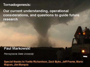
Title: Tornadogenesis: Our Current Understanding
1
Tornadogenesis Our current understanding,
operational considerations, and questions to
guide future research
Paul Markowski Pennsylvania State University
Special thanks to Yvette Richardson, Zack Byko,
Jeff Frame, Mario Majcen, Jim Marquis
2
What we know
- Supercells acquire net cyclonic rotation aloft by
tilting streamwise (horizontal) vorticity
3
What we know
- Supercells acquire net cyclonic rotation aloft by
tilting streamwise (horizontal) vorticity - Although most significant tornadoes are
associated with supercell thunderstorms, most
supercells are not tornadic - Whats perhaps most troubling is that most
supercells contain low-level mesocyclones, and
perhaps even mesocyclones at the surface!
nontornadic
nontornadic
nontornadic
tornadic
4
Markowski et al. (2002)
5
One of the most important observations made in
VORTEX might be the striking kinematic
similarities between tornadic and nontornadic
supercells at scales larger than the tornado
cyclone.
tornadic
nontornadic
6
The most intense mesocyclones are not necessarily
the ones most likely to be associated with
tornadogenesis!
Superior, NE Mesocyclone 22 June 2003 025200 -
030059 UTC
Wakimoto et al. (2004)
7
What we know
- Supercells acquire net cyclonic rotation aloft by
tilting streamwise (horizontal) vorticity - Although most significant tornadoes are
associated with supercell thunderstorms, most
supercells are not tornadic
- Tornadogenesis involves rearranging, twisting,
and stretching vortex lines so that they become
vertically oriented and packed tightly together
at the ground
8
What are vortex lines?
A vortex line is a curve in the fluid such that
its tangent at any given point gives the
direction of the local vorticity.
The magnitude of vorticity is inversely
proportional to the spacing of vortex lines.
When horizontal density gradients and
turbulence are absent, vortex lines are frozen
in the fluid, i.e., they are material lines
(Helmholtzs Theorem).
9
photo courtesy of Matt Biddle
Wicker and Wilhelmson (1995)
10
How to make a tornado
pre-existing vertical vorticity at the surface
vertical vorticity is initially negligible at the
surface
11
(No Transcript)
12
NSSL archive photo
Courtesy of Dave Blanchard
Courtesy of Dave Blanchard
13
purely barotropic process
purely baroclinic process
Courtesy of Bob Davies-Jones
14
see Rasmussen et al. (2006), Kennedy et al. (2007)
simulation by Ed Adlerman
descending reflectivity core (aka blob)
15
Wicker and Wilhelmson (1995)
Brandes (1978)
Xue (2004)
16
What we know
- Supercells acquire net cyclonic rotation aloft by
tilting streamwise (horizontal) vorticity - Although most significant tornadoes are
associated with supercell thunderstorms, most
supercells are not tornadic
- Tornadogenesis involves rearranging, twisting,
and stretching vortex lines so that they become
vertically oriented and packed tightly together
at the ground
- Tornadogenesis, if it occurs, is associated with
the development of the rear-flank downdraft (RFD)
at least in environments containing negligible
preexisting vertical vorticity at the
surface
17
Paul Markowski
Jim Marquis
Jeff Beck
18
What we know
- Supercells acquire net cyclonic rotation aloft by
tilting streamwise (horizontal) vorticity - Although most significant tornadoes are
associated with supercell thunderstorms, most
supercells are not tornadic
- Tornadogenesis involves rearranging, twisting,
and stretching vortex lines so that they become
vertically oriented and packed tightly together
at the ground
- Tornadogenesis, if it occurs, is associated with
the development of the rear-flank downdraft (RFD) - The temperature of the RFD seems to be important
to tornadogenesis RFDs that are excessively cold
apparently are unfavorable for tornadogenesis
19
Adapted from Markowski et al. (2002)
20
Photo by B. Prentice
NSSL
21
dual-Doppler analysis of a nontornadic supercell
on 12 June 2004 near Beatrice, NE
view from southwest
3 km
3 km
Majcen et al. (2007)
22
Observations obtained within forward-flank outflow
Shabbott and Markowski (2006)
23
What we know
- Best operational means for discriminating between
significantly tornadic (i.e., F2 and stronger)
and nontornadic supercells is to use radar data
in conjunction with information about the
near-storm environment - low-level shear (e.g., 0-1 km shear vector
magnitude, 0-1 km SRH) - low-level relative humidity (e.g., LCL height)
Nontornadic supercell environments and F0-F1
tornadic supercell environments are
indistinguishable for practical purposes!
24
Tornadic storms likely
Tornadic storms unlikely
courtesy of Harold Brooks
25
SPC Significant Tornado Parameter
26
But nontornadic supercell environments and F0-F1
tornadic supercell environments are
indistinguishable for practical purposes!
adapted from Thompson et al. (2004)
27
0-6 km shear
EHI
CAPE
STP
adapted from Rasmussen and Blanchard (1998)
28
Speculations about tornadogenesis(why is the
combination of low-level shear and high BL
relative humidity so special?)
- The greater the low-level shear the better (i.e.,
the greater the density of near-ground vortex
lines the better) - It can be generated internally by a storms own
temperature gradientsBUTlarge temperature
gradients imply that theres substantially cold
air somewhere - the cold air is unfavorable baggagesignificant
tornadoes are most likely to occur when strong
low-level shear is present without the
accompanying cold air baggagethis argues for
having large low-level shear in the ambient
environment, and an ambient environment in which
the low-level shear does not need further
enhancement by storm-scale cold pools (and in
fact, an ambient environment that suppresses the
development of excessively cold outflow, e.g., an
environment with large low-level RH)
29
Mesoscale boundaries
- Large-scale conditions occasionally support
significant tornadoes (outbreak days), but more
commonly, significant tornadoes are only favored
in relatively small regions where low-level shear
and/or moisture is locally enhanced
2 June 1995
- Mesoscale boundaries often enhance low-level
shear and/or moisture, and many supercells have
been observed to become tornadic upon interacting
with such boundaries - But many supercells weaken upon encountering
mesoscale boundariesclearly not all boundaries
are favorable!
30
What we dont know
31
What we dont know
- Outstanding RFD issues
- What are its forcings as a function of location
within a given supercell, evolutionary stage, and
supercell type (e.g., tornadic vs nontornadic)?
Does it matter?
32
0-1 km storm-relative helicity
30 km
23 km
33
1945 UTC 12 June 2002
25 km
hodographs every 5 km (every 25th grid point)
25 km
OFB
dryline
7
V
0
lowest 1.5 km only (tick marks every 500 m)
-5
4 m/s
0
-8
Markowski and Richardson (2007)
U
34
Refractivity
received power (dBM)
specific humidity (g/kg)
35
What we dont know
- Mesoscale variability
- What effect does it have on storms, if any?
36
(No Transcript)
37
23 May 2002 Lipscomb Co., Texas, supercell
Frame et al. (2007)
- neither storm-relative winds nor trajectories
within the outflow parallel the forward-flank
gust front - vorticity vectors in forward-flank outflow not
directed toward the updraft
38
What we dont know
- Role of storm-scale baroclinity
- How important is it to tornadogenesis?
- Thermodynamic fields above the surface?
- How far back in time do we have to look?
- Has the importance of the forward-flank
baroclinic zone been overemphasized? - How important is precipitation microphysics?
39
AVHRR image of a thunderstorm over Balearic
Island, Spain
cloud shadow
courtesy of P. Wang
40
8 June 1995
Markowski et al. (1998)
41
Simulation results at t 2 h
No radiative effects
Emulated radiative cooling
z
z
z contoured at 0.004 s-1 intervals
Markowski and Harrington (2005) Frame and
Markowski (2007)
42
The future
43
VORTEX2
- Second highly coordinated field phase of an
ongoing, broad investigation of tornadogenesis,
tornado structure, and the relationship between
tornadoes, their parent thunderstorms, and the
larger-scale environment - Target dates May and June, 2009 and 2010
- Steering Committee
- Don Burgess (Cooperative Institute for Mesoscale
Meteorological Studies) - David Dowell (National Center for Atmospheric
Research) - Paul Markowski (Penn State University)
- Erik Rasmussen (Cooperative Institute for
Mesoscale Meteorological Studies) - Yvette Richardson (Penn State University)
- Lou Wicker (National Severe Storms Laboratory)
- Josh Wurman (Center for Severe Weather Research)
44
tethered
45
fully mobile
46
http//www.vortex2.org
Recommended
CrystalGraphics Presentations


