
Corporate Background - PowerPoint PPT Presentation
1 / 62
Title: Corporate Background
1
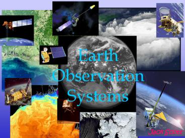
Earth Observation Systems
Jack Scott
2
From Tiros to NPOESS
?
EOS-Aqua (2005)
First Image from Tiros-1 (1960)
3
NPOESS-Convergence and Evolution
?
DMSP/POES to NPOESS
METOP
NOAA - Civil Operational
EUMETSAT Coordination
Date POES Program
1960 TIROS
1970 ITOS (Improved TIROS)
1981 TIROS-N (NOAA)
1998 NOAA-15 (improved sensors)
SeaWifs
EOS-Terra Aqua (science)
NPOESS
DMSP - DoD Operational since 1966
NPP risk reduction
Windsat risk reduction
4
POES/NOAA-Legacy Program
?
- NOAA Satellite
- ? Cloud Cover (Vis/IR) (AVHRR-1100m)
- ? Sea Surface Temperature, Ocean Color (AVHRR)
- ? Vegetation, Fires (AVHRR)
- Cloud Temperature, Humidity, Vertical Profiles
(AMSU) - Search and Rescue (SARSAT)
- Data Collection (ARGOS)
HRPT 1698-1706 MHz, 665 Kbps APT VHF 137MHz, 72
Kbps
Satellite Launch Orbit AVHRR ATOVS
NOAA-12 1991 500 X
NOAA-15 1993 730 X
NOAA-16 2000 1330 X X
NOAA-17 2002 1000 X X
NOAA-18 Mar 2005 1400 X X
NOAA-N Jan 2008 1400
NOAA reception with a .46m L-Band antenna or
greater
Spacecraft damaged in factory mishap
Will fly on NPOESS
5
METOP-EUMETSAT
?
- METOP Satellite
- ? Cloud Cover (Vis/IR) (AVHRR-1100m)
- ? Sea Surface Temperature, Ocean Color (AVHRR)
- ? Vegetation, Fires (AVHRR)
- Cloud Temperature, Humidity (AMSU/HIRS)
- Vertical Profiles (AMSU/IASI)
- Ocean Winds (ASCAT)
- Data Collection (ARGOS)
HRPT 1701.3 MHz, 3.5Mbps APT VHF 137MHz, 72 Kbps
METOP 930
NOAA 1400
Initial Joint Polar System (IJPS)
METOP HRPT reception with a 2.0m L-Band antenna.
EUMETSAT data need access keys
6
DMSP-S-Band (Encrypted)
?
- US Military Weather Satellite
- ? Cloud Cover (Vis/IR) (OLS - 550m)
- ? Night Time Lights (OLS 550m)
- ? Wind Speed, Rain Rate, Sea Ice, Temp, Pressure
(SSM/T) - Water Vapor (SSM/T2)
- Clear over latitudes gt60 degrees
DMSP reception with a 1.2 m S-Band antenna and
processing package (decryption required for less
than 60 degrees latitudes)
7
Day/Night Band on NPOESS
?
Day/Night Band-No Moonlight
Day/Night Band-Terminator
8
Coriolis - Risk Reduction
?
NRL Satellite (US Navy)
Launch 6 January 2003
Passive microwave polarimeter to measure ocean
surface winds, speed and direction. (S-band)
Polarimeter failed in January and was
successfully restarted in JuneLimited data
release from FNMOC
2221.5 MHz, 256 Kbps
- Secondary Products
- Sea surface temperature
- soil moisture
- rain rate
- ice and snow characteristics
- water vapor
- Primary Products
- Wind Speed
- Wind Direction
- EDRs available
- available later
General data release expected in November
9
SeaWifs Program
?
NASA (commercial) ? License for R/T data
access (after 2 weeks free) ? Launch Aug 1997
(5 year design life) ? Orbit 1220 ?
Mission Determine the spatial and temporal
distribution of phytoplankton. Quantify the
oceans role in the global carbon cycle
1702.5 MHz, 665 Kbps
an ocean color mission and more
10
Oceansat-1, IRS-P4
?
Indian Space Research Organization ? License
for data access ? Launch May 1999 (5 year
design life) ? Orbit 1200 LTAN
8350 MHz, 20.8 Mbps
Main Sensor (SeaWiFS heritage) ? Ocean Color
Monitor (OCM) same bands as SeaWiFS ?
Applications chlorophyll, ocean color,
phytoplankton blooms, suspended sediments,
vegetation, aerosols (smoke).. ? Advantages
higher resolution, avoid sun glint, uses SeaWiFS
processing
avoids sun glint
Oceansat-2, 2006
11
EOS Terra
?
8212MHz, 13 Mbps
Spacecraft-TRW 6 year design life
MODIS Moderate Resolution Imaging
Spectroradiometer
MOPITT Measurements of Pollution in the
Troposphere
Launch 18 Dec 1999
1030 LTDN
ASTER Advanced Spaceborne Thermal Emission and
Reflection
MISR Multi-angle Imaging Spectro-Radiometer
CERES Cloud Earths Radiant Energy System
12
Carbon Cycle Terra (am)
?
ASTER, CERES, MOPITT, MODIS
Legend
13
EOS Aqua
?
8160 MHz, 15 Mbps
AMSR Advanced Microwave Scanning Radiometer for
EOS
Spacecraft-TRW 6 year design life
Launch 04 May 2002
1330 LTAN
MODIS Moderate Resolution Imaging
Spectroradiometer
AIRS Atmospheric Infrared Sounder
CERES Cloud Earths Radiant Energy System
AMSU Advanced Microwave Sounding Unit
HSB (failed) Humidity Sounder for Brazil
14
Water Cycle Aqua (pm)
?
AIRS/AMSU/HSB
Legend
AMSR, MODIS, CERES
15
MODIS Katrina over Gulf
16
MODIS Katrina over Mississippi
17
MODIS after Katrina
18
MODIS New Orleans, before Katrina
19
MODIS New Orleans, after Katrina
20
Quickbird New Orleans, before Katrina
21
Quickbird New Orleans, after Katrina
22
MODIS Sea Surface Temperature
?
Description MODIS Derived Product Sea Surface
Temperature January 11, 2004 (0800 GMT), Bay
of Bengal. Aqua/MODIS 1km Thermal IR bands,
using MOD28 SST_MODIS algorithm MODIS Sea
Surface Temperature algorithm
23
MODIS Suspended Sediment
?
Each year the Yangtze River will deposit enough
silt to cover 1 square mile 90 feet deep!
24
EOS Aura
?
Mission To study how atmospheric composition
affects and responds to the Earths changing
climate.
8160 MHz, 15 Kbps
Launch July 15 2004
Sensors
- HIRDLS - High Resolution Dynamics Limb Sounder
- Atmospheric temperatures and greenhouse gasses
- Ozone transport between Stratosphere
Troposhere - MLS - Microwave Limb Sounder
- Atmospheric thermal emissions
- Effects of volcanic eruptions on global
climate - OMI Ozone Monitoring Instrument
- Hyperspectral imaging of back scatter Visible
and UV radiation for ozone and trace gases - Distinguish between aerosol types, smoke,
dust, sulfates - NPOESS Legacy Sensor
- TES Tropospheric Emission Spectrometer
- Quantity, distribution and mixing of minor
gases - Tropheric Ozone
25
NPOESS The Future Environmental System
Civilian Military Applications
Global Weather, Climate and Environmental data
26
NPOESS A Timeline
(NPP/NPOESS)
?
27
NPOESS Satellite Configuration
?
CMIS
ATMS
VIIRS
CrIS
Per US/EUMETSAT agreement, NPOESS will fly
CrIS/ATMS on all the 1330 and 1730 spacecraft,
using EUMETSATs IASI/AMSU on the 2130
spacecraft. This gives three advanced sounders
which greatly improving numerical forecast
capability.
CMIS- µwave imager VIIRS- vis/IR imager CrIS-
IR sounder ATMS- µwave sounder OMPS-
ozone GPSOS- GPS occultation ADCS- data
collection SESS- space environment APS- aerosol
polarimeter SARSAT - search rescue TSIS- solar
irradiance ERBS- Earth radiation budget ALT-
altimeter SS- survivability monitor
OMPS
ERBS
28
NPOESS Environmental Data Records
?
Cloud Top Pressure
Atm Vert Moist Profile
Precipitable Water
Atm Vert Temp Profile
Precipitation Type/Rate
Cloud Top Temperature
Down LW Radiance (Sfc)
Imagery
Pressure (Surface/Profile)
Sea Surface Temperature
Down SW Radiance (Sfc)
Sea Ice Characterization
Electric Fields
Sea Surface Winds
Sea SFC Height/TOPO
Soil Moisture
Electron Density Profile
Snow Cover/Depth
Energetic Ions
Aerosol Optical Thickness
Solar Irradiance
Aerosol Particle Size
Geomagnetic Field
Supra-Therm-Aurora Prop
Ice Surface Temperature
Aerosol Refractive Index
Surface Type
In-situ Plasma Fluctuation
Albedo (Surface)
Active Fires (Application product)
Auroral Boundary
In-situ Plasma Temp
Surface Wind Stress
Ionospheric Scintillation
Auroral Energy Deposition
Suspended Matter
Med Energy Chgd Parts
Auroral Imagery
Total Water Content
Land Surface Temp
Cloud Base Height
Vegetative Index
Net Heat Flux
Cloud Cover/Layers
LEGEND
Net Solar Radiation (TOA)
Cloud Effective Part Size
Neutral Density Profile
Cloud Ice Water Path
VIIRS (24)
CMIS (19)
Cloud Liquid Water
Ocean Color/Chlorophyll
CrIS/ATMS (3)
Cloud Optical Thickness
Ocean Wave Character
OMPS (1)
Outgoing LW Rad (TOA)
Cloud Particle Size/Distrib
SESS (13) (11)
(13)
O3 Total Column Profile
Cloud Top Height
- Key Performance Parameters
To be moved to P3I when SESS change implemented
29
NPOESS Data Modes
?
- There are three NPOESS data streams, potentially
coming down simultaneously - SMD stored mission data (SafetyNet)
- 100 of data observed by the satellite
- All data stored on the onboard recorder since
last 2 ground station contacts and real time data
within station circle - 300Mbps at Ka band (very complex signal)
- Set of 15 sites around the world are called
SafetyNetTM - Linked to US by ATT fiber optic cable
- HRD high rate data (X-band)2.4m antenna
- 100 of NPOESS data as it is observed (real time)
by the satellite in view of a readout station
(except data from ERBS and TSIS) - Dynamic Ancillary data (3200 km swath)
- 20 Mbps at 7812 or 7830 MHz (selectable)
- LRD low rate data (L-band).2m antenna
- Selected subset of NPOESS data
- 6x1 Compression of VIIRS data
- Dynamic Ancillary data (3200 km swath)
- 3.88Mbps at 1706 MHz
30
NPOESS Low Rate Data
?
Limited LRD Bandwidth
1330 2130
1730
VIIRS
CMIS
CrIS
CCSDS
31
NPOESS Principal Sensors
?
Visible/IR Imaging Radiometer Suite (VIIRS)
Cross-track IR Sounder (CrIS)
23 EDRs, 2 KPPs
Conically scanning Microwave Imager/Sounder
(CMIS)
Advanced Technology Microwave Sounder (ATMS)
19 EDRs, 2 KPPs
Ozone Mapping Profiler Suite (OMPS)
3 EDRs, 2 KPPs
32
VIIRS/MODIS Comparison
?
Visible/IR Imaging Radiometer Suite (VIIRS)
Moderate Resolution Imaging Spectroradiometer
(MODIS)
7 years
Design Life 5 years
3000 km
Swath 2330 km
.4 - 12µm, 12 bit
Bands .4 - 14µm, 12 bit
Resolution
2 bands _at_ 250m
5 bands _at_ 375 m (imaging)
5 bands _at_ 500m
16 bands _at_ 750m
Day/Night band_at_740m
29 bands _at_ 1000m
Improved resolution across swath!
Resolution at Nadir
.Finer spatial resolution, Better sensitivity!
33
Spectral Bands
?
UV
5
6
7
DNB Day/Night Band (CCD)
34
- SeaWiFS
- 1 402-422
- 2 433-453
- 3 480-500
- 4 500-520
- 545-565
- 6 660-680
- 7 745-785
- 8 845-885
AVHRR 1 580 - 680 2 840 - 940 3a
1.58-1.64 3b 3.55 - 3.93 4 10.3 -
11.3 5 11.5 - 12.5
- MODIS
- 8 405 - 420
- 9 438 - 448
- 483 493
- 12 546 - 556
- 1 620 - 670
- 13 662 - 672
- 15 743 - 753
- 16 862 - 877
- 2 841 - 877
- 5 1.23 - 1.25
- 26 1.36 - 1.39
- 1.63 - 1.65
- 7 2.11 - 2.16
- 3.66 - 3.84
- 23 4.02 - 4.08
VIIRS M1 402 - 422 M2 436 - 464 M3
478 498 M4 545 - 565 I1
620 - 670 M5 662 - 682 M6 744 -
758 M7 845 - 885 I2 845 -
885 M8 1.23 - 1.25 M9 1.371 - 1.385 M10 1.58 -
1.64 I3 1.58 - 1.64 M11 2.235 - 2.285 M12 3.61 -
3.79 I4 3.55 - 3.93 M13 3.97 - 4.13 M14 8.40 -
8.7 M15 10.3 - 11.3 M16 11.5 - 12.5 I5 10.6 - 12.5
35
VIIRS Spatial Resolution
?
36
CMIS A passive microwave radiometer
?
Technology evolution since 1987
Charactertic SSMI TMI SSMIS AMSR-E CMIS
Program DMSP F8-F15 TRMM DMSP F16-F20 Aqua Windsat NPOESS
Diameter 0.61m 0.61m 0.61m 1.6m 2.2m
Channels 7 9 24 12 77
Mass 48kg 54kg 96kg 324kg 250kg
Power 45W 50W 135W 350W 340W
Data Rate 3.3kbps 8.8kbps 13.7kbps 87.4kbps 315kbps
Conically scanning Microwave Imager/Sounder
(CMIS)
- Technological improvements over heritage sensors
- Size 2.2 meter LF aperture provides better
resolution - More channels
- Lower frequencies 6 and 10-GHz channels
- 40 FFT channels improves sounding
- Higher bandwidth
- Better data products
- Improves on current products
- New operational products
37
CrIMSS Infrared Microwave Sounding
?
Heritage Sensors
NOAA AMSU-A1,A2
NOAA MHS
NOAA HIRS
Cross-track IR Sounder (CrIS)
EOS-Aqua AMSU
EOS-Aqua HSB
EOS-Aqua AIRS
NPOESS CrIS
NPOESS ATMS
Compressed to single unit saving 100 kgs
Advanced Technology Microwave Sounder (ATMS)
- CrIMSS Capabilities
- Troposphere Temperature 1 K for 1 km layer
- Stratosphere Temperature 1 K for 4 km layer
- Surface to Troposphere Humidity 10 for 2 km
layer
Passive Sounding
38
CrIMSS Infrared Microwave sounding
?
Heritage Sensors
NOAA AMSU-A1,A2
NOAA MHS
NOAA HIRS
Cross-track IR Sounder (CrIS)
EOS-Aqua AMSU
EOS-Aqua HSB
EOS-Aqua AIRS
NPOESS CrIS
NPOESS ATMS
Compressed to single unit saving 100 kgs
Advanced Technology Microwave Sounder (ATMS)
- CrIMSS Capabilities
- Troposphere Temperature 1 K for 1 km layer
- Stratosphere Temperature 1 K for 4 km layer
- Surface to Troposphere Humidity 10 for 2 km
layer
Passive Sounding
39
OMPS Ozone Mapping Scanner Profiler
?
..monitor the ozone depletion for the Montreal
Protocol...
A nadir pointing scanner that will be used to
obtain measurements of the total column ozone and
a limb scanner which looks past the forward edge
of the spacecraft to obtain vertical profiles of
ozone
Limb Profiler
Nadir Scanner
Ozone Mapping Profiler Suite (OMPS)
Heritage Missions
Nimbus-7 1978 Antarctic Ozone hole
Total Ozone Mapping Spectrometer
(TOMS) 1979-present Ozone aerosol profiles
Upper Atmospheric Research Satellite
(UARS) 1991-present Chlorine radicals, solar UV
EOS-Aura 2004 Lower atmosphere chemistry,
aerosols water vapor
Aura
40
Other NPOESS Sensors
?
Radar Altimeter
? Sea Surface height measurement (pulsed radar
altimeter) ? 1730 ? Jason-1/Poseidon
Earths Radiation Budget Suite (ERBS)
? Earths emitted radiation measurement ?
1330 ? Terra/Aqua CERES
Total Solar Irradiance Sensor (TSIS)
? Total irradiance and spectral irradiance of
sunlight ? 1730 ? Solar Radiation and Climate
Experiment (SORCE) mission
Survivability Sensor (SS)
? Protection against assault ? All ? Other
space programs
41
Other NPOESS Sensors
?
Space Environment Sensor Suite
? Particles and fields resulting from solar
activity (solar storms) ? 1730 ? other space
missions
Advanced Data Collection System and Search and
Rescue Satellite Aided Tracking
? Global environmental data collection and SAR
distress signals ? ADCS 1330/1730, SARSAT -
all ? NOAA spacecraft
Aerosol Polarimetry Sensor
? Aerosol concentration and composition ?
2130 ? ON HOLD
42
NPOESS Preparatory Program
?
bridge between EOS and NPOESS
NPP Provides
- Continuity of climate data sets begun with the
Terra satellite in 1999 - Risk reduction for four critical sensors that
will be flown operationally on NPOESS - Early algorithms development which convert the
sensor measurements into environmental data
products. - Early test of the NPOESS ground segmentscommand,
control communications, and data processing - Four sensors will provide 27 of the 55 NPOESS
Environmental Data Records (EDRs)
43
Land Imaging on NPOESS C1 (2130)
?
44
Landsat Legacy
?
Satellite Launch Notes
Landsat 1 1972
Landsat-2 1975
Landsat-3 1978
Landsat-4 1982 Standby
Landsat-5 1984 Operational
Landsat-6 1993 Failed on Launch
Landsat-7 1999 Scan Line failure-Operational
Alice Springs, LS data collection since 1979
The 33 year record of data acquired by the
Landsat satellites constitutes the longest
continuous record of the earth's continental
surfaces
Lake Disappointment, WA
Lake Carnegie, WA
Off shore, Bahamas
45
NPOESS ALI Sensor from EO-1 Mission
?
46
Advanced Land Imager
?
Three bands have been added to the Landsat
ETM The thermal IR band was dropped
47
Land Imaging Gap Filler ???
?
ALI on C1 or free flyeravoid a big data gap...
Uncertainty with NPOESS cost and schedule
? Concern that Landsat will not last until 2010,
NPOESS C1 launch ? Worries concerning schedule
and cost to develop a land imager
NPOESS land imaging technical issues
? Orbit differences EO-1 is at 700km, NPOESS at
830km ? EO platform is free of jitter, NPOESS is
mechanically noisy
Landsat 7
? Degraded data due to failed scan converter ?
Only one working gyroscope-one failure to end of
life
Launch by 2008
Decision on this hot topic is due next month.
48
Other Missions
1730
1330
2130
Local Equatorial Crossing Time
49
Ocean Surface Topography Mission (Jason-1 follow
on)
?
Mission Objectives (Launch 2008) Measure Ocean
Surface Topography (3.3 cm) Increase
understanding of ocean circulation Improve
forecasting of climate events Measure global sea
level change
OSTM NASA/CNES Launch Apr 2008
Tsunami, Dec 26, 2004
Jason-1 TOPEX NASA/CNES Launch Dec 7, 2001
Period 800 km/hr
60 cm
1.1 m
50 cm
800 km
50
QuickBird January 1 2004
Kalutara Beach, Sri Lanka
51
QuickBird December 26 2004
Kalutara Beach, Sri Lanka
52
A few minutes later
Kalutara Beach, Sri Lanka
53
Water receding..
826 am
December 26, Khao Luk, Thailand
54
A wall of water building in the distance.
55
A wall of water churning up sand and debris..
830 am
56
832 am
57
A nearly 10m wave coming ashore..
833 am
58
Global Precipitation Measurement (TRMM follow on)
?
GPM is, like TRMM, composed of one sun
non-synchronous orbit satellite (a core
satellite)-borne a precipitation radar and a
microwave scanning radiometer
TRMM Launch Nov 27 , 1997
TRMM Orbit Tropical rainfall, which falls
between 35 degrees north latitude and 35 degrees
south latitude, comprises more than two-thirds of
the rainfall on Earth.
59
Synthetic Aperture Radar
- RADARSAT
- ERS
- ALOS Dec 2005 (?)
- RADARSAT-2 2006 (?)
60
SAR image of Salton Sea, California
?
Landsat-7 30 m resolution
ERS-2 30m resolution
road
agriculture
Desert
Salt Lake
surface disturbance due to winds
61
SAR Applications
?
Topographical Mapping
Floods and Cyclones
? Digital Elevation Maps ? Stereo mapping
? All weather damage assessment and mitigation
planning ? Rising flood waters from storms and
cyclones
Sea Ice Hazards
? Shipping and Maritime Hazards for Antarctic
support ? Monitoring ice shelf and ice bergs
Earthquakes and Regional Deformation
? Surface change in seismically active areas ?
Rising flood waters from storms and cyclones
Wind Tracking
Ground Subsidence
? Aid coastal region maritime traffic and low
flying aircraft ? Winds close to coast, rivers,
bays and lakes
? Surface subsidence and rebound due to aquifer
discharge and recharge ? Subsidence due to
withdraw of gas and petroleum
Oil Slicks
Ocean Surveillance and Coastal Protection
? All weather ship tracking ? Ship detection,
wake detection, apparent heading
? Monitor/detect oil slicks natural and
man-made ? Pollution enforcement and spill
containment
62
SAR examples
28 mm contours
Ocean Surveillance
Oil Seeps
Ships
Earthquake deformation
SAR can penetrate light sand up to 2 meters
Oil Field subsidence
Blowing dust and sand
Stereo Radar Topographic Mapping
Compare ETM and SAR
63
SAR Spacecraft
?
- ? TeraSAR X, Ger, 1m, 2006
- ? TeraSAR L, Ger, 1m, 2008
- ? RISAT (C), India, 10m, 2006
- COSMO 1-4 (X), Italy, 1m, 2006-7
- Surveyor 1-5 (C), China, 10m, 2007-9
Others
Radarsat-1
? Launch Nov 4, 1995 ? 35 500 km, 10 m 100
m resolution ? C-band
Envisat (ASAR)
? Launch March 1 2002 ? 60-100km, 30 m
resolution ? C-band
ALOS
ERS-2
? Launch April 21, 1995 ? 100km, 30 m
resolution ? C-band
Radarsat-2
? Launch 2006, 600 orbit (7 year mission) ?
20-100m, 3 meter Ultra fine, 10 meter resolution
? C-band, selective polarization
64
ALOS
?
precise land coverage observation
Launch Sept 2005 Orbit 1030 Design 3-5
year Data rate 138 Mbps
PRISM ? Terrain Elevation Mapping (stereo) ?
Three optical systems (nadir, forward, backward)
0.52 - 0.77µm ? 35/70 Km FOV _at_ 2.5m
AVNIR ? Land use classification ? Infrared
radiometer 4 band ? 70 km FOV _at_ 10 m
PALSAR ? Terrain Elevation Mapping (SAR) ?
L-band, 127 GHz ? 70 km _at_ 10m/ 350 km (scan)
Launch delay until February 2006 (contaminated
electronics)
65
Thank You
Recommended
CrystalGraphics Presentations


