
Global Water Resource Assessment Project -Validation of Global EPIC- - PowerPoint PPT Presentation
Title:
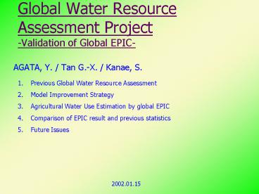
Global Water Resource Assessment Project -Validation of Global EPIC-
Description:
Water Supply. GSWP (Global Soil Wetness Project) Result of 'runoff' from each cells (Monthly) ... water demand(Indus. Agri. Domes.) S: Freshwater production ... – PowerPoint PPT presentation
Number of Views:51
Avg rating:3.0/5.0
Title: Global Water Resource Assessment Project -Validation of Global EPIC-
1
Global Water Resource Assessment
Project-Validation of Global EPIC-
- AGATA, Y. / Tan G.-X. / Kanae, S.
- Previous Global Water Resource Assessment
- Model Improvement Strategy
- Agricultural Water Use Estimation by global EPIC
- Comparison of EPIC result and previous statistics
- Future Issues
2002.01.15
2
Global Water Resource Assessment (previous)
- Mainstream 0.5-degree grid cells.
- IHP/UNESCO
- Shiklomanov, 2001
- Univ. of New Hampshire, USA
- Vorosmarty et al., 2000
- Kassel Univ., Germany
- Alcamo et al., 2000 Water Use
- Univ. of Tokyo
- Oki et al.(2001) Using Advanced Estimation of
River Discharge
3
Previous Method
- 0.5-degree grid cells
- Water Supply
- GSWP (Global Soil Wetness Project) Result of
'runoff' from each cells (Monthly) - River discharge estimation by TRIP (Total Runoff
Integrating Pathways) and GSWP data
4
Previous Method 2
- Water Demand
- Base1 WRI (World Resource Institute) water- use
statistics of each countries - Base2 CIECIN global population data
- Industrial and Domestic(Urban) Water Use
Re-distribute WRI country data so that values in
every cells are proportional to population within
that cell.
5
Cont'd
Domestic Water Use
Industrial Water Use
6
Previous Method3
- Agricultural Water Use Today's Topic
- Base WRI country-based statistics
- How should we re-distribute this values?
- Proportional to Grid Irrigation Area? (Kassel
Univ.) - or to Grid Cropland Area? (WRI)
Prop. To Irrigation Area
Prop. To Cropland Area
7
Previous Method 4
- Estimation of Water Stress Distribution
- Symbols
- R Runoff from each cell
- Q River discharge
- W Total water demand(Indus.Agri.Domes.)
- S Freshwater production by desalinization
- C Population
8
(cont'd)
- Criteria
- Water demand per capita W/C
- Withdrawal-to-Availability ratio (W-S)/Q
- gt0.4 severe water stress
- lt0.1 safe
W/C
(W-S)/Q
9
(cont'd)
- What is 'available water'?
- Not whole amount of Q can be used.
- Used (and lost) or polluted in upstream region
- Introduction of Alpha-index
- Available water R ? ?D
- ?D Sum of river water from upstream cells
alpha1.0
(W-S)/Q, alpha0.0
10
(cont'd)
- Sensitivity of alpha-index to water stress
estimation
Change in population under water stress according
to change in alpha
(W-S)/Q
11
Model Strategy
- Current 'nearly static' model
- ---or merely 'calculation'
- Severe problem in future projection
- Scenario-dependent
- What if no data and/or projection available?
- Unrealistic assumption
12
(cont'd)
- To 'dynamic' model with as less external
variables as possible - Sub-models
- Climate change / River flow
- Agriculture model
- Industrial water use model
- Urbanization model
- Environmental water demand estimation
- Linkage of all models
- To be one of the goals of CREST project
13
Estimation by EPIC
- Result Monthly 0.1-degree grid estimation of
maximum irrigation water demand
Annual Total
14
Estimation by EPIC
EPIC
WRI (cropland)
WRI (irrigation)
15
Comparison
- Annual Total Agri. Water Demand
- EPIC 8,971109m3
- Two peaks in March and September
- WRIKassel Irrigation2,396 109m3
16
(cont'd)
- EPIC result WRI statistics
- EPIC is larger India
- EPIC is smaller USA
17
(cont'd)
- New irrigation area dataset by Kassel Univ. is
available
Old (currently used)
New
18
Future Issues
- Use of common dataset to drive each submodels
- Climate, soil type, vegetation, river network,
crop type etc. - Needs Common data archive and uniform (standard)
data format - Determination of interface of each model
- Definition of 'available water'
Recommended
CrystalGraphics Presentations


