
Atmospheric Science Faculty Retreat - TAMASAG - PowerPoint PPT Presentation
Title:
Atmospheric Science Faculty Retreat - TAMASAG
Description:
Atmospheric Science Faculty Retreat TAMASAG – PowerPoint PPT presentation
Number of Views:39
Avg rating:3.0/5.0
Title: Atmospheric Science Faculty Retreat - TAMASAG
1
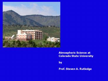
Atmospheric Science at Colorado State
University by Prof. Steven A. Rutledge
2
Mission
- Graduate Degree Program
- Cutting-Edge Atmospheric Research
- Service to the Profession
3
GRADUATE DEGREE PROGRAM
- Our academic energies are directed towards
graduate - education and advising
- Graduated 550 M.S. and 250 Ph.D. students in
Departments 40 year history - Current average 10 Ph.D. degrees/yr. and 15
M.S. degrees/yr. - Education philosophy provide breadth in
fundamentals and depth in specializations (core
classes and specialized classes)our curriculum
is never stagnant! - Students are integral members of research teams
- About 100 graduate students enrolled, most under
GRA support - About 150 applications per year 20 admitted
4
ATS Research Areas
Atmospheric Chemistry
Atmospheric Radiation and Remote Sensing
Biosphere and the Carbon Cycle
(Structure by Sub-Disciplines)
(Kummerow, Stephens, Vonder Haar)
(Collett, Heald, Kreidenweis)
(Denning, Ito)
Cloud Physics/Dynamics
Atmosphere/Ocean Dynamics/Circulation
Climate Studies
(Everyone)
(Cotton, Johnson, Rutledge)
(Ito, Schubert, Randall)
Tropical Cyclones
Mesoscale Dynamics
Radar Meteorology
(Schubert)
(Cotton, Johnson, Rutledge)
(Rutledge)
5
Impacts on storm intensity
Clean 100 cm-3 Polluted 1000 cm-3 Double
2000 cm-3
Simulated tropical cyclone storm intensity
changes (minimum sea level pressure) and maximum
surface winds with Saharan dust acting as CCN
from Zhang et al. (2007). Cotton et al. (2007)
then propose that seeding hurricanes with CCN may
be a way of reducing TC intenstiy.
6
Lightning observed by Space Shuttle
NASA-TRMM Satellite Ku band radar Microwave
image Optical lightning detector
Optical Sensor
Radar
Orbit altitude 220 miles
Optical Sensor NASA MSFC
7
Global Lightning Observed from the
NASA-OTD 10-1000 times more lightning over land
than Ocean Global Flash Rate about 40 flashes
per second
8
B
Graeme Stephens, PI
MODIS 12 µm (Channel 32) 23 Aug 2006 2100 UTC
Hurricane Ileana
A
A
B
20
CloudSat Radar Reflectivity (dBZ)
Eye
Height (km)
10
0
9
Coincident TRMM/CloudSat Case3 April 2007
10
Coincident TRMM/CloudSat Case3 April 2007
11
Coincident TRMM/CloudSat Case3 April 2007
12
Trends in Southern Hemisphere surface
climate consistent with forcing by the Antarctic
ozone hole
(Relationship is seen for the Arctic Ozone Hole
as well)
Circles are trends in station temperatures
(Celsius/30 years). Vectors are trends in surface
winds (longest vector is 5 m/s/30 years).
13
Research on the Carbon cycle..
14
The CSU-CHILL National Radar Facility A Dual
Polarization S-Band System
The CSU-CHILL radar uses a unique 9m diameter
offset feed antenna to selectively transmit and
receive horizontally or vertically polarized
signals. Polarimetric data allows information on
hydrometeor shape and orientation to be
determined. Here a dual polarization quantity
related to hail (Hdr) is shown. An accumulation
of hailstones was found in the positive Hdr swath
left by the storm. Dual polarization radar
research activities conducted at the CSU-CHILL
Facility support both operational (hydrometeor
identification improved rainfall estimation,
etc.) and educational applications (remote real
time radar displays via the internet case study
archives, etc.)
Plot of Hdr hail parameter and the underlying
Earth surface generated by VCHILL software
interfaced with Google Earth
15
And just earlier this week at the CHILL site.
16
A hail core identified by Dual-polarization radar.
V
hail
rain
H
Zdr 10 log10 (Zhh/Zvv)
17
Hail Storm
18
Arcus example
19
Vertical cross sections through the same
arcus-producing storm system
20
MESOCYCLONE
21
WINTER STORM
22
(No Transcript)
23
DUNDEE Down Under Doppler and Electricity
Experiment
1988 1989-1990
Spider lightning above the MIT radar Courtesy,
Dr. Tom Rickenbach
Darwin C-band, Dr. Tom Keenan
DUNDEE was carried out in the vicinity of Darwin,
Northern Territory, Australia during the wet
seasons of November 1988 through February 1989,
and November 1989 through February 1990. The
general goal of DUNDEE was to investigate the
dynamical and electrical properties of tropical
mesoscale convective systems and isolated deep
convective storms. The observational network
consisted of two C-band Doppler radars (MIT and
TOGA), a 50 MHz vertically pointing wind
profiler, mesonet stations, upper air sounding
stations, and cloud electricity instrumentation.
24
Williams et al. 1992 JAS
Rutledge et al, 1992 BAMS
Quantify the lightning-CAPE correlation Consider
graupel to be dominant particle type in mixed
phase region with w(CAPE)1/2, ZD6, MD3, and
VTD 1/2, we find, ZW12CAPE6 and
MW6CAPE3 Small changes in CAPE lead to large
changes of M in mixed phase region, when combined
with ice crystals and SLW results in
electrification.
25
Rain Yield defined as mass of water per CG
lightning flash
26
TRMM-LBA
27
Location of campaign
28
Brazilian Lightning Detection Network (BLDN)
Oscillations apparent East (west) anoms more
(less) lightning.
Petersen et al., 2001
29
STEPSSevere Thunderstorm Electrification and
Precipitation StudyMay-July 2000
30
Radar Network
Dual-Doppler and Triple Doppler configurations
31
STEPS Ops Center
CSU-CHILL National Radar Facility 10 cm
polarimetric/Doppler www.chill.colostate.edu
32
- STEPS Fixed Instrumentation Triple-Doppler
Network and LMA (VHF TOA)
- At KGLD
- NWS
- T-28
- NSSL
- Electric field balloon
- Mobile mesonet
- MGLASS
33
2130 UTC
2328 UTC
KGLD
0110 UTC
0251 UTC
Tessendorf et al., JAS, 2005
Storm swath of base reflectivities (2100-0251
UTC) with NLDN lightning data overlaid.
34
23 June storm Early normal tripole,
-CGs
- 29 June Supercell
- Inverted tripole
- CGs
- 3 June storm
- Inverted dipole
- No CGs
Later, collapse inverted tripole, CGs
35
Q Why did charge structures differ? A
Updraft and shear.
29 June
3 June
23 June
36
PACS Eastern Pacific Investigation of Climate and
the Coupled Ocean-Atmospheric System EPIC 2001
ITCZ Operations (Sept. 2001)
How are the location, strength, and other
characteristics of ITCZ convection determined?
What mechanism or set of mechanisms forces
convection in the east Pacific ITCZ?
37
(No Transcript)
38
NAME-North American Monsoon Experiment--2004
39
Diurnal trends
- Frequent, low-intensity precipitation initiating
over the SMO around 1600 LDT - Less frequent, but higher intensity
precipitation over the lower terrain during the
morning (0800 LDT) - Consistent with NERN results
40
(No Transcript)
41
20 June 07 MCS
42
(No Transcript)
43
Plan View
Vertical (1st 10 LMA pts)
Reflectivity (dBZ)
White Diamond - Mean loc of 1st 10 LMA pts Red
Triangle - SPCG strike location Grey Points -
LMA sources
Initiation in Transition Zone just below Freezing
Level Bi-level flash w/ sloping upper
All sources (N-S vertical projection)
Start of Flash
Time (UTC)
CG
N
S
44
Plan View
Reflectivity (dBZ)
White Diamond - Mean loc of 1st 10 LMA pts Red
Triangles - SPCG strike locations Grey Points -
LMA sources This flash is about 600 km in length!
Initiation in Decaying Convection just behind
Leading Line Complex flash behavior in vertical
All sources (E-W vertical projection)
Start of Flash Complex
Time (UTC)
W
E
45
Thats all.
- Questions
Recommended
CrystalGraphics Presentations


