
Global observation of forest cover and landuse dynamics GOFCGOLD in Africa - PowerPoint PPT Presentation
1 / 40
Title:
Global observation of forest cover and landuse dynamics GOFCGOLD in Africa
Description:
Global observation of forest cover and land-use dynamics (GOFC/GOLD) in Africa ... and research institutions in DRC, Malawi, Mozambique, Tanzania, Zambia and Zimbabwe. ... – PowerPoint PPT presentation
Number of Views:95
Avg rating:3.0/5.0
Title: Global observation of forest cover and landuse dynamics GOFCGOLD in Africa
1
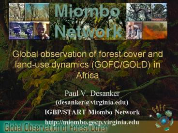
Global observation of forest cover and land-use
dynamics (GOFC/GOLD) in Africa
- Paul V. Desanker (desanker_at_virginia.edu)
- IGBP/START Miombo Network
- http//miombo.gecp.virginia.edu
2
Outline What is the Miombo Network What is
GOFC/GOLD and what role do they play in
environmental assessment and decision
support? What data are available for the
community?
3
The Miombo Network is a regional alliance of
researchers working on land use and land-use
change, under the auspices of the IGBP/IHDP Land
Use and Cover Change (LUCC) Project and the
IHDP/IGBP/WCRP Global Change System for Analysis,
research and Training (START) Members in Africa
include government, university and research
institutions in DRC, Malawi, Mozambique,
Tanzania, Zambia and Zimbabwe. Elsewhere, members
include Universities, research institutions and
NGOs in the U.S., Europe and Australia. Main
sponsors include NASA, WWF, START, and NSF.
4
Land Use and Fire
- Dominant form of land use management is
subsistence agriculture, with slash
burn/shifting cultivation - Fire central feature of land and vegetation
management
5
Slash and Burn Agriculture
6
Slash and Burn Agriculture in Zambia, Landsat TM
7
Examples of 15 day fire counts
for Africa determined from AVHRR
8
Critical Issues related to Data and Monitoring
- Patterns and rates of change in land cover
- Validated and timely delivery of data to
environmental analysts and decision makers - Issues of cost
- Processing methodologies
- Multiple demands for data
- Limited capacity to process and utilize
geospatial data
9
GOFC/GOLD Heritage
- Committee on Earth Observing Satellites (CEOS)
- Global Terrestrial Observing System (GTOS) under
CEOS - Global Observation of Forest Cover (GOFC) and
Land Dynamics (GOLD) under GTOS
10
What is GOFC?
- An ambitious, multifaceted international strategy
to bring the Earths forests/land cover under
continuous observation. - A vision to share data, information and
knowledge, leading to informed action. - A coordinated program of activities to ensure
that earth observation and other data are used
effectively for global monitoring for natural
resource management, policy and global change
research.
11
What is GOFC?
- A network of participants implementing
coordinated demonstrations of the use of
geospatial information and technology for
sustainable development - An international organization of space agencies
and end users working together. - A long term process of building an improved match
between data products and user needs.
12
Who is involved?
- Key players
- International bodies
- Researchers
- Space agencies
- NGOs
- National forest agencies
- Operates through
- Scientific and Technical Board.
- Implementation Teams (Land Cover and Fire)
- Regional Networks
13
GOFC/GOLD Regional Networks
- Provide guidance on regional user needs and
capabilities - utilizing existing science networks
- GOFC interface to national mapping and monitoring
activities - Foster lateral transfer of technology and
experience between countries and regions - Intended to provide transition to operational
continuity - Current network initiatives
- South East Asia SEARIN - Central Africa -
OSFAC - Southern Africa Miombo Network
- Boreal (initial meetings W. Russia/Fennoscandia,
Far East) - E. Asia (under discussion - South America
(under discussion)
14
GOFC/GOLD Miombo Network
- Coordinates pilot GOFC activities in Southern
Africa - Offers mechanism for extensive validation of
products and access to user groups - Acts as a bridge for data delivery and access,
and training for user community in Southern
Africa
15
Miombo Landsat 5 and 7 Data Archive
(Also have 1990 Landsat 5 data for area boxed
from Earthsat)
16
Forest/Land Cover
17
Goals and Objectives
- Improve access to remote sensing data.
- Develop a global data set of coarse and fine
resolution data (such as global Landsat data for
2000) and make them available through a GOFC
mechanism to users, such as FAO and UNEP, who
need access to imagery. - This will be done through CEOS agency
contributions, data buys, other mechanisms. - The goal will be much improved data and
information system for widespread dissemination
of data sets.
18
Early Initiatives (cont.)
- Improved pre-processing of remotely sensed data.
- Develop a prototyping effort for improved
products through "best-practices" or community
consensus atmospheric correction, and
georegistration. - Evaluation and validation of global land cover
products. - Validating global and regional land cover
products is a very high priority. The principal
vehicle for doing this will be regional GOFC
networks for validation.
19
Early Initiatives (cont.)
- Improved global land cover products
- Provide a demonstration of improved global land
cover products using new remote sensing
technologies taking advantage of existing
research and development activities. sensors,
e.g., from MODIS and results from
VEGA-2000/GLC2000. - Also demonstration of regional high resolution
forest/land cover maps including fine resolution
fractional cover for degradation assessment (from
systems such as Landsat and Spot)
20
Early Initiatives (cont.)
- Land cover change monitoring
- Demonstration of a multi-level Land Cover Change
monitoring systems - global moderate resolution
change detection with responsive high-resolution
acquisition and associated distribution system. - Coordinating a state-of-the-art-review of methods
for global assessment of deforestation will also
be a goal. - Coupled remote sensing - in situ systems
- Demonstration of coupled remote sensing-in situ
approaches, such as the kNN technique and others,
which are being developed within the forest
management community.
21
Early Initiatives (cont.)
- Regional carbon data bundles
- Integrated sets of data (or bundle) relevant to
regional carbon assessment including forest type,
fractional cover, area of change and biomass
inventory will be created and made available
22
Program activities and initiatives
- Forest cover and carbon.
- Contribute to the development of a global carbon
observatory for carbon source-sink issues, both
in a scientific and policy context. - a) characterization of the missing sink in
temperate zone forests, as a function of changes
within forests through changes in density,
changes in the extent of forest areas,
replacement of other systems by forests, or loss
of forests, - b) source terms in the tropics, the uncertainty
leading directly to uncertainty in the estimated
sink, - c) issues of measurement methods for large area
assessments of changes in land covers into and
out of forest classes, changes in stand density,
and methods for linking in-situ measurements from
stand inventory data to remote sensing data. - Links to the IGOS Terrestrial Carbon Observatory
23
Initial priorities (cont.)
- Ecosystem Assessment.
- To provide a demonstration of the role for global
observational data for other international needs
beyond carbon, - GOFC/GOLD should support product needs for the
Millennium Ecosystem Assessment with a focus on
information relevant to biodiversity and
ecosystem structure and distribution
24
Initial priorities (cont.)
- Forest resource assessment and management.
- Using the regional networks the IT will target
key projects for demonstration of support to
forest managers and the national scale. - Emphasis is not on capacity building but to seek
input from the forestry agencies and prototype
some key outputs and products, which make use of
new remote sensing information coupled to in-situ
measurements. - This will also assist in the development of
regional "harmonized" forest inventories (as
maps) merged from individual country efforts.
25
Initiation of Observatories
- Carbon Observatory The overall goal of the
Carbon Observatory is to map current carbon
storage as well as the changes in carbon storage
across the global landscape. - (Miombo Network - Field measurements of carbon
density in different land uses as input into
carbon accounting for the Miombo region, others
doing the same in other ecosystems of Africa - Ecosystems Observatory (for the Millennium
Ecosystem Assessment and Other communities) The
Ecosystems Observatory will focus on the remote
sensing of the extent, integrity, composition and
change of the Worlds various ecosystems. The
observatory will use a course resolution base map
(1-km) that will be progressively overlaid with
medium-to-fine resolution remotely sensed data as
they become available.
26
Observatories
- Forest Status Observatory
- The Forest Status Observatory will provide a
demonstration of improved global and regional
products using new remote sensing technologies by
taking advantage of existing research and
development activities, for example, data from
MODIS sensors and results from VEGA-2000/GLC2000.
- It would also provide a demonstration of
regional high resolution forest/land cover maps
including fine resolution fractional cover for
degradation assessment (from systems such as
Landsat and SPOT).
27
Some example contributory projects
- VEGA-2000, global and regional (CNES)
- Global Land Cover 2000 (JRC)
- Percent Tree Cover product(s) (NASA/UMd/GLCF)
- Global Forest Watch (WRI)
- FAO AsiaCover/AfriCover
- G8 Forest Initiative
- EU Boreal forest cover mapping project
- GRFM/GRBM from NASDA
- MODLand 250 m production
- NASA Landsat Global Acquisition
- MRLC
- National Programs
28
Data Distribution to Stakeholders in Central and
Southern Africa
- Distribution of Landsat data on CD to national
reps each country has copies of ALL data
available in the Miombo Network archive for their
region(total of gt300 scenes, mostly older data) - Acquisition of Landsat 5 and 7 (see map) ongoing.
29
Miombo Data Server set up in collaboration with
MSU-TRFIC. (http//www.bsrsi.msu.edu/trfic/MIOMBO/
)
30
Example of current capabilities
tree cover derived from 1992-93 1km AVHRR
(DeFries et al, 2000)
31
Landsat 7 2000 Data Set
- NASA has committed to produce a global
ortho-rectified data set of the globe for 2000. - Complementary to early 1990s data set.
- Almost complete
- Committee set up to select data.
- Chair Tony Janetos WRI (on STB)
- Also possibility of a global land cover
classification. - An Implementation Team is providing input to
ensure GOFC needs met.
32
ETM Data Archive Coverage (after 21 mths of
operation, US archives)
33
Cover Information System Requirements
- Data quality needed for operational products
- Product Validation
- Availability and Access
- Cost (affordable to the user)
- Reporting frequency targetted to needs and
science annual to decadal
34
FIRESouthern Africa Fire Network
(SafNET)Active Fire over Africa on the Web
35
Principal GOFC-Fire goals
- Fire emissions suites along with input data for
easier validation/intercomparison - Product accuracy operational network of fire
validation sites and protocols established
providing accuracy assessment for operational
products and test bed for new or enhanced
products leading to standard products of known
accuracy - Enhanced user products and data access -
operational multi-source fire / GIS products -
Web based data access - User awareness increased understanding of the
utility of satellite fire products for global
change research, resource management and policy
(UN, Regional, National, Local)
36
Example GOFC Contributory Projects/fire
- GOES Fire Monitoring (NOAA)
- ATSR Fire Atlas (ESA)
- DMSP Global Fire System (NOAA)
- TRMM Active Fire Monitoring (NASA)
- MODIS Global Fire /Rapid Response System (NASA)
- SEA Asia Fire and Haze Monitoring (NOAA)
- Fire M3 (CCRS/CFS)
- GLOBSCAR / Italscar (ESA)
- Global Fire Monitoring Center (Germany)
- Miombo Fire Validation Network (NASA)
- Miombo Network LCLUC
- Boreal Fires Carbon and Emissions (CCRS)
- AVHRR US Fire Emissions (NASA)
- AVHRR World Fire Web (EU/JRC) )
37
MODIS Rapid Response SystemExample of Active
Fire / Corrected Reflectance Product Siberia
(05/22/01)
38
Forthcoming challenges
- Broaden involvement in GOFC
- Through implementation teams and networks
- Through international conference in 2003
- Broaden access to multiple data sources
especially those from commercial satellites - Improved communications about GOFC/GOLD
(participation at WSSD Johannesburg). - Development of synergies with related activities
- Mainstreaming use of Remote Sensing use in
development analysis and decision support - Technological constraints associated with the
Internet
39
Related Events at WSSD
- Modis Rapid Response System at NASA Booth in
Ubuntu (active fires until previous day) - Miombo GOFC/GOLD activities at NASA Booth in
Ubuntu (Safari 2000, LCLUC mapping etc under NASA
earth science programs - CEOS and ESA booths at Ubuntu
- GISD within US booths etc
40
For further information
- http//www.gofc.org
- http//mombo.gecp.virginia.edu
- http//fire.geog.umd.edu