
Lecture 16a - PowerPoint PPT Presentation
1 / 17
Title:
Lecture 16a
Description:
FOR 220 Aerial Photo Interpretation and Forest Measurements. Overview -- Digital Sensors ... print, and share digital remote sensing data. Digital Image ... – PowerPoint PPT presentation
Number of Views:82
Avg rating:3.0/5.0
Title: Lecture 16a
1
FOR 220 Aerial Photo Interpretation and Forest
Measurements
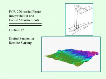
Lecture 17 Digital Sensors in Remote Sensing
FOR 220 Aerial Photo Interpretation and Forest
Measurements
2
Overview -- Digital Sensors
- Display of digital images
- Inside your computer monitor
- Bands
- Spectral separation
- Spectral signatures
- Processed Information
- Geo-rectification
- Ratios - Vegetation Indices
- Classification
- Modeling
- Into the GIS...
3
Digital Image Display
- How your computer monitor works
- CRT displays use RGB color cube to map and
display colors. - Red, Green, and Blue are separate channels
- 3 color guns in back of monitor, 1 for each
additive primary color - Colors are formed on screen as RGB gets mixed.
This process has implications for how we view,
interpret, print, and share digital remote
sensing data.
4
Digital Image Display
Bands
Most passive digital sensors simultaneously
collect multiple ranges of electromagnetic
radiation. These ranges of energy are called
bands. Bands can be classed as narrow or
wide Example Landsat-7 (Thematic Mapper)
detects 8 bands. 1. Blue Narrow 2.
Green Narrow 3. Red Narrow 4. NIR Narrow 5.
NIR-2 Narrow 6. TIR Narrow? 7.
MIR Narrow 8. Panchromatic Wide
5
Digital Image Display
Bands
Recall that the computer monitor uses an RGB
color model to create displays. We can choose
bands from the remote sensing data to be
represented as Red, Green, or Blue during
display. The result is known as a
composite Conventionally named according to
the band number specified for RGB. Example
NIR band for the Red color gun, Red band for
the Green color gun, Green band for the Blue
color gun yields the popular false color
composite which shows green vegetation as
red. See next slide for graphic explanation...
6
Digital Image Display
Band 4 (0.7-0.9 ?m)
Band 3 (0.55-0.7 ?m)
RGB432 (False Color Composite)
Band 2 (0.45-0.55 ?m)
7
Digital Image Display
RGB321
RGB432
RGB543
8
Bands / Spectral Signatures
Remember that different landscape features may
have different spectral signatures. Separate
bands of digital sensors allow us to exploit
spectral signatures -- This is known as
Classification. More about classification
later.
9
Image Processing and Analysis
Most common procedures
1. Geo-rectification, Projection 2. Map
Algebra 3. Image Classification
10
Image Processing and Analysis
1. Geo-rectification, Projection
Digital image is tied to the real
world. Geo-rectification Application of a
coordinate system to the image Projection Applic
ation of a chosen projection to the image
Usually both are done at the same time.
Process Use control points -- points that can
be identified in the image whose exact location
is known (in chosen coordinate system). Computer
warps the image to make it match a theoretical
model based on the control points.
11
Image Processing and Analysis
1. Geo-rectification, Projection
Rectification
Ground Control Points
12
Image Processing and Analysis
2. Map Algebra
Bands are treated as grids of numbers which can
be added, subtracted, multiplied, Bands of a
single image may be treated as separate layers
of information.
5 3 2 5 2 3
1 3 1 3 2 3
6 6 3 8 4 6
A common operation is the creation of vegetation
indices by band ratio-ing.
13
Image Processing and Analysis
2. Map Algebra -- Band Ratios
14
Image Processing and Analysis
2. Map Algebra -- Band Ratios -- Vegetation
Indices
- Vegetation Index Band ratio product which
indicates the vegetation green-ness of
individual pixels (accounting for differences in
illumination due to aspect). - Most common vegetation index is NDVI
(Normalized Difference Vegetation Index)
NDVI (Band 4 - Band 3) / (Band 4 Band 3)
15
Image Processing and Analysis
3. Classification
- Bands of a single image are used to identify
and separate spectral signatures of landscape
features. - Ordination and other statistical techniques are
used to cluster pixels of similar spectral
signatures in a theoretical space. - The maximum likelihood classifier is most often
used. - Each cluster is then assigned to a category and
applied to the image to create a classified
image. - The resulting classified image can now be used
and interpreted as a map. - The resulting classified image will have errors!
Accuracy assessment is critical. Maps created by
image classification should report an estimate of
accuracy.
16
Image Processing and Analysis
3. Classification
Black Box
Transformation / Clustering
Maximum Likelihood Classifier
Band 4
Spectral Signatures
Band 3
Band 2
Band 1
Classified Image (Map)
17
Modeling / GIS
Remote Sensing Images as GIS layers
Remote sensing data (raw or processed) is most
powerful when incorporated into a GIS.
Recommended
CrystalGraphics Presentations


