
Pierce County Flood Mapping Project: - PowerPoint PPT Presentation
1 / 45
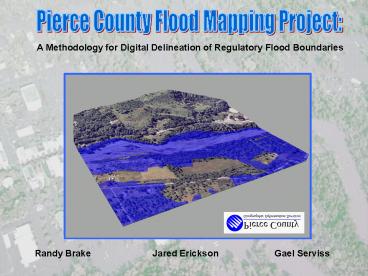
Title:
Pierce County Flood Mapping Project:
Description:
County has obtained higher accuracy digital topographic mapping (from a DTM) with ortho-photos. ... knowledge and expertise in developing new updated and more ... – PowerPoint PPT presentation
Number of Views:88
Avg rating:3.0/5.0
Title: Pierce County Flood Mapping Project:
1
Pierce County Flood Mapping Project
A Methodology for Digital Delineation of
Regulatory Flood Boundaries
Jared Erickson
Randy Brake
Gael Serviss
2
Introduction
This study examined the feasibility of
generating 100 year flood plains from digital
terrain models using GIS.
1. Reason and Benefits of the study. 2. Pilot
Project. 3. Data and Methodology. 4. Project
Expansion 5. QC and Final Editing 6.
Conclusions Problems and Successes
3
Reason for Mapping Project
- County has obtained higher accuracy digital
topographic mapping (from a DTM) with
ortho-photos. - Recent major flooding events have found that
current FEMA mapping is not accurate to actual
flooding conditions at many locations. - Pierce County has the needed GIS resources and
technical expertise to accomplish such mapping
projects. - Pierce County responded with interest and
commitment to FEMAs invitation to participate as
a COOPERATING TECHNICAL COMMUNITY (CTC).
4
Mapping Project Scope
- Re-mapping focuses on numbered A-Zones only for
both stream and river systems. - Floodway delineation also not a part of the
scope. - All other other flood zones and floodways remain
unchanged unless future detailed studies are
completed. - Some areas lacking adequate DTM and Ortho-photo
coverage therefore, no change from existing FEMA
mapping.
5
Project Benefits
- Provide more accurate floodplain mapping than
what currently exists. - Aid in floodplain regulation and permitting for
new development (i.e. elevations certificates,
finish floor elevations, Deep and/or Fast Flowing
Floodway, flood insurance, etc). - Floodwarning and Flood response activities.
- Digital data much more useful in administering
floodplain management programs. - Aid many Federal, State and Local agencies and
officials.
6
FEMA CTC Program
- FEMA has very limited funding to complete mapping
updates nationwide. - Basically a new plan and strategy developed by
FEMA to increase local involvement in, and
ownership of, the flood mapping program. - Many states, regional agencies and local
jurisdictions has acquired the needed technical
resources in flood hazard identification. - Therefore, program is designed to use local
resources, knowledge and expertise in developing
new updated and more accurate mapping and more
efficiently. - Program aims to interject a tailored, local focus
into a national program where unique conditions
may exist the necessitate special approaches to
flood hazard identification.
7
Project Data
8
Stage 1 Data Creation
1. Create hydro, topo, breakline, dtm_point,
and road coverages for the stream under study
from the DXFs.
2. Create centerline coverage and route of
stream using orthophotos and hydrography coverage.
3. Place monitoring stations from FEMAs
database on centerline using the route and
repositioning if necessary.
4. Create a cross section coverage using the
FIS Maps.
Arc/Info
AML
ArcView/Avenue
9
Step 1A Getting DXF Tiles.
1. Select DXF Tiles within 1 mile of the stream
10
Breaklines
Step 1B Process DXFs.
Roads
DXF Tile
Dtm Points
Hydro
Topo
11
Step 1C Append to form stream coverages.
Individual DXF Tiles
Stream wide Coverage
12
Step 2 Create Centerline.
13
Step 3 Position stations using route.
14
Step 4A Create Cross-Sections.
15
Step 4B Extend Cross-Sections 1 mile.
16
Stage 2 DTM Creation/Modeling
1. Generate DTM (Tin and Grid) of land surface.
2. Order and Intersect extended cross-sections.
Transform modified cross sections into PolygonZs.
3. Generate DTM (Tin and Grid) of 100 year flood
surface.
4. Generate Grids and polygons of 100 year
floodplain.
5. Adjust modeled floodplain with expert
knowledge.
ArcView
Avenue
Spatial Analyst
3D-Analyst
17
Avenue Dialog/Scripts
18
Hard Breaklines
Step 1 DTM Model Creation
Mass Points
19
Step 2 Construct 100 Year Flood Surface
Re-order and Intersect Arcs
Make PolygonZ's
20
Step 2 Model 100 year flood surface.
TIN
PolygonZs
21
Floodplain Model
22
Modeling Products
Floating Point Grid
Integer Grid
Polygon
- gt 1 Foot
- Polygon creation
- Bathymetric Grid
- Depth of Flood
- Floodzone boundary
23
FloodZone Models
24
3D Visualization
25
Pilot Project Estimates
26
Project Expansion
30 Streams and 7 Lakes
27
Project Expansion
28
The Model in Retrospect Sources of Error
New contours, old hydrology.
Stream channel evolution erosion, deposition,
and meandering.
Placement of stations and cross-sections.
Projection of station elevation from NGVD 27.
29
FEMA Data Problems
- Problem
- 100-year flood surface from the Flood Insurance
Study (FIS) is below the DTM surface Elevation
from the DXFs. - Basically, the new Ortho-DXF DTM is not
matching up with the old hydraulic model. - Result
- Fragmented floodplains with long stretches of
stream with no 100-year floodplain.
No Floodplain
30
FEMA Data Problems
- 100-year flood surface should be
- above the DTM Elevation.
- DTM Elevation from DXF-Orthos
- dips is above the 100-year flood
- surface.
31
Quality Control and Final Editing
AutoCAD Process
1. Download GIS data as a .dxf
32
Quality Control and Final Editing
AutoCAD Process
1. Download GIS data as a .dxf
2. Create a .dwg from the .dxf
33
Creating the Drawing
- Insert roads, hydrology, FEMA floodplain, 100
year floodplain, centerline, cross sections and
spot elevations dxfs. - Clean up scaling, point style, layers and color.
- Create a layout with a legend.
- Plot
34
Quality Control and Final Editing
AutoCAD Process
1. Download GIS data as a .dxf
2. Create a .dwg from the .dxf
3. Print the drawing for markups
35
Drawing Ready for Markups
36
Quality Control and Final Editing
AutoCAD Process
1. Download GIS data as a .dxf
2. Create a .dwg from the .dxf
3. Print the drawing for markups
4. Draw Polygons
37
Drawing the Polygons
- Create a new layer.
- Create a polygon by using polylines, making sure
that they are joined and closed when fininshed
with the shape. - Draw on the top of the 100 year flood plain based
on redlines. - As you go smooth the line.
38
New Polyline on the 100 Year Floodplain
39
Quality Control and Final Editing
AutoCAD Process
1. Download GIS data as a .dxf
2. Create a .dwg from the .dxf
3. Print the drawing for markups
4. Draw Polygons
5. Print drawings for QC
40
Ready for Quality Control
41
Quality Control and Final Editing
AutoCAD Process
1. Download GIS data as a .dxf
2. Create a .dwg from the .dxf
3. Print the drawing for markups
4. Draw Polygons
5. Print drawings for QC
6. Wblock out polygon as a .dxf.
42
Isolated Polygon for .dxf
43
Quality Control and Final Editing
AutoCAD Process
1. Download GIS data as a .dxf
2. Create a .dwg from the .dxf
3. Print the drawing for markups
4. Draw Polygons
5. Print drawings for QC
6. Wblock out polygon as a .dxf.
7. Send to GIS.
44
Conclusion
It is possible to model the 100-Year Floodplain
using GIS and DTMs.
- Faster and Less Expensive
- Reproducible Method
45
Contacts
Gael Serviss Engineering Technician gservis_at_co.pie
rce.wa.us (253) 798-4682
Randy Brake Civil Engineer 2 rbrake_at_co.pierce.wa.u
s (253) 798-4651
Jared Erickson Information Technology Specialist
1 jericks_at_co.pierce.wa.us (253) 798-3455
Recommended
CrystalGraphics Presentations


