
Deep Coring in the Valles Caldera, New Mexico - PowerPoint PPT Presentation
1 / 37
Title:
Deep Coring in the Valles Caldera, New Mexico
Description:
of the South Mountain Rhyolite Dome c. 520 k.a., which dammed. the drainage to San Diego Canyon ... Run 25H-2: 62.7 m to 64.2 m depth ... – PowerPoint PPT presentation
Number of Views:74
Avg rating:3.0/5.0
Title: Deep Coring in the Valles Caldera, New Mexico
1
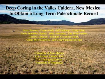
Deep Coring in the Valles Caldera, New Mexico to
Obtain a Long-Term Paleoclimate Record
Peter Fawcett, Fraser Goff, Jeff Heikoop,
Craig Allen, Linda Donohoo-Hurley, John
Geissman, Tim Wawrzyniec, Catrina Johnson,
Julianna Fessenden-Rahn, Giday WoldeGabriel,
and Doug Schnurrenberger
University of New Mexico Los Alamos National
Lab U.S. Geological Survey University of Minnesota
2
The Valles Caldera
3
Index Map Valles Caldera
o
106
o
o
36
36
Cerro Toledo
Cerro Rubio
Los Posos Domes
Cerro Santa Rosa
Cerro San Luis
Cerro Seco
San Antonio Mountain
Cerro del Abrigo
Cerro del Medio
Sulphur Springs
Drill Site VC-3 core
Banco Bonito
South Mountain
San Diego Canyon
o
o
35 45
35 45
Figure modified from Gardner et al. (1996)
4
(No Transcript)
5
Drilling Details
Location Valle Grande, Jemez Mountains,
NM 35.87oN, 106.46oW, 2,594 m
elevation Driller DOSECC (Dave Altman, Kevin
Loveland) GLAD5 Project Drilling Dates May
15 22, 2004 Total Depth Cored 82.1m Funded
By U.S.G.S. (Allen) NSF Paleoclimate Program
(Fawcett, Geissman) LANL IGPP (Goff,
Heikoop) Special Acknowledgement to Valles
Caldera Trust and Bob Parmenter (Head Scientist)
for permission to drill in the Valle Grande
6
Hypotheses
Deep lake formed in the Valle Grande following
the eruption of the South Mountain Rhyolite Dome
c. 520 k.a., which dammed the drainage to San
Diego Canyon The 80 m of lacustrine sediment
plus sands and gravels recovered during drilling
possibly represents 70 k.y. of time during the
middle Pleistocene Lake record spans most of a
glacial-interglacial cycle during the
mid-Pleistocene
7
(No Transcript)
8
(No Transcript)
9
(No Transcript)
10
(No Transcript)
11
(No Transcript)
12
(No Transcript)
13
Strat Column
14
Run 32E-1 80.26 m to 80.55 m
Base of Core Indurated silty muds and gravels
15
Run 31E-1 78.68 m to 79.1 m depth
Pumiceous sands and gravels, indurated silty
mudstone
16
75.72 to 75.81 m
Possible tephra
Ar/Ar date submitted
17
76.0 to 76.1 m Pumiceous sandy gravel
Ar/Ar date submitted
18
Run 29E-1 74.48 m to 75.72 m depth
Laminated diatomaceous silty mud with turbidite
19
Run 27E-3 70.31 m to 71.76 m depth
Turbidite (1 meter thick)
20
Run 26E-3 67.38 m to 68.42 m depth
Thickly laminated silty clay with minor diatoms
21
Run 25H-2 62.7 m to 64.2 m depth
Thinly laminated silty clay with rare diatoms and
sandy gravels
22
Run 22H-1 53.68 m to 55.18 m depth
Thinly laminated silty diatomaceous clay with
thick diatomites
23
Run 20H-1 47.68 m to 49.18 m depth
Thinly to thickly laminated silty clay with
diatoms 45 cm depth in run very well preserved
laminations (varves?)
24
Run 19H-2 46.18 m to 47.63 m depth
Thickly bedded to thinly laminated, bioturbated
silty clay Distinct burrows evident Unit has
very high magnetic susceptibility
25
Run 17H-1 38.68 m to 40.18 m depth
Thinly laminated silty diatomaceous clay
26
Run 14H-2 31.2 m to 32.5 m depth
Thinly laminated silty diatomaceous clay with
prominent diatomaceous sands
27
Run 13H-2 28.18 m to 29.62 m depth
Silty diatomaceous clay Recumbent fold nose
evident
28
Run 12H-1 23.68 m to 25.18 m depth
Deep mudcrack ( 1 m) with oxidized upper
mud Clear dessication interval
29
Run 7H-2 10.34 m to 11.57 m depth
Finely laminated silty diatomaceous
clay Frequent sandy lenses and rhyolitic
dropstones evident Siderite rhombs present
30
Run 6E-1 5.79 m to 7.19 m depth
Silty to sandy diatomaceous clay, disseminated
organics and charcoal Mudcrack evident (Fill
present in upper 10 cm)
31
Run 1P-1 0 m to 1.29 m depth
Run 3P-1 3.01 m to 3.1 m depth
32
Strat Column
33
Age Control of Core
- 2 levels submitted Argon-Argon dates (76.1 m and
75.8 m depth) - 2 levels submitted for Radiocarbon dates (6.7 m
and 8.1 m depth)
34
Basic Lithology of Lacustrine Material
- Quartz
- Devitrified Volcanic Glass
- Feldspars (minor)
- Carbonate at various levels
- (very small siderite rhombs)
- Diatoms (multiple species present)
- Clays (t.b.d.)
35
Summary
- Considerable downcore variation in sedimentary
facies, magnetic susceptibility and sediment
density - Rapid facies changes and mudcrack intervals show
dramatic changes in water levels through time
(climate? watershed?) - If sedimentation rates are 1 mm/yr, then
lacustrine material probably represents 70 kyr
of time - Long-term record for the mid-Pleistocene in the
- SW US
36
Ongoing and Future Work
- Sedimentology and geochemistry, major and minor
elements, clay minerals present (UNM) - Paleomagnetic and rock magnetic analyses (UNM)
- Stable isotopes of organics, C/N ratios
- (Heikoop, Fessenden-Rahn LANL)
- Innovative dating techniques (WoldeGabriel
LANL) - Pollen analysis, charcoal density (Anderson, NAU)
- Diatom analysis (Platt Bradbury)
37
(No Transcript)
Recommended
CrystalGraphics Presentations


