
The Woodlands - PowerPoint PPT Presentation
1 / 52
Title:
The Woodlands
Description:
The Woodlands – PowerPoint PPT presentation
Number of Views:103
Avg rating:3.0/5.0
Title: The Woodlands
1
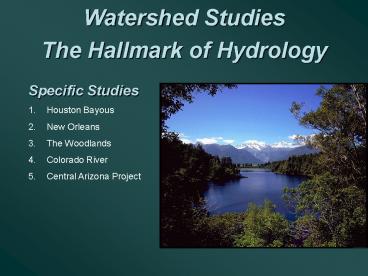
Watershed Studies The Hallmark of Hydrology
- Specific Studies
- Houston Bayous
- New Orleans
- The Woodlands
- Colorado River
- Central Arizona Project
2
Watershed Shapes
- Important hydrologic characteristic
- Elongated Shape
- Concentrated Shape
- Affects Timing and Peak Flow
- created by morphology of stream
1
1
2
1
2
3
Stream Ordering
3
Elevation Contours
Water flows at right angles to elevation contours
and from higher to lower elevations
4
Subbasins Divided according to topography and
hydrology
SUB C
Sub B
Sub A
Overland Flow
Outlet
Channel Flow
5
Parameters that Affect Response in a Watershed
Floodplain
Divide
- Rainfall intensity / duration
- Size, Slope, Shape, Soil, Storage
- Channel morphology
- Location of Developments
- Land use/land cover
- Soil type
- Percent impervious
Reservoir
Natural stream
Urban
Concrete channel
Floodplain
6
The Floodplain
Top Width
7
Watershed Hydraulics
Floodplain
Divide
D
QD
Tributary
C
Reservoir
Confluence
QC
Main Stream
B
QB
A
QA
Cross Sections
Cross Sections
8
Buffalo Bayou Floodplain Area
9
UH-Downtown
White Oak
Buffalo
10
STORM SURGE MODEL DURING RITA
White Oak
Buffalo
11
Houston Floodplains with Storm Surge
12
Urbanization Effect in a Watershed
Floodplain
Divide
Confluence
Channeliized stream
Urban
Concrete channel
Hydrograph response to rainfall will change with
urbanization and decrease in roughness coeff.
13
Urbanization Effect in a Watershed
Floodplain
Divide
Increase Peak Decrease timing Loss of Storage
Confluence
Q
Channeliized stream
Natural
Urban
Concrete channel
T
14
The Water Balance on a WS
Example 1. A lake with surface area 525 ac was
monitored over a one month period. Inflow was 30
cfs on average, outflow was 27 cfs. Seepage was
measured as 1.5 inches. Total rainfall was 4.25
in and evap loss was 6.0 inches. Estimate the
total storage change for this lake.
Governing Equation Inflow - Outflow
DS/Dt Inputs P plus Qin Outputs Ev plus Qout
plus GW seepage Combining P Qin - Qout - GW
- Ev DS/Dt
15
The Water Balance on a WS
P Qin - Qout - GW - Ev DS/Dt Convert all
units to inches, then to ac-ft storage
(30-27)ft3/s (12 in/ft)(3600 s/hr)(24hr/d)(30 d)
43,500 ft2/ acre (525 ac) 4.25 4.08 -1.5
- 6.0 in 0.83 in increase over
lake DS 0.83 (525 ac)/12 36.3 ac-ft
increase
16
Structural Flood Control
- Objectives
- Increase channel flow rate
- Means
- Channelization / concrete
- Levee construction
- Swale clearing
- Gobi mats Gabions
- Rip-rap protection
17
Brays Bayou
Concrete Channel under a bridge
18
Brays Bayou-Typical Urban System
- Concrete-lined urban channel (200 million)
- Built in the 1960s to alleviate flooding
- Increase flow rates and decrease water levels
- Capacity eroded with upstream development
- Original 100 yr channel can now only carry 10
yr - Due to our inability to predict true urban
impact - Current Project Brays will completely update
the channel and add upstream storage areas
455 million - completion date 2012
19
TS Allison Impacts Southwest Freeway
Detention Storage
June 9, 2001
Downtown Houston 15 inches in 3 hours 500 year
flood event
20
Adding Storage for Flood Control
- Objectives
- Runoff storage controls
- Means
- Retention/detention ponds
- Natural drainage system
- Runoff catchment areas
21
Adding Storage for Flood Control
- Objectives
- Runoff storage controls
- Means
- Major reservoirs
- Major dam construction
- Dikes and levees
22
New Orleans Flooding
23
New Orleans Levee Break 17th Street
24
Levee Break - Industrial Canal
25
Non-Structural Buyouts
- Objectives
- Manage old and new structures
- Means
- Buyout Programs
- Relocate old structures
- Condemn frequently flooded structures
- New Orleans - unique case
26
The Woodlands
- The Woodlands is a 30-year-old totally planned
community north of Houston. - Designed to minimize the floodplain and water
quality impacts as development proceeds.
27
USE of Storage Reservoirs
28
Cochrans Crossing
Alden Bridge
College Park
Sterling Ridge
Research Forest
Indian Springs
Panther Creek
Town Center
Grogans Mill
29
Guidelines for Planning in an Urban Drainage Basin
- Maximize the distance of storm water travel
from the site to a collection area or stream. - Maximize the concentration time by slowing the
rate of storm water runoff. - Minimize the volume of overland flow per unit
area of developed land. - Utilize buffers such as forests and wetlands
to protect collection areas and streams from
urban impacts. - Divert storm water away from critical features
such as steep slopes, unstable soils, or valued
habitats.
30
The Woodlands
- The Woodlands planners wanted to design the
community to withstand a 100-year storm. - In doing this, they would attempt to minimize any
changes to the existing, undeveloped floodplain.
31
Land Use
- More than 33 was designated as open
space - There are 3.5 lots per acre in
residential areas, or about 20
impervious - Extensive use of roadside ditches
32
The Woodlands
- Designed detention ponds that are both
effective and attractive. - Incorporated these ponds into the fabric of
communities and golf courses. - Ponds were used to control the volume and
quality of urban runoff into Panther Branch.
33
Detention Ponds
- Community Center -
- One of the first ponds built in Texas - 1972
- Fountains added for aesthetic value and to
increase circulation of air for water quality
34
Channel Design
- Most streams and ditches have been left in
their natural state, thus increasing their
Manning roughness coefficients and their storage
capacities. - This drainage system design minimizes the
impact of urbanization on the peak runoff
response.
35
Flow and Erosion Control
- Another method of controlling the flow rate is
placing energy dissipaters in the streambeds. - These are commonly located directly near
bridges due to steeper downward slopes.
36
Bridge Designs
- Only channelized under the bridges in order to
reduce erosion of the banks and the deterioration
of bridge structures. - Since this increases the flow rate, structures
are built at each end to control velocities
37
Urbanization
- Urban development designed to complement
waterways. - This reflection pool also serves as storage for
runoff from local parking facilities. - The concept is to allow for full urbanization
but with a minimum environmental impact on the
watershed floodplain.
38
The Woodlands - a Major Test
- The hydrologic system at The Woodlands was
severely tested during October 17-18, 1994, when
a greater than 100-year event dropped heavy rains
over the area. - The design worked well, with only a few houses
impacted. - The same storm flooded 1000s in other watersheds.
39
Conclusions
- Example of how to build an environmentally
sound community - 70,000 and will reach 150,000 population 2020
- Example of a sustainable watershed concept that
has worked - Concepts need to be studied and expanded to
other areas
40
ROCKY MOUNTAIN WATERSHEDS
41
Colorado River
- In Southwestern U.S.
- About 1450 miles in length
- Drains Rocky Mountains to west
- Several cities have aqueducts from the Colorado
River - Los Angeles - 14 in RF
- San Diego
- Phoenix - 7 in RF
- Tucson
42
- Hoover Dam Builders came in 1931 finished in 1935
- The building of the Hoover Dam meant jobs for
many people (16,000 workers) - 96 men died during
its construction - Colorado River became most controlled river in
the U.S.
43
Agricultural runoff in Colorado - Salinity in
return flows
44
Central Arizona Projectand the Colorado River
45
Central Arizona Projectand the Colorado River
46
Colorado River Compact
- 1922 agreement
- Allocates water among
- seven states
- Divides river into 2 areas
- Lower Basin Nevada, Arizona, California
- Upper Basin Colorado,
- New Mexico, Utah, Wyoming
Each section receives 7.5 million acre-foot of
supply
47
History of CAP
Lake Havasu
- Authorized by the Colorado River Basin Project
Act of 1968 - Construction began in 1973 at Lake Havasu
- Aqueduct completed in 1993
- Dams completed in 1994
- Many Indian distribution systems remain to be
built - Require another 10-20 yrs to finish
48
The Water is Used for
- Nearly 1 million acres agricultural land for
irrigation - Municipal water for Arizona - 7 inches/yr
- Phoenix, Tucson, Scottsdale
- 12 Indian tribes
Ak-Chin Indian tends to a irrigated field
49
Fannin-McFarland Reach 1A winds through a
populated area near Apache Junction.
- Check structures regulate the flow
50
Dimensions of CAP Canal
- At beginning
- 80 ft across top
- 24 ft across bottom
- 16.5 ft deep
- Oversized section of the canal, which acts as an
internal reservoir system - 160 ft across top
- 80 ft across bottom
51
The Central Arizona Project
- Avg annual loss in canal is about 7
- CAP delivers avg 1.5 million acre-ft water
annually - Arizona suffering from 2.5 million acre-ft
groundwater overdraft
52
Watershed Studies Summary
WS Characteristics Urban effects Flood control
programs Woodlands example Colorado River Central
Arizona Project
Recommended
CrystalGraphics Presentations


