
Andrew Lipsky - PowerPoint PPT Presentation
1 / 69
Title: Andrew Lipsky
1
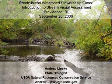
Rhode island Watershed Stewardship Class
Introduction to Stream Visual Assessment Providenc
e, RI September 26, 2006
- Andrew Lipsky
- State Biologist
- USDA Natural Resources Conservation Service
- Andrew.Lipsky_at_ri.usda.gov
2
Stream Visual Assessment Protocol (SVAP)
3
Stream Visual Assessment Protocal-SVAPOne among
Many
- All protocols, indices, and assessment tools used
to characterize stream condition. - Vary significantly in required scale, expertise,
and data intensity.
4
Healthy Stream Ecosystems
5
Habitat Thresholds
6
SVAP
- Qualitative and meant to be conducted with the
input and assistance of the landowner - Allows relatively fast assessment of meaningful
stream and riparian characteristics - Provides the basics for planning stream and
riparian conservation practices
7
Benchmarks
- So, how do you figure out how a stream should
look??? - Reference sites Benchmarks that serve as
examples of relatively unimpacted systems that
exhibit a complete set of structural and
functional elements - You may have to contact/collaborate with other
agencies who have reference site data in the
basin of interest
8
(No Transcript)
9
Using SVAP
- Two part approach Reach identification and
assessment - Select a representative reach
- If channel changes dramatically, add additional
reaches - Determine active channel (bankfull) width
- Assessment reach 12 X bankfull width
- Example Bankfull Width 32 feet
- Assess at least 384 feet
10
Scoring
- Maximum 15 stream elements to score
- Range of scores 10 (best conditions) to 0
(worst conditions) - Macroinvertebrates 15 to -3
- Score only elements that are relevant to the
reach you are assessing - Intermediate scoring is allowed
11
(No Transcript)
12
(No Transcript)
13
SVAP Assessment
- Two page worksheet with 15 assessment elements
- Not all elements are applicable everywhere in the
US - Overall score summation of all scored values
divided by the number scored - EXAMPLE 12 elements scored
- Sum 82
- SVAP Score 82/12 6.8 (Fair)
14
Bankfull Channel Width
- Determines the length of the assessment reach
- Numerous field indicators to determine bankfull
channel width some stronger according to
physiographic region - ALWAYS try to measure bankfull channel width just
upstream of a hydraulic control - Riffles, bedrock outcrops, waterfalls, etc.
15
Bankfull Channel Width
16
K. Gullett photo
17
Embryonic active floodplain developing in incised
channel. Stage IV of channel evolution. a.
Abandoned floodplain b. Active floodplain
indicating bankfull stage
Adapted from Vermont Stream Geomorphic Assessment
VT Agency of Natural Resources
18
SVAP Scoring Elements
19
Channel Condition
20
(No Transcript)
21
Channel Condition
22
(No Transcript)
23
Hydrologic Alteration
24
Hydrologic Alteration
25
Riparian Zone
26
Left Bank Narrow Riparian Buffer
Right Bank No Buffer Emergent Vegetation boundary
Sept.18, 2004 Flood level in Town hay field
27
(No Transcript)
28
Bank Stability
29
Bank Stability
U. of Wash. photo
K. Gullett photo
30
Water Appearance
31
Water Appearance
K. Gullett photo
32
Nutrient Enrichment
33
Nutrient Enrichment
M. Zuroske photo
D. Orth photo
34
Barriers to Fish Movement
35
Barriers to Fish Passage-A regional and local
perspective
Barriers to Fish Passage in RI
- Dams of the Eastern United States
36
- Impacts of River and Stream Dams/Crossings
- Habitat loss and degradation
- Alteration of Ecological Processes
- Population fragmentation isolation
- Reduced access to vital habitats
- Disruption of processes that maintain regional
populations
37
Passage Barriers
K. Gullett photo
K. Gullett photo
USFS photo
38
The RI River Stream Continuity Project
The RI River Stream Continuity ProjectRoad
Crossings as Potential Barriers to Wildlife and
Fish Movement
Watershed Approach
39
Alosids Declining Populations
Current Commercial Shad Harvest 5 of Historic
Catch
Data provided by RIDEM Fish Wildlife
40
Instream Fish Cover
41
Aquatic Habitats formed by the free movement of
water and materials, during high flows
42
Habitat Structure
Minnows/sucker
Brook trout
Bass/sunfish
43
Fish and Invertebrate Habitat
44
Instream Fish Cover
U. of Wash. photo
45
Pools
A stream with many pool types will support a wide
variety of aquatic species. Rivers with low
sinuosity (few bends) and monotonous pool
characteristics do not have sufficient quantities
and variety of habitat to support a diverse
aquatic community. An even mix of all pool types
is most desirable. In the absence of some pool
types, it is better to have deep pools over
shallow pools. All small-shallow pools or lack of
pools entirely are the least desirable
conditions.
46
Pools
Refuge for fish during low flow, drought
periods Resting and feeding area Refuge
from predators
47
Stream Bed Terminology
- Riffles the sections of the bed with the
steepest slopes and shallowest depths at flows
below bankfull. Riffles typically occur at the
cross over locations and have a poorly defined
thalweg. - Runs differ from riffles in that depth of flow
is typically greater and slope of the bed is less
than that of riffles. Runs will often have a well
defined thalweg. - Pools are the deepest locations of the reach.
Water surface slope of pools at below bankfull
flows is near zero. Pools are often located at
the outside of meander bends.
48
Stream BedTerminology
- Glides are located immediately downstream of
pools. The slope of the channel bed through a
glide is negative while the slope of the water
surface is positive. The head of the glide can be
difficult to identify. Use the following
characteristics to help you locate the head of
the glide - the location of increased flow velocity coming
out of the pool, - the location at which the steeply sloped bed
rising out of the pool decreases to a lesser
gradient, - the location at which the thalweg coming out of
the pool becomes less well defined and
essentially fades completely. - the location which is approximately same
elevation as the tail of the run
49
Invertebrate Habitat
50
Invertebrate Habitat
51
Canopy Cover
52
Canopy Cover
AFS photo
53
Manure Presence
Score only if livestock and/or human waste
discharge is present
54
Manure Presence
55
Riffle Embeddedness
Score only if riffles are present, a naturally
occurring alluvial feature, or known to be buried.
56
Riffle Embeddedness
K. Gullett photo
57
Macroinvertebrates Observed
58
Macroinvertebrates Observed
59
Group I Mayfly- Ephemeroptera (collector)
60
Group I Stonefly-Plecoptera (Shredder)
61
Group II Crayfish-Crustacean
62
Group II Dragon Fly
63
Group III Midge Fly Larvae
64
Summary
- Assess stream reach 12 X bankfull width
- Score a maximum 15 elements use those applicable
to your site - Assign a rating for each elementintermediate
scoring is OK - Calculate overall score
- Determine the narrative rating
- Describe potential causes of poor conditions and
recommendations for improving them
65
Identify Reaches to be evaluated
66
(No Transcript)
67
(No Transcript)
68
(No Transcript)
69
In 1735 The RI General Assembly stated that any
mill owner erecting a dam across a water where
migratory fish normally pass had to provide a
good and sufficient Way through such Dam or Weir
for the fish to pass and repass that be opened
during the spring runs.,
Courtesy of Buckley and Nixon(2001) An Historical
Assessment of Anadromous Fish in the Blackstone
River
Recommended
CrystalGraphics Presentations


