
LEED-ND: A Tool For Public Health, Environmental Quality and Community Design
1 / 69
Title:
LEED-ND: A Tool For Public Health, Environmental Quality and Community Design
Description:
ND = Neighborhood Developments A LEED rating system being developed through a partnership between: US Green Building Council Natural Resources Defense Council ... – PowerPoint PPT presentation
Number of Views:25
Avg rating:3.0/5.0
Title: LEED-ND: A Tool For Public Health, Environmental Quality and Community Design
1
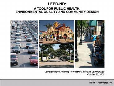
LEED-ND A TOOL FOR PUBLIC HEALTH, ENVIRONMENTAL
QUALITY AND COMMUNITY DESIGN
Comprehensive Planning for Healthy Cities and
Communities October 26, 2006
2
AGENDA
- LEED Rating System (5 min)
- LEED-ND Overview (5 min)
- Public Health and the Built Environment Report
Summary (5 min) - LEED-ND Rating System (20 min)
- Implications for Comprehensive Plans (10 min)
3
WHAT IS LEED?
- Leadership in Energy and Environmental Design
- Developed by the US Green Building Council
- A leading-edge system for designing,
constructing, operating and certifying the
worlds greenest buildings. - Goal TRANSFORM THE MARKET!
289 Certified Projects 2,069 Registered
Projects
4
LEED PRODUCTS
- LEED-NC LEED for New Construction and Major
Renovations/Additions (for commercial and
institutional buildings, released in 2000) - LEED-EB LEED for Existing Buildings (released
2004) - LEED-CI LEED for Commercial Interiors (released
2004) - LEED-CS LEED for Core and Shell (public release
2005) - LEED-H LEED for Homes (public release 2006)
- LEED-ND LEED for Neighborhood Developments
(public release 2006)
5
WHAT IS LEED-ND?
- ND Neighborhood Developments
- A LEED rating system being developed through a
partnership between - US Green Building Council
- Natural Resources Defense Council (Smart Growth)
- Congress for the New Urbanism
- A rating system that combines elements of smart
growth, urbanism, and green building
6
LEED-ND TIMELINE
- 2003 - Partnership began
- 2004 - Core Committee formed
- May 2005 Draft Public Health Indicators Report
- Sept 2005 Public Comment Period on Draft Rating
System - Fall 2005 Fall 2006 Revisions to Rating
System Based on Public Comments - Pilot-Test Projects (2007)
- Refine Rating System (2008)
- LEED-ND Launch (2009)
7
HOW GREEN ARE THESE PROJECTS?
8
WHY IS LEED-ND NEEDED?
- Land Use Patterns Impacts
- Natural Environment
- Natural Resources
- Energy Use
- Transportation Patterns and Choices
- Public Health
- Social Networks
9
LAND CONSUMPTION
- Increase in developed land from 1982 1997 34
- Average annual increase in developed land 2.3 to
2.6 - Increase in urbanized land relative to population
growth 2.65 times
10
LAND CONSUMPTION
- California Paves or Builds on over 400 acres
daily
11
DRIVING
12
DRIVING
- Annual growth in VMT 3.1
- Average time commuters spend in traffic 36 hours
per year - Total pavement in US 34,500 square miles (think
Illinois!) - Miles of public roadways 4 million
13
CLIMATE CHANGE
- Air temperature has risen 0.5 to 1.1 degrees
since the late 19th Century - 20th Century was warmest on record since 1400
- Sea level has risen 10 cm in last 100 years
14
WILDLIFE
- Number of species of plants and animals native to
US 20,500 - Plants and animals threatened with extinction 32
- Development encroaching on wildlife
15
CHARACTER-LESS PLACES
16
PUBLIC HEALTH - OBESITY TRENDS IN ADULTS
(BMI ?30, or about 30 lbs overweight for 54
person)
1996
2004
17
UNDERSTANDING THE RELATIONSHIP BETWEEN PUBLIC
HEALTH AND THE BUILT ENVIRONMENT
18
RESEARCH OVERVIEW
- Public Health Areas Studied
- Physical Fitness
- Cardiovascular and Respiratory Health
- Traffic Accidents
- Social Capital
- Mental Health
19
BUILT ENVIRONMENT CHARACTERISTICS
- Regional location
- Population and employment density
- Mix of land uses
- More types of land uses
- More retail land uses
- Transit access and availability
- Connectivity
20
BUILT ENVIRONMENT CHARACTERISTICS
- Access to parks and trails
- Slower speeds on roads
- Sidewalks, crosswalks
- Attractive and interesting streets
- Bike lanes, bike trails and safe bike storage
21
LEED-ND RATING SYSTEM SUMMARY
22
ORGANIZATION
- 3 Categories
- Smart Location and Linkage
- Neighborhood Pattern and Design
- Green Construction and Technology
- Prerequisites and Credits
- 9 Prerequisites
- 47 Credits
- 100 Points Total
23
PREREQUISITES
- Smart Location
- Water and Wastewater Infrastructure
- Imperiled Species and Ecological Communities
- Wetland and Water Body Conservation
- Agricultural Land Conservation
- Floodplain Avoidance
- Open Community
- Compact Development
- Construction Activity Pollution Prevention
24
SMART LOCATION
- Locate on an Infill site.
- OR
- Locate near transit - 50 of DUs or building
entrances within ¼ mile walk of bus or ½ mile
walk of BRT, light rail, heavy rail or ferry. - OR
- Locate near mix of uses - ¼ mile walk distance of
4 uses or ½ mile walk distance of 6 uses - OR
- Lower VMT Rates - Prove that the average rate of
VMT per occupant of the project is lower (or will
be lower) than the average rate for the metro
region as a whole
25
COMPACT DEVELOPMENT
- Average residential density of 7 DUs per acre or
greater - AND
- Average non-residential FAR of 0.50 or greater
26
SMART LOCATION AND LINKAGE CREDITS
- Brownfields Redevelopment
- Preferred Locations
- Reduced Automobile Dependence
- Bicycle Network
- Housing and Jobs Proximity
- School Proximity
- Steep Slope Preservation
- Site Design for Habitat or Wetland Conservation
- Restoration of Wetlands or Habitat
- Conservation Management of Habitat or Wetlands
27
PREFERRED LOCATIONS (10 points)
- Project Location
- Infill and previously developed
- Infill only
- Adjacent and previously developed
- Previously developed only
- Adjacent only
- AND
- Street Network Grid Density (street centerline
miles per square mile) - 40
- 30-39
- 20-29
- 10-19
28
PREFERRED LOCATIONS (10 points)
29
REDUCED AUTO DEPENDENCE (7 points)
- Locate near transit
- OR
- Locate in area with lower
- than average VMT
- AND car sharing (1 point)
Total rides available per weekday Points earned
60 124 2
125 249 3
250 499 4
500999 5
1000 or more 6
Percent of average regional per capita VMT or SOV mode share Points earned
71 to 80 2
61 to 70 3
51 to 60 4
41 to 50 5
40 or less 6
30
NEIGHBORHOOD PATTERN AND DESIGN CREDITS
- Compact Development
- Diversity of Uses
- Diversity of Housing Types
- Affordable Rental and For Sale Housing
- Reduced Parking Footprint
- Walkable Streets
- Street Network
31
NEIGHBORHOOD PATTERN AND DESIGN CREDITS
- Transit Facilities
- Transportation Demand Management
- Access to Surrounding Vicinity
- Access to Public Spaces
- Universal Accessibility
- Local Food Production
- Community Outreach and Involvement
32
WALKABLE STREETS (8 points)
- Entry location
- Building height-to-width ratio
- Sidewalks
- Street design speed
- Building setback
- Street-level building facades
- On-street parking
- Ground floor retail
- Street trees
33
COMPACT DEVELOPMENT (7points)
Residential Density (DU/acre) Non-residential Density (FAR). Points Available
10 to 20 0.75 to lt 1.0 1
21 to 30 1.0 to lt 1.5 2
31 to 40 1.5 to lt 2.0 3
41 to 50 2.0 to lt 2.5 4
51 to 60 2.5 and higher 5
61 to 70 2.5 and higher 6
gt 71 2.5 and higher 7
34
AFFORDABLE HOUSING
- Affordable Rental Housing
- 15 of rental units at 50 area median income
(AMI) - 30 at up to 80 AMI
- 1 point each 2 for both
- Affordable For-Sale Housing
- 10 of for-sale housing at up to 80 AMI
- 20 at up to 120 AMI
- 1 point each 2 for both
35
LOCAL FOOD PRODUCTION
- Allow food-producing gardens
- AND
- Option 1 Dedicate space to neighborhood farms
and gardens - Option 2 Purchase shares in a local Community
Supported Agriculture Program - Option 3 Locate within ¼ mile of an existing
farmers market.
36
DIVERSITY OF USES (4 points)
- Locate project within a 1/2 mile walk distance of
- 2 uses (1 point)
- 4 uses (2 points)
- 7 uses (3 points)
- 10 uses (4 points)
- List of uses are defined as those that reduce
auto use and increase walking
37
GREEN CONSTRUCTION AND TECHNOLOGY CREDITS
- Certified Green Buildings
- Energy Efficiency in Buildings
- Reduced Water Use
- Building Reuse and Adaptive Reuse
- Reuse of Historic Buildings
- Minimize Site Disturbance Through Site Design
- Minimize Site Disturbance During Construction
38
GREEN CONSTRUCTION AND TECHNOLOGY CREDITS
- Contaminant Reduction in Brownfield Remediation
- Stormwater Management
- Heat Island Reduction
- Solar Orientation
- On-Site Power Generation
- On-Site Renewable Energy Sources
- District Heating and Cooling
- Infrastructure Energy Efficiency
39
GREEN CONSTRUCTION AND TECHNOLOGY CREDITS
- Wastewater Management
- Recycled Content and Reused Materials
- Construction Waste Management
- Comprehensive Waste Management
- Light Pollution Reduction
40
CASE STUDIES
- Dockside Green, Victoria, BC
- 11-acre brownfield site located in the heart of
the City of Victoria - Four distinct character areas for a comprehensive
mix of uses
41
CASE STUDIES
- Dockside Green, Victoria, BC
- Carshare program mini-transit
- On-site renewable energy
- Potable water use reduction in buildings
- 100 sewage treatment on-site
- No potable water use for irrigation
- Green roofs
- LEED buildings
42
CASE STUDIES
- Dockside Green, Victoria, BC
- Market assisted housing
- Community advisory group
- Large plaza/community amphitheater
- North / south trail connection through the middle
of the site
43
CASE STUDIES
- King Farm, Rockville, MD
- 430 acres near existing development
- Mixed-use, TND with historic architectural
characteristics of the City of Rockville
44
CASE STUDIES
- King Farm, Rockville, MD
- Community shuttle bus
- Locally provided materials
- Adjacent to Shady Grove Metro station
- Tree plantings
- Affordable housing
- Integrated network of sidewalks
- Numerous pocket parks
- Most homes with shallow setbacks and front
porches
45
CASE STUDIES - SCORECARD
Dockside Green King Farm
Prerequisites
Location Efficiency 2/2 2/2
Environmental Preservation 5/5 4/5 (unless easement is purchased)
Compact, Complete Connected Neighborhood(s) 3/3 3/3
Resource Efficiency 0/0 0/0
Totals 10/10 9/10
46
CASE STUDIES - SCORECARD
Dockside Green King Farm
Credits
Location Efficiency 25/28 13/28
Environmental Preservation 10/13 6/13
Compact, Complete Connected Neighborhood(s) 27/42 21/42
Resource Efficiency 21/25 3/25
Innovation Accredited Professionals 5/6 4/6
Totals 88/114 Gold 47/114 Certified
47
POINT ALLOCATION
- 100 Points Total
- Points By Category
- Smart Location and Linkage (30 points)
- Neighborhood Pattern and Design (40 Points)
- Green Construction and Technology (30 Points)
48
CREDITS WITH GREATEST IMPACT ON HEALTH
- Preferred Locations (10)
- Walkable Streets (8)
- Compact Development (7)
- Reduce Automobile Dependence (7)
- Diversity of Uses (4)
- Housing and Jobs Proximity (3)
- Street Network (2)
- Bicycle Network (1)
- Access to Surrounding Vicinity (1)
- Access to Public Spaces (1)
- Access to Active Public Spaces (1)
49
3-STAGE CERTIFICATION
- Preliminary Review Pre-entitlement
- Plan Certification Post Entitlement
- Certification of Completed Neighborhood
Development Post Construction
50
IMPLICATIONS FOR COMPREHENSIVE PLANNING 6
STRATEGIES FOR CHANGE
51
REGIONAL DEVELOPMENT FRAMEWORK
- 4 Goals
- Efficient growth
- Multimodal transportation
- Housing choices
- Natural resource protection
- Required Components
- Land Use
- Transportation
- Water Resources
- Parks and Open Space
- Implementation
52
1 FOCUS AT A VARIETY OF SCALES
- Region Metropolis, City and Town
- Neighborhood, District and Corridor
- Block, Street, Building
53
2 LOCATE DEVELOPMENT IN APPROPRIATE LOCATIONS
- Downtowns
- Corridors
- Mixed use centers
- Transit-oriented development
54
3 UNDERSTAND BUILDING BLOCKS OF COMMUNITY
- Divide city into its component parts
- Map land use, design and form characteristics
- Understand differences and similarities
strengths and issues - Understand if, how and when areas will change or
stay the same
55
(No Transcript)
56
(No Transcript)
57
(No Transcript)
58
(No Transcript)
59
(No Transcript)
60
4 REDUCE RELIANCE ON LAND USE MAP
- Map future patterns and structures to better
represent - Mixed use
- Transportation and land use integration
- Relationship between urban and rural
- Desired character and function of different parts
of the city - Focus on 3 dimensional results of 2 dimensional
plan
61
(No Transcript)
62
(No Transcript)
63
(No Transcript)
64
(No Transcript)
65
(No Transcript)
66
5 THINK IN NEW WAYS ABOUT INFRASTRUCTURE
- Think in new (and old) ways about infrastructure
- Treat streets and transit as shapers of place
- Design networks to support walkability and
desired block pattern - Create a foundation for context sensitive design
- Address connectivity
- Plan for transit service
67
6 INCORPORATE HEALTH THROUGHOUT PLAN
- Add chapter on public health
- Incorporate health into all components
- Parks and Recreation
- Open Space Protection
- Housing
- Plan for implementation
- Zoning (form-based and conventional)
- Government budgets
- Street standards
- Design guidelines
68
CONCLUSIONS
- Built Environment is strongly linked to health
outcomes - LEED-ND can be used as a public health tool
- LEED-ND and health report can be used to guide
planning and budgeting decisions - Comprehensive plans
- District/neighborhood plans
- Street design standards
- Parks and open space plans
- Indicators for change
- Budget priorities of governments
69
FOR ADDITIONAL INFORMATION
- Matt Raimi
- Raimi Associates, Inc.
- 510-666-1010
- matt_at_raimiassociates.com
- OR
- www.usgbc.org/leed/nd
Recommended
CrystalGraphics Presentations


