
Denali National Park - PowerPoint PPT Presentation
1 / 12
Title:
Denali National Park
Description:
Links To Other Pages In This PPT/Home Page What year did the park become an Official National Park and why? How did the park form (from an Earth Science Perspective)? – PowerPoint PPT presentation
Number of Views:495
Avg rating:3.0/5.0
Title: Denali National Park
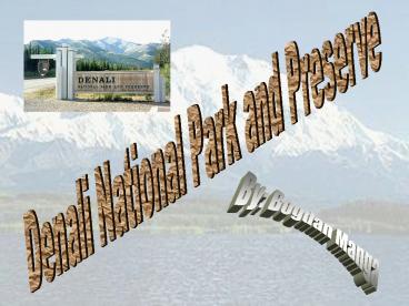
1
Denali National Park and Preserve
By Bogdan Manga
2
Links To Other Pages In This PPT/Home Page
What year did the park become an Official
National Park and why? How did the park form
(from an Earth Science Perspective)? What types
of rocks can be found inside the park? What
special landforms or features are inside your
park? How is the land in the park currently
changing? What environmental issues are
affecting your park? How is technology used to
preserve and maintain the park? Map of
Denali Bibliography
3
What year did the park become an Official
National Park and why?
The Denali area became the Denali National Park
and Preserve all through the inspiration of one
man. In 1906, Charles Sheldon, whom was a hunter
and a naturalist, first visited the area of the
future park for himself in 1906. He knew that he
had to protect the area and the many Dall sheep
against commercial hunting. The harvested
wildlife at the time was sold in quantity.
Sheldon tried to talk the Congress into setting
the large area (at the time it was approximately
2 million acres) aside as the Mt. McKinley
National Park on February 26, 1917. In 1980, the
Alaska National Interest Lands Conservation Act
changed the name of the park to Denali National
Park and the land space became 6 million acres.
Almost all of the 2 million acres set aside in
1917 are designated as a wilderness area. Over
425,000 people visit the Denali National Park and
Reserve each year.
Home Page
4
How did the park form (from an Earth Science
Perspective)?
The Denali areas highest point, Mt. McKinley, is
a granitic pluton and rises to 20,320 feet in
elevation. The mountain is rising constantly due
to the force of tectonic pressure, but erosion
wears it down the sedimentary rock at
approximately the same pace. The subduction
force created by the Pacific plate sliding under
the North American tectonic plate not only raised
Mt. McKinley, but also great mountain ranges that
are currently located across southern Alaska. As
the Pacific plate pushes itself down into the hot
mantle, it shoves and crushes the continent above
it into very tall and majestic mountains, which
comprise of some very active volcanoes, some the
most active in North America. Mt. McKinley is
raised faster than the rocks around it because it
is located at the intersection of large and
active strike-slip faults, which are faults that
cause rocks to move parallel with Earths
surface. These faults allow the rocks buried
deep in the ground to be unroofed faster than the
rocks around them. Remember that the tectonic
forces, formed by the subduction of the Pacific
plate beneath the North American plate, caused
Mt. McKinley and the other mountains in the
Alaska Range to go from flat land to towering
mountains.
Home Page
5
What types of rocks can be found inside the park?
Different types of rock can be found inside the
Denali National Park and Preserve. Mt. McKinley
is made up of mainly granite, which is the same
material as the crust of the earth below it.
Most of the mountains around Mt. McKinley are
made out of sedimentary rock, which are layers of
limestone, sandstone, and shale. Mt. McKinley
rises at one millimeter per year, which is much
faster than its neighboring mountains because
granite resists much better to weathering and
erosion than sedimentary rock does. Mt. McKinley
is basically the only landform that consists of
mainly granite in the park. The oldest rocks in
the park, the Yukon-Tanana rocks, are shallow
sedimentary rocks that have volcanic flows and
also intrusions, which are molten injections of
rocks. Remember that many types of sedimentary
rocks are found in the Denali National Park and
Preserve, but Mt. McKinley is made primarily of
granite.
From top to bottom granite, limestone,
sandstone, shale
Home Page
6
What special landforms or features are inside
your park?
The best known landform inside Denali National
Park and Preserve is Mt. McKinley, which is
also known as Denali, which means the great
one in the Athabascan dialect. Its North Peak
rises to an elevation of 19,470 ft, while its
South Peak is well higher and stands at 20,320
ft. The South Peaks height is considered the
official height of the mountain. Many other
mountains that are part of the Alaska Range are
also located in this park. This park is home to
the tallest mountains in the 600 mile range,
including Mt. Foraker (17,400 ft.) and Mt. Hunter
(14,573 ft). There are also many glaciers
running down the mountains, many of them being
tens of miles long. Mt. McKinley is the most
famous landform in the park and the highest part
of the lengthy Alaska Range. Many things can be
found the 6 million acres of the park.
Ruth Glacier
Home Page
Mt. McKinley (Denali)
7
How is the land in the park currently changing?
The land inside Denali National Park and Preserve
is still constantly changing because the park
lies on the Denali fault. The Great One is
growing at one millimeter per year, which is much
faster than its neighbors made of sedimentary
rock. This is because granite resists weathering
and erosion much better than sedimentary rock.
You can also tell that Mt. McKinley grows faster
because it is only 56 million years old, while
the other landforms in the park are 100-400
million years old. The other mountains in the
park are also currently rising at a constant
rate. The park also experiences many
earthquakes, as many as 1,000 per year, but they
are generally not noticed by us humans because
they are in such remote locations. These
earthquakes, which occur along the Denali fault,
can be large enough to alter the land. Also,
many glaciers spread out from the range and
extend as long as 44 miles, grow at 19,800 feet,
and melt at 800 feet above sea level. These
glaciers carry large boulders with them, and
these scrape and modify the land. Glaciers can
reshape a landform by its constant scratching.
The ice erodes the rock and soil beneath it away
and carries the materials far from where they
used to be.
Home Page
8
What environmental issues are affecting your park?
There are very few human-caused environmental
issues throughout the whole 6 million acres of
the park, and the existing problems are minor.
The air quality inside of the Denali National
Park and Preserve is exceptionally good. Denali
has been recorded with some of the cleanest and
most sanitized air in the country. Still, there
are small but recordable amounts of pollution in
the park. The surprising thing, though, is where
they come from. People have figured out that the
minimal pollution in the park comes from European
and Asian industrial sources. These pollutants
travel through the Arctic regions through what is
called the arctic haze. In the future, the
cleanliness on Denalis air may rely on
international environmental policies, not just
rules that are only intact here, in the USA.
Fires can rage through the boreal forest of the
park, but these help plants that rely on fire to
grow, and these plants help to have a healthy
ecosystem to grow. Exotic plants might also grow
to become a problem in the park someday. One
plant, the Melilotus alba (white sweet clover),
has gotten into Denali, but only in places where
human disturbance occurs. The main reason that
Denali doesnt have many exotic plants is because
of its climate. Only the circumpolar plants,
which are accustomed to the region, are able to
live in interior Alaska. Other plants have not
yet adapted to the climate Denali National Park
and Preserve experiences. Another factor that
protects the park is that Alaska has an ecosystem
that is not affected by any human activity, such
as livestock grazing. The sounds inside the park
are not affected by any human noises except for
the occasional helicopter monitoring something.
Overall, the subarctic biome that Denali is in is
extremely environmental friendly, and the park is
one of the last true wildernesses in the world.
Home Page
9
How is technology used to preserve and maintain
the park?
Technology is used in different ways at Denali
National Park and Preserve. Air quality monitors
are used, and these have recorded that the Denali
area has great visibility and very clean air.
The only pollutants recorded in the park come
from Europe and Asia, and those travel over the
North Pole through something that is called
Arctic Haze. Seismographs record the
earthquakes that occur in the park. There are
approximately 600 earthquakes a year that are 1
or greater. The largest recorded earthquake in
the park occurred on May 21, 1991, with a
magnitude of 6.1 and it was located at 112 km in
depth, exactly below Mount McKinley. There are
sound monitoring stations around the park, and
these measure the soundscape. This detects the
distribution, intensity, and frequency of both
natural and human-generated sounds. These tests
help single out areas of special management
concern, and then scientists go out to the place
and try to fix it. Weather observations occur
daily at the park headquarters ever since 1923.
This includes the maximum temperature, the
minimum temperature, and the precipitation
levels. These weather observations also
contribute to climate change data, which can help
predict the weather in the park. Lastly, the use
of websites, such as http//www.nps.gov/dena/index
.htm, increases the populations awareness of the
park. For example, on http//www.nps.gov/history/
, it specifically states, We invite you to learn
more about history and how the National Park
Service works to preserve it.
Seismograph
Sound Monitoring Station
Home Page
10
Map of Denali
North America with Denali
Mt. Foraker
Home Page
11
Bibliography
- Title Slide Picture - http//freepages.family.root
sweb.ancestry.com/soakbear/denali.htm - What year did the park become an Official
National Park and why? - Denali Education Packet
for Students and Teachers and Welcome to Denali
National Park By M. C. Hall - Picture 1 - http//www.alaskanalpinetreks.com/Ima
geGallery/Wildlife_3/DallSheepRamStandingOnRock.ht
ml - Picture 2 - http//www.pbs.org/nationalparks/medi
a_detail/385/ - How did the park form (from an Earth Science
Perspective)? - Geology section of
http//en.wikipedia.org/wiki/Mount_McKinley - Picture 1 - http//www.alaska-in-pictures.com/car
ibou-with-mt-mckinley-4302-pictures.htm - Picture 2 - http//www.answersingenesis.org/artic
les/arj/v1/n1/catastrophic-granite-formation - What types of rocks can be found in the park? -
http//www.nps.gov/dena/naturescience/geologicform
ations.htm - Picture 1 - http//www.beg.utexas.edu/mainweb/pub
lications/graphics/granite.htm - Picture 2 - http//jg.msdpt.k12.in.us/Technology/
Indiana.htm - Picture 3 - http//www.answersincreation.org/curr
iculum/geology/geology_chapter_6.htm - Picture 4 - http//www.csulb.edu/rodrigue/geog14
0/lectures/crustmaterials.html - What special landforms or features can be found
inside your park? - http//www.nps.gov/PWR/customc
f/apps/maps/showmap.cfm?alphacodedenaparknameDe
nali20National20Park20and20Preserve and
http//www.nps.gov/dena/naturescience/index.htm - Picture 1 - http//www.geo.uu.nl/fg/berendsen/pic
tures/photography/alaska/Ruth.jpg - Picture 2 - http//www.dailyspeculations.com/word
press/?p2513 - How is the land in the park currently changing? -
http//www.nps.gov/dena/naturescience/naturalfeatu
resandecosystems.htm and http//www.nps.gov/dena/n
aturescience/geologicformations.htm and
http//www.nps.gov/dena/naturescience/glaciers.htm
and http//nsidc.org/glaciers/questions/land.html
- Picture 1 - http//www.nps.gov/dena/naturescience
/geologicactivity.htm
Bibliography is continued on the next page.
12
Bibliography (continued)
- 7. What environmental issues are affecting your
park? - http//www.nps.gov/dena/naturescience/envi
ronmentalfactors.htm (click on the links at the
top to see more) - Picture 1 - http//www.nps.gov/dena/naturescience
/airquality.htm - Picture 2 - http//www.aphotoflora.com/DevonandCo
rnwall/Melilotus20alba01-07-04.jpg - 8. How is technology used to preserve and
maintain the park? - http//www.nps.gov/dena/natur
escience/environmentalfactors.htm and its links
at the top, and also the links in the text - Picture 1 - http//vixandmore.blogspot.com/2007/0
3/dogs-and-earthquakes-dueling-metaphors.html - Picture 2 - http//www.nature.nps.gov/ParkScience
/index.cfm?ArticleID350 - 9. Map 1 (Denali National Park and Preserve) -
http//www.trailmonkey.com/USpages/alaska/maps/Den
aliMcKinleyMAPtopo.jpg - 10. Map 2 (Alaska) - http//avagabonde.blogspot.c
om/2009/07/alaska-trip-denali-national-park-and.ht
ml (my image is cropped) - Map 3 (North America with Denali) -
http//www.philippegatta.fr/denali2.htm - Picture on this page - http//nature.wallpaperme.c
om/Nature-World-Travel/AlaskaRange_DenaliNation
alPark_Alaska.jpg.html - Background Picture - http//ice-cream.mattters.com
/timeline/2010/3/5/man-arrested-for-assault-with-i
ce-cream-cake
Home Page
Alaska Range in the fall