
Geotechnical Investigation and Recommendations for Drayton Bridge - PowerPoint PPT Presentation
1 / 35
Title:
Geotechnical Investigation and Recommendations for Drayton Bridge
Description:
Halliburton finally came in and plugged. Attempt at Plugging. Rocks at Bottom ... Halliburton & Semenko to the Rescue. Boring 13 Snow Removal. Building Ice ... – PowerPoint PPT presentation
Number of Views:652
Avg rating:3.0/5.0
Title: Geotechnical Investigation and Recommendations for Drayton Bridge
1
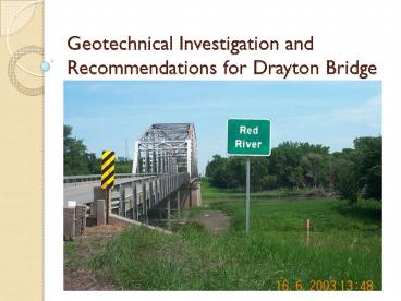
Geotechnical Investigation and Recommendations
for Drayton Bridge
2
Geotechnical Responsibilities
- Settlement/Rate of Settlement
- Slope Stability
- Pile Length Estimations
- Boring Logs
- Instrumentation
- Plan Notes/SPs
3
Drilling Operations (2003 to 2008)
- Drilled 13 borings that ranged in depth from 101
feet to 182 feet. Avg. depth 162 ft - 2 abutments/36 piers approx. 1boring per 3 pier
units. - Average Boring took from 2 to 4 days to complete.
- Goal is to drill 10 feet into 100 bpf material.
- Boring 13 was drilled in the center of the river,
through the ice, in March 2008. - Encountered Artesian water flow in almost all of
our borings.
4
Boring Log
5
Boring Layout
- Show profile
6
Profile with Borings
7
Drilling Operations
8
Drilling Operations Mud Rotary
9
Night Drilling
10
Boring 8 - Artesian
- Water being produced at roughly 300 gallons per
minute. - Tried numerous times to plug using bentonite
plugs, inner tubes, neat cement. - Halliburton finally came in and plugged
11
Attempt at Plugging
12
(No Transcript)
13
Rocks at Bottom of Boring 168 ft.
14
Batching Neat Cement19 bag mix
15
Halliburton Semenko to the Rescue
16
Boring 13 Snow Removal
17
Building Ice
18
Interstate Drilling Services
19
Pile Length Estimations
- Use FHWA Program Driven for Estimations
- Piling Used on this project will be HP14x73
14x102 - Piling will terminate in the high blowcount
glacial till. - Estimated pile length varies from 145 to 205 feet
in length. - Total Plan Length of Piling is 80,110 lf
20
Riverbank Instability
21
Stability Analysis
- Stability of Riverbanks on the Red River has and
continues to be a problem. - Documented stability problems on East end of
Existing Bridge. - Use information obtained from borings to conduct
a stability analysis with FHWA program ReSSA - Minimum FS allowed is 1.5
- Recommended 41 inslopes and 61 endslopes to
maintain Min. FS - Limited Embankment height
22
Stability Analysis - Inslope
- Show cross section
23
(No Transcript)
24
- It should be emphasized that both of these mass
wasting processes are natural phenomena, that can
be expected in regions of bank erosion along the
Red River --- such as those along cutbanks on the
outside of river meanders. - However, man can inadvertently accelerate the
process of slump development by - the placement of a load on top or along the
slope, itself - tree removal
- increasing soil moisture content, by lawn
watering or installation of drain fields within
prone regions.
25
Settlement Estimations/Recommendations
- East Embankment
- Max embankment height is 10 feet
- Total predicted settlement is 5.8 inches
- 90 5.2 inches in 1182 days
- Wick drains _at_ 10 ft spacing can achieve 90
settlement in 320 days - West Embankment
- Max embankment height is 17 feet
- Total predicted settlement is 14.4 inches
- 90 13.0 inches in 1641 days
- 5 ft. surcharge in addition to Wick drains _at_ a 9
ft spacing can achieve 90 settlement in 340 days.
26
East Embankment
27
West Embankment
28
Driving Wick Drains
- Show driven graph
29
Using Wick Drains to Accelerate Settlement
- Pic of wicks
30
Downdrag Concerns
- Settlement of soil after piles are driven applies
additional loads to the pile. - The additional load is caused by the friction or
adhesion between the pile and the downward moving
soil. - Preboring and backfilling with Bentonite Slurry
Bridge
New fill
Consolidatingsoil
Bearing stratum
31
Geotechnical Instrumentation
- Will Allow Monitoring of
- Settlement
- Rate of Settlement
- Pore Pressure (Water Pressure) in soil as
Embankments are built - Control Rate of Placement to Maintain Minimum
Factor of Safety.
32
Geotechnical Instrumentation
- Vibrating Wire Settlement Cell
33
Settlement Plate
34
Geotechnical Instrumentation
- Vibrating Wire Piezometer
35
Special Thanks to Grand Forks District and the
Drayton Section for all their help.