
Complex Terrain Environment - PowerPoint PPT Presentation
1 / 24
Title:
Complex Terrain Environment
Description:
Overview Rapid Unified Generation of Urban Databases (RUGUD) Urban and Underground Model Generator (U2MG) Scene Extraction and Autonomous Generation of Urban ... – PowerPoint PPT presentation
Number of Views:228
Avg rating:3.0/5.0
Title: Complex Terrain Environment
1
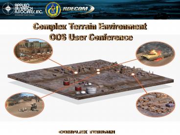
Complex Terrain Environment OOS User Conference
2
Overview
- Rapid Unified Generation of Urban Databases
(RUGUD) - Urban and Underground Model Generator (U2MG)
- Scene Extraction and Autonomous Generation of
Urban Landscapes (SEAGUL)
3
Terrain Generation Goals
- Timely database creation
- Automation
- Manual Interaction
- Correlation of runtime products
- Verification and Validation
- Metrics Collection
- Rich Urban Attribution
- Metadata
- Configuration Management
- Relationships
- Open Standards
- Open Formats
- COTS/GOTS integration
- Imagery
- Visuals
- Structural
- SAF
- Paper Electronic Maps
- Data Reuse
- Data and System Analysis
- Ease of use
4
What is RUGUD?
- A GOTS data processing framework
- A data driven infrastructure with value-added
capabilities - Persistent storage, metadata tracking, etc.
- Plugin interfaces for COTS/GOTS tool incorporation
VV Tools
Metrics Tools
Preview Tools
DEMs
Imagery
Vectors
LIDAR
Hyperspectral
Correlated Export
SEAGUL
U2MG
TIN Tool
OpenFlt
OTF
Clutter Tool
NVIG
ESRI Shape
COLLADA
SEDRIS
5
RUGUDs Purpose
- RUGUD provides a research environment to develop
and test new capabilities - Focus on gaps and deficiencies in terrain
generation, especially in complex environments - Provides a light-weight terrain generation
mechanism for smaller programs - Free to government and contractors
- Focus on ease of use
- Useful for iterative tweaking of databases for
research and analysis
6
Recent Efforts
- OneSAF Objective Terrain Format (OTF) Export
- Preliminary support including UHRBs
- Night Vision Image Generator Support
- Automates NVL generation process
- RUGUD can export ERF databases from standard
terrain source data (e.g., DTED, GeoTIFF, Shape) - OneTESS Live Terrain Format (LTF) Support
- Hi-res (1-meter and below) terrain representation
- MSCO effort to integrate with ERC
- COLLADA export
- Gaming community interchange format
- Successfully tested in Maya, Ogre, Delta3d, Open
Scene Graph
7
OTF Export Status
- Uses the ERC OTF compiler
- Currently from v1.5, soon to be v2.0
- Databases are usable in v2.0
- Known Limitations
- Single tile (multi-tile by May)
- Data size limited by system memory (large dataset
support by May) - Limited data cleanup support
- Best to clean data as a pre-process (snap roads,
clean/generalize areal boundaries, etc.) to RUGUD
8
U2MG Overview
- Urban and Underground Model Generator (U2MG)
- Funded as BAA through RDECOM STTC
- Prototype based on Integrated Munitions Effects
Assessment (IMEA) editor
9
Feature Highlights
- Stand-alone editor and plug-in accessible through
an API - Supports creation of geo-typical and geo-specific
buildings - Generates structurally correct buildings and
places rooms, hallways, doors, windows
automatically - Buildings are exported to visual (e.g.,
OpenFlight) and SAF formats (e.g., OneSAF)
OneSAF Test Bed
OpenFlight Database
10
Automated Interior Layouts
2 Elevators
2 Bathrooms
Staircase
Exit
Corner Office
Entry Door
Exit
Hotel
Main Entrance
Office Building
Staircase
2 Public Bathrooms
Exit
2 Elevators
Kitchen
Bathroom
Office
Reception
Exit
Breakfast or Sitting Area
Hotel Room (2 Queen Bed)
Hotel Room (1 King Bed)
11
Non-orthogonal Buildings
- Supports placement of non-orthogonal walls in the
editor - Both exterior and interior walls can be
non-orthogonal - Models can be exported to OpenFlight, UHRB XML,
COLLADA
Regions Bank, Orlando
Washington Hall, USMA Westpoint
12
Underground Models
- Set the depth of a building from the U2MG editor
and the U2MG API. - Initial implementation of tunnels in U2MG
- Multiple cross-sections rectangular, arched, and
elliptical. - Textures based on tunnel type walkway, subway,
roadway, sanitary sewer, storm sewer, and cave. - Optional corner smoothing.
- Export to OpenFlight.
- Updated U2MG Plug-ins for RUGUD
- Geo-specific import of U2MG models.
- U2MG tunnel generator plug-in.
- U2MG parameter mappings from source data
attribution.
13
RUGUD OTF OUT - McKenna
14
RUGUD OTF OUT - Barstow
15
SEAGUL in a Nutshell
- Goals Earth, Buildings, Tree scene
reconstruction - Aimed at full-automation (minimum parameter
tweaking) - Benefits from multiple sensors (lidar,
hyperspectral) - Feature extraction is closed loop
16
Terrain Extraction
- Implements Hierarchical Robust Interpolation
(Kraus 98) - Accepts LAS and ASCII formats
- Outputs ASCII and TIF
- Iterative updating (later in brief)
LIDAR point cloud
Interpolated point cloud
DSM processed by SEAGUL to extract DTM
Subtraction of DTM from DSM yields nDSM (off
terrain points)
Original DSM (interpolated TEC point cloud)
17
Building Extraction
- Completeness is good
1km x 1km Barstow Data (Tile D9)
- Regularization and orientation solved
simultaneously - Capture multilevel complicated roofs, porches,
and sheds - Outlines updated during complex roof
reconstruction
18
Hyperspectral Updating
- Semi-automated
1
water
asphalt
LIDAR
2
- Automated
- Use a building extraction procedure (could be any
procedure) - Identify a set of spectra that occur inside
building regions - Eliminate/add a spectrum from the set
- Eliminate/add LIDAR data at locations where this
spectrum occurs - Repeat Steps 1-4 until convergence
1
Hyperspectral
2
4
3
3
5
4
5
Spectra within Region boundaries
Feedback loop
19
Points of Contact
- Julio de la Cruz
- RDECOM STTC
- Julio.Delacruz_at_us.army.mil
- 407-384-3733
- Chuck Campbell
- Applied Research Associates, Inc.
- ccampbell_at_ara.com
- 407-384-2702
- www.rapidterrain.com
19
20
- Questions?
21
Amphitheatre, April 9 0930-1030
Real-time Physics Effects OOS User Conference
22
- Backup
23
Game Support with ICT
- RUGUD imports standard MS data source formats
- RUGUD processes the data using COTS and GOTS
plug-in tools - RUGUD outputs COLLADA format
- COLLADA is imported using Feeling plugin for Maya
- Artistic enhancements can be applied
- Game formats are output via Maya plug-ins
Gamebryo screenshot using Barstow LIDAR
hyperspectral source data
24
Game Support with ICT
- West Point
- RUGUD automatically created geometry database
- Exported to COLLADA
- ICT extruded building features and applied
geospecific textures - Imported into Maya and output back to COLLADA
- Significant reduction in artists effort
Before
After