
Chapter 3 Plate Tectonics: A Unifying Theory - PowerPoint PPT Presentation
1 / 22
Title:
Chapter 3 Plate Tectonics: A Unifying Theory
Description:
Named southern super-continent Gondwana in book 'The Face of the Earth' ... Geologists discovered that orientations of iron-bearing minerals is affected by ... – PowerPoint PPT presentation
Number of Views:241
Avg rating:3.0/5.0
Title: Chapter 3 Plate Tectonics: A Unifying Theory
1
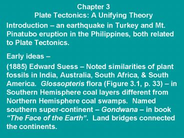
Chapter 3Plate Tectonics A Unifying Theory
- Introduction an earthquake in Turkey and Mt.
Pinatubo eruption in the Philippines, both
related to Plate Tectonics. - Early ideas
- (1885) Edward Suess Noted similarities of plant
fossils in India, Australia, South Africa,
South America. Glossopteris flora (Figure 3.1,
p. 33) in Southern Hemisphere coal layers
different from Northern Hemisphere coal swamps.
Named southern super-continent Gondwana in
book The Face of the Earth. Land bridges
connected the continents.
2
2
- (1910) Frank Taylor suggested that the
mid-Atlantic ridge was related to continental
drift. - (1915) Alfred Wegener suggested the name Pangaea
for the single large continent. Used geologic,
paleontologic, and climatic evidence to show
joining of continents prior to their breakup. - These other early hypotheses concerning
Continental Drift gained attention, but not
acceptance, as mechanism for movement could not
explained.
3
3
- (1937) Alexander du Toit offered additional
info by noting that the Permian reptile
Mesosaurus (present in South America and southern
Africa) lived in freshwater environments.
4
4
- WWII technology used to map ocean floor.
Included sonar and magnetometers. Variations in
ocean floor magnetism led to study of terrestrial
lava flows. - Geologists discovered that orientations of
iron-bearing minerals is affected by the strength
and polarity of the Earths magnetic field (pp.
37-38). Plotting of old lavas suggested
wandering of Magnetic North (Figure 3.6).
5
5
- Seafloor spreading proposed by Harry Hess in
1962, by which continental and oceanic plates
moved together. Driving mechanism is the thermal
convection cells. Figure 3.7, 3.9, 3.10 (p. 39
40) shows how parallel, symmetrical magnetic
stripes in oceanic plates form. Measuring the
Past Intensity of the Earth's Magnetic Field
Magnetic Field weakening? - More evidence for seafloor spreading Oldest
oceanic crust lt180 m.y. vs. 3.96 b.y. oldest
continental crust.
6
6
- Basics of Plate Tectonics Theory
- Crust composed of irregular plates
- Plates float on asthenosphere Isostacy
- Plates move in relation to one another
- Crustal types Oceanic (basalt) 3 gm/cm3 and
Continental (granite) 2.7 gm/cm - Three types of plate boundaries
- Divergent (spreading)
- Convergent (subduction zones)
- Transform (lateral contact)
7
7
Map showing major crustal plates and boundaries.
8
8
Divergent margins Continental rift zone Rio
Grande Rift, East Africa Rift
Initiation begins with stretching and
splitting of continental crust. Extension
results in formation of graben basins.
9
Tensional strain Brittle deformation
continental rift crustal stretching
9
Graben basin
High angle Normal fault (gravity fault)
Rio Grande Valley from El Paso northward into S.
Colorado consists of a series of graben basins,
resulting from stretching of crust. Basins
in-fill with sediments basalts.
10
10
Divergent margins Oceanic rift zone
Mid-Atlantic Ridge, East Pacific Rise
Continued stretching opens a new ocean basin,
escaping mantle derived magma cools to form new
mafic ocean floor.
Continental crust/ Oceanic crust juncture.
11
11
Old oceanic crust, preserved in areas of
conti-nental collision are called
Ophiolites. Jormua mafic-ultramafic com-plex in
Finland, about 1.96 billion years old. Oldest
ocean bottom is lt 180 m.y..
12
12
When an oceanic plate is converging on another
oceanic plate or on a continental plate, this
creates a convergent zone (subduction zone).
Oceanic-oceanic con-vergent zones likely begin
when an oceanic rift zone loses its vertical
convection current upwhelling and one plate
starts to sink back into the mantle. Oceanic-conti
nental convergent zones may begin when sediment
loading at the conti-nental margin breaks the
oceanic plate loose from the continental plate
starts to sink back into the mantle.
13
13
In the Subduction zones, the sinking oceanic
plate starts to melt, producing magma that rises
to form volcanic chains. Oceanic-Oceanic
Subduction Zone Volcanic Island Arc
System Examples Japan, Philipines, Aleutians,
Lesser Antilles Caribbean Oceanic-Continental
Subduction Zone Volcanic Continental Arc
System Examples - Cascade Mts., Andes Mts.,
Sierra Nevada Mts. (old), Central America, Mexico
USGS Cascades Volcano Observatory
14
14
Convergent boundary Subduction zone
Subduction zone magma includes oceanic sediments,
water, melted oceanic crust explosive
intermediate lavas Andesites.
Back Arc Basin Subduction Zone
15
15
- Melting oceanic crust, oceanic sediments, and
sea water produces over-abundance of magma that
rises to produce volcanism. Rising magma plutons
may melt some of overlying crustal material.
Increased quartz content causes more explosive
volcanism. Examples include Mt. St. Helens, El
Chichon, Mt. Pinatubo, - Remember the Bowen Reaction Series Quartz
last to solidify, first to melt.
16
16
Other subduction zone materials include The
material scraped off the descending plate is
referred to as subduction complex (or mélange).
Occasionally, slices of oceanic crust and upper
mantle are included in the mélange. These
oceanic crust/mantle slices are referred to as
ophiolites or ophiolite suites see p. 45
slide 11. Additional info on Subduction Zones
17
17
After oceanic plate is consumed by the
subduction zone, a continent to continent
collision occurs (Fig. 3.18, p. 47). Examples of
mountains resulting from continent to continent
collisions Alps, Appalachians, Himalayas,
Atlas. Transform Boundaries are present where
adjacent plates slide past one another San
Andreas Fault Zone, Anatoli Fault Zone.
Plumbing is not suitable for vulcanism in
Transform fault zones.
18
18
- Unusually strong mantle plumes of magma
occasionally break through crustal plates,
forming Hot Spot volcanoes, Ex Hawaiian
Islands/Emperor Seamounts, Yellowstone, San
Francisco Volcanic Field (Flagstaff, AZ). - Driving Force for Plate Movements are the
vertical convection currents. Two models are 1)
Shallow cells in asthenosphere and 2) Deep cells
in entire mantle. - Ridge-push at Divergent (Rift) zones and
Slab-pull in Subduction zones may also contribute
to plate motion.
19
19
Plate Tectonics and Mountain Building
(Orogeny) Presence of ophiolite suites in
mountain interiors (Alps, Himalayas, Urals,
Appa-lachians) mark the sites of old subduction
zones. When subduction zones close, continents
collide to build mountains. Opening Closure of
an ocean basin is termed The Wilson Cycle,
Example is the Paleozoic Iapetus Ocean. Exotic
Terranes small microplates are accreted along
the continental margin.
20
20
Plate Tectonics the Distribution of Life
(Ecosystems, Fossils, etc.) Distribution of
continents affects oceanic currents (which
redistribute tropical heat) and air currents
(land heats up faster than water). Mountain
ranges may act as biological barriers (to
migrations) and locally affect weather and
climate, which affects the distribution of
terrestrial ecosystems. The opening of an ocean
basin splits terrestrial ecosystems.
21
21
The uplift of the Isthmus of Panama, 5 m.y.
ago, closed seaway between Caribbean and Pacific
separated marine organisms, while it joined
North America South America, allowing for the
migration of mammals. Mesozoic/early Cenozoic
separation of Australia (with its primitive
marsupials) saved marsupials from competition
with reproductively more efficient placental
mammals.
22
22
- Plate Tectonics Natural Resources
- Plate tectonics may affect distribution of basin
settings favorable for the deposition and
preservation of organics (to form petroleum),
then later on with the development of certain
structural features to form oil reservoirs. - Vulcanism related to rifting and subduction may
introduce metallic-bearing hydro-thermal
solutions from great depths. - When a particular resource is found in a certain
setting, other occurrences may occur elsewhere in
similar settings.
Recommended
CrystalGraphics Presentations


