
LIS 407: Class 10 - PowerPoint PPT Presentation
1 / 35
Title:
LIS 407: Class 10
Description:
Statistical Abstract of the United States. Historical Statistics of the United States ... 2D -- political, physical, road maps. Atlas. Collection of maps. Gazetteer ... – PowerPoint PPT presentation
Number of Views:1284
Avg rating:3.0/5.0
Title: LIS 407: Class 10
1
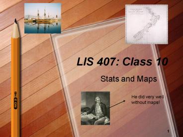
LIS 407 Class 10
- Stats and Maps
He did very well without maps!
2
1. Statistical Resources
- Statistical Abstract of the United States
- Historical Statistics of the United States
- Occupational Outlook Handbook
- Sourcebook of Criminal Justice Statistics
- Digest of Education Statistics
- LexisNexis Statistical (formerly known as
Statistical Universe)
3
Stats
- Numbers that change
- Statistics organize numbers in patterns.
- Descriptive
- present
- past or historical
- Predictions about the future
- Correlation
- Regression
- Inferences about causation
- Role of the U.S. government
- Produce data
- Original data from agencies are difficult to find
4
Stats
- Statistical Abstract of the United States
- http//www.census.gov/stat_abstract
- Published by the U.S. Census Bureau
- Popular statistical data from
- Federal agencies
- Non-governmental sources
- Coverage areas include
- Vital statistics
- Education, Social welfare
- Law enforcement
- Foreign commerce
- Employment, prices, business, finance
- Caveats
- Index is not thorough may need to look up
several different terms to find a good match - Numbers in index refer to table number, not page
number (confusing!) - Still essential source in virtually every
library even with online version freely
available
5
Stats
- LexisNexis Statistical
- Covers three primary print sources
- American Statistics Index (ASI) indexes
government figures from 1973-present.Includes
Statistical Abstracts - Statistical Reference Index (SRI) indexes
state, industry, and 1,000 non-governmental
statistical sources from 1980-present. - Index to International Statistics indexes
abstracts 2,000 international organizations
statistical sources from 1983-present.
6
Lexis-Nexis Statistical
7
Stats the tricks
- Format
- Image of statistical chart
- Excel spreadsheet for downloading data
- Search
- Use more than one term if possible
- Browse subject list for related terms
- Lexis-Nexis Statistical How do I?
8
(No Transcript)
9
More Stats
- Economic Indicators
- http//www.gpoaccess.gov/indicators/index.html
- Survey of Current Business
- http//www.bea.doc.gov/bea/pubs.htm
- Federal Reserve Bulletin
- http//www.federalreserve.gov/publications.htm
- Economic Report of the President
- http//www.gpoaccess.gov/usbudget/
- Current economic policy and trends
- Annual includes Economic Indicators
- Stunning amount of data
10
Stats
- Tool for business sources
- TableBase
- http//0-search.rdsinc.com.library.simmons.edu/ses
sions?useridsimmonsproductsTBL - Tables published in articles, reports, and
annuals in business sources - Enhanced indexing
- Produced by Responsive Database Service (RDS)
- Source for indicators
- Frumkin, Norman. Guide to Economic Indicators
11
The usual problems
- Data Definition Differences
- Different agencies define the key variable in
different ways. - Adult (Bureau of Census, Department of Justice)
- Data Collection Differences
- Different time frames monthly, quarterly, FY
- Data Population Differences
- Census
- Sample different samples
- Data Continuity Differences
- New administration re-org
- Where did the data go?
12
Stats
- Numbers seem really low!
- Numbers are truncated (in thousands, etc.)
- Data for every group except the one that I care
about. - Are categories mutually exclusive? Then
calculate the missing group - I need more current data.
- How old is the data?
- How old is the source?
- When did you search?
- Ive looked at everything. I cant find the data
I need. - Talk to librarian (Oops, I am the librarian!)
- Talk to subject specialist
- Proxy or surrogate
13
Stats All what you wanted to know about your
nation but were perhaps afraid to ask.
- U.S. Census Bureau Factfinder
- http//factfinder.census.gov/home/saff/main.html?_
langen - U.S. Census Bureau Gateway
- http//www.census.gov/main/www/cen2000.html
- Latest Economic Indicators
- http//www.census.gov/cgi-bin/briefroom/BriefRm
- Historical U.S. Census data 1790-1970
- U.S., state, regional data
- Population, home ownership, foreign-born
population, poverty, etc. - http//www.census.gov/population/www/censusdata/hi
scendata.html
14
Data, data, data
- The data you have are not what you want.
- The data you want are not what you really need.
- The data you really need
- .
- .
- are not available.
- Murphys Law of Statistics
15
2. Geographical data The multiple uses of
geographic information
- James Cook - Wikipedia, the free encyclopedia
- Election 2004 Results
16
Misinformation using maps
- Mapmakers and Mythmakers Russian Disinformation
Practices Obscure Even Today's Oil Fields - December 1, 2005, Thursday
- By ANDREW E. KRAMER (NYT) Business/Financial
Desk - NY Times Late Edition - Final, Section C, Page 1,
Column 3, 1617 words - Russian disinformation practices obscure maps
that show country's oil fields some practices
that once governed large regions of former Soviet
Union may still lurk in hallways where
bureaucrats from Communist past cling to power
not only do they carry over history of secrecy,
but they also serve to continue tradition of
keeping foreigners at bay while employing plenty
of people made dependent on Moscow misleading
maps also reflect government's tightening grip on
Russian oil, one of world's critical supplies,
and one that is to become even more important in
future with plans for direct shipments to US by
2010 from ports in Far East and Arctic secrecy
rule over maps is enforced by Federal Security
Service, successor to old KGB doctored maps
belong to deep-rooted Russian tradition of
deceiving outsiders, going back to days of
Potemkin villages of 18th century and perhaps
earlier during cold war is was called
maskirovka, Soviet military parlance for
deception, disinformation and deceit
17
Geographical sources Darling, should we look at
the map?
- Map
- Globe 3D
- 2D -- political, physical, road maps
- Atlas
- Collection of maps
- Gazetteer
- Geographical dictionary of place names
- May include other data population, historical,
statistical, economics, etc. - Geo-encoded
- A sense of where the data are
18
Types
- Atlases
- General
- Subject
- Historic
- Maps
- Political
- Other
- Gazetteer
- Print v. Digital
- Geo-encoded database
19
Why do we need maps?
- Current events
- Ecuador, Irak,
- Recreation Michelin Guide
- Business
- Historical geography
- Turkestan?
- Genealogy
- Examine geo-encoded data
- Examine geographical relationships
- Manipulate spatially related data
20
Shelving the map
- Mostly oversize
- Best to lay flat, easier to see spines
- Display case?
- Be careful that maps are not lost!
- Digital maps big data
- Servers
21
Ratio
- Ratio of
- the distance on map to the distance on Earth.
- 14 means that 1 inch 4 miles
- 124,000 means that one inch on the map equals
24,000 inches on the ground. - In general, the larger the scale the more detail,
the smaller the scale the less detail.
22
Ratio
23
Map evaluation criteria
- Mathematical formula to transform a curved
surface into a flat plane - Convert 3 dimensions into 2 dimensions
- Possible distortions
- Size
- Shape
- Direction
- Distance
- Mercator vs. Peters maps
- http//www.colorado.edu/geography/gcraft/notes/map
proj/mapproj_f.html
24
Map evaluation criteria
- Distinguishes political, economic, topographic
features - Topo Maps
- Elevation (brown)
- Water (blue)
- Human impact (black)
- Major highways, admin. boundaries (red)
- Vegetation (green)
- Topo Maps at http//www.topozone.com/
25
Topographic maps
- Topographic maps
- United States Geographical Survey
- http//www.usgs.gov
- Colors
- Symbols
- Edition
- Survey date, printing date
26
Digital maps and other maps
- MIT
- http//ortho.mit.edu/nsdi
- National Library of Scotland. Digital Library.
Maps from our Collection. - http//www.nls.uk/digitallibrary/map/index.html
- Atlases
- thematic maps
- National Atlas of the United States
- http//nationalatlas.gov
- Historical atlases
- Gazetteers
27
GIS
- GIS - Geographical Information Systems
- In the strictest sense, a GIS is a computer
system capable of assembling, storing,
manipulating, and displaying geographically
referenced information, i.e. data identified
according to their locations. - USGS GIS
- Overlay of data layers
- http//erg.usgs.gov/isb/pubs/gis_poster/
- Environmental Systems Resource Institute (ESRI)
- http//www.esri.com
- Demos
- http//maps.esri.com/
- Data and Internet Maps
- http//www.geographynetwork.com/
28
Other geographical sources
- Gazetteers a list of geographical names or
physical features, or both, either appended to an
atlas or published as a separate volume - The Columbia- Lipincott Gazetteer of the World
(1961). - The National Gazetteer of the United States of
America (only some volumes published)
29
Geographical names
- Geographic Names Information System (GNIS)
- NGA GNS Names Files of Selected Countries
- Why are geographic names important?
30
Travel guides and Google maps!
- Electronic resources have taken over the market
of travel guides. - ViaMichelin route planner europe travel guide
maps Michelin restaurants
31
CybercartographyMaps and mapping in the
Information Era/ Taylord Caquard/ Cartographica
41 (1).
- The increasing ubiquity of maps is a new way of
imposing uniform views of the world and offers
the possibility of creating egocentric maps. - Openstreet Map at www.openstreetmap.org
- The Internet Commission at the International
Cartographic Association was created in 1999. - Cybercartography multimedia plus cartographic
information.
32
Towards a Geography of the World without maps
lessons from Ptolemy and Postal Codes. Annals of
the association of American Geographers (2005),
95(3). Michael Curry.
- Until the 1960s the delivery of mail in the USA
occurred almost completely without the use of
maps. - Early 60s The USA ZIP code. Interestingly, the
codes came associated with social, cultural, and
demographic characteristics. - Dr. 90210?
- Much of everyday life goes on in a world without
space. - IT has made this fact even more evident.
33
Maps? Who needs them?
- Even though we are increasingly surrounded by
maps, people today very largely live out their
lives with little attention to or need of them.
(p.685). - Close your eyes and try to visualize a map you
know well. - Post Office (1971) Charles Bukowski
34
People and maps
- People do not, on the whole, walk around with
anything that could seriously be termed maps in
their heads, and to attempt to resuscitate that
idea by redefining maps as set of directions is
to be dishonest. (p.689).
35
Read and email comments
- Monmonier, M. (2006). Cartography uncertainty,
interventions, and dynamic display. Progress in
Human Cartography, 30 (3), 373-381. - Armstrong, M. P. Ruggles, A.J. (2005).
Geographic Information technologies and personal
privacy. Cartographica, 40 (4), 63-73.
Recommended
CrystalGraphics Presentations


