
Map Types and Cartographic Design - PowerPoint PPT Presentation
1 / 42
Title:
Map Types and Cartographic Design
Description:
The Parts of a Map: Map Elements. The United States of America. Alaska ... Depends heavily on the dimension of the data to be shown in the map figure. ... – PowerPoint PPT presentation
Number of Views:699
Avg rating:3.0/5.0
Title: Map Types and Cartographic Design
1
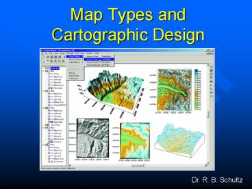
Map Types and Cartographic Design
Dr. R. B. Schultz
2
Making Maps With GIS
- The Parts of a Map
- Choosing a Map Type
- Designing the Map
3
What is a map?
- A graphic depiction of all or part of a
geographic realm in which the real-world features
have been replaced by symbols in their correct
spatial location at a reduced scale.
power line
4
Map function in GIS
- Storage
- Temporary communication
- Intermediate check of data
- Final report
- To be effective, must be correctly designed and
constructed.
5
The Parts of a Map Map Elements
Border
Title
Neat line
The United States of America
Figure
Legend
Scale
Ground
Washington,D.C.
National Capital
Alaska
0
4
1
2
3
Hawaii
hundreds of
kilometers
0
Lambert Conformal Conic Projection
4
0
4
Source U.S. Dept. of State
Credits
Place name
Inset
North Arrow
6
The medium is the message
- Paper
- Film
- Mylar
- Monitor
- Projection
- Broadcast TV
- THE DISPLAY IS PART OF THE
- SYMBOLIZATION
7
Cartographic Elements
- Medium
- Figure
- Ground
- Reference information
8
Cartographic Elements (2)
- Border
- Neatline
- Insets
- Scale up
- Scale down
- Metadata e.g. index
- Off-map references
9
Cartographic Elements (3)
- Page coordinates
- Ground elements
- Graticule/Grid
- North arrow
10
Cartographic Elements (4)
- Figure
- Point/Line/Area symbols
- Text
- Place Names
- Title
11
Cartographic Elements (5)
- Reference Information
- Scale
- Projection(s)
- Sources (2)
- Credits
- Legend
- Reliability
12
Map impactWhich is the best?
- Distribution of Employment
- by State 1996
- USA Employment Distribution 1996
- U.S. Employment 1996 Distribution
- America at Work
- Where the Jobs are Today
13
Text Selection and Placement
6
6
e
t
u
o
R
S
d
U
u
M
New York
e
k
2
a
L
CA
BM 232
NV
POINT
LINE
AREA
Some cartographic label placement conventions.
Points right and above preferred with no overlap.
Lines Following the direction of the line,
curved if a river. Text should read up on the
left of the map and
down on the right. Areas On a gently curved line
following the shape of the figure and upright.
14
Choosing Elements
- Map research
- Map compilation
- Worksheet
- Selection
- Placement
- Layout
- Tools in GIS not ideal
15
Choosing a Map Type
- Cartographers have designed hundreds of map
types methods of cartographic representation. - Not all GISs allow all types.
- Most have a set of basic types
- Depends heavily on the dimension of the data to
be shown in the map figure.
16
Choosing the Wrong Type
- Fairly common GIS error.
- Due to lack of knowledge about cartographic
options. - Can still have perfect symbolization.
- Possibility of misinformation
- Definite reduction in communication effectiveness.
17
Map Types Point Data
- Reference
- Topographic
- Dot
- Picture Symbol
- Graduated Symbol
18
Map Types Line Data
- Network
- Flow
- Isopleth
- Reference
19
Map Types Area Data
- Choropleth
- Area qualitative
- Stepped surface
- Hypsometric
- Dasymetric
- Reference
20
Map Types Volume Data
- Isopleth, Stepped Surface, Hypsometric
- Gridded fishnet
- Realistic perspective
- Hill-shaded
- Image map
21
Map Types Time
- Multiple views
- Animation
- Moving map
- Fly thru
- Fly by
22
Choosing Types
- Check the data
- Continuous
- Discrete
- Accuracy Precision
- Reliability
- Dimension (Point, Line, Area, Volume)
- Scale of Measurement (Nominal etc.)
- GIS capability
- May need to supplement GIS software
23
Data Scaling (Stevens)
- Nominal (Name of a place)
- Ordinal (Small, med., large town)
- Interval (Arbitrary zero e.g. Sea Level)
- Ratio (Absolute zero e.g. dollars, densities)
24
Example Choropleth Mapping
- Data should be AREA (e.g. States)
- Data should not suffer from area effect.
- Population?
- Per capita Income?
- Elevation? Temperature?
- Boundaries unambiguous.
- Areas non-overlapping.
25
Classification
- Equal Interval
- Natural groups
- N-tiles
- Equal or unequal?
- Logarithmic? Linear? Discontinuous?
- How many classes?
- Non-overlapping, distinctive groups.
26
(No Transcript)
27
The Need for Design
- To appear professional and avoid errors, GIS maps
should reflect cartographic knowledge about map
design. - A map has a visual grammar or structure that must
be understood and used if the best map design is
desired. - Cartographic convention (e.g. forests should be
green).
28
Map Design
- A GIS map is designed in a process called the
design loop. - Good map design requires that map elements be
placed in a balanced arrangement within the neat
line.
29
The Design Loop
- Create map layout as macro
- Draw on screen (proof plot)
- Look
- Edit macro
- Repeat until happy
- Make final plot
30
Graphic Editors
31
Graphic Editor Software
- Vector
- Adobe Illustrator
- CorelDraw
- Freehand
- Raster
- Photoshop
- CorelPaint
- Fractal Paint
32
Map Design (2)
- Visual balance is affected by
- the "weight" of the symbols
- the visual hierarchy of the symbols and elements
- the location of the elements with respect to each
other and the visual center of the map.
33
Visual center
5 of height
5 of height
Portrait
Landscape
34
Visual Layout
Eye expects (1) balance and (2) alignment
35
Symbol weight
36
Color and Map Design
- Color is a complex visual variable and in a GIS
is specified by Red, Green, or Blue (RGB) or Hue,
Saturation and Intensity (HIS) values. - Red, Green, Blue are additive primaries.
- Magenta, Cyan and Yellow are subtractive
primaries. - Saturation and Intensity map better onto values
than hue.
37
Dimensions of Color
HUE
INTENSITY
SATURATION
38
Simultaneous Contrast
39
Color Primaries
Additive color
Subtractive color
40
Text placement
Santa Barbara
Santa Barbara
Path right
Santa Barbara
P a t h D o w n
Santa Barbara
L a g o o n
41
Scale and Generalization
- Smaller scale means fewer features.
- Smaller scale means smoother features.
- Smaller scale means combining features.
- Smaller scale means displacing features.
- Often scales are mixed or overgeneralized.
42
Map Design and GIS
- When a GIS map is the result of a complex
analytical or modeling process, good design is
essential for understanding. - The map is what distinguishes GIS as a different
approach to the management of information, so
extra care should be taken to improve the final
maps that a GIS generates in a GIS task.
Recommended
CrystalGraphics Presentations


