
Fundamentals of Geographic Information Systems and Spatial Data - PowerPoint PPT Presentation
Title: Fundamentals of Geographic Information Systems and Spatial Data
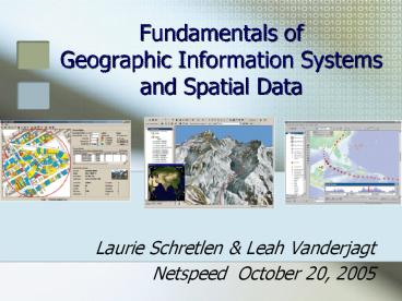
1
Fundamentals of Geographic Information Systems
and Spatial Data
- Laurie Schretlen Leah Vanderjagt
- Netspeed October 20, 2005
2
GIS Spatial Data - Today
- Introduction to Geographic Information Systems
(GIS) technology basics, applications, and
directions - Spatial data information resources for GIS
research - Spatial data access
- in Canada and in Alberta
- GEODE
3
(No Transcript)
4
(No Transcript)
5
(No Transcript)
6
(No Transcript)
7
(No Transcript)
8
(No Transcript)
9
GIS Components
- Map data
- Information about location w/graphics
http//www.zoology.unimelb.edu.au/stats/Eworksheet
s/images/RandomCoordinates.jpg
10
GIS Components
- Attribute data
- Information about what can be found at a
particular location
http//www.extension.umn.edu/distribution/naturalr
esources/images/5740f02.gif
11
GIS as database
http//utca.eng.ua.edu/projects/final_reports/0240
3fnl_files/image004.jpg
12
Spatial data examples
- Road networks
- Vegetation inventories
- Soil inventories
- Census results
- Municipal boundaries
- Elevation values
- Climate readings
- Habitat ranges
13
GIS Components
- Software
- A technology for storing and analyzing location
and attribute data
http//www.l.hsr.ch/skripte/gisscripts/media/softw
arescreen1.jpg
14
GIS Components
- Hardware
- Systems to support rapid graphic analysis and
processing
http//www.gdf-hannover.de/pics/gisrechner.png
15
GIS Personnel
- People
- Project coordinators
- Data analysts
- Programmers
- Data and knowledge managers
- Librarians
16
GIS Components
- Methods
- The analysis to be performed on the data
http//www.wwf.org.co/colombia/images/a28_c.gif
17
GIS Methods and Analysis
- GIS is used to answer questions and support
decisions - The quality of the answer depends on
- The METHODS chosen
- The DATA (more on that later)
18
Data Layers
- The ability to stack layers in a GIS allows us
to ask questions about the relationship between
different objects of study
Image courtesy of Charlene Nielsen, Department of
Biology, University of Alberta
19
Overlay
- What two things occur at the same location?
http//www.orthogate.com/guide/workshops/images/im
age002.gif
20
Overlay GIS
- What residences lie beneath this toxic plume of
ammonia?
21
Overlay GIS
http//www.saultc.on.ca/GIS/images/RedPineTraill_s
m.jpg
22
Buffering
- What lots are located near this road?
http//news.sina.com.cn/duihua/sars/LearnMoreAbout
GIS/gis4.files/buffer.gif
23
(No Transcript)
24
Modeling
- GIS is used to ask what if?
- Testing scenarios and possible outcomes
25
Modeling
26
(No Transcript)
27
Image created by Leah Vanderjagt, 2005 Data
NRCan CDED City of Edmonton 2001 Digital
Orthophotos
28
Modeling - Site Selection
- Combining best conditions from multiple layers to
come up with the best location for a proposed
facility - Eg. Good slope drainage enough distance from
streams access to roads Best site
29
Modeling
30
GIS Applications
- GIS applications combine multiple analytical
processes to support decision-making - Some examples from non-profit and government
sectors
31
Habitat tracking and analysis
- maps.gov.bc.ca/imf406/imf.jsp?sitelibc_habwiz
32
www.shim.bc.ca/atlases/shim/shim.htm
33
Health Care Disease outbreak monitoring and
modeling
Avian Flu
Affected and at-risk poultry farms
Dispersion of Avian Flu in Thailand
http//www.gisdevelopment.net/application/health/l
inks/ma04184pf.htm
34
SARS Mapping
Distribution map
Outbreak model Buffalo, NY
35
(No Transcript)
36
Facilities Management for Municipal Government
37
Route Optimization Modeling
38
Crime Analysis
39
Other uses
- Many groups still need to create paper maps to
support operations - nearly always GIS-based - GIS is also used for storage of information
there is an archiving function
40
(No Transcript)
41
Directions for GIS
- WEB APPLICATIONS
- Standards
- Unlocking the GIS black box -distributed
experimentation and collaboration - GIScience
42
GIS in Academic Institutions
- GIS is used extensively in science/ecology
disciplines - Renewable resources management
- Forestry
- Biology (ecology)
- Geography
- Earth and atmospheric sciences
- Geology
43
GIS in Academic Institutions
- Also used in
- Civil engineering
- Business
- Economics
- History
- Psychology
- Health
44
GIS and Libraries
- Community demographic analysis
45
GIS - Bibliography
46
Spatial data access
- Map Attribute data is usually referred to
as spatial data - Locating the right spatial data and obtaining the
rights to use it is a major component of every
GIS project
47
Spatial data quality Inconsistencies
48
Spatial data quality Projections
http//www.colorado.edu/geography/gcraft/notes/map
proj/gif/twoproj.gif
49
Spatial data access
- Spatial data is expensive to create and update
- Government agencies and large corporations can
afford it - Data sharing is not necessarily a part of the
plan
50
Spatial data access
- If its shared, spatial data is either sold by
the producer or by a designated value-added
reseller - Public consultations have resulted in open
sharing of more and more spatial data sets at the
federal level - Some federal data is made available through the
Depository Services Program
51
Canadian Geospatial Data Infrastructure
52
Spatial data access
- There is much more data available for purchase
- Therefore, there is a spatial data economy in
Canada - This economy is driven by cost-recovery policies
- Government agencies charge other agencies,
corporations, and individuals for data access
53
Different models of access
- United States wide, very open access to drive
commercial development - Canada stewardship model of cost-recovery
- Provincial economy examples
- Manitoba
- Alberta
54
Alberta Policy Environment
- Government agencies cost-recovery sales
- Third party vendors data enhancers and resellers
for profit - Data producers who do not sell or distribute
their data
55
Challenges to Access
- What is the result of Albertas policy
environment? - Data creators dont have sufficient resources to
respond to individual researcher demand - Data suppliers do not document or support data
products - Data suppliers primary business is not data
supply, ie. creating happy data customers
56
Post-secondary Response
- Underground data economy have and have-not
departments at one institution - Some data creators provide data in exchange for
research results - Individuals or projects receive licenses for
data cannot be shared with institution - Academic libraries began to acquire data through
license (database model) - Successful examples NRCan, DMTI
57
GEODE
- To address issues of access to spatial data in
Alberta, the GEODE project was launched in 1999 - Participating institutions
- University of Alberta
- University of Calgary
- SAIT
- University of Lethbridge
- Miistakis Institute for the Rockies
58
GEODE
- Access to Alberta-based spatial data
- Digital elevation models
- Topographic data
- Alberta Vegetation Index
- Census boundaries
- Landsat 7 imagery
- Metadata development
- Data browser
- 10,000 files downloaded
59
Benefits to GIS Researchers
- Consortium-wide access to high quality data
- Centralized price and acquisition negotiations
- The opportunity to work with industry-standard
Alberta data
60
Benefits to suppliers
- One point of access for post-secondary
institutions - Data support coordinated through library and
departments - Institutional licensing
- Training of future employees with industry
standard data
61
GEODEs Transformation
- GEODE was reconceived in late 2004 as a
consortium to facilitate and promote access to
spatial data for post-secondary education in
Alberta - Objectives
- Develop new funding strategies
- Enhance contents of collection
- Expand institutional membership
62
Benefits of institutional membership
- Access to GEODE collections
- Training and assistance with GEODE service
delivery - Advocacy and liaison with vendors
- Cost-sharing
- Technology/infrastructure guidance
- Collaborative development of best practices
63
GIS for Post-secondary Education
- For access to spatial data for GIS research and
teaching to continue and thrive in Alberta,
academic libraries need to collaborate to - Develop spatial data collections according to
shared research priorities - Lobby for access with producers and vendors
- Share resources and expertise
64
Moving forward
- Long-range technology goal database-driven web
service delivery of spatial data files - GEODE is seeking assistance with the development
of a province-wide licensing model for spatial
data use in research and teaching
65
Questions? Discussion?
- Laurie Schretlen lschretl _at_ ucalgary.ca
- Leah Vanderjagt leahv _at_ ualberta.ca
66
Web Citations
- Google Local www.google.ca
- Google Earth earth.google.com
- BC Habitat Wizard maps.gov.bc.ca/imf406/imf.jsp?s
itelibc_habwiz - Sensitive Habitat Inventory and Mapping
www.shim.bc.ca/atlases/shim/shim.htm
Recommended
CrystalGraphics Presentations


