
RED ROADS A discussion of developmentrelated road requirements and their implications - PowerPoint PPT Presentation
1 / 23
Title:
RED ROADS A discussion of developmentrelated road requirements and their implications
Description:
... road width data in the Surveyor's GIS System, we were able to create 2 maps for ... This is the same definition as on the Road Width Maps. Additionally: ... – PowerPoint PPT presentation
Number of Views:111
Avg rating:3.0/5.0
Title: RED ROADS A discussion of developmentrelated road requirements and their implications
1
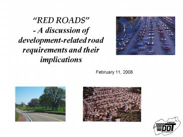
RED ROADS- A discussion of development-related
road requirements and their implications
- February 11, 2008
2
RED ROADS A DISCUSSION OF DEVELOPMENT-RELATED
ROAD REQUIREMENTS AND THEIR IMPLICATIONS
- PREPARED FOR
- JOINT MEETING OF THE BOARD OF SUPERVISORS AND
- PLANNING COMMISSIONERS
- FEBRUARY 11, 2008
- BOARD OF SUPERVISORS CHAMBERS
- PREPARED BY
WORKING TEAM LINDA WRIGHT, SURVEYORS OFFICE JON
VEGNA, DOT CRAIG MCKIBBIN, DOT VAL AKANA, DOT
ADVISORY TEAM SUPERVISOR SWEENEY JOSE CRUMMETT,
SURVEYORS OFFICE RICHARD SHEPARD, DOT JIM WARE,
DOT TOM CELIO, DOT
3
Agenda
- Welcome, Introductions (Supervisor Sweeney)
- What is Driving the Need for this Discussion
(Supervisor Sweeney) - Objectives for this Workshop (Supervisor Sweeney)
- Background The Approach (Jim Ware)
- Summary of Development-related Road Requirements
(Jim) - Translation of Requirements into Maps for Two
Pilot Areas (Jim) - Implications of the Requirements (Richard
Shepard) - Questions/Discussion (Richard)
- Next Steps (Richard)
4
What is Driving the Need for this Discussion?
- As we will see later in this presentation, there
is a lack of consistency (and in some cases a
lack of clarity) between the road requirements
related to new development - General Plan
- Subdivision Ordinance
- Design and Improvement Standards Manual (DISM)
- 2007 California Fire Code (and proposed
amendments) - California Fire Protection Regulations
- In turn, it is no surprise that it is difficult
for staff, the public, and decision makers to
interpret and apply the requirements to new
development in a consistent way.
5
Our objectives with this workshop are two-fold
- Attain consistent requirements
- Part of the solution is the update to the Design
and Improvement Standards Manual (DISM), - However, inconsistent requirements need input
from you as decision makers to help guide staff - This may require changes not only to the DISM,
but also to ordinances, General Plan policies,
etc. - Discuss the possibility of creating a simple and
clear method (e.g., maps) for the public, county
staff, and decision makers to more easily
understand the requirements.
6
Background The Approach
- General Plan
- Ordinances
- California Fire Protection Regulations
- 2007 California Fire Code
- DISM
Reviewed Existing Road Requirements Associated
withLand Development from
Summarized the Requirements and Implications
Specifically for
- Road Width, ROW Width
- Secondary Access (i.e., 2 ways in and out)
- Road Width
- Dead End Roads
Created Maps for Two Pilot Areas to Depict the
Impacts of the Requirements on
7
Summarized Requirements for ROAD WIDTH (see
supporting tables for detailed citations)
Source
Requirement
Applies to Building Permits And
Discretionary Development
Applies to Discretionary Development
8
Working with existing DOT road width data in the
Surveyors GIS System, we were able to create 2
maps for each of 2 pilot areas to display the
requirements
- 2 GEOGRAPHIC AREAS
- In and around the town of El Dorado, south on
Highway 49 to Sand Ridge - El Dorado Hills, northeast of Green Valley and
Salmon Falls Roads - 2 MAPS per AREA
- Road Widths
- Dead End Roads
9
Explanation of the Maps (I)
- ROAD WIDTH MAPS
- RED roads are less than 18 feet wide and, in
theory, no development (including building
permits) should be allowed without road widening
to the minimum 18 feet. - GREEN roads are at least 24 feet wide and,
therefore, are likely to be acceptable for
ministerial permits as well as discretionary
development. - YELLOW roads are at least 18 feet but less than
24 feet wide and, therefore, are likely to be
acceptable for ministerial permits but not
discretionary development. - BLUE roads DO NOT meet the General Plans
Circulation Requirement for 2025 and, in theory,
should be upgraded before new development is
allowed. - Additionally, once dead end roads turn a
particular color, the remainder of the road stays
that color all the way to the end, whether or not
the road widens out after the pinch point
(examples China Hill and Church Mine Roads).
10
Explanation of the Maps (II)
- ROAD WIDTH MAPS
- BRIDGES
- BOX CULVERTS
- Bridges and culverts can also be constraints
and can turn a road yellow or red, even if the
road would otherwise be green. - For example, on Greenstone Road, between Highway
50 and Mother Lode Drive, there is a 19 foot wide
bridge which makes at least part of Greenstone
Road yellow otherwise it would be green. - Note A bridge is defined as having at least a
20 foot long span anything smaller is a box
culvert.
11
Summarized Requirements for SECONDARY ACCESS
(see supporting tables for detailed citations)
Source
Requirement
Applies to Building Permits And
Discretionary Development
Applies to Discretionary Development
12
Explanation of the Maps (III)
- DEAD END ROAD MAPS
- RED roads DO NOT connect to 2 County-maintained
roads. In other words, a NON County-maintained
road does not count as a connection. - GREEN roads DO connect to 2 County-maintained
roads. - BLUE roads DO NOT meet the General Plans
Circulation Requirement for 2025 and, in theory,
should be upgraded before new development is
allowed. This is the same definition as on the
Road Width Maps. - Additionally
- If a road branches off a dead end road, it is
also a dead end road (e.g., all roads off Fowler,
after Toyan, are RED). - Closed loop roads are automatically dead ends and
therefore, are RED.
13
Assumptions/Limitations of Data
- Road width data is only available for
County-maintained roads. There is almost NO width
data available for NON County-maintained roads. - All maps were created with existing DOT data the
road width data is updated periodically. - Road widths are measured from edge of surface
(i.e., pavement or gravel) to edge of surface. - Road width data was not collected for these maps
it was collected solely for maintaining County
roads. Therefore, the data does not necessarily
include the narrowest point on any given road. - While the GIS system is set up to store data
collected at every mile post, the data was not
collected at every mile post. (A mile post
exists at every 1/100 of a mile.) - The bridge road width data is reasonably accurate
as it is maintained for reporting to the State
and Federal governments. The box culvert data is
several years old. (Cross culvert data is
currently being collected.) Some work still needs
to be done to reconcile DOT data to GIS data for
bridge and culvert locations.
14
Implications and Questions
15
If we strictly adhered to the standards, all
building in some areas of the county would stop
without significant road upgrades. (I)
- Road Width
- Should we entertain the possibility of having
different road standards for rural versus urban
areas of the county? - Standard Plan 101-C incorporates this option to a
certain degree because road width widens with
increasing ADT. - We would need to amend the General Plan.
- Should we allow ministerial (i.e., building)
permits on roads less than 18 feet wide, without
requiring road widening? - Should we allow discretionary development in
areas where roads do not meet the General Plan
2025 circulation plan, without requiring road
widening? - What do we do with the new Fire Code and
amendments proposed by the Fire Districts? (They
imply that the 18 foot minimum should be 20
feet.) - What other issues are raised by the road width
requirements that need to be addressed?
16
If we strictly adhered to the standards, all
building in some areas of the county would stop
without significant road upgrades. (II)
- Secondary Access
- The General Plan makes a blanket and general
statement about the need for new developments to
develop a circulation plan that includes
secondary access. The DISM and Fire Regulations
describe specific requirements related to
secondary access and dead end roads. - Should secondary access be required for all
discretionary development applications (including
parcel maps, subdivisions, design reviews,
etc.)? - Exceptions vary for length of dead end roads
based on distance, number of parcels and/or size
of parcels. How best to reconcile the various
rules? - What other issues are raised by the requirements
that need to be addressed?
17
Discussion
18
Next Steps (I)
- Homework?
- Follow-on Discussion?
- More Mapping?
- Funding required to do more of this is variable
and depends on decisions related to - Focus/Priorities,
- Amount and Accuracy of Data, and
- Timeframe.
19
Next Steps (II)
- DOT has at least some road width data for over
90 of all County maintained roads this data is
already available on a County-wide map but has
not been distributed widely. - We could make this available now, without
coloring the roads. - The mapping effort for the 2 pilot areas has
consumed about 250 hours of staff time since
September. (Staff has worked on this project as
they have found time.) - The pilot areas cover about 12 of the
County-maintained road miles. - 250 hours divided by 12 approximately 2100
hours (i.e., 260 work days) to do all County
maintained roads with the same approach that we
have taken with the pilot areas.
20
BACK-UP
21
There are 3 sets of fire requirements that affect
new development 2 are driven by the State and 1
is driven by the local Fire Protection Districts
(I)
- California Law consists of 29 codes, covering
various subject areas, the State Constitution and
Statutes. Two of the 29 codes that create
fire-related requirements are - The Public Resources Code authorizes the
California Code of Regulation Title 14. Natural
Resources - Cal Fire (formerly CDF) publishes its Fire
Protection regulations under Title 14. - The regulations specifically pertaining to roads
were last updated in 1991. - The Health and Safety Code authorizes the
California Code of Regulation Title 24. Building
Standards Code - Title 24 is owned by the States Building
Standards Commission. - Part 9 of Title 24 is the California Fire Code
which contains fire-safety-related building
standards referenced in other parts of Title 24. - The updated Fire Code was adopted by the state in
2007, along with the new Building Code,
Electrical Code, Plumbing Code, Energy Code,
Mechanical Code, etc.
22
There are 3 sets of fire requirements that affect
new development 2 are driven by the State and 1
is driven by the local Fire Protection Districts
(II)
- The Fire Prevention Officers (FPOs) Association,
whose members are appointed by the Fire Chief in
each Fire District, is recommending to their
Chiefs, that they adopt Title 24, Part 9.
California Fire Code with certain amendments. - County staff is working with the FPOs to better
understand the proposed amendments and their
implications on new development. - The 3 sets of fire requirements cross over in
certain areas, for example, road widths and
secondary access. - Working with the FPOs, county staff will need to
reconcile the requirements and make
recommendations as to which to choose for
incorporation into the DISM, for example.
23
Level of Service (Capacity)
- For smaller, local roads, Level of Service is not
a limiting factor because the number of daily
trips is low. Other requirements drive their
widths (e.g., Fire Safe Regulations, Standard
Plan 101-C, etc.). - For larger roads, Level of Service (i.e.,
Capacity) is already encompassed in the BLUE
General Plan Roads. - For example, the capacity model shows that Green
Valley Road, between Salmon Falls Road and Deer
Valley Road, should be an undivided 4 lane
arterial which, according to the General Plan
(Table TC-1, page 65) should be 64 feet wide with
80 feet of ROW. - Therefore, Level of Service is not shown as a
separate map.
Recommended
CrystalGraphics Presentations


