
PREDICTING HIGHTEMPERATURE GEOTHERMAL RESOURCES IN THE GREAT BASIN USING GIS - PowerPoint PPT Presentation
1 / 25
Title: PREDICTING HIGHTEMPERATURE GEOTHERMAL RESOURCES IN THE GREAT BASIN USING GIS
1
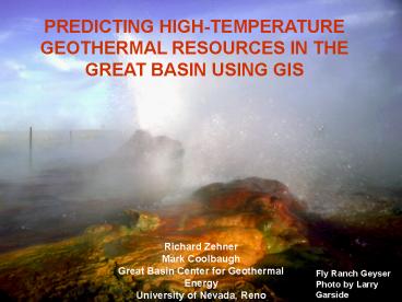
PREDICTING HIGH-TEMPERATURE GEOTHERMAL RESOURCES
IN THE GREAT BASIN USING GIS
Richard Zehner Mark Coolbaugh Great Basin Center
for Geothermal Energy University of Nevada, Reno
Fly Ranch Geyser Photo by Larry Garside
2
- CENTER GOALS
- To accelerate the acquisition, organization,
cataloging, and linking of critical data and
information on the geothermal resources of the
Great Basin. - To provide rapid and easy access to geothermal
data and information for stakeholders involved in
geothermal development.
3
What we actually do
- Determine what data pertinent to geothermal
exploration is relevant to collect - Design projects and collect the data
- Quantify relationships
- Get the data into a useable spatial format
- Perform data-driven spatial analysis of the data
(e.g., WoFE, logistic regression) - Derive predictability maps
- Post the data on the internet (ArcSDE, ArcIMS)
Photo by Greg Arehart
4
Factors Associated with High-Temperature
Geothermal Systems
- Recent volcanism (magmatic systems)
- Shear and dilational strain
- Conduits to the surface (faults)
- Temperature Gradient/ Heat Flow
- Earthquakes
Steamboat Hot Spring terrace Photo by Don Hudson
5
Geothermal Systems in Nevada Great Basin, USA
Big Southern Butte
Newberry Crater
China Hat
Medicine Lake
Roosevelt/ Cove Fort
Mammoth
Boundary of Great Basin
Coso
6
Spatial Analysis
- How do you find new sites for geothermal power
plants? - Some geothermal systems arent hot enough
- Some high-temperature systems are hidden by
fast-flowing aquifers or impermeable cap rock - We have a good idea what geologic factors are
associated with them. - Need some way to compare these factors and use
them to search for more
- Expert techniques (Boolean logic, fuzzy logic,
eyeballing it - Data driven techniques Weights of Evidence,
logistic regression, neural networks
Fales Hot Spring
7
How Weights of Evidence and Logistic Regression
Work
- The study area is selected and divided into
cells. - The training sites (point shapefile) are compared
with this study grid. - The prior probability is determined by dividing
the number of cells containing a training site
with the total number of cells. - An evidence layer (integer grid) is introduced,
and the number of cells in each integer category
that contain training sites is counted, and
compared with the area that integer category
covers. Probabilities (odds) are calculated. - If integer categories contain a statistically
higher probability of containing a training site
than the prior probability, it can be used as a
predictive layer in the GIS.
10
.
..
..
10
.
6 training sites in 100 cells prior probability
of 0.06
.
..
..
.
Note that the area proportions of finding a
training site in a cell (6 sites in 100 cells)
are translated to a probability (and later, to
odds).
8
- Weights of Evidence
- W ln O (A B) ln O (A) (Weight)
- Where (A B) probability of finding a training
site in a cell (A), given the presence of a
category of an evidence layer (B) - ln O (A)B the prior logit, similar
to the prior probability
Note Natural log scale so increase by 1 unit
increases the probability by 2.7 times.
9
- Once you find evidence layers with good
predictability - Reclassify into integer grids that give best
statistical bang for the buck - Calculate the response theme on evidence layers
- The probability of finding a training site for
each unique condition in the study area is
calculated - The result is a map showing probability of
finding a training site (e.g., deposit)
Unique Conditions Table
10
ArcSDM Module
11
- Start the Modeling
- Define study area
- Select training sites (point shapefile of
deposits)
12
3. Build and test the evidence layers
Nevada Geodesy Network
- Network of permanent GPS stations
- Sub-millimeter accuracy
- Measures current strain
Photo by Cornè Kreemer
13
Super accurate GPS can show sub-millimeter
changes in station locations, which correspond to
crustal strain (and other factors). The
resolution of the data is better where there are
many locations.
The data are filtered and fed into a crustal
model, which calculates the components of strain
(shear and dilation). The output is a set of
points on a 0.1o x 0.1o grid, which can be
converted to a shapefile and then interpolated
onto a surface using a variety of techniques.
14
Dilational component of crustal strain as
interpreted from (1) Geodesy and (2) Quaternary
fault data
Slip rates in the USGS Quaternary Fault and Fold
Database were converted to long-term strain rate
tensors (ESRI floating point GRID) using an Arc
3x extension
ESRI floating point GRIDs Warmer colors indicate
higher extension rates
Black dots are training points
1. Strain from GPS/Geodesy
2. Strain from faults
15
Crustal Dilation Layer Sum of GPS-derived and
Fault slip-rate derived estimates (floating point
GRIDS)
Black dots GPS stations Black lines Faults
with estimated slip rates
16
Proxy for Through-Going Faults Combined Map of
Residual Isostatic Gravity (basins only) and DEM
Gravity 20-km upward continued isostatic
residual, regional patterns subtracted to produce
basins-only anomalies DEM smoothed to 1
km Gravity and DEM combined (conversion factor
60 m/mgal)
- 1) Gravity gradients can indicate location of
major normal faults - 2) Topographic gradients can do the same
- 3) Combination gravity and topographic relief
map (conversion factor 60 m/mgal)
17
4. Select the best evidence layers and run
WoFE/LR for our model, six maps were combined
into four evidence layers, reclassified into ESRI
integer GRIDs.
2 classes (binary)
Earthquakes
5 classes
3 classes
3 classes
Gravity/DEM Gradient
Dilational Strain GPS and Faults
Temperature Gradient
18
using WoFE/Logistic regression in the GIS, we
can overcome some of the problems of hot spring
systems not making it to the surface, such as big
regional aquifers.
We first calculated probabilities outside
regional aquifers.
then extrapolated into areas of regional
aquifers.
Logistic regression predicts 33 more
high-temperature (?150C) geothermal systems in
the aquifers regions than are currently known
19
(No Transcript)
20
Close-Up View
21
Finally, get the layers onto the Web
22
(No Transcript)
23
(No Transcript)
24
- Thanks to
- Department of Energy
- Contributing Scientists David Blackwell, Geoff
Blewitt, Graeme Bonham-Carter, Cornè Kreemer,
Aasha Pancha, Gary Oppliger, Gary Raines, Don
Sawatzky, USGS Quaternary Fault Group - Photographs Greg Arehart, Jim Faulds, Larry
Garside, Cornè Kreemer, Lisa Shevenell - UNR Library and Keck Center for hosting our
ArcSDE/ArcIMS
Visit our Web Site at http//www.unr.edu/Geotherma
l/ To get information and download a free copy
of ArcSDM (Spatial Data Modeler), go to
http//ntserv.gis.nrcan.gc.ca/sdm/default_e.htm
Main Terrace, Steamboat, NV. Photo by Greg Arehart
25
(No Transcript)