
The National Ecological Observatory Network: Overview - PowerPoint PPT Presentation
1 / 21
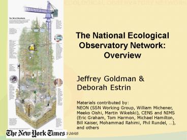
Title: The National Ecological Observatory Network: Overview
1
The National Ecological Observatory
NetworkOverview
Jeffrey Goldman Deborah Estrin Materials
contributed by NEON (SSN Working Group, William
Michener, Meeko Oishi, Martin Wikelski), CENS and
NIMS (Eric Graham, Tom Harmon, Michael Hamilton,
Bill Kaiser, Mohammad Rahimi, Phil Rundel, ),
and others
5/10/05
2
NEON A Bold Initiative for Big Science NSFs
Major Research Equipment and Facilities
Construction Process
scientific research that requires a massive
capital investment, that involves large teams of
scientists, and that is expected to yield very
significant resultsi.e., transform the science
3
The NEON Mission To provide the capacity to
forecast future states of ecological systems for
the advancement of science and the benefit of
society.
- Two Overarching Questions
- How are ecosystems affected by variations in
climate and changes in land use? - How will the patterns and movements of organisms
be affected by variations in climate and changes
in land use?
4
(No Transcript)
5
NEON Science
- How are ecosystems affected by variations in
climate and changes in land use? - How will ecosystems respond to changes in land
use and climate across a range of spatial and
temporal scales? And, are the responses gradual
or abrupt? - How do changes in land use and climate influence
the movement of water and materials from
terrestrial to aquatic ecosystems? And, how does
this affect nutrient dynamics and ecosystem
metabolism? - How will the patterns and movements of organisms
be affected by variations in climate and changes
in land use? - How will plant and animal biodiversity respond to
land use change and climate variations? And, do
changes in biodiversity have a reciprocal effect
on land use and climate? - How do changes in land use and climate affect the
spread of infectious diseases and invasive
species? And, what are the ecological
implications?
6
NEON Climate Domains
7
NEON Deployment
8
NEON Fielded Instruments and Embedded CI
9
NEON Open, Evolvable Architecture
- High resolution measurement of key biological
drivers (physical, chemical) - Observation of realizable biological response
variables - In situ organism tracking, imaging, automated
sample collection - Remote sensing of land cover at large spatial
scale - Seamless incorporation of new biological,
chemical and physical sensors as technology
matures - Based on well defined hardware and software
interfaces and tools (plug and play) - e.g., from nearer term instruments (such as
automated dust collectors) to longer term
(automated genomic analysis)
10
NEON Fielded Instruments Structure
- Fundamental Instrumented Unit (FIU)
- automatically gather relevant biotic and abiotic
data - FIU will include two components BioMesoNet
Tower, SensorNetworks - three fixed FIU deployed per NEON Domain
- user community will augment with targeted higher
spatial resolution deployments
11
BioMesoNet Measurements
- Basic 10 Meter Tower- Air temperature (at 10 m,
1.5 m, 10 cm, 0 cm) - - Barometric pressure (at 1.5 m)
- Relative humidity (at 10 m, 1.5 m 2 other
canopy-dependent heights) - - Precipitation (rain snow liquid equivalent)
- Wind speed direction (at 10 m, 1.5 m 2 other
canopy-dependent - heights)
- - Soil moisture (at -2, -30, -100 cm)
- - Soil temperature (at -5, -15, -30cm)
- Advanced 10 Meter TowerBasic components plus
- - Incoming, reflected, total diffuse solar
radiation (at 1.5 m) - - Sensible and latent heat CO2 fluxes
- - CO2 concentration (at 8-10 vertical levels from
ground to above canopy) - - H2O vapor (at 8-10 vertical levels from ground
to above canopy) - - Stable isotopes of C O in H2O CO2
- - CO concentration (at 3-5 m)
- - NO, NO2, NOx concentrations
- - O3 concentration (at 3-5 m)
- - Airborne particulates (e.g., pollen, bacteria)
- - Dry deposition of SO42-, NO3-, NH4, SO2,
HNO3 - - Wet deposition of NH4, NO3-, o-PO43-, SO42-,
Cl-, Ca2, Mg2, K, pH - - Leaf/canopy condition (moisture, incidence of
disease, remote sensing calibration) - Leaf wetness (at 10 m, 1.5 m 2 other
canopy-dependent heights)
12
BioMesoNet Tower
- Biotic and abiotic sensors, above- and
below-ground - air temperature, wind speed, humidity, heat
flux, precipitation, photosynthetically active
radiation (PAR), whole tree transpiration, wet
deposition, CO2 and H2O vapor, etc. dry
deposition chemistry, full range spectrometry,
stable isotopes - 60 sensors per Primary tower (1 per site) 15
sensors per secondary tower (3 per site) - Wireless sensor platforms host associated data
acquisition, processing, and communications. - powered through solar panel installations and
batteries line power where available. - Communications via wireless infrastructure
- 802.11 (WIFI) or General Packet Radio Service
(GPRS) cellular infrastructure - Instrument configuration and instructions
received from NEON control nodes and users, - Data communicated back to NEON archive and
analysis centers.
13
Terrestrial Sensor Measurements
- Canopy Climate Sensor Nets
- - Total, diffuse, incident photosynthetically
active radiation (PAR) - - Sunshine duration
- Biological temperature (i.e. soil/leaf/canopy
surface temperature) - - Air temperature (at 10 m,1.5 m,10 cm,0 cm,
Climate only) - - Relative humidity (at 0 m 1.5 m, Climate
only) - - Precipitation (rain snow liquid equivalent,
Climate only)
Soil Sensor Net - Root mycorrhizae phenology -
Soil respiration (CO2 emission) - Soil NO3-
concentration - Soil O2 concentration - Soil pH -
Soil water potential - Soil water volume - Soil
moisture (at -2, -30, -100 cm) - Soil
temperature (at -5, -15, -30cm) - Biological
temperature (i.e. soil/leaf/canopy surface
temperature)
14
Aquatic Sensor Measurements
Groundwater Platform - Groundwater level - Soil
moisture
- Small StreamPlatforms
- Automated water sample collection for chemical,
biological, isotopic measurements - Dissolved organic carbon concentration
- - Dissolved gas concentrations CO2, N2, N2O,
CH4, O2 - - Nutrient concentrations NO3-, NH4, PO43-, Si
- - pH
- - Oxidation/reduction potential
- - Conductivity
- - Turbidity
- Chlorophyll
- Water Depth
15
Sensor Networks (SNs)
- Sensor Networks (SNs)
- distributed wireless platforms.
- configurable sensor suites, sensing actions,
local storage, analysis, event detection - data returned over low power or intermittent
high-power wireless - some wireless sensor platforms will serve as
gateways to NEON archives and control points - Microclimate SN Network of biotic and abiotic
sensors, many of which are on the BioMesoNet flux
Tower, which gather meteorological data. - 12 sensors per array, 12 arrays per site, 3
sites per domain - Soil SN Network of soil sensors, including soil
temperature, moisture, water potential, soil
chemistry (pH, CO2, O2, N), surface fluxes,
low-density respiration chambers, automated
mini-rhizotrons. - 25 sensors per array, 12 arrays per site
- Canopy SN Habitat-contingent network of of
biotic and abiotic sensors placed within and near
the forest canopy, including basic meteorological
measurements, PAR, rainfall, sap flow, and
others. - 12 sensors per array, 12 arrays per site
- Aquatic SN Network of sensors that measure
biotic and abiotic parameters in streams - 3-5 sensors per array, 1 array per site
16
Fundamental Sentinel Unit Measurements
- Remote Sensing
- MODIS Satellite
- Land Use, Land Cover
- Primary Production
- Airborne Instrument Pods
- Hyperspectral
- LiDAR
- Side Aperture Radar (SAR)
- Interferometry
- Thermal Imaging
- Field Observation Programs
- Biodiversity
- - Soil Microbes
- Nematodes- Ants
- - Ground Beetles
- - Plants
- Algae
- - Aquatic Invertebrates
- Fish
- Breeding Bird Survey
- Aquatic Biogeochemistry
- - Ground Water Flow
- - Aquatic Sediments
- Vectors Pathogens - Mosquito West Nile,
Encephalitis, etc. - Deer Mice Hanta Virus, Plague, etc.
- Phenology
- Standardized Lilacs
- Dominant Plant Species- First Robin Nesting
- Organism Tracking System
- Deer Mice
17
Three types of Embedded CI Software
- Autonomous capabilities requiring software
support - Triggering high end sensing
- Node Articulation and mobility
- Sample collection
- Base network operations requiring software
support - Adaptive routing, duty cycling
- Reliable transport
- Time and position
- Interactive capabilities requiring software
support - System health monitoring
- System configuration and reconfiguration
(plug and play) - Calibration tests
- Directed manual sampling
- System tasking
18
Citizen Science Gateway
Cyberinfrastructure
Signage
- Training Scientists and Students
19
Site and Facility Prospectuses
Biocollections
Stable Isotope
Cyberinfrastructure
Genomics
20
NEON A continental research platform designed to
provide the capacity to forecast future states of
ecological systems for the advancement of
science and the benefit of society
- Novel infrastructure that
- allows scientists to observe the previously
unobservable - enables a new forecasting and predictive
capacity for ecology - takes advantage of new and evolving in situ
sensing technologies - couples human and natural systems
21
Why multi-scale distributed sensor-networking
will transform ecology
Radioastronomy
Computing
Field ecology
Supercomputers
Single Telescopes
Individual observations
because it has done so over and over again
Very Large Array
Internet
NEON
Recommended
CrystalGraphics Presentations


