
An Interoperability language to connect netCDF and Geographic communities: ncMLGML v' 0'5 - PowerPoint PPT Presentation
1 / 42
Title:
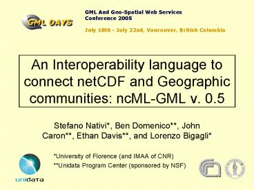
An Interoperability language to connect netCDF and Geographic communities: ncMLGML v' 0'5
Description:
Implicit georeferencing (e.g., CF conventions) 5D Datasets. Community Context ... Implicit geo-location metadata (x, y, z, t) range shape (t, z, y, x) variable shape ... – PowerPoint PPT presentation
Number of Views:37
Avg rating:3.0/5.0
Title: An Interoperability language to connect netCDF and Geographic communities: ncMLGML v' 0'5
1
An Interoperability language to connect netCDF
and Geographic communities ncML-GML v. 0.5
GML And Geo-Spatial Web ServicesConference
2005 July 18th - July 22nd, Vancouver, British
Columbia
- Stefano Nativi, Ben Domenico, John Caron,
Ethan Davis, and Lorenzo Bigagli - University of Florence (and IMAA of CNR)
- Unidata Program Center (sponsored by NSF)
2
Outline
- Sample Use Case
- Atmospheric and Ocean Sciences Community Context
- Existing Technologies
- Overall objectives for Bridging Gap
- standard interfaces
- gateway implementation
- Where Does GML Fit?
- What is ncML GML?
- Conclusions
- References
- Paper
- glossary
3
Real-time Local Forecast Use
IDD
Assimilation
Local weather forecast model
Initialization
- Data integration
- atmospheric
- hydrological
- demographic
- infrastructure
Assimilation
Coupled hydro/flood model
4
Hydrological, Demographic, Infrastructure Data in
GIS
- Represent characteristics of discrete objects
- Spatial characteristics change slowly
- Spatial resolution on the order of meters
- Stored in GIS and relational database tables
- Explicit georeferencing
- Use GIS spatial and SQL queries
5
Atmospheric or OceanScience Data
- Represent state of fluids
- Samples of continuous functions of many
parameters in 3D space and time - Spatial resolution on the order of kilometers
- Very large binary datasets
- Specialized formats (e.g., GRIB, netCDF, HDF)
- Implicit georeferencing (e.g., CF conventions)
6
5D Datasets
7
Community Context
- Many existing client/server data systems in the
atmosphere, ocean sciences communities (AIS or
ESIS) - Standards evolving from original base in GIS
community - Standards based gateway needed between existing
AIS data systems and traditional GIS world
8
Existing Technology In Oceans/Atmosphere
Communities
Client Application
THREDDS
HTTP
Catalog.xml
NetCDF
IOsp
GRIB
HDF5
NIDS
GINI
9
OGC Data Service with NetCDF Dataset Protocols
Application
WFS
WCS
GML
DTED
GeoTIFF
Static GIS Features
NITF
HDF-EOS
10
Client Application
NetCDF-Java version 2.2
NetcdfDataset
NetcdfFile
HTTP
HDF5
NetCDF-3
IOsp
NetCDF-4
GRIB
NIDS
GINI
11
WCS Client
NcMLGML
getCapabilities
geoTIFF
getCoverage
netCDF
describeCoverage
WCS coverage
NetCDF
GMLgenerator
geoTIFFgenerator
NcML-G metadata
THREDDS catalogs
OPeNDAP
THREDDS catalogs enhanced with NcML-GML
NetCDF/OPeNDAP data server
netCDF objects
THREDDS enhanced catalog generation tools
12
NcML-GML What is it?
- An Abstract and Content Model reconciliation
schema for ES and GIS info realms - A Mediation Markup Language between ncML (XML
representation of netCDF metadata) and GML - An extension of ncML core schema, based on GML
grammar
13
The Motivations
- NcML (i.e. netCDF) and GML semantics are not
completely interoperable - For example a netCDF dataset can generate lots
of geo-information Coverages, but only some of
them are "useful" or "meaningful" for
visualization using traditional GIS - To keep ncML and GML loosely coupled
- NcML must be free to change without any direct
effect on GML, and vice versa. - To enable ncML and GML interoperability using a
declarative language (i.e. a mark-up language) - To support the development of combined" ESGIS
applications/services, where both communities
semantics and data models are required - WCS could be a good example (i.e. a GALEON
objective)
14
Objectives
- To explicitly mediate from netCDF hyperspatial
data to GI coverage data models - To explicitly encode netCDF CF conventions into
GML-based elements
15
NetCDF dataset content
N-Dimension Coordinate Systems
ltdimensiongt, ltcoordinateSystemgt ltcoordinateAxisgt
ltnetcdf typegt
explicit/semi-implicit/implicit Geometry
ltdimensiongt, ltvariablegt
netCDF multidimensional dataset (e.g. 4/5D
hypercube)
Scalar measured quantities
ltvariablegt
16
Geoinformation coverage content
2D Spatial Coordinate System elev time
explicit/implicit Geometry
Spatial Reference System (SRS)
2Delevtime dataset
Range set
17
NcML-GML Mediation Process
2D elev time Coverages
netCDF hyperspace dataset (3/4/5D)
a Coverage
18
NcML-GML Related GI conceptsin brief
- A netCDF dataset can contain several different
coverages - Each coverage is characterized by a domain, a
range-set and is referenced by a CS/CRS - Each coverage is optionally described by a
geographic extent - Each domain is characterized by a geometry
- Supported domains regular grid domain, irregular
grid domain and multipoint domain - Each range-set lists or points set of values
associated to each domain location - Supported range-set types scalar range-set and
parametric range-set
19
Supported data encodings
- Domain
- Regular grid geometry
- Irregular grid geometry
- Multipoint geometry
- Range set
- Scalar range set
- Parametric range set
20
NcML-GML concepts mapping in brief
Semantics level
21
The Content Model
- The content model for ncML-GML is called ncML-G
- ncML-G package diagram
22
The Content Model Netcdf Coverages
- NcML-G UML model for NetCDF coverage data
ltlt
ncML
gtgt
NetcdfType
Metadata directly derived from netCDF dataset.
Metadata structure designed for ES users/systems.
at least one CS object exists
CS name is a unique
CS axis name is a unique
ltlt
neCDF-coverage
gtgt
ltlt
GML-based
gtgt
NetcdfCoverages
NetCDFCoverage
ltlt
GML
gtgt
-
aCoverageFunction
CoverageFunction
0..1
Metadata related to GI aspects, directly derived
from netCDF dataset semantics or extracted from
ncML metadata.
Metadata content is designed for GIS users/systems
(i.e. GML-based).
23
The Content Model Netcdf Coverage
- NcML-G UML model for NetCDF coverage data
24
The Content Model Netcdf Coverage Domain
ltlt
GML-based
gtgt
ltlt
GML-based
gtgt
1..
NetCDFCoverage
CoverageDomain
domain
ltlt
GML
gtgt
-
aCoverageFunction
0..1
characterizedBy
domain
ltlt
GML-based
gtgt
ltlt
GML-based
gtgt
ltlt
GML
gtgt
ltlt
GML
gtgt
NetCDFGridCoverage
NetCDFMultipointCoverage
GridDomain
RectifiedGridDomain
Implicit domain
describedBy
ltlt
GML
gtgt
-
aSRS
SRS
-
ltlt
GML
gtgt
aSRS
SRS
geometry
ltlt
GML-based
gtgt
ltlt
GML-based
gtgt
IrregularGridDomain
RectifiedIrregularGridDomain
characterizedBy
semi-implicit domain
geometry
ltlt
GML
gtgt
domain
MultiPoint
explicit domain geometry
25
The Content Model NetCDF Coverage RangeSet
26
The XML encoding schema
- netcdf-coverage.xsd
- Schema dependencies
ncML
ncML
netcdf
netcdf-cs
ncML Vs GML mediation schema
ncML-GML
netcdf-coverage
GML
GML
feature
grids
temporal
GML
coverage
coordinate ReferenceSystem
27
XML Schema diagram
- netcdfCoverages
- (element)
28
XML Schema diagram
- NetcdfCoverageType
- (abstract complex type)
29
XML Schema diagram
- NetcdfGridCoverageType
- (complex type)
30
XML Schema diagram
- NetcdfMultiPointType
- (complex type)
31
A simple Example CDL
- BADC dataset
- NetCDF CF1 conventions
- CDL version
- netcdf simple
- dimensions
- latitude 3
- longitude 2
- time UNLIMITED // (5 currently)
- variables
- double time(time)
- timestandard_name "time"
- timeunits "minutes since
1994-01-01 000000" - timelong_name "time"
- float latitude(latitude)
- latitudestandard_name
"latitude" - latitudeunits "degrees_north"
- latitudepoint_spacing "even"
- latitudelong_name "latitude"
32
A simple Example CDL
- float temp(time, latitude, longitude)
- tempstandard_name
"surface_temperature" - templong_name "Surface
temperature in degrees C" - tempunits "deg_C"
- temp_FillValue 2.e020f
- tempvalid_min -80.f
- tempvalid_max 60.f
- tempcomment "This parameter
may be erroneous." - // global attributes
- institute "The British
Atmospheric Data Centre." - Conventions "CF-1.0"
- source "Model developed in
conjunction with IPLSPSC." - history "10 Sep 2002 - Created
by hand.\n", - "18 Mar 2003 -
Modified by feet.\n" - title "Model output from
imaginary model (temperONETER)." - comment "Not very useful
data." - references "A great report
somewhere!" - data
33
A simple ExamplencML core elements
34
A simple ExamplencML coordSyst elements
35
A simple Example ncML-GML coverage elements
Domain
36
A simple Example ncML-GML coverage elements
Range set
Coordinate Reference System
37
The Interoperability Experiment
- Java API for ncML-GML ver. 0.5 is under
development - NcML-GML 0.5 will be assessed in the framework of
GALEON IE - Use WCS for netCDF community
38
NcML-GML 0.5 API
- API Functionality
- Convert from binary netCDF file (netCDF-CF 1.0
compliant) to ncML-GML document - Validate ncML-GML document
- With respect to inter-element constraints (not
enforced by XML Schema Language) - Convert from ncML-GML document to binary netCDF
file (netCDF-CF 1.0 compliant)
39
NcML-GML 0.5 API
- Technological aspects
- Declarative programming (e.g. XSLT) falls short
for complex transformation (context-dependent,
parametric, etc.) - The API features a hybrid approach declarative
procedural (Java based)
40
GALEON IE
- OGC Interoperability experiment Geo-interface
for Air, Land, Earth, Oceans NetCDF - Main objectives
- Evaluate netCDF/OPeNDAP as WCS data transport
vehicle - Evaluate effectiveness of ncML-GML in WCS data
encoding - Investigate protocol adequacy for serving and
interacting with (5D) datasets involving multiple
parameters (e.g., temperature, pressure, wind
speed and direction) - three spatial dimensions
- two temporal dimensions (i.e. actual time,
forecast time) - .. suggest extensions to WCS spec.s
41
GALEON Use Case 3
- Objective To access a netCDF 5D dataset through
WCS-THREDDS gateway getting a ncML-GML - Return a WCS getCapabilities response based on
THREDDS inventory list catalogs - Return a WCS describeCoverage response based on
ncML-GML data model - Serve the dataset as a ncML-GML file
- Experiment a WCS client able to access and
analyze 5D datasets in ncML-GML form
Gateway WCS Server
WCS Client
42
Conclusions
- NcML-GML addresses the netCDF Vs. GI coverage
data model harmonization and mediation issue - It implements ncML and GML interoperability,
keeping them loosely coupled and in a declarative
way - It is an example of Mediation Markup Language
- It is particularly suitable to support combined
ESGIS applications/services - NcML-GML 0.5 supports grid (regular and
irregular) and multi-point domains - API for ncML-GML 0.5 are under development, and
will be evaluated in the framework of the OGC IE
GALEON - NcML-GML will be tested as a means for generating
WCS describeCoverage and getCoverage responses
43
References
- netCDFhttp//my.unidata.ucar.edu/content/software
/netcdf/index.html - GALEONhttp//my.unidata.ucar.edu/content/projects
/THREDDS/GALEON/GALEON-Activity-Plan.htm - Acronym Glossaryhttp//my.unidata.ucar.edu/conten
t/publications/acronyms/glossary.html
Recommended
CrystalGraphics Presentations


