
WFO Tucson - PowerPoint PPT Presentation
1 / 1
Title: WFO Tucson
1
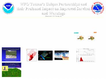
WFO Tucsons Unique Partnerships and their
Profound Impact on Improved Services and
WarningsGlenn Lader NWS Tucson, AZ
Introduction WFO Tucson, located on the
University of Arizona campus is fortunate to be
co-located with the USGS Arizona Water Science
Center and the USGS Tucson field office with the
University of Arizona Hydrology and Water
Resources Department located nearby. The
resources of these groups, working in tandem with
the WFO, provide excellent collaboration and
research, with a main objective to improve
operations and thus service delivery.
Partnership with University of Arizona and
USDA One major collaborative effort underway is a
COMET project to develop a site specific flash
flood rainfall-runoff model for use at the WFO.
Model Input
- Uses radar digital hybrid reflectivity scan (DHR)
- Available every 4 or 5 minutes
- Spatial resolution is 1 km by 1 degree
- AMBER program provides radar grid shape file
- Radar Intersection tool creates a weighted file
for those radar grids that fall into one or more
sub-watersheds
- Kinematic Runoff and Erosion Model (KINEROS2)
Overview. - Distributed event-driven rainfall runoff model.
- Companion GIS package (AGWA) generates model
parameters from Digital Elevation Model (DEM),
soil, and land use GIS coverage. - Project has re-written the KINEROS2 sub-process
models into a library of self-contained
components, adding a radar interface component.
USDA will maintain this library as the official
version, and the NWS operation software can be
kept easily up-to-date.
AMBER
AGWA
Partnership with USGS On July 31, 2006, major
flash flooding hit the Tucson Metro Area with
several record peak discharges. The close
NWS-USGS relationship yielded constant
communication on this day from USGS field staff
to WFO operations with the latest specific
information. Such a strong working relationship
insured not only better warnings during a
significant event, but also led to a major
collaborative effort with the USGS on debris flow
research from the same event.
KINEROS2 sub-watersheds
Radar grid
KINEROS2 has been successfully applied to small
watersheds in Arizona (Faures et al., 1995
Goodrich et al., 1990 Goodrich et al., 1997
Michaud, 1992) Nevada (Woolhiser et al.,
2001) Iowa (Kalin and Hantush, 2003) Ohio
(Venturini et al., 2001) Indiana (Arabi,
Undated) Netherlands (Jetten et al., 1999 ) Japan
(Santos et al., 2001) northern Thailand (Ziegler,
2001)
Intersect radar grid with KINEROS2 sub-watersheds
Santa Cruz near Lochiel watershed
Radar Interface Tool
Flash Flood Example in Sabino Canyon
Schematic View -Images from http//www.tucson.ars.
ag.gov/kineros/
Plan View
- Operational Use at WFO Tucson
- The forecast staff is using the Site Specific
Model to assist in Flash Flood Warnings during
the Monsoon Season. - The model can be run for select basins but is
most typically setup for the Sabino Canyon
Watershed, on the Santa Catalina Mountains just
north of Tucson.
- Characteristics of KINEROS2
- Distributed Model composed of a cascade of planes
and channel elements - Kinematic wave equations
- Dynamic infiltration algorithm handles two-layer
soil profile - Can redistribute soil water during short rain
interruptions - Channel element transmission losses through
infiltration - Summing up, KINEROS2 is
- Well suited to simulate semi-arid surface
Hydrology