
Latitude distance measured from north and south. - PowerPoint PPT Presentation
1 / 39
Title:
Latitude distance measured from north and south.
Description:
TIME ZONES - Daylight Savings puts more sunlight hours in the working part of the day. ... TIME ZONES. Political Map show boundaries of countries and ... – PowerPoint PPT presentation
Number of Views:114
Avg rating:3.0/5.0
Title: Latitude distance measured from north and south.
1
(No Transcript)
2
(No Transcript)
3
Latitude distance measured from north and south.
GEOGRAPHY
- Parallels horizontal lines.
4
Longitude distance measured from east to west.
GEOGRAPHY
- Meridians vertical lines.
5
Equator line that circles the middle of the
globe halfway between the north and south poles.
GEOGRAPHY
- - The Equator is measured by latitude.
6
Prime Meridian A line that divides the globe in
half vertically, which runs thru Greenwich,
England.
GEOGRAPHY
- - The Prime Meridian is measured by longitude.
7
Hemispheres Halves of earth.
GEOGRAPHY
- - The Equator divides the Earth into northern and
southern hemispheres.
8
GEOGRAPHY
Hemispheres Halves of earth.
- - The Prime Meridian divides the Earth into
eastern and western hemispheres.
9
(No Transcript)
10
(No Transcript)
11
Degrees latitude and longitude are measured in
degrees from the equator to the Prime Meridian
and are labeled with direction.
GEOGRAPHY
12
Coordinates One of a set of numbers that
determines the location of a point in space.
GEOGRAPHY
13
Time Zones the world is divided into 24 time
zones that are determined by how far they are
away from Greenwich, England.
TIME ZONES
14
Greenwich Mean Time The starting place for time
zones.
TIME ZONES
15
Daylight Saving Time from April to November
most of the U.S. shifts their clocks ahead 1 hour.
TIME ZONES
- Daylight Savings puts more sunlight hours in
the working part of the day.
16
International Date Line Runs along the 180
longitude, also is exactly 12 hours behind
Greenwich, England.
TIME ZONES
17
Political Map show boundaries of countries and
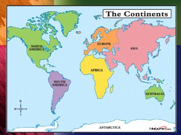
sometimes of states and provinces.
MAPS
18
Resource Maps use symbols to show where oil is
pumped, minerals are mined, or certain crops are
grown.
MAPS
- They also show areas of human activity.
19
Climate Maps have blobs of shading or color
to show how hot, cold, rainy, or how dry a region
is at a given time of year.
MAPS
- The newspaper publishes a climate map.
20
Topographical Maps or called Physical Maps,
use colors, shading, or shapes to show mountains,
deserts, forests, lakes, and oceans.
MAPS
21
Key also called a legend, tells you what the
information of colors, shading, shapes, and
symbols stand for in a map.
MAPS
22
Region geographical area with one or more
features that set it apart from other areas.
REGIONS
23
Physical Features- Amount of rainfall-
Climate- Vegetation- Animals
REGIONS
24
Cultural Features- Language- Religion-
Population- Use of resources
REGIONS
25
Habitat - conditions that support a particular
species.
REGIONS
- Most plants and animals have an ideal habitat.
26
Ecosystems habitats that involve relationships
between animals, plants, and other parts of the
environment.
REGIONS
27
Tropical natural region that is always hot.
NATURAL REGIONS
28
3 types of tropical regions
NATURAL REGIONS
Tropical Rain Forest rainy and dense with trees.
29
3 types of tropical regions
NATURAL REGIONS
Savanna fairly dry and sparsely dotted with
trees.
30
3 types of tropical regions
NATURAL REGIONS
Desert dry with sandy soils.
31
Subtropical has many features of a rain forest
but is located a bit too far north to be called
tropical.
NATURAL REGIONS
32
Semi-desert hot and dry but receives too much
rainfall to be considered a desert.
NATURAL REGIONS
33
Temperate regions that have warm and cool
seasons.
NATURAL REGIONS
Forest and Woodlands fairly wet with trees and
meadows.
34
Temperate regions that have warm and cool
seasons.
NATURAL REGIONS
Grassland fairly dry with tall grasses.
35
Arctic are always cold.
NATURAL REGIONS
Taiga wet with evergreen forests.
36
Arctic are always cold.
NATURAL REGIONS
Tundra very cold and sometimes very dry too
cold for trees, but good for mosses, lichen, and
shrubs.
37
Arable able to grow crops.
HUMANS AND ECOSYSTEMS
Adapt change behaviors and ways of life.
38
Weathering eroding of soil and rock by wind and
rain.
HUMANS AND ECOSYSTEMS
Desertification land that once supported grass
now cannot support anything.
39
Deforestation the destruction and removal of
forest and its undergrowth by natural or human
forces.
HUMANS AND ECOSYSTEMS
Recommended
CrystalGraphics Presentations


