
STARS Ship Tracking and Routing System - PowerPoint PPT Presentation
Title:
STARS Ship Tracking and Routing System
Description:
Dead reckons ship positions with constant speeds regardless of wind/waves ... Uses ship motion response and safe operating envelope as routing criteria ... – PowerPoint PPT presentation
Number of Views:175
Avg rating:3.0/5.0
Title: STARS Ship Tracking and Routing System
1
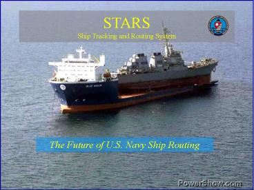
STARSShip Tracking and Routing System
- The Future of U.S. Navy Ship Routing
2
STARS Benefits over Current Techniques
STARS
Current
- Uses maximum head/beam/following seas and true
wind limits as routing criteria - Dead reckons ship positions with constant speeds
regardless of wind/waves - No automatic route optimization
- Uses ship motion response and safe operating
envelope as routing criteria - Dead reckons by simulating voluntary and
involuntary speed reduction due to weather - Route optimization with fuel and arrival time
ranges
3
STARS Methodology
4
Defining the Safe Operating Envelope
Ship Loading Information
Motion Parameters
Environmental Parameters
5
Mission Planning
- Easy to use interface to create and modify
routes and plans - Point and click route creation
6
Ingest of MOVREPs
7
STARS Weather Display
- Imports METCAST grib data
- Color coded wind and wave, surface pressure and
500 mb height contour charts - Color coded tropical cyclone wind circles
- Global monthly wind/wave climatology
- Full zoom capability
8
Point Weather Forecast Results
9
STARS Route Simulation
- Dead reckons ship by simulating route in
forecast weather and custom ship response
characteristics - Auto speed reduction when Safe Operating Limits
are exceeded
10
STARS Route Simulation
- Text readout (printable) of simulation data
- Data available every six hours along track
11
STARS Route Optimization
- User-defined grid and value range
- Minimizes fuel use for a range of arrival times
while satisfying user-specified Safe Operating
Constraints - Clearly shows danger areas
- First guess for novice ship router
12
STARS Route Optimization Output
13
Route Comparisons
- Compare two or more routes at once
- Displays differences in distance, maximum ship
motions and wave height, and ETA
14
STARS Ship Tracking
- Displays all active routes
- DR through latest wind/wave data
- Separate window prioritizes routes by time
remaining until Safe Operating Envelope is
exceeded
15
STARS Seakeep Display
- Basic characteristics generated by Navys Ship
Motion Program - Predicts motion, load, resistance and engine
overload in user specified wind/wave conditions - Provides what if answers before changing
heading or speed for damage avoidance - Tactical routing advice
16
Mission Planning Examples
- STARS
17
(No Transcript)
18
(No Transcript)
19
(No Transcript)
20
(No Transcript)
21
(No Transcript)
22
STARSShip Tracking and Routing System
- Represents a paradigm shift for U.S. Navy ship
routing. That is moving from weather routing by
customer-defined environmental limits to weather
routing using scientifically-developed hull
response and vessel motion limits. - Benefits are unequalled by any other software
package available to Navy METOC regional centers. - Routing and Tracking modules display waypoint by
waypoint listing of ship position, environmental
effects and ship response to these effects. - Not designed to replace the Joint METOC Viewer
(JMV). - Distributed to Navy METOC regional centers in FY
2002.
Recommended
CrystalGraphics Presentations


