
Weather Camera Program - PowerPoint PPT Presentation
1 / 24
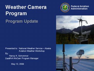
Title:
Weather Camera Program
Description:
Deficient weather information in Alaska contributes to a ... Cameras are installed with fixed direction (pan, tilt, zoom is fixed) Site requirements include: ... – PowerPoint PPT presentation
Number of Views:67
Avg rating:3.0/5.0
Title: Weather Camera Program
1
Weather Camera Program
- Program Update
National Weather Service Alaska Aviation
Weather Workshop
Nancy K. Schommer FAA WxCam Program Manager
May 13, 2008
2
Why - Improve Safety
- Deficient weather information in Alaska
contributes to a higher risk of accidents and
flight inefficiencies. - The effective use of automated weather systems is
limited and costly. And even with these sensors,
the National Transportation Safety Board (NTSB)
statistics indicate that numerous capability
shortfalls still exist. - The NTSB Safety Study Aviation Safety in Alaska,
November 1995, recommended that the FAA assist
the National Weather Service (NWS) with an
evaluation of the technical feasibility and
aviation safety benefits of remote color video
weather observing systems in Alaska. - A quick look at safety improvements indicates a
25 decrease in weather related accidents within
25 miles of an installed weather camera.
3
What - Weather Camera Images
- Provide visual information of destination or en
route weather and airport conditions to the pilot - cost effective means of information gathering and
dissemination - allows pilots, flight service station
specialists, and dispatchers to assess current
conditions for making go or no-go decisions - Weather Camera images are a designated
supplementary weather product. In accordance
with the Aeronautical Information Manual,
supplementary weather products may be used for
enhanced situational awareness.
4
Information Dissemination
- Images are made available to the public via the
Internet at no charge - Username and passwords are not required
- Over 2 million website hits per year
- Images are updated approximately every 10 minutes
- The previous six hours of images are made
available as a time lapse image loop - Clear day images with visibility annotations are
provided for each camera field of view - Site information is provided to include latitude,
longitude, and location maps depicting each
camera site location and individual camera angles
are provided - Links are provided to automated weather sensor
data (METAR) when co-located at the camera site
5
http//akweathercams.faa.gov
6
Site Implementation
- Weather Camera sites are installed at airports
and en route locations that have a predicted high
accident rate. - Each site supports up to 4 cameras
- Cameras are installed with fixed direction (pan,
tilt, zoom is fixed) - Site requirements include
- Tower or mounting structure
- Power
- Communication capabilities (average image size
30Kb) - Equipment Space
7
Sites with No Existing Infrastructure
- Access is limited
- Remote no roads
- Helicopter or charter
- Power supplied by
- Solar Panels
- Wind Generators
- Communications
- Commercial satellite internet services
8
Installation Summary
- 63 sites were available in 2005
- 71 sites available in 2006 (8 were added)
- 82 sites available in 2007 (12 sites added, but
Galena out of service for a total of 82 sites -
to include 6 new pass sites - 95 sites planned in 2008 (13 new sites to add)
- 3 of the 13 already installed and operational
- 221 sites planned available by 2014 (126 added)
9
New for 2006 Camera Sites Added
- The following new sites have been added to the
public website in 2006 - Akhiok
- New Stuyahok
- Beluga
- Arctic Village
- Minchumina
- McGrath
- Wrangell
- Saint Paul
10
New for 2007 Camera Sites Added
- Fort Yukon
- Valdez
- Chandalar (Atigun Pass)
- Chignik Bay
- Puntilla Lake (Rainy Pass)
- Rohn (Ptarmigan Pass)
- Unalakleet
- West Lake Clark Pass
- Merrill Pass High
- Merrill Pass Low
- Birchwood
- Cape Spencer
- Note Galena was taken out of service when the
Air Force Control Tower, on which the cameras
were installed, was demolished. Galena is
expected to be returned to service in the summer
of 2008.
11
Puntilla Lake (Rainy Pass)
12
Puntilla Lake (Rainy Pass)
North
Northwest
Southeast
13
Rhon (Ptramigan Pass)
14
Rhon (Ptarmigan Pass)
North
South
East
15
Merrill Pass (high and low)
16
(No Transcript)
17
Lake Clark West
18
Chandalar (Atigun Pass)
19
New for 2008
- Berners Bay/Echo Cove
- Iliamna
- Savoonga
- Wales/Tin City
- Fales Pass
- Galena reinstalled
- Yukon River Bridge
- Metlakatla
- Taku Inlet
- Yakatat
- Hydaburg
- Skagway
- Homer
20
New for the Future
- The Weather Camera Program is proud to announce
the FAA's decision to invest approximately 102
million dollars over the next 26 years for the
additional installation of and continued
operation of aviation weather cameras in Alaska.
An additional 136 weather camera sites are
planned to be installed over the next seven
years. Together with the 85 already operational
sites, this will bring the network of weather
cameras to a total of 221 sites by 2014. The
benefits provided by these weather camera sites
will reduce aviation accidents, save lives, and
prevent unnecessary fuel usage.
21
New Features to the Website
List of All Sites
Map of all Sites
22
List of All Sites
23
Map of All Sites
24
- Questions??
- Comments
Program Manager Nancy K. Schommer, 907-271-5177
Recommended
CrystalGraphics Presentations


