
Week 1 Introduction PowerPoint PPT Presentation
1 / 17
Title: Week 1 Introduction
1
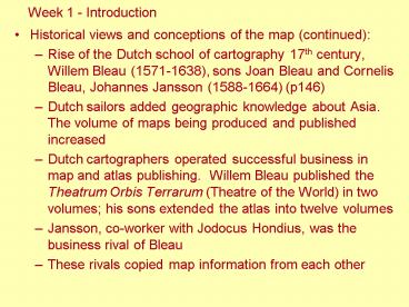
Week 1 - Introduction
- Historical views and conceptions of the map
(continued) - Rise of the Dutch school of cartography 17th
century, Willem Bleau (1571-1638), sons Joan
Bleau and Cornelis Bleau, Johannes Jansson
(1588-1664) (p146) - Dutch sailors added geographic knowledge about
Asia. The volume of maps being produced and
published increased - Dutch cartographers operated successful business
in map and atlas publishing. Willem Bleau
published the Theatrum Orbis Terrarum (Theatre of
the World) in two volumes his sons extended the
atlas into twelve volumes - Jansson, co-worker with Jodocus Hondius, was the
business rival of Bleau - These rivals copied map information from each
other
2
Some resources http//www.let.rug.nl/maps/frankd
erink/ http//www.artelino.com/articles/historica
l_maps_netherlands.asp http//www.henry-davis.com
/MAPS/Ren/Ren1/Reno.html http//www.maphistory.in
fo/collecting.html
3
A 17th century map publishing house in Antwerp,
Netherlands
4
Willem Bleaus Map of Britain
Willem Janszoon Bleau, 1571-1638, was official
cartographer for the East India Company
5
Willem Bleaus Novo Totius Terrarum Orbis
Geographica (Geography of the World)
6
Johannes Janssons Novo Totius Terrarum Orbis
Geographica (Geography of the World)
7
Details of East and Southeast Asia in Janssons
Geography of the World
8
Jadocus Hondius World Map of 1630
9
Week 1 - Introduction
- Historical views and conceptions of the map
(continued) - With larger numbers of maps being published, maps
became more common and were no longer possessed
only by explorers and royalty, but became
available to those who could afford to purchase
them. - Geographic knowledge began to spread more rapidly
than before. - Large companies, such as the East India Company,
which conduct a large amount of trading overseas
had their own official cartographers. - Meanwhile, map and atlas publishing became an
important and profitable business. - Dutch cartographers really made a great impact in
the 17th century.
10
Week 1 - Introduction
- Historical views and conceptions of the map
(continued) - The 18th century became a very important one due
to the influence of French cartographers. - French cartographers began to produce maps with a
very high degree of accuracy. - Mapmaking in France became truly scientific,
systematic and methodical when techniques of
surveying were developed, particularly through
the process of land triangulation.
11
Theodolite an instrument used to take sightings
of landmarks in a survey
12
Week 1 - Introduction
- Historical views and conceptions of the map
(continued) - The first step in a triangulation survey is the
selection of a baseline of known length. - The angles between lines of sight from the
baselines endpoints to a distant landmark are
then measured. - These distances are then used as new baselines.
- This process is repeated until the entire area
being surveyed is covered by a network or a grid
of triangles. - The grid provides a necessary skeleton on which
topographic details can be accurately positioned.
13
Triangulation of France
14
Week 1 - Introduction
- Historical views and conceptions of the map
(continued) - One family with four generations of cartographers
stood out to make a significant contribution.
This is the Cassini family. - Jacques Cassini followed in the footsteps of his
father, Jean-Dominique, to create the first map
of France to be based on the triangulation of the
country that the family had initiated in the
1670s. - Aided by his son, Cesar-Francois Cassini de
Thury, Jacques Cassini finally completed the
18-sheet mapping project in 1744, now referred to
as Carte de Cassini. - It was the first accurate cartographic survey of
an entire nation. Three years later,
Cesar-Francois embarked on an even more detailed
175-sheet mapping program, which was not to be
completed until the 1790s.
15
Carte de Cassini, completed in 1744, was the
first land survey of a nation.
16
Week 1 - Introduction
- Historical views and conceptions of the map
(continued) - The Cassini family also compiled and published
Carte de France from 1750-1815. - It consists of 182 sheets of maps covering all of
France at the same scale, allowing the sheets to
be joined together with seamless geographic
information to form a map about 39 feet high by
38 feet wide. - It is a physical map with rich historical
cultural information and exquisite graphic art.
17
The accurately surveyed Carte de France reveals
the inaccuracies of previous national maps of
France.
Recommended
