
3D City Modeling from Airborne TLS Imagery with - PowerPoint PPT Presentation
1 / 78
Title:
3D City Modeling from Airborne TLS Imagery with
Description:
3D City Modeling from Airborne TLS Imagery with – PowerPoint PPT presentation
Number of Views:527
Avg rating:3.0/5.0
Title: 3D City Modeling from Airborne TLS Imagery with
1
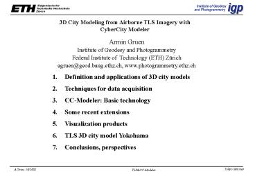
3D City Modeling from Airborne TLS Imagery with
CyberCity Modeler
Armin Gruen Institute of Geodesy and
Photogrammetry Federal Institute of Technology
(ETH) Zürich agruen_at_geod.baug.ethz.ch,
www.photogrammetry.ethz.ch
1. Definition and applications of 3D city
models 2. Techniques for data acquisition 3. CC-Mo
deler Basic technology 4. Some recent
extensions 5. Visualization products 6. TLS 3D
city model Yokohama 7. Conclusions, perspectives
2
(No Transcript)
3
Cooperation Starlabo Corp./IGP,ETHZ
Userinterface Image measurement in mono and
stereo (Image and shadow enhancement)
Rectification Orthoimage generation 3-ray
forward intersection (point positioning)
DTM/DSM modeling and interpolation Automatic
and semi-automatic tiepoint generation
Sensor/trajectory modeling, triangulation
(Image matching (automatic, semi-automatic
various algorithms) for DSM/DTM generation)
(Adaptation of methods and software for
ALOS/PRISM processing) (Feature/object
extraction, e.g. 3D city modeling)
4
(No Transcript)
5
DEFINITION OF 3D CITY MODELS
buildings, terrain, vegetation, traffic
networks (road, railway) public utilities
(energy, sewage), telecommunication, etc.
6
(No Transcript)
7
3D Model of University of Melbourne Campus from
Ikonos 1m BW Stereo
Produced with CyberCity Modeler
8
Feature Extraction Completeness
Aerial Photography (115K)
Ikonos 1m Pan Stereo
9
3D Model of University of Melbourne Campus
Aerial Photography (115K)
Ikonos 1m Stereo Imagery
10
(No Transcript)
11
Applications of Cybercity data
- City and regional planning
- Planning and design of construction sites
- Landscape architecture
- Monument preservation
- Telecommunication
- Environmental engineering
- Risk assessment
- Energy providers (solar power industry)
- Microclimate studies
- Insurance, retail entertainment industries
- Delivery of mail and goods
- Tourism, sports
- Car navigation
- etc.
12
monument preservation
architecture
transportation planning
Level of detail
telecommunication
Accuracy
13
Acquisition Techniques
(a) Scanning of maps (b) Laserscanning from
airborne platforms (c) Photogrammetry Ad(a) 2D
results, not up-to-date gt requires (b),
(c) Ad(b) 2.5D, unstructured DSM, fixed
resolution, smoothed gt requires (c) Ad(c) 3D,
up-to-date, accurate, flexible, multidata source,
hybrid results (e.g. photorealistic)
14
Conversion of aerial image data into 3-D models
15
(No Transcript)
16
(No Transcript)
17
(No Transcript)
18
Goals of acquisition 3-D description
Objects Buildings, traffic/transportation
(roads, brides, etc.), water, terrain,
vegetation, etc. Level of detail Flexible
Accuracy 10 cm --- 2 m Structured data
Phases of data handling Measurement,
structuring Visualization, animation Analysis
19
(No Transcript)
20
(No Transcript)
21
(No Transcript)
22
(No Transcript)
23
Pointcloud ? Structured and adjusted roof faces
a) 3-D Pointcloud
(b) Face assignment (non-planar)
(c) Face adjustment (planar)
24
(No Transcript)
25
CC-Modeler userinterface
26
CC-Mapping interface
27
CPU gt 5 units /sec gt use procedure
on-line Total gt 500 CCM units/day Editing lt
5 Main factor Operator
28
(No Transcript)
29
(No Transcript)
30
(No Transcript)
31
(No Transcript)
32
Result V3D
33
Visualization AutoCad Inventor Explorer
(SGI) Terrainview (viewtec) Skyline (idc)
CyberWalk (Müller) Alias Wavefront Cosmoplayer Own
software (Integration image raster
data) Derived Products True Orthophoto Building
information system, Multimedia environment CC
SIS (Cybercity Spatial Information System)
34
(No Transcript)
35
(No Transcript)
36
(No Transcript)
37
(No Transcript)
38
(No Transcript)
39
(No Transcript)
40
(No Transcript)
41
(No Transcript)
42
(No Transcript)
43
(No Transcript)
44
(No Transcript)
45
46
(No Transcript)
47
(No Transcript)
48
(No Transcript)
49
(No Transcript)
50
(No Transcript)
51
New extensions to CCM
CyberCity-Modeler (Gruen, Wang, 1998) -
semi-automated - images (satellite, aerial,
terrestrial) - polyhedral world (buildings,
roads, waterways, bridges, trees, DTM, etc.) ?
Commercial software (CyberCity AG) CyberCity -
Spatial Information System (Wang, Gruen, 2000) -
hybrid (vector, raster data) - 3D - relational
database (ORACLE)
52
Extensions to CCM
V3D initial
Interface
Geometric regularization
Automatic by L.S.adjustment
Semi-automatic by CAD editing
Neighbourhood topology correction
Vertical wall integration
V3D corrected
Interface
53
- Geometrical regularization
- Measurement errors
- Building irregularities
- CC-Edit
- Unique height for all points of a group
(eaves, ridge, other structure points) - Roof patches form planar faces
- Parallelity of straight edges
- Right angles of intersecting roof edges
- Collinearity of edge points
54
Regularization by CAD editing
Automated, semi-automated, planimetric operations
(equal height constraints observed during
measurement)
55
Topology adjustment
Automated, semi-automated
56
Topology adjustment
CC-Edit CC-Modeler user interface for
editing with example of false (left) and
automatically corrected topology (right)
57
Façade integration
Combination of rooflandscape façades from
maps Problems Outdated map content
Inaccurate map data Structural differences
Plan view of rooflandscape (dark) and the
related façade representation from a map (light)
58
Automated façade integration Left Plan view
of roofs and façades from map Right
Integration result
59
TLS ... Three-Line Scanner gt Starimager Patent
Prof. Sh. Murai, granted in Japan 8 June 1998,
valid for Japan , USA, Australia Developed by
STARLABO Corp., Tokyo Components Linear Array
Camera Stabilizer, INS GPS
Platforms Airplane, helicopter
60
(No Transcript)
61
(No Transcript)
62
(No Transcript)
63
(No Transcript)
64
(No Transcript)
65
(No Transcript)
66
(No Transcript)
67
Project Yokohama CCM statistics 2 square km 2
482 roof objects 26 bridge objects 20 road
objects 129 trees 4 waterways 8 powerlines 170
road lights DTM points 1 521 730
(matching) orthoimage 0.2 m pi ca. 500 façade
images
68
(No Transcript)
69
(No Transcript)
70
(No Transcript)
71
(No Transcript)
72
(No Transcript)
73
(No Transcript)
74
(No Transcript)
75
Conclusions
Semi-automated approach of CCM successful
Functional extensions according to user
requests 3D city modeling - Growing
applications /customers - Generation of virgin
databases, updating - Formidable RD problems
Flexible level of detail, correct topology, 3-D
hybrid GIS platforms, analysis functions,
vis-software Current scenery - Highres
satellite sensors ( 2 m, 1 m, 0.6 m) - Digital
aerial cameras (3 with gt100 Mpixel/squareframe) -
Integrated sensors (Laser, Opt. Cameras, Radar)
- Digital camcorders and still video cameras
76
- Conclusions, Perspectives
- Growing demand for 3D data in structured form
(CAAD, GIS, BIS) - Aerial Photogrammetry 3D, actual, precise,
flexible, fast, photorealistic, complete
(full 3-D city models) - Fully automatic Longterm research Progress
Multiple cues, multi-sensors - Semi-automatic
Strategy measurement by operator
automated structuring - HighRes satellite imagery Only for very low
resolution models - Laserscanning Only for lower resolution objects
77
- Visualization, Animation
- Vis software Problems with
- Synthetic ? real data ?
- Complex userinterface
- Transfer of data formats
- Extension to 3D spatial info system (CC-SIS)
- Animation
- Integration of dynamic processes
- Population of Cybercity with virtual actors
78
- Perspectives
- Database-driven information system for urban
navigation, infrastructure management, etc. - Access via InternetGlobal earth ? individual
home
HTML, VRML, Java City Navigator - 3D Teleservices (PCs, PDAs, Mobiles)
- - Property and facility management
- - Teleshopping, tourism, etc.
- - Car navigation
- - Monitoring of dynamic processes, like weather,
traffic, crowds, acoustics, nuclear, chemical
and other emissions
Recommended
CrystalGraphics Presentations


![Moving to a Low CO2-Future on a Local Level The Experiences of the City of Hannover [Germany] PowerPoint PPT Presentation](https://s3.amazonaws.com/images.powershow.com/6917333.th0.jpg?_=202106111011)
