
APPLICATION OF LIDAR IN FLOODPLAIN MAPPING - PowerPoint PPT Presentation
Title:
APPLICATION OF LIDAR IN FLOODPLAIN MAPPING
Description:
GIS and hydraulic models to map the possible extent of flooding, and to prove ... Softwares used : ArcGis ( Arctoolbox, ArcMap),Arcview , HEC-RAS HecGeoRas extension ... – PowerPoint PPT presentation
Number of Views:502
Avg rating:3.0/5.0
Title: APPLICATION OF LIDAR IN FLOODPLAIN MAPPING
1
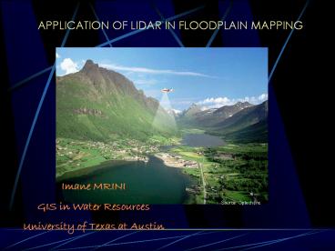
APPLICATION OF LIDAR IN FLOODPLAIN MAPPING
Imane MRINI GIS in Water Resources University of
Texas at Austin
Source. Optech,Inc
2
PURPOSE OF THIS PROJECT
- Show how LIDAR technology can be used jointly
with - GIS and hydraulic models to map the possible
extent of flooding, and to prove that it could be
an invaluable tool in flood mapping because of
its high accuracy.
3
WHAT IS LIDAR ?
Acronym for Light Detection And Ranging
- Airborne laser system used to acquire x, y, and z
coordinates of terrain, and consist of - Airborne Global Positioning System (GPS)
- Attendant GPS base station
- Inertial Measuring Unit (IMU)
- Light-emitting scanning laser.
4
HOW LIDAR WORKS
- Laser pulse rate up to 25,000 per sec.
- Operating altitude 400 - 2,000 meters.
- Swath width up to 1,500 meters
- at 2,000 meter altitude.
5
PRECISION OF THE LIDAR DEM
Source.BEG
6
LIDAR INSTRUMENT All-Terrain Laser Mapper (ALTM)
7
LIDAR FACTS
- Elevation accuracy 10 to 25 cm
- records first and last returns of individual
pulses and intensity
Applications in ? Flood mapping ? Forest
management ? Coastal management ? Land cover
classification ? Atmospheric pollution monitoring
8
DATA PROCESSING Source BEG
- compute a differentially corrected aircraft
trajectory using a GPS software, - generate the raw x, y, and z data,
- grid the data to generate an all-points DEM,
(4) filter the raw data and re-grid to generate a
vegetation-removed DEM
9
EFFECT OF VEGETATION REMOVAL
After
Before
10
FLOODPLAIN MODELING
- Study area Waller creek watershed in Austin,TX
- LIDAR data source Bureau of Economic Geology-
University of Texas at Austin - Type of Lidar data 1m DEMs of the all-point and
bare-earth data as interchange files ( e.00) - Spatial reference UTM zone 14, datum NAD 1983
- Softwares used ArcGis ( Arctoolbox,
ArcMap),Arcview , HEC-RASHecGeoRas extension
11
STUDY AREA
Waller Creek Watershed
12
ALL-POINT LIDAR DATA OF WALLER CREEK
13
BARE EARTH LIDAR DATA FOR WALLER CREEK
14
FLOOD MODELING PROCEDURE
HEC-GeoRas Preprocessing
Geometric data stream centerlines, riverbanks,
floodplain boundaries, cross-sections along the
streams
ARCVIEW Terrain model processing
Hydraulic modeling
Flood map visualization
HEC-GeoRas Postprocessing
Import file
LIDAR input data 1m grid DEM
Hydrologic modeling
Plan data ( Flow regime)
Flow data from HEC-HMS
15
Extracting geometric data
- Use of Spatial Analyst ,3D Analyst and
Hec-GeoRas extensions - Using HEC-GeoRas extension and the digitizing
tool in Arcview, I generated - - Streamcenterlines
- - Stream banks
- - Flow path centerlines
- - Cross section lines
16
STREAM CENTERLINES
17
STREAM BANKS
18
FLOW PATH LINES
19
CROSS-SECTIONS CUTLINES
20
DIFFICULTY ENCOUNTERED
- Problem Hec-GeoRas program only works with TINs
- Solution Convert grids to TINs in ArcMap using
the best vertical accuracy to generate the
maximum number of triangles in a reasonable
amount of time
21
CONVERTING TINs TO GRID
22
EXTRACTED CROSS SECTIONS
23
PREPARING THE IMPORT FILE TO HEC-RAS
24
DIFFICULTY ENCOUNTERED AT THIS STAGE
- An error message from the Hec-PreRAS program
during the import file process.
25
WORK TO BE DONE MODELING WITH HEC-RAS
- Cross-section extracted
- from the TIN.
- RAS stream geometry.
- Resulting water
- elevations.
26
PREVIOUS FLOOD MAPPING WITH TINs (Source. Esteban
Azagra)
27
Future work
- Solving the problem of the HecRas import file,
hopefully before December 6 - Potential ideas to develop
- - Write a program that incorporate grid data in
the preprocessing for HEC-RAS - Obtain a more detailed TINs from the grid
conversion
28
ACKNOWLEDGMENT
- Dr. David Maidment, University of texas at Austin
- Becky Smith, Bureau of Economic Geology,
University of Texas at Austin - John Andrews, Bureau of Economic Geology,
University of Texas at Austin
Recommended
CrystalGraphics Presentations


