
Time and Space - PowerPoint PPT Presentation
Title:
Time and Space
Description:
Time and Space. Introduction. Definition of time series. Linking temporal data with spatial features ... Space-Time Scales and Hydrologic Processes. Time. Space ... – PowerPoint PPT presentation
Number of Views:54
Avg rating:3.0/5.0
Title: Time and Space
1
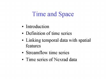
Time and Space
- Introduction
- Definition of time series
- Linking temporal data with spatial features
- Streamflow time series
- Time series of Nexrad data
2
Hydrologic Information System
Analysis, Modeling, Decision Making
Arc Hydro Geodatabase
3
Space-Time Scales and Hydrologic Processes
Subsurface water
Surface water
Time
Atmospheric water
Space
Figure adapted from Sivapalan and Bloschl (2000).
4
Water Watch Real Time Streamflow Data ( 5000
gages)
http//waterdata.usgs.gov/nwis/rt
Updated every 4 hours
5
Spring and Fall 2002
October 2002
March 2002
Drought in Northwest
Drought in Northeast
6
USGS NWISWebhttp//water.usgs.gov
- Real-time and Historic Data
- Streamflow and stage
- Groundwater levels
- Water Quality
- Site information
- Tabular or Graphical Format
7
Streamstats
A program for finding streamflow statistics at
any location on a stream
http//ststdmamrl.er.usgs.gov/streamstats/
8
Streamflow Information in Space and Time
Future Possibilities
Current
Time
Real Time data
Historical daily mean discharge
Streamstats
Streamflow statistics
At Gages
Anywhere on a Stream
Space
9
Hydrologic Data in Space and Time
Time
Hydrologic Information Continuum
Future
Present
Past
Space
Point
Continuous Surface
Area
Line
10
Coupling Spatial and Temporal Data
1 hour Nexard Rainfall on the Guadalupe
Basin October 13, 2001
11
Time and Space
- Introduction
- Definition of time series
- Linking temporal data with spatial features
- Streamflow time series
- Time series of Nexrad data
12
Arc Hydro Time Series Object
TSDateTime
(Time of measurement)
(Data value)
TSValue
FeatureID
(Spatial Feature)
TSType
(Type of Data)
13
Arc Hydro Time Series Object
TSDateTime
TSValue
FeatureID
TSType
14
View 1 Time Series for a Spatial Feature
TSDateTime
101
FeatureID
TSType
15
View 2 Time Series of a Particular Type
TSDateTime
FeatureID
Evaporation
TSType
16
View 3 Time Series of a ParticularType for a
Single Feature
TSDateTime
FeatureID
Evaporation
TSType
17
View 4 A Time Snapshot of Spatial Attributes
TSDateTime
1989-03-30 010000
FeatureID
TSType
18
Time Series Type
Unified Modeling Language Representation in
Visio 2000
19
Time series class properties
- TSTypeID integer which indexes type of time
series - Variable Name of the variable (text)
- Units Units of measurement (text)
- IsRegular True/False to indicate whether
measured at regular time intervals or irregularly
(boolean) - TSInterval Time interval for regular data
(Coded Value Domain of acceptable intervals) - DataType Type of time series data (Coded Value
Domain of specified types) - Origin Recorded or Generated (Coded Value
Domain)
20
Coded Value Domains
21
Data Types
22
Time and Space
- Introduction
- Definition of time series
- Linking temporal data with spatial features
- Streamflow time series
- Time series of Nexrad data
23
Connecting to Time Series
Flow
HydroID
FeatureID
Time
TimeSeries
HydroPoint
CrossSection
FeatureID of time series is HydroID of feature
the time series describes
24
(No Transcript)
25
Time and Space
- Introduction
- Definition of time series
- Linking temporal data with spatial features
- Streamflow time series
- Time series of Nexrad data
26
National Water Information System
Arc Hydro NWIS data retrieval tool
Web access to USGS water resources data
27
NWIS Data
- Metadata
- Tabular Output
- Year.Month.Day
- Discharge (cfs)
28
Example Austin, TX
29
Retrieving NWIS Data
- Select Gage Layer
- Enter Period of Record
30
NWIS Results
31
Streamflow Time Series
Arc Hydro Time Series Table
32
Creating a Time Series View
33
Time Series Extracted to Excel(In Excel, use
Data/Get External Data to query Geodatabase)
Excel view
Geodatabase view
34
Time Series in Arc Hydro USA
1,596 HCDN Stations out of 18,827 gaging
Stations (Daily stream flow from Oct, 1988 Sep,
2000 Source NWIS website)
35
Time and Space
- Introduction
- Definition of time series
- Linking temporal data with spatial features
- Streamflow time series
- Time series of Nexrad data
36
(No Transcript)
37
HRAP Cells for Nexrad Data
Average area 14.5 km2
38
Coupling Spatial and Temporal Data
1 hour Nexard Rainfall on the Guadalupe
Basin October 13, 2001
39
Water Balance in the Landscape
Atmospheric Water
Precipitation
Evaporation
Runoff
Soil Water
Surface Water
Recharge
Baseflow
Groundwater
40
EDNA Catchments
Average area 7.5 km2
41
Modflow Groundwater Cells
Modflow Model of the Edwards-Trinity aquifer
Average area 2.6 km2
42
Intersection of Nexrad and Catchments
Surface Water Balance
Atmospheric Water
Soil Water
Surface Water
43
Intersection of Nexrad and Modflow Cells
Atmospheric Water
Groundwater Balance
Groundwater
44
Intersection of Nexrad, Catchments and Modflow
Atmospheric Water
Soil Water
Surface Water
Groundwater
Recommended
CrystalGraphics Presentations


