
NRL Global Model Adaptive Observing During TPARCTCS08 - PowerPoint PPT Presentation
Title:
NRL Global Model Adaptive Observing During TPARCTCS08
Description:
Observe TCs and their environment from genesis to ... C130, P3. Driftsondes. NOGAPS SVs: 5 Fixed Regions, Twice Daily. T79L30 adjoint/TLM resolution ... – PowerPoint PPT presentation
Number of Views:53
Avg rating:3.0/5.0
Title: NRL Global Model Adaptive Observing During TPARCTCS08
1
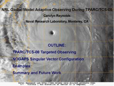
NRL Global Model Adaptive Observing During
TPARC/TCS-08 Carolyn Reynolds Naval Research
Laboratory, Monterey, CA OUTLINE TPARC/TCS-08
Targeted Observing NOGAPS Singular Vector
Configuration Examples Summary and Future Work
2
THORPEX Pacific Asian Regional Campaign
(TPARC) Tropical Cyclone Structure 08
(TCS-08) Observe TCs and their environment from
genesis to extratropical transition. Aug-Oct
2008 9 nations 4 aircraft (lidar, Eldora radar,
dropsondes), driftsondes, rapid-scan satellite
obs, off-time radiosondes, buoys.
Targeted Observing Objective Take additional
observations in regions where they are most
likely to improve forecasts Ensemble-based and
adjoint-based guidance provided from operational,
research, and academic centers
NRL real-time products - Navy Operational
Global Atmospheric Prediction System (NOGAPS)
Singular Vectors (SVs, this talk) - Coupled
Ocean-Atmosphere Mesoscale Prediction System
(COAMPS) Adjoint (4A.1, Tuesday
morning) Leading SVs Fastest growing initial
perturbations to a given forecast. Provide
information on regions where forecasts are most
sensitive to changes in the analysis.
3
DROPSONDE and DRIFTSONDE OBSERVATIONS September
2008
TPARC/TCS08 Observations
Falcon
Driftsondes
DOTSTAR
NOAA Hurricane Observations
C130, P3
Source Fleet Numerical Meteorology and
Oceanography Center.
4
- NOGAPS SVs 5 Fixed Regions, Twice Daily
- T79L30 adjoint/TLM resolution
- T239L30 (operational) trajectory
- Dry Total Energy norm
- Details
- 48-h lead-time off 00Z run (available 09 UTC,
39-h prior to target time) - 60-h lead-time off 12Z run (available 21 UTC,
51-h prior to target time) - 48-h opt times for all regions except 72-h opt
time for North Pacific Region - During high-interest periods
- 24-h lead time and 36-h lead time products
- Flow-dependent verification regions
- Centered on Guam
- Storms affecting Taiwan
- Storms affecting Japan
- ET Region
- Central North Pacific
5
ET Region
North Pac Region
NOGAPS SV Examples for Targets on 2008092900 SV
total energy (shaded) with 500-hPa streamlines
(blue) and 850-hPa vorticity (black).
Japan Region
Pre-TC Higos
TC Jangmi
GUAM Region
Taiwan Region
6
NOGAPS SVs on ECMWF/UKMO Preview System Uniform
graphics facilitated comparison
Targets for Jangmi, 2008082800. Sensitive regions
from southeast to north of storm. Note
similarities among SV products (top row) and
among ensemble (ETKF) products, bottom row.
7
Many Other Targeting Products also Available
U Washington Ensemble Sensitivity
COAMPS TE Adjoint
Targets for Jangmi, 2008082800 Sensitivity
primarily southeast to northeast of storm.
JMA SVs
NTU ADSSVs
8
NOGAPS SVs for Jangmi (2008092800) 500-hPa
streamlines help relate sensitivity to steering
dynamics
SVs related to TC dynamics. Associated with
weakness in the ridge on the north side of storm
and peripheral high to southeast of storm.
9
NOGAPS SVs for Jangmi (2008092800) Sensitivity
dominated by wind field
WIND COMPONENT
TEMPERATURE COMPONENT
Sensitivity to wind field max at
500-hPa Sensitivity to temp field max in mid and
upper troposphere.
10
DOTSTAR OBSERVATIONS FOR JANGMI, 2008082800.
TC track (pink) and DOTSTAR flight (yellow)
superimposed on satellite and radar image of TC
Jangmi. Observations around the storm, plus
additional observations in sensitive region to
east and southeast of storm. Additional
observations were taken to north and east of TC
by the Falcon.
Dropwindsonde Observations for Typhoon
Surveillance near the Taiwan Region
http//typhoon.as.ntu.edu.tw/DOTSTAR/en/
11
NAVDAS (3DVAR) Analysis Error STDV Estimate for
500-hPa wind (m/s)
September values for days with no special obs
show relatively low error values over Japan
(high-density observing network). With DOTSTAR
Observations for TC Jangmi, low error values
extend to area east of Taiwan. NAVDAS estimates
significant reduction in analysis error (close to
20) in vicinity of Jangmi.
12
- SUMMARY NOGAPS SVS for TPARC/TCS-08
- NOGAPS SVs for real-time targeted observing
guidance - Five fixed region SVs provided twice daily
- Having many products available proved useful.
Discussions led to targeting consensus. - Often possible to relate position of sensitivity
to general dynamic understanding of steering
mechanisms - For current configuration, sensitivity to wind
field stronger than sensitivity to temperature
field - NOGAPS ensemble products (time-longitude
diagrams, not shown), useful for downstream
impact problem - Future work
- Data-denial experiments will be done post-time
- Products for Winter TPARC
13
NOGAPS Ensemble Products
NOGAPS ET Ensembles with Stochastic Convection
(T119L30, 32-member control, 240 h, once daily)
NOGAPS ET Ensemble 200-hPa V black contours-
control shading ens. spread, 35-60N Squares
shows longitude of TC Sinlaku
Time-longitude diagrams for depicting energy
propagation, forecast uncertainty Large ensemble
spread downstream from Sinlaku indicating
uncertainty in ET
14
DOWNSTREAM PROPAGATION OF SIGNAL
Initial SVs After 24h After 48h Final SVs
Evolution of NOGAPS North Pacific 72-h SVs from
2008092600 Illustrates rapid downstream
propagation Useful for winter TPARC? Try 96-h
SVs?
15
NOGAPS SVs for Jangmi (2008092800) Sensitivity
dominated by wind field
500-hPa Vorticity
500-hPa Temperature
Elongated vorticity structures extend to
southeast and northwest of storm Temperature
dipole about storm center
Recommended
CrystalGraphics Presentations


