
Remote Sensing - PowerPoint PPT Presentation
1 / 30
Title:
Remote Sensing
Description:
Airborne platforms can include kites, balloons, model aircraft, microlights, ... is generated by the device and bounced back off the surface and recorded by the device ... – PowerPoint PPT presentation
Number of Views:123
Avg rating:3.0/5.0
Title: Remote Sensing
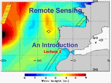
1
Remote Sensing
- An Introduction
Lecture 1
2
Remote Sensing
- Definition the acquisition of (environmental)
data without contact with the object or surface - Sensors mounted on airborne and satellite
platforms - Major environmental data source
- Airborne platforms can include kites, balloons,
model aircraft, microlights, autogyros, light
aircraft, and helicopters etc..
3
Remote Sensing
- Airborne Sensors are either
- Cameras (including traditional and digital camera
and video) - Scanners
- Traditional versus Digital
4
Remote Sensing
- Electromagnetic Spectrum (EMS)
- Visible, Near Infrared (NIR), Thermal Infrared
(TIR), Microwave wavelengths - Short Wave (SW) to Long Wave (LW)
5
Remote Sensing
6
Remote Sensing
Sun-Sensor-Terrain System
- Energy from the Sun (primary source)
- Interacts with surface (land, water, vegetation)
- Absorbed (A), Reflected (R), Transmitted (T), or
Emitted (E) - Reflected and Emitted energy from surface
detected and recorded by remote sensor - Contains information about the surface
- Image-based remote sensing
- Passive Remote Sensing (Reflected and Emitted)
- Also Active Remote Sensing
- Weak microwave signals mean that some specialised
remote sensing devices have to be constructed
that provide their own energy source - Microwave energy is generated by the device and
bounced back off the surface and recorded by the
device - Basis of RADAR RAdio Detection And Ranging
Atmosphere
E
R
A
T
7
Remote Sensing
- Fundamental Concept of Resolution in remote
sensing - Spatial (detail)
- Spectral (wavelengths)
- Temporal (time)
- Radiometric
8
Remote Sensing
Spectral Bands (in micrometers) Landsat TM
(Thematic Mapper) 1. 0.45 - 0.52 (Blue) 2.
0.52 - 0.60 (Green) 3. 0.63 - 0.69 (Red) 4.
0.76 - 0.90 (Near-Ifrared) 5. 1.55 - 1.75
(Middle-Infrared) 6. 10.4 - 12.5 (Thermal) 7.
2.08 - 2.35 (Middle-Infrared)
9
Remote Sensing
- Spatial Resolution (Size of IFOV) Landsat TM
(Thematic Mapper) - Bands 1,2,3,4,57 30 m Band 6 120 m
1 2 5 10 20 30
- Temporal Resolution Landsat 1,2, and 3 (Both TM
and MSS) - 18 Days (Every 251 Orbits) (frequency of revisit)
- Radiometric Resolution Landsats 1, 2 3
Multispectral Scanner 6-Bit (64 levels) - Landsats 4 5 Thematic Mapper and Multispectral
Scanner 8-Bit (256 levels)
10
Remote Sensing
- Aerial photographs are the cheapest and most
familiar examples of RS - Paper prints but now digital, computer
compatible - Aerial photographs provide the highest spatial
resolution (smallest object that can be detected
or resolved) - But poorest spectral resolution
- Usually vertical
- Mono, Stereo, or Orthophotographs
- Panchromatic, Colour, Colour Infrared (CIR),
Multispectral
11
Remote Sensing
- More recently other airborne sensors
- Combine high spatial resolution and multispectral
capability, extend spectral resolution - CASI Compact Airborne Spectrographic Imager
- ATM Airborne Thematic Mapper
- LIDAR
- Thermal Infrared (TIR)
- RADAR
12
Remote Sensing
Oil Plume
CASI
Sewage Discharge
13
Remote Sensing
CASI
14
Remote Sensing
ATM Sediment Dynamics Intertidal Surfaces
15
Remote Sensing
LIDAR
16
Remote Sensing
LIDAR DEM
17
Remote Sensing
TIR
18
Remote Sensing
- Satellite remote sensing dates back to 1972 with
launch of first Landsat series in the USA - Subsequently many satellites and sensors such as
Landsat, SPOT, RADARSAT, ERS, ENVISAT etc. - Many land-based, some coastal and marine e.g.
CZCS and Seasat
Landsat TM
19
Remote Sensing
SPOT
20
Remote Sensing
SST - AVHRR
21
Remote Sensing
AVHRR - Algal Blooms
22
Remote Sensing
ERS-1 RADAR Oil Spills
23
Remote Sensing
Aqua MODIS "true color" image from 21 March 2001
showing the Mississippi and Atchafalaya River
sediment plumes entering the Gulf of Mexico.
24
Remote Sensing
QuickBird - MS - Coast of Spain
25
Remote Sensing
ENVISAT MS image - Coast of Africa - Namibia -
Namib Desert
26
Remote Sensing
IKONOS - Colour and Panchromatic - San Francisco
27
Remote Sensing
SIDE SCAN SONAR
28
Remote Sensing
- Over time improved spatial, spectral and temporal
resolution - Large volumes of digital data/imagery
- Available from multiple sources
- On Tape and now CD
- Expensive to purchase 25.00 - N,000!
29
Remote Sensing
- Analog imagery is usually analysed and
interpreted using photointerpretation and factors
(e.g. tone, texture, size, shape, association,
colour..) - Digital data and imagery can be interpreted in a
traditional way - on screen - Processed using tools and techniques of Digital
Image Processing (DIP)
30
Remote Sensing
large area coverage
small
- Different sources of remote sensing data and
imagery are complementary - Provide different information
- Many different applications as you will see!
pattern distribution
Scale
detail
small area coverage
large
Recommended
CrystalGraphics Presentations


