
Tropical Cyclones - PowerPoint PPT Presentation
Title:
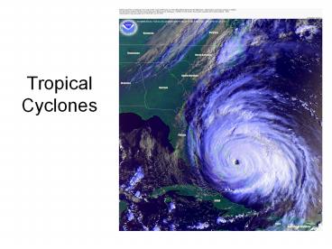
Tropical Cyclones
Description:
Tropical Cyclones – PowerPoint PPT presentation
Number of Views:8748
Avg rating:3.0/5.0
Title: Tropical Cyclones
1
Tropical Cyclones
2
Storms passing within 65 miles of my home in
Greenville, NC in my lifetime
3
Backing way up
- Today
- Brief review The Tropics
- Conditions for development
- Classical stages of development
- Storm dangers
- Tomorrow
- Forecast process
- Case study 2005 season (Katrina, Rita, Wilma,
etc.)
4
Analyzing the Tropics
- Located 23 ½ N to 23 ½ S
- Large amount of solar radiation
- Little seasonal variation
- Warm water tremendous latent heat source
- High relative humidity promotes cumulus cloud
development - Easterly winds at the surface
5
Necessary but not sufficient conditions for
TC development (Gray 1968)
1. Strong moisture convergence into the vortex
caused by frictionally-forced low level
convergence (Ekman turning), 2. Accompanying
upper tropospheric divergence that leads to deep
cumulus convection, 3. Slightly more net
divergence than convergence in the vortex
column, 4. Horizontal wind shear present in the
lower troposphere but minimal vertical shear, 5.
Sea-surface and deeper ocean temperatures at or
exceeding 26.5 C, 6. Poleward latitude of at
least 5 degrees to invoke Coriolis turning,
and 7. A pre-existing low-level vorticity
disturbance
6
(No Transcript)
7
(No Transcript)
8
Classical factors governing TC motion (track)
- Synoptic steering flow
- Coriolis (beta) effect
- Convective asymmetries
- Sea-surface temperature gradients
- Landmass interaction
9
(No Transcript)
10
Frequency of Occurrence
July 17
11
June formative regions
12
July formative regions
13
August formative regions
14
September formative regions
15
October formative regions
16
November formative regions
17
How to define a TC
The phrase tropical cyclone (TC) is a general
term for a cyclone originating over the tropical
oceans (AMS Glossary 2nd edition) that is driven
principally by heat transfer with the ocean
(Emanuel 2003). TCs with wind speeds of at least
39 mph but not more than 73 mph are known as
tropical storms. TCs with wind speeds at or over
74 mph (64 kts, or 33 m s-1) are known as
hurricanes in the North Atlantic and Eastern
North Pacific Oceans, typhoons in the Northwest
Pacific Ocean, severe tropical cyclones in the
Southwest Pacific and Southeast Indian oceans,
and severe cyclonic storms in the North Indian
Ocean (Neumann 1993). The term hurricane was
derived from the various West Indian words for
monstrous gods (Dunn and Miller 1960).
18
Formative Mechanisms
- Tropics characterized by strong tropical
inversion 500-1000 m above ocean - Must have a lifting mechanism to overcome this
very strong and very persistent inversion - Inter-Tropical Convergence Zone
- NE trade winds north of zone collide with SE
trade winds south of zone - Persistent thunderstorm formation
- Stalled cold fronts over very warm waters
- Enhanced convective activity
- Easterly waves
- Forces surface convergence (? lifting)
- Tropical easterly waves are the classical
mechanism
19
Stages of Development
- Tropical (Easterly) Wave
- Tropical Disturbance
- Tropical Depression (given a )
- Tropical Storm (given a name)
- Hurricane (categories 1 thru 5)
Increasing Organization
20
Tropical (Easterly) Wave
21
Tropical (Easterly) Wave
- Troughs of low pressure
- Found in the easterly trade winds (hence named
easterly a wave in the easterlies) - Migrate westward at low latitudes
- (i.e., they move from east to west)
- Surface wind convergence
- On the east side of the trough axis
22
Tropical (Easterly) Wave
- Tropical
- trough
- Upside
- down
- Notice
- rain is
- behind
- trough
Subsidence (sinking) and clear air
Rising air Thunderstorms
23
Tropical (Easterly) Wave
24
Tropical (Easterly) Wave
25
Tropical Disturbance
- Broad area of disorganized clusters of
thunderstorms - Commonly exist only 24 to 48 hours
- Key question can thunderstorm convection
maintaining itself? - Critical to future intensification!
26
Organization
- Convergence ? Rising motion / thunderstorms
- Thunderstorms ? Intense latent heat release
- Latent heat release ? Enhances convection
- Convection ? Lower surface pressure
- Low surface pressure ? Wind convergence
- POSITIVE FEEDBACK!
27
Tropical Depression
- A tropical disturbance that has closed isobars
and a circulation center - Winds typically range 20mph to 30mph
- Given a number by National Hurricane Center
- subsequently tracked
28
Tropical Storm
- Now were talking!
- Definition a cyclonic circulation originating
over tropical oceans with sustained surface winds
of at least 39mph (17m/s or 34kts) - Named at this point
29
Facts about naming of TCs
- Each ocean basin has its own list of names
- Atlantic, Northeast Pacific (off Mexico),
Northwest Pacific (near China / Taiwan /
Philippines), Northeast Indian, Northwest Indian,
Southwest Pacific (off Australia) - World Meteorological Organization (a subgroup of
the UN) approves names - Countries bounding each ocean basin submit names
to WMO for approval - Thus names in Atlantic are of English, Spanish,
French, Creole, and West Indian origin
30
Facts about naming, ctd.
- Atlantic basin has 6 lists of names (thus, this
years names were also used in 2000, 1994, etc.) - 21 letters (no Q, U, X, Y, or Z), Alphabetical,
alternate male/female - If exhaust the list (only happened in 2005), use
Greek letters (Alpha, Beta, Gamma, Delta,
Epsilon, Zeta, etc etc) - Other basins have only one list
- Simply start with the next name, no matter if
only one day or 100 days between storms
31
Atlantic Tropical Cyclone Names
2006 2007 2008 2009 2010 2011
Alberto Andrea Arthur Ana Alex Arlene
Beryl Barry Bertha Bill Bonnie Bret
Chris Chantal Cristobal Claudette Colin Cindy
Debby Dean Dolly Danny Danielle Don
Ernesto Erin Edouard Erika Earl Emily
Florence Felix Fay Fabian Fiona Franklin
Gordon Gabrielle Gustav Grace Gaston Gert
Helene Humberto Hanna Henri Hermine Harvey
Isaac Ingrid Isidore Ida Igor Irene
Joyce Jerry Josephine Joaquin Julia Jose
Kirk Karen Kyle Kate Karl Katia
Leslie Lorenzo Lili Larry Lisa Lee
Michael Melissa Marco Mindy Matthew Maria
Nadine Noel Nana Nicholas Nicole Nate
Oscar Olga Omar Odette Otto Ophelia
Patty Pablo Paloma Peter Paula Philippe
Rafael Rebekah Rene Rose Richard Rina
Sandy Sebastien Sally Sam Shary Sean
Tony Tanya Teddy Teresa Tomas Tammy
Valerie Van Vicky Victor Virginie Vince
William Wendy Wilfred Wanda Walter Whitney
32
List of retired names by year
Retired Hurricane Names (by year) Retired Hurricane Names (by year) Retired Hurricane Names (by year) Retired Hurricane Names (by year) 1954CarolHazel 1955ConnieDianeIoneJanet 1956 1957Audrey 1958 1959
1960Donna 1961CarlaHattie 1962 1963Flora 1964CleoDoraHilda 1965Betsy 1966Inez 1967Beulah 1968Edna 1969Camille
1970Celia 1971 1972Agnes 1973 1974CarmenFifi 1975Eloise 1976 1977Anita 1978 1979DavidFrederic
1980Allen 1981 1982 1983Alicia 1984 1985ElenaGloria 1986 1987 1988GilbertJoan 1989Hugo
1990DianaKlaus 1991Bob 1992Andrew 1993 1994 1995LuisMarilynOpalRoxanne 1996CesarFranHortense 1997 1998GeorgesMitch 1999FloydLenny
2000Keith 2001AllisonIrisMichelle 2002IsidoreLili 2003FabianIsabelJuan 2004CharleyFrancesIvanJeanne 2005DennisKatrinaRitaStanWilma
33
Tropical Storm KYLE
34
Hurricane
- Maximum sustained winds of at least 74mph (64
knots, 33m/s) - Most organized tropical cyclone
- Well-defined parts
- Positive feedback mechanism at its finest
- Can last upwards of 20 days
- Travel over 1000km
- Categorized further based on intensity
- Categories 1 thru 5
35
A two-dimensional depiction of hurricane
structure - Vertical motion (arrows) - Cloud
matter (shading, both deep cumulus towers and
cirrus shield the central dense overcast)
Source Frank (1977)
36
Hurricane cross-sections
Sources Frank (1977)
Temperature perturbation (degrees C). Notice the
warm core is especially pronounced around 300 hPa
Relative humidity distribution. Notice RH
increases radially-inward
37
West-east distribution of tangential velocity.
Positive V? represents cyclonic motion. Notice
the wind maxima is concentrated between 900 and
500 hPa. This feature (vertical location of
strongest hurricane winds) will be
revisited! Note also the reversal of wind
direction above 300 hPa, from cyclonic to
anticyclonic. This allows for mass to be
evacuated from the inner-core updrafts, and
encourages stronger updrafts. (It also is
responsible for creating the central dense
overcast).
Source Frank (1977)
38
Radial view of equivalent potential temperature.
Notice the warm-core structure of the eye.
39
Theoretical depiction of the tropical cyclone as
a Carnot engine.
40
Hurricane Classification
- Classification in more detail
- Saffir-Simpson scale 5 categories based on
intensity
41
Hurricane Parts
- Eye
- Central Dense Overcast
- Eye wall
- Spiral Rain Bands
42
(No Transcript)
43
Hurricane Alberto Category 1
Tropical Depression 4
44
Hurricane Danielle Category 2
45
Hurricane Rita Category 3
46
Hurricane Fran Category 3
47
Hurricane Gert Category 4
Hurricane Floyd Category 2
48
Hurricane Mitch Category 5
Recommended
CrystalGraphics Presentations


