
Some researchers decided to measure the - PowerPoint PPT Presentation
1 / 24
Title:
Some researchers decided to measure the
Description:
Some researchers decided to measure the. number of atoms of essential or controlling ... species of the shortgrass prairie (a xeric grassland) growing ... – PowerPoint PPT presentation
Number of Views:41
Avg rating:3.0/5.0
Title: Some researchers decided to measure the
1
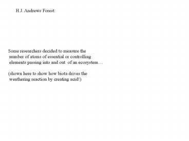
H.J. Andrews Forest
Some researchers decided to measure the number
of atoms of essential or controlling elements
passing into and out of an ecosystem (shown
here to show how biota drives the weathering
reaction by creating acid!)
2
Hydrogen ions
Well-buffered!
3
Metalic cations
uptake
4
Back to soil moisture story
Chapin et al.
5
Formula depth to which rain will penetrate
soil ppt ? (field cap. current)
Depth to which water will penetrate
rainfall
Field capacity - current water per
depth of soil
(as long as the soil is at or above field
capacity the water just keeps being pulled
down by gravity)
6
Your desert sandy soil has a 0.05 ml wilting
point and a 0.15 ml field capacity. The soil is
at permanent wilting.. How far will 2 cm of rain
penetrate into the soil? a) 2 cm b) 6.67
cm c) 10 cm d) 20 cm e) 40 cm
7
Precipitation for the Colorado Front
Range. Given were semiarid, stored water will
run out sometime in mid to late summer.
8
(No Transcript)
9
(No Transcript)
10
What the plant roots see.(plains of Wyoming)
11
In semiarid zones Soils can recharge to field
capacity during the non-growing season (to some
depth???) Plants then mine the water and reduce
moisture to permanent wilting and then live
hand to mouth on rainfall events This pattern
maximized in summer wet ecosystems like Great
Plains.
12
THE SOIL TEXTURE-CLIMATE INTERACTION EFFECT
13
Vulnerable to evapor- ation.
Plant-available water is reduced by surface
evaporation
Chapin et al.
14
Solar energy can evaporate water from Surface
soils. It can also pull water up and out of the
soil when surface soils are at field
capacity. Capillary Action!
15
Envision a loam soil and a sand soil, both at
permanent wilting. Loam holds 0.22 cc of H20
per CC Sand holds 0.09 cc of H20 per CC What
happens when a 1 cm (ca. 0.4 inch) rain event
occurs?
(field capacity permanent wilting of loam
.22 Field capacity permanent wilting of clay
.09)
16
Loam 1/. 22 4.6 cm Sand 1/.09 11.1
cm Suppose, however, that solar energy
evaporates all the water in the top 3 cm of
soil? The plants get ONLY whats left loam
4.6-3 1.6 cc, sand 11.1-3 8.1 cc
17
loam 4.6-3 1.6 cc, sand 11.1-3 8.1
cc Water available in loam 1.6 cm.22 .35
cm Water available in sand 8.1.09 .73
cm The sand soil has .73/.35 2.1x as much
water!!!! Are sand soils be better than loam
soils in providing water in semiarid zones?
YESbut does this matter?
18
Sala et al 1988
19
Great Plains NPP
clay
NPP
sand
34
10 20 30 40 50 60 70 Rainfall (cm)
20
When rainfall is at 34 cm, plant production is
the same for sites on sand soils as on clay
soils. When rainfallgt34 cm, loam soils have
higher NPP. When rainfall lt34 cm, sand soils
have higher NPP. (the limiting factor of water is
more limiting than is the lack of soil
fertility).
21
NPP is an ecosystem characteristic an
interaction between biotic-abiotic characteristics
of system. The effect of soil texture on NPP
is a climate- soil texture interaction Sandy
soils superior in arid environments. Clay soils
superior in humid environments.
22
(No Transcript)
23
On Boulder Open Space, you can find the dominant
plant species of the shortgrass prairie (a xeric
grassland) growing adjacent to the dominant
species of the tallgrass prairie (a semi-humid
grassland). How can both communities coexist in
the same climate zone? Soil texture. The
shortgrass community is found on clays The
tallgrass community if found on a coarse-textured
soil. (But more to the story is needed to explain
its presence.)
24
Coarse Soil
Clay soil