
Workshop 2 - PowerPoint PPT Presentation
1 / 25
Title:
Workshop 2
Description:
Scientists install a new tiltmeter after an eruption at Rabaul Caldera, PNG ... Installing a tiltmeter at Soufriere Hills Volcano, Monsterrat in 1995. Tilt Measurement ... – PowerPoint PPT presentation
Number of Views:58
Avg rating:3.0/5.0
Title: Workshop 2
1
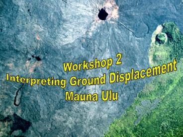
Workshop 2 Interpreting Ground Displacement Mauna
Ulu
2
- 1GS135 GEOLOGICAL HAZARDS ENGINEERING GEOLOGY
SCHOOL OF EARTH ENVIRONMENTAL
SCIENCES Workshop 2 Interpreting Ground
Displacement
3
Volcanic Geohazard
- Volcanic Hazards
- Monitoring
4
Volcano Monitoring Methods
- Core methods
- Seismic
- Ground deformation
- Supportive methods
- Microgravity, electrical magnetic studies
- Geochemical monitoring (gas water)
- Satellite-based methods
- Global Positioning System
- Radar Interferometry
- Thermal monitoring
volcanoes.usgs.gov/About/What/Monitor/monitor.html
5
Volcano Deformation
- Principles Methods
- Tilt measurement
- Tiltmeter
- Dry tilt
- Lateral displacements
- EDM (infrared laser
- microwave)
- GPS
- Vertical displacements
- Precise levelling
- Space-based
- Radar interferometry
- Laser altimetry
6
Ground Deformation Sources Patterns
?h
Mogi spherical source
?h
Linear source (dyke)
7
Tilt Measurement
- Early versions
- Water - tube tiltmeters
- Dry tilt levelling
8
Tilt Measurement
- Borehole tiltmeters
- Provide continuous record
- Need to be insulated from T rainfall effects
Scientists install a new tiltmeter after an
eruption at Rabaul Caldera, PNG
Tavurvur Volcano erupts in background
9
Tilt Measurement
- Problems
- Site specific
- No measure of absolute altitude change or
horizontal movements
Installing a tiltmeter at Soufriere Hills
Volcano, Monsterrat in 1995
10
Tilt Measurement
- Tilt Related to Puu Oo Eruptions (Kilauea,
Hawaii)
http//volcanoes.usgs.gov/About/What/Monitor/Defor
mation/TiltKilauea.html
11
Precise Levelling
- Most accurate way of deriving relative height
changes - First used to investigate 1910 Usu (Japan)
eruption - Regular monitoring tool since mid 1960s
- Involves use of a level and graduated measuring
staff - Time consuming and labour intensive
- Accuracies of 0.8mm over 1km possible
Etna (1989 eruption)
http//vulcan.wr.usgs.gov/Monitoring/Descriptions/
description_geodetic_level.html
12
Precise Leveling the Method
a e permanent benchmarks b c d
temporary staff and instrument positions Height
difference e - a sum of all the foresights
minus sum of all the backsights
Benchmark
Turning point
Benchmark
foresight
e
backsight
d
c
b
a
Any number of turning points may be used
13
Electronic Distance Measurement
- Measures horizontal distance changes in a
network of benchmarks - Uses laser or IR Total Stations (incorporate
electronic theodolite) - Light beam bounced off reflector a few kms away
- Preliminary distance read from instrument
- Corrections for T and P made to give final
distance - Accuracies of a few cm
http//vulcan.wr.usgs.gov/Monitoring/Descriptions/
description_EDM_meas.html
14
Electronic Distance Measurement
Slope-Distance Measurements using EDM's and
Theodolites
EDM Set-up on Road100, northeast of Mount St.
Helens
15
Electronic Distance Measurement
http//vulcan.wr.usgs.gov/Projects/Deformation/MSH
16
Global Positioning System
Etna 1996
- Most accurate way of measuring horizontal
position over large distances - Utilises constellation of 24 satellites that
beam radio signals to Earth - Determines precise distance to satellite and thus
position on Earth - At least 4 satellites needed
- Accuracies of a few mm over 10s km using dual
receiver differential GPS - Drawbacks line of sight weather
http//vulcan.wr.usgs.gov/Monitoring/GPS/framework
.html
17
GPS The Method
- One antenna (rover) is set up vertically above a
benchmark - Locked on to satellites 15 minutes. Data stored
in hand-held controller
http//vulcan.wr.usgs.gov/Monitoring/GPS/descript
ion_GPS.html
18
GPS The Method
- A second antenna (base) is left locked on to
satellites at start of days work - Rover moved on to successive benchmarks in a
network designed to provide good spatial coverage
http//vulcan.wr.usgs.gov/Monitoring/GPS/descript
ion_GPS.html
19
Integrated Monitoring Networks
20
Mauna Ulu
volcano.und.nodak.edu/vwdocs/Parks/hawaii/chain_cr
ater/menu2.html
21
Tiltmeter
22
Mauna Ulu
23
Mauna Ulu
- 1. Is the centre of ground displacement at
Halemaumau Crater, the upper east rift zone, or
the upper southwest rift zone? (Circle one) - 2. Does the ground displacement pattern indicate
uplift or subsidence? (Circle one) - 3. What is the maximum amount of ground
displacement? - 4. What type of volcanic activity would you
expect to be associated with this ground
displacement pattern? - 5. Where is volcanic activity likely to occur?
- 6. Why are the lines dashed for the southwest
part of the pattern? - 7. Are the tilt vectors useful for defining the
centre of ground displacement?
24
Mauna Ulu
25
Mauna Ulu
- 1. Where is the centre of ground displacement
located? Halemaumau Crater, the upper east rift
zone, or the upper southwest rift zone? (Circle
one) - 2. Does the ground displacement pattern indicate
uplift or subsidence? (Circle one) - 3. What is the maximum amount of ground
displacement? - Answer the following questions after contouring
the ground displacement data. Begin by contouring
the data to define a pattern of ground
displacement. A contour interval of 5 mm works
best (i.e., 0, 5, 10, 15, ... 45). - 4. Does the pattern defined by the contours
support your answer to question 1? - 5. Draw a line on the diagram where volcanic
activity probably occurred. - 6. Did you have any difficulties defining the
south-western part of the pattern? Explain.
Recommended
CrystalGraphics Presentations


