
Matthew Lagor - PowerPoint PPT Presentation
Title:
Matthew Lagor
Description:
The GOES Sounder retrieves temperature and moisture profiles ... With the GOES Sounder capabilities, forecasters can accurately ... – PowerPoint PPT presentation
Number of Views:56
Avg rating:3.0/5.0
Title: Matthew Lagor
1
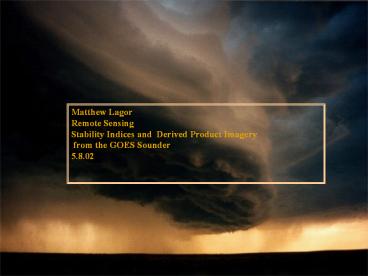
Matthew Lagor Remote Sensing Stability Indices
and Derived Product Imagery from the GOES
Sounder 5.8.02
2
Introduction
- GOES Sounder Impact and DPI uses
- Atmospheric Stability Products
- Limitations of DPI
- Questions
3
GOES Sounder Impact
- GOES Profile retrievals (in absence of clouds),
typically have - a separation of 50 km and are determined at 40
pressure levels from - 1000 to .1 hPa. Compared to horizontal
resolution of the radiosonde - stations that are roughly 400 km apart.
- The radiosonde network launches one balloon
every 12 hours. - The GOES Sounder retrieves temperature and
moisture profiles - over the entire US and ocean every hour. This
corresponds to nearly - 2000-3000 retrievals per hour.
- Sounder profiles are assimilated into the
numerical prediction - models.
- With the GOES Sounder capabilities, forecasters
can accurately - monitor and track atmospheric changes on both
small and large - scales. As well as improve both nowcasting and
forecasting methods.
4
GOES-8 Sounder Channels
- The GOES Sounder has 18 thermal infrared bands
as well as a visible channel
Wavelength (um), Channel, Purpose
Longwave 14.71 1 Stratosphere temperature
14.37 2 Tropopause temperature 14.06 3
Upper-level temperature 13.96 4 Midlevel
temperature 13.37 5 Low-level temperature
Window 12.66 6 Total PW 12.02 7 Surface
temp., moisture 11.03 8 Surface temperature
Ozone 9.71 9 Total ozone Water vapor
7.43 10 Low-level moisture 7.02 11 Midlevel
moisture 6.51 12 Upper-level moisture
Shortwave 4.57 13 Low-level temperature
4.52 14 Midlevel temperature 4.45 15
Upper-level temperature
Nitrogen 4.13 16 Boundary-layer temperature
Window 3.98 17 Surface temperature 3.74 18
Surface temp., moisture Visible 0.94 Cloud
5
Derived Product Imagery (DPI)
- Some of the products include Total Precipitable
Water, - Lifted Index, Cloud Amount, Cloud Top Pressure,
- Cloud Top Temperature, Ozone, and Land-Sea
Surface - Temperature.
- Pseudo Images such as CAPE and CIN can also be
derived - from the temperature and moisture profiles.
- Sounder derived products were experimentally
used by - forecasters dating back to 1996.
- Products such as LI, CAPE, and TPW have improved
- both real-time nowcasting and forecasting
convective - development and severe weather activity.
- GOES Sounder retrievals have also been used to
forecast the - potential for downbursts
6
Total Precipitable Water
- Precipitable water is the total moisture content
in a column of air - condensed into millimeters of water.
- Values across the US range from 5 to 55 mm
- Calculated by integrating over the retrieved
moisture profile
- Moisture profile is calculated through the
radiance - measurements found in the longwave split
windows, the - shortwave window, and the water vapor band.
- Used to delineate stable from unstable air
masses, rainfall - intensity, dry line location, and low
temperatures.
7
(No Transcript)
8
CAPE
- The available positive (buoyant) energy a parcel
would - obtain ascending from the LFC to the EL.
- CAPE is a pseudo DPI product values having been
- recreated after the fact in an image format from
the - CAPE values.
- A moderately unstable air mass would have a CAPE
- value close to 1500 J/kg. Typical values of
severe - weather CAPE values range from 3000-5000 J/kg.
9
(No Transcript)
10
Lifted Index
- The Lifted Index is formed by lifting a boundary
layer parcel - to 500 mb and comparing the resultant
temperature of the - parcel with the ambient temperature.
- LI values are taken directly from the sounding.
- Negative values of LI indicate the parcel of air
being warmer - than the environment, therefore being indicative
of an unstable - environment.
- LI values from 4 to 8 degrees C correspond to
significant - potential instability.
- LI Images can be used to judge areas of
potential convective - development and current storm intensities.
11
(No Transcript)
12
(No Transcript)
13
(No Transcript)
14
GOES Sounder Limitations
- Sounder data can only be retrieved in the absence
- of clouds.
- Timeliness and vertical resolution remain as a
source - for improvement
- Satellite and radiosonde measurements are not
- always concurrent in time or space
- Radiosonde data are point measurements, while
- satellite derived quantities are volumetric
- measurements.
15
Questions?
Recommended
CrystalGraphics Presentations


