
NOAAs National Weather Service BaltimoreWashington Weather Forecast Office - PowerPoint PPT Presentation
1 / 49
Title: NOAAs National Weather Service BaltimoreWashington Weather Forecast Office
1
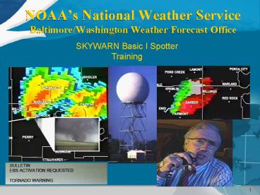
NOAAs National Weather ServiceBaltimore/Washingt
on Weather Forecast Office
SKYWARN Basic I Spotter Training
- SKYWARN Basic I Spotter
- Training Session
2
Basic I Spotter Training
Today we will learn the following basics -
- NOAAs National Weather Service
- SKYWARN Spotters
- Severe Storm Spotting Techniques
- How to Report to the NWS
- More Training and Other Information
3
Hazardous Weather
Adversely impacts society and the economy
- Hundreds of people in the U.S. die each year in
weather and flood related events - Thousands are injured
- Tornadoes, floods and hurricanes alone cause over
11.4 billion dollars each year - U.S. experiences more adverse weather then any
other nation in the world
4
About NOAAs National Weather Service
- A Typical Year Brings
- 7 Hurricanes
- 1,000 Tornadoes
- 5,000 Floods
- 10,000 Violent Thunderstorms
- Drought Conditions
- 500 Deaths 5,000 Injuries 14 Billion in Losses
- Provide climate, water, weather forecasts and
warnings to protect life and property and enhance
the economy - Data and products are used by other government
agencies, the private sector, the public, and the
global community.
5
NWS Service Delivery
Observe
Distribute
Respond Feedback
Products Services
Process
Feedback
6
Key Partnerships
- Emergency managers
- Other government agencies
- Broadcast and print media
- SKYWARN Spotters
- Amateur Radio Operators
- Cooperative Observers
7
NOAAs NWS Service Delivery Facilities
8
NOAAs National Weather Service
Baltimore/Washington Weather Forecast Office
(WFO) Sterling, Virginia
9
WFO Area of Responsibility
Approximately 27,000 square miles
Serving 8.5 Million People
- Maryland
- 13 Counties
- City of Baltimore
- Chesapeake Bay
- Tidal Potomac
- West Virginia
- 8 Counties
- Virginia
- 22 Counties
- 11 independent cities
- District of Columbia
Region is prone to all types of weather hazards!
10
WFO HydrologicArea of Responsibility
- River Basins
- Potomac
- 11,600 square miles
- 22 forecast points
- Shenandoah
- 3,050 square miles
- 6 forecast points
- Rappahannock
- 1,580 square miles
- 2 forecast points
11
Observation Sources - Technology
- Doppler radar (WSR-88D)
- NOAA Geostationary Operational Environmental
Satellite (GOES) - Automated Surface Observation System (ASOS)
- Upper Air (weather balloons)
12
NOAAs NWS Baltimore/Washington Doppler Radar
- 80 Ft Tower
- 30 Ft Radome
- 25 Ft Radar Dish
- 750 KW Power
- 0.8 Beam
Doppler Velocity Image of September 24, 2001
College Park Tornado
Cross-section of April 23, 1999 Hail Storm over
Northern Virginia
13
WSR-88D Radar Coverage
- Radars are spaced so that there is good
over-lapping coverage in the Eastern U.S.
Dover Radar reflectivity and velocity images
viewed at the Weather Office in Sterling
Severe Rotating Thunderstorm over the Delmarva
14
NOAA Geostationary Operational Environmental
Satellite (GOES)
- Orbits Over the Equator at 22,000 Miles
- GOES-12 (GOES EAST) is at 75W Longitude
- GOES-10 (GOES WEST) is at 135W Longitude
- GOES-9 (GOES Pacific) is at 205W Longitude
Severe Thunderstorms near Ohio River
Hurricane Fran
Hurricane Georges
15
Automated Surface Observing System (ASOS)
Wind
Present Weather
Temperature
Visibility
Ceiling
Pressure
Rain Gauge
ASOS at Reagan National Airport
16
Upper Air Observations(Weather Balloons)
- Observations are taken twice a day - Midnight and
Noon UTC or Greenwich England Time - 72 sites in the U.S. plus sites all around the
world - Measures Temperature, Pressure, Humidity, and Wind
17
Technological Limitations
- Radar
- Can not see through mountains
- Cannot sense below cloud base
- Not continuous scanning (5 minutes between scans)
- Satellites
- See only the tops of clouds
- Automated Observation Stations and Gages
- Can not measure snow or ice depth
- Can not discriminate hail, sleet, or tornadoes
- Can not tell us that trees are down
SKYWARN Spotters are our ground truth!
18
All Hazards NOAA Weather Radio
Transmitters
Manassas VA 162.55 MHz Pikesville MD 162.40
MHz Hagerstown MD 162.475 MHz Moorefield WV
162.40 MHz Frostburg MD 162.425
MHz Charlottesville VA 162.45 MHz
Receivers
Can be purchased in Nature and Electronic Stores
and Catalogs. They generally range in price from
15 to 75.
19
All Hazards NOAA Weather Radio
EAS Emergency Alert System SAME Specific Area
Message Encoding
Radio Coverage Map
Radio Broadcast Workstation
20
SKYWARN
Community Volunteers
- National Weather Service
- SKYWARN
- Severe Storm Spotting Techniques
- How to Report to the National Weather Service
- More training and other information
21
SKYWARN
- SKYWARN is a national network of volunteer severe
storm spotters. - SKYWARN spotters are trained by National Weather
Service (NWS) meteorologists - SKYWARN programs are run independently by each
NWS Forecast Office - SKYWARN spotters are usually people with a
strong interest in weather and those who are
public service oriented and want to help protect
people and communities from hazards
22
Spotters By County
We can never have enough spotters!
23
SKYWARN Amateur Radio Station (WX4LWX)
- Real-Time 2-Way Communication
- Backup Communication
- Two 2-Meter Radios
- One 440 Radio
- One HF Radio
- One Packet Terminal
- Computer for Radar Display and Intranet
Information
This radio station was funded by a grant from the
National Capitol Foundation for Amateur Radio
(FAR)
24
NOAAs National Weather Serviceand SKYWARN
Working Together To Save Lives
- National Weather Service
- SKYWARN
- ---- End of Part 1 ---- Basic1-Part2
- Severe Storm Spotting Techniques
- How to Report to the National Weather Service
- More training and other information
25
SEVERE STORM SPOTTINGSKYWARN Basic I Training
- An Introduction to Understanding Thunderstorms
and Learning Some of their Visual Clues
26
Objectives
- Understanding Thunderstorm Hazards
- Knowing what Safety Actions to Take
- Learning Basic NWS Terminology
- Thunderstorm Life Cycle
- Structure and Appearance of Severe Thunderstorms
27
Thunderstorm Hazards
- Lightning
- Flash Floods
- Hail
- Downbursts
- Tornadoes
28
NWS Terminology
Watch versus Warning
- WATCH means conditions are favorable for the
potential hazard to occur in and near the watch
area - WARNING means that the threat is imminent or
already occurring in the warning area
29
Lightning
If you can see a lightning stroke or hear the
thunder, you are close enough to be struck and
need to take immediate action
- The average distance from one stroke to the next
is 2 to 3 miles - Lightning can come from the upper part of the
storm and strike tens of miles away! - Lightning kills around 100 people per year and
injures hundreds
30
Lightning Safety Indoors
- Close windows and doors
- Doorways are NOT safe
- Stay away from electronic equipment and
appliances - Stay away from plumbing
- Do NOT use a corded phone
- Unplug expensive electronics and appliances or
install good surge protectors
Move indoors immediately
31
Lightning Safety Cars
- If no building is not available
- Hard top enclosed vehicles are okay
- Soft top, convertibles are not
It is not the tires that help protect you. It is
the metal casing. When lighting hits a car, the
charge runs over the metal surface and down into
the ground. A soft top car does not provide the
metal casing to protect you.
32
Lightning Safety Outdoors
- If no building OR car is available
- Find a low area with dense brush and take the
position shown in the picture to minimize your
chances of being struck
Picture of hair standing up taken just prior to
lightning striking. These teenagers were not
killed, but a nearby hiker was.
33
Flash Floods
- Flash Floods can occur from stationary, slow
moving or training thunderstorms - Rainfall amounts in this region can reach 5
inches of rain per hour - The worst events tend to occur with either a
tropical system or the remnants of a tropical
system.
Madison County June 1995
Camille Nelson County August 1969
34
Flash Floods
- Over half of flood fatalities occur from people
driving vehicles into flood waters
Water typically flows downstream at 6 to 12 mph.
As little as 1 to 2 feet of water will float most
vehicles!!!
35
Flood Safety Tips
- Never enter water over a road if it is too deep
to see the pavement beneath. Find an alternate
safe route. Turn around dont drown!!! - If your vehicle stalls in unexpected high water,
leave it at once and seek higher ground. - Be very care at night. Visibility is greatly
reduced and flooding is harder to recognize.
Fredericksburg, September 4, 2000
36
Floods and Cars Dont Mix
37
Floods and Cars Dont Mix
38
How Fast?
Dam Failure
Debris dams can suddenly break
39
NWS Terminology
Severe Thunderstorms
- Severe Thunderstorm means that the thunderstorm
is producing - Wind gusts 58 mph or higher
- Hail penny size (3/4) or larger
- Tornadoes also qualify a storm as being severe
Note The National Weather Service does not
classify a thunderstorm as severe based on
intense lightning or flash flooding
40
Large Hail
- Hail near La Plata, MD was up to 4.5 inches in
size on April 28, 2002 - Hail can impact at speeds over 100 mph!
- Hail is a sign that this is a powerful storm and
it falls near the area where a tornado would form.
La Plata, MD - April 28, 2002
Slicing through a hailstone shows its rings.
41
Large Hail
- Hail causes billions of dollars in property
damage and crop damage every year - In April 1999, a hail storm in Northern Virginia
did 275 million in damage - Typically, it takes golf ball size hail to begin
to dent a car - Smaller hail, when wind driven, can also produce
damage
Damaged siding Southern VA June 1993
Winchester, VA - April 1999
42
Downbursts / High Winds
- Sudden downward rush of air from a thunderstorm.
- Wind Gusts can reach 150 mph.
- Sometimes referred to as a wind shear or
microburst
43
Downbursts / High Winds
- Downburst damage can easily be mistaken for that
of a tornado - Safety actions for a downburst are the same as a
tornado
Anne Arundel County MD August 1999
44
Tornadoes
College Park, MD September 24, 2001
Frostburg MD June 1998
45
NWS Terminology
Tornado versus Funnel Cloud
- Funnel Cloud is a funnel-shaped cloud most often
seen protruding from a thunderstorm. It is NOT
touching the ground or causing damage. - Tornado may appear as a funnel-shaped cloud. A
tornado is a violently rotating column of air
that extends from the thunderstorm all the way to
the ground.
46
High Wind / Tornado Safety
- Close Windows and Doors, if time!
- Basement or Interior room on lowest level
- If in a camper or mobile home, seek shelter in a
substantial house with a foundation or find a
ditch outdoors.
Bathroom
Interior Closet
Weak tornado damage
47
Tornado Safety Outdoors
- Do not try to outrun it
- Do not take shelter in an underpass
Get away from your car and into a low area
48
Tornado Safety Outdoors
- If no structurally strong buildings are
available, find a ditch or low area - Take the position shown in picture to the right
49
Break Time!
- Questions?
Recommended
CrystalGraphics Presentations


