
Arab Federation of Surveyors - PowerPoint PPT Presentation
1 / 7
Title:
Arab Federation of Surveyors
Description:
Cooperation , coordination, communication among the surveyors in Arab countries ... Held by the Department of Lands & Survey. with ... Purpose of the seminar ... – PowerPoint PPT presentation
Number of Views:40
Avg rating:3.0/5.0
Title: Arab Federation of Surveyors
1
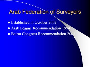
Arab Federation of Surveyors
- Established in October 2002
- Arab League Recommendation 1994
- Beirut Congress Recommendation 2001
2
Arab Federation Objectives
- Cooperation , coordination, communication among
the surveyors in Arab countries and other
international organizations - Organizing meetings, seminars, etc.
- Making activities through committees
- Issuing documents, magazine, etc
3
- Cadastre in Jordan
- and
- Improving Surveying Services
- Held by the Department of Lands Survey
- with
- the collaboration of the Arab Federation of
Survey - September 10 12, 2003
- Amman - Jordan
4
Purpose of the seminar
- To consolidate activities held under the
patronage of the Arab Federation of Survey - To increase coordination and cooperation between
Arab countries in fields of Cadastre - To present Jordans experience in the field of
surveying and cadastre in public, private and
academic sector
5
Abstracts of papers presented at the seminar
- The Department of Lands and Survey
- The paper describes and gives information about
the process of modernization in the department
during the last 8 years. It also explains the
effects of this process on the services provided
for both, the public and private sectors - The Royal Jordanian Geographic Center
- The paper describes and gives information about
the role, duties, tasks and services provided by
the Center and both the national and regional
level, and finally the facilities available to
conduct high standard surveying activities
6
- The Balqa Applied University
- The paper presents and gives information about
Geomatics Surveying Engineering and its
components like, Photogrammetry, Cartography, GIS
and Remote Sensing, etc. The paper also explains
and emphasis the important role the university
plays by providing the society with qualified
surveying engineers. - The Association of Licensed Surveyors
- The paper gives general information about the
association and its history, goals, tasks and
ambitions. It also gives examples of different
projects executed by the private sector in and
outside Jordan.
7
Recommendation of the conference
- Continue to organise such meetings
- Built a knowledge guide
- Standardisation of procedures
- Issue a periodic magazine