
Remote Sensing - PowerPoint PPT Presentation
1 / 131
Title:
Remote Sensing
Description:
Remote Sensing – PowerPoint PPT presentation
Number of Views:478
Avg rating:3.0/5.0
Title: Remote Sensing
1
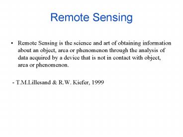
Remote Sensing
- Remote Sensing is the science and art of
obtaining information about an object, area or
phenomenon through the analysis of data acquired
by a device that is not in contact with object,
area or phenomenon. - - T.M.Lillesand R.W. Kiefer, 1999
2
Process of Remote Sensing
- Energy source
- Atmosphere
- Earth Features
- Sensors
- Data Processing
- Analysis and Applications
3
(No Transcript)
4
(No Transcript)
5
(No Transcript)
6
Energy sources and Radiation Principles
- Electromagnetic Theory Wave Model
- Electromagnetic Energy
- E hv
- Where v the electromagnetic wave's frequenc
- h Planck's constant 6.625x10⁻³⁴ Joule-Seconds
7
(No Transcript)
8
Planck Radiation Law
- The primary law governing blackbody radiation is
the Planck Radiation Law, which governs the
intensity of radiation emitted by unit surface
area into a fixed direction (solid angle) from
the blackbody as a function of wavelength for a
fixed temperature. The Planck Law can be
expressed through the following equation. - The behavior is illustrated in the figure shown
above. The Planck Law gives a distribution that
peaks at a certain wavelength, the peak shifts to
shorter wavelengths for higher temperatures, and
the area under the curve grows rapidly with
increasing temperature.
9
The Wien and Stefan-Boltzmann Laws
- The behavior of blackbody radiation is described
by the Planck Law, but we can derive from the
Planck Law two other radiation laws that are very
useful. The Wien Displacement Law, and the
Stefan-Boltzmann Law are illustrated in the
following equations. - The Wien Law gives the wavelength of the peak of
the radiation distribution, while the
Stefan-Boltzmann Law gives the total energy being
emitted at all wavelengths by the blackbody
(which is the area under the Planck Law curve).
Thus, the Wien Law explains the shift of the peak
to shorter wavelengths as the temperature
increases, while the Stefan-Boltzmann Law
explains the growth in the height of the curve as
the temperature increases. Notice that this
growth is very abrupt, since it varies as the
fourth power of the temperature.
10
Electromagnetic Spectrum
11
Energy Interactions in the Atmosphere
- Radiation used for Remote Sensing reaches earths
surface after going through the atmosphere of the
earth. Gases and particles in the atmosphere
affect the radiation. - These effects are caused by Atmospheric
Scattering and Absorption.
12
(No Transcript)
13
Scattering
- Scattering of Electromagnetic Radiation
- Scattering of electromagnetic radiation is
caused by the interaction of radiation with
matter resulting in the reradiation of part of
the energy to other directions not along the path
of the incidint radiation. Scattering effectively
removes energy from the incident beam. Unlike
absorption, this energy is not lost, but is
redistributed to other directions. Both the
gaseous and aerosol components of the atmosphere
cause scattering in the atmosphere. - Scattering by gaseous molecules
- The law of scattering by air molecules was
discovered by Rayleigh in 1871, and hence this
scattering is named Rayleigh Scattering. Rayleigh
scattering occurs when the size of the particle
responsible for the scattering event is much
smaller than the wavelength of the radiation. The
scattered light intensity is inversely
proportional to the fourth power of the
wavelength. Hence, blue light is scattered more
than red light. This phenomenon explains why the
sky is blue and why the setting sun is red. The
scattered light intensity in Rayleigh scattering
for unpolarized light is proportional to (1
cos2 s) where s is the scattering angle, i.e. the
angle between the directions of the incident and
scattered rays. - Scattering by Aerosols
- Scattering by aerosol particles depends on the
shapes, sizes and the materials of the particles.
If the size of the particle is similar to or
larger than the radiation wavelength, the
scattering is named Mie Scattering. The
scattering intensity and its angular distribution
may be calculated numerically for a spherical
particle. However, for irregular particles, the
calculation can become very complicated. In
general, the scattered radiation in Mie
scattering is mainly confined within a small
angle about the forward direction. The radiation
is said to be very strongly forward scattered.
14
Atmospheric Absorption
- Absorption by Gaseous Molecules
- The energy of a gaseous molecule can exist in
various forms - Translational Energy Energy due to translational
motion of the centre of mass of the molecule. The
average translational kinetic energy of a
molecule is equal to kT/2 where k is the
Boltzmann's constant and T is the absolute
temperature of the gas. - Rotational Energy Energy due to rotation of the
molecule about an axis through its centre of
mass. - Vibrational Energy Energy due to vibration of
the component atoms of a molecule about their
equilibrium positions. This vibration is
associated with stretching of chemical bonds
between the atoms. - Electronic Energy Energy due to the energy
states of the electrons of the molecule. - The last three forms are quantized, i.e. the
energy can change only in discrete amount, known
as the transitional energy. A photon of
electromagnetic radiation can be absorbed by a
molecule when its frequency matches one of the
available transitional energies. - Ultraviolet Absorption
- Absorption of ultraviolet (UV) in the atmosphere
is chiefly due to electronic transitions of the
atomic and molecular oxygen and nitrogen. Due to
the ultraviolet absorption, some of the oxygen
and nitrogen molecules in the upper atmosphere
undergo photochemical dissociation to become
atomic oxygen and nitrogen. These atoms play an
important role in the absorption of solar
ultraviolet radiation in the thermosphere. The
photochemical dissociation of oxygen is also
responsible for the formation of the ozone layer
in the stratosphere.
15
Atmospheric Absorption Cntd.
- Ozone Layers
- Ozone in the stratosphere absorbs about 99 of
the harmful solar UV radiation shorter than 320
nm. It is formed in three-body collisions of
atomic oxygen (O) with molecular oxygen (O2) in
the presence of a third atom or molecule. The
ozone molecules also undergo photochemical
dissociation to atomic O and molecular O2. When
the formation and dissociation processes are in
equilibrium, ozone exists at a constant
concentration level. However, existence of
certain atoms (such as atomic chlorine) will
catalyse the dissociation of O3 back to O2 and
the ozone concentration will decrease. It has
been observed by measurement from space platforms
that the ozone layers are depleting over time,
causing a small increase in solar ultraviolet
radiation reaching the earth. In recent years,
increasing use of the flurocarbon compounds in
aerosol sprays and refrigerant results in the
release of atomic chlorine into the upper
atmosphere due to photochemical dissociation of
the fluorocarbon compounds, contributing to the
depletion of the ozone layers. - Visible Region
- There is little absorption of the
electromagnetic radiation in the visible part of
the spectrum. - Infrared Absorption
- The absorption in the infrared (IR) region is
mainly due to rotational and vibrational
transitions of the molecules. The main
atmospheric constituents responsible for infrared
absorption are water vapour (H2O) and carbon
dioxide (CO2) molecules. The water and carbon
dioxide molecules have absorption bands centred
at the wavelengths from near to long wave
infrared (0.7 to 15 µm). In the far infrared
region, most of the radiation is absorbed by the
atmosphere. - Microwave Region The atmosphere is practically
transparent to the microwave radiation.
16
Spectral Reflectance
- What is Spectral Reflectance?
17
(No Transcript)
18
Active and Passive Remote Sensing
- Based on the energy source Remote Sensing is
classified in to two major classes. - Passive Remote Sensing
- Remote sensing systems which measure energy
that is naturally available are called passive
sensors. Passive sensors can only be used to
detect energy when the naturally occurring energy
is available. For all reflected energy, this can
only take place during the time when the sun is
illuminating the Earth. There is no reflected
energy available from the sun at night. Energy
that is naturally emitted (such as thermal
infrared) can be detected day or night, as long
as the amount of energy is large enough to be
recorded. - Active Remote Sensing
- Active Remote Sensing provides its own energy
source for illumination. The sensor emits
radiation which is directed toward the target to
be investigated. The radiation reflected from
that target is detected and measured by the
sensor. Advantages for active sensors include the
ability to obtain measurements anytime,
regardless of the time of day or season. Active
sensors can be used for examining wavelengths
that are not sufficiently provided by the sun,
such as microwaves, or to better control the way
a target is illuminated. However, active systems
require the generation of a fairly large amount
of energy to adequately illuminate targets.
19
Satellites
20
Multi Spectral Data Collection- Pushbroom
21
Multi Spectral Data Collection- Whiskbroom
22
Satellites and Sensor Types
- Multi-Spectral Imaging using discrete detectors
and scanning mirrors - Landsat MSS, TM, ETM, GOES, AVHRR, SeaWIFS
ATLAS - Multi-Spectral Imaging using linear arrays
(Pushbroom) - SPOT1-4, IRS, Ikonos, Quick Bird, ASTER
- Image Spectrometry using Linear arrays
(Whiskbroom) - AVRIS,MODIS
23
Process of Satellite Remote Sensing
24
Satellite Data Format
25
Landsat 7
26
Landsat
- Landsat has a revisit period of 16 days.
- Due to cloud cover and other variables, Landsat
does not record images continuously. - The actual number of images recorded is a small
percentage of the theoretical value. - In addition, for this study, the satellites
overpass date must have corresponded to a
particular water level. - These combined constraints resulted in a
relatively small number of potentially useful
images. These constraints apply to all of the
remote sensing satellites employed in this study. - Landsat scene cover 185 km X 185 km and cost
6000.00 ( 0.57/km2). - The Landsat image used for this project was taken
on October 23, 1999. - The average water level at the United States
Geological Station (USGS) gauging station located
in Lake Kissimmee was 51.98 above mean sea level
(AMSL) on this date.
27
Landsat TM Image June 29 1998
28
Landsat Image
29
SPOT
- The SPOT satellite has a scanner with images that
cover a 60 km x 60 km area per scene. - Two cameras are onboard SPOT
- one has a 20m x 20m ground resolution cell size
and records data in 3 spectral bands while - the other has one panchromatic band with a ground
cell size of 10m x 10m. - The SPOT scenes acquired for this project were
taken on March 2, 1993 for both the 3-band color
and the 1-band panchromatic. - The average water level at the USGS gauging
station located in Lake Kissimmee was 50.74 AMSL
on this date. - The cost of an uncertified 60 km x 60 km SPOT
scene was 1,500.00 per Level 1A processing.
Therefore imagery cost for this project is
2.40/km2
30
SPOT Image
31
SPOT Image
32
IKONOS
- The IKONOS, which was launched in the year 2000,
is one of the latest commercial earth-looking
remote sensing satellites. IKONOS has two
cameras one has a 3-band, four meter ground cell
size while the other has one-band, one-meter
ground cell size resolution. - The price of uncertified IKONOS imagery taken
over the United States is 18.00/km2 for
onemeter resolution panchromatic and 20/km2 for
four meter, 3 band color imagery.
33
IKONOS Image
34
QuickBird
35
Quickbird Image
36
Great Pyramid of Giza Quickbird Image
37
Is it a Aerial photograph?
38
Hyperspectral Scanners Compact Airborne
Spectrographic Imager (CASI)
- The hyperspectral instrument used in this study
was taken by the Compact Airborne Spectrographic
Imager (CASI) which is a charge couple device
push-broom imaging spectrograph intended for the
acquisition of visible and near infrared
hyperspectral imagery. - The CASI combines some of the better features of
aerial photography and satellite imagery with the
analytical potential of a spectrometer. - The CASI sensor detects an array of narrow
spectral bands in the visible and infrared
wavelengths, using along-track scanning. - The spectral range covered by the 288 channels
is between 0.4 and 0.9 µm. Each band covers a
wavelength range of 0.018 µm. - Spatial resolution depends on the altitude of the
aircraft, the spectral bands measured and the
bandwidths used are all programmable.
39
CASI Image
WHITE TARGETS USED TO AID GROUND DATA COLLECTION
40
Radar
- The microwave atmospheric window is nearly 100
clear - Much longer wavelengths cm to m scale
- Primarily an active form of remote sensing
- Energy return is dominated by surface roughness
and measured as a function of the travel time of
the radar pulse - Difference between Radar and other remote sensing
are pulse generator, duplexer and antenna
,duplexer controls timing of pulse release and
reception
41
Advantages
- All time / all weather capability
- Information on surface roughness at the human
scale - Centimeters rather than microns
- Penetration of soil function of the dielectric
constant - Rule of thumb is that for dry soils, penetration
depth (cm) 10 - For hyper-arid environments, radar can penetrate
3-5 meters
Disadvantages
- Very costly
- Imagery is complex and typically hard to
interpret - Little to no information on composition of the
surface materials
42
RADAR Image
43
Radar Bands
- Radar pulses are sent and received in discrete
wavelength regions (designated with letters) - Controlled by the federal government so as not to
interfere with commercial broadcasting and
emergency frequencies - Most commonly used
- Ka-band 0.8 1.1 cm (1.0 cm)
- C-band 3.8 - 7.5 cm (5.3 cm) L-band 15.0 -
30.0 cm (23.5 cm) - X-band 2.4 3.8 cm (3.0 cm)
- S-band 12 cm
- P-band 30.0 - 100.0 cm (68 cm)
44
Two Radar Modes
- 1. Passive same principles as emitted energy in
the Thermal IR however, energy is a function of
the surface dielectric constant as well as the
temperature the dielectric constant is greater
for metals and soils with higher moisture content
- 2. Active most common form of radar remote
sensing. 90 of all data collected - known as SLAR (side-looking airborne radar) SLAR
can be either real aperture radar (RAR) or
synthetic aperture radar (SAR). Active remote
sensing controls the source as well as the data
collection - Energy is transmitted and received by an antenna
looking off at an angle to - the surface typically mounted to the side of a
planes fuselage for airborne systems - Side-looking geometry affects how the signal
interacts with the surface - also causes unique geometric distortions that
must be corrected - Nadir-viewing radar systems are known as radar
altimeters used for mapping topography
45
Terminology
- 1. Ground range distance away from the nadir
point (perpendicular to the flight direction) - 2. Slant range distance along the beam path
- 3. Azimuth distance along the flight direction
- 4. Look angle angle from the vertical to the
beam - 5. Depression angle complement to the look angle
- 6. Swath width illuminated surface on the
ground - 7. Pulse duration time of the pulse
46
Radar in Operation
- Beam pulse transmitted to surface illuminates a
narrow strip of land - Returned energy (backscatter) is received by the
antenna and the timing logged - Energy only returned if the surface is rough
compared to the wavelength - Corner reflector is an object on the surface
with a certain geometry with respect to the
incident energy whereby all the energy is
returned to the antenna - Near-range is received first (shorter travel
time) then the far-range - All backscatter within any given zone of the
swath width perpendicular to the azimuth
direction is received at the same time. there is
no way to resolve features within this strip
(azimuth resolution)
47
Radar Resolution
- The ability of the radar return to distinguish
between two objects in the range direction only
can happen if the received pulse from the object
closest to the antenna ends before the returned
pulse of the far-range object begins can be
defined in terms of the pulse duration and the
ground range distance - Shorter pulse duration and smaller depression
angles result in better range resolution - Common pulse duration 0.05 - 0.3 µseconds,
- Small depression angles produce large radar
shadows - Short pulse durations result in less return and
more noise
R ct/2 cos 0 Where C speed of light T
pulse duration 0depression angle
48
Azimuth Resolution
- Distance parallel to the azimuth (flight)
direction - Azimuth resolution equals the swath width
- Best resolution achieved with commercial systems
15-60m
Ra GR B Where GR ground range B antenna
beamwidth
49
Synthetic Aperture Radar (SAR)
- way around the RAR limitation by using the
motion of the plane (artificially enlarge the
antenna length) - Uses the principle of Doppler shift to track the
motion of objects in the azimuth direction
through successive pulses - Objects in the near range are observed for
shorter times than those in the far-range - Synthesized beam is much narrower than the
original swath width azimuth resolution can be
decreased to 5-20m
50
Radar Polarization
- SLAR systems can commonly transmit and receive in
different polarization planes (horizontal and
vertical) - results in image designations such as
- C-band horizontal send, vertical receive
- P-band horizontal send, horizontal receive
- Interaction with surface features can depolarize
the beam - The physical process of depolarization is not
always well understood - Horizontal send and receive is the strongest
most objects on the surface have a vertical
orientation therefore they scatter back most of
the energy - Depending on the surface properties of the
surface under study, vertical send/receive may
be important
51
(No Transcript)
52
(No Transcript)
53
(No Transcript)
54
(No Transcript)
55
(No Transcript)
56
(No Transcript)
57
(No Transcript)
58
(No Transcript)
59
(No Transcript)
60
(No Transcript)
61
(No Transcript)
62
(No Transcript)
63
(No Transcript)
64
(No Transcript)
65
(No Transcript)
66
(No Transcript)
67
Light Detection And Ranging (LiDAR)
- Light Detection And Ranging uses the same
principle as RADAR. The LiDAR instrument
transmits light out to a target. The transmitted
light interacts with and is changed by the
target. Some of this light is reflected scattered
back to the instrument where it is analyzed. The
change in the properties of the light enables
some property of the target to be determined. The
time for the light to travel out to the target
and back to the LiDAR is used to determine the
range to the target.
68
LiDAR Cntd.
- There are three basic generic types of LiDAR
- Range finders - helps to measure the distance
from the lidar instrument to a solid or hard
target. - Differential Absorption LiDAR - used to measure
chemical concentrations (such as ozone, water
vapor, pollutants) in the atmosphere. A DIAL
lidar uses two different laser wavelengths which
are selected so that one of the wavelengths is
absorbed by the molecule of interest whilst the
other wavelength is not. The difference in
intensity of the two return signals can be used
to deduce the concentration of the molecule being
investigated. - Doppler LiDAR - Doppler lidar is used to measure
the velocity of a target. When the light
transmitted from the lidar hits a target moving
towards or away from the lidar, the wavelength of
the light reflected/scattered off the target will
be changed slightly. This is known as a Doppler
shift - hence Doppler LiDAR.
69
Raw LiDAR data
70
LiDAR data on the Digital Surface Model
71
After filtering out the non-ground points
LiDAR data of the bare earth is very useful for
generating contours and also useful to generate
the Orthophoto, which is one among the data
sources for GIS.
72
LiDAR data
73
Raw LiDAR data and Processed data
74
Remote Sensing Applications
- Satellites Humans third-eye in the space.
- Applications
- Forest management
- Landuse management
- Mapping
- Agriculture
- Geology
- Coastal Management
- Etc.
75
(No Transcript)
76
(No Transcript)
77
Remote Sensing Applications Cntd.
- Forest management
- To estimate the deforestation
- To identify the diseased forest area
- Biomass estimation
- Land Use Land Cover Change detection
- Landuse change
- Urban Expansion
- After disaster Assessment
- Agriculture
- Vegetation mapping
- Vegetation monitoring
- Yield estimation
78
Remote Sensing Applications Cntd.
- Geology
- Mineral exploration and Structural Mapping
- Sedimentation mapping and monitoring
- Lithological mapping
- Mapping
- Topological mapping
- DEMs
- Thematic Mapping
- Coastal Management
- Oil spill detection
- Ocean management
- Fish and ocean-life assessment
- Etc.
- Glacier-melt assessment
- Flood damage assessment
79
Potential for Remote Sensing to Locate the
Ordinary High Water Line A Case Study of Lakes
Kissimmee and Hatchineha
80
Ordinary High Water Line What is it?
- A boundary line
- A point to which the water normally rises during
the high water season - It excludes floods and freshets
- It is an ambulatory line that shifts in response
to long term gradual, natural changes in water
levels or the shoreline
81
Why use remote sensing to locate the OHWL?
- Efficiency
- It has been suggested that it works
- Theoretically, if it works, there would be only
one variable, vegetation
82
Reasons remote sensing may work to locate the
OHWL
- Davis (1973) found a relationship between the
OHWL, and the location of upland and wetland
vegetation - Under normal hydrologic conditions, distinct
vegetation shifts are expected on shorelines - Remote sensors primarily detect vegetation on the
ground - Davis, J.H., Jr. 1973. Establishment of Mean
High Water Lines in Florida Lakes. Publication
No. 24. Florida Water Resources Research Center.
Research Project Technical Completion Report.
ORR Project Number A-015-FLA.
83
Reasons remote sensing may work to locate the
OHWL (contd.)
- Remote sensing technology provides researchers
with the ability to determine land use/land cover
types on a broad scale - The USGS Gap Analysis Project found Landsat
images sufficient for mapping vegetation and
habitat - Landscape ecologists use satellite imagery to
characterize vegetation, species distributions,
and communities
84
Study Hypotheses
- Vegetation can be used as an indicator of the
OWHL - Landsat, SPOT, IRS, and IKONOS will not be
effective for locating the OHWL - CASI will be useful for locating the OHWL
85
Study Area
Figure 1-1. Study Area.
86
Methods
- Obtain satellite images from Landsat, IRS, SPOT
and IKONOS when water known to be at OHWL - Obtain CASI airborne hyperspectral images
- Landsat image was geometrically rectified and the
SPOT image was rectified to it - IRS, IKONOS and CASI came pre-processed
radiometrically and geometrically - An unsupervised classification was performed
87
Methods (contd.)
- Ground truth surveys were conducted by land use
type that included - Taking GPS point at the OHWL
- Collecting and recording vegetation 50m below the
OHWL and up to 50m above the OHWL - Vegetation information was charted and visual
interpretation of the images was conducted - Descriptive statistics were used to establish the
accuracy of vegetation as an indicator of OHWL
88
Figure 3-5 Idealized vegetation transect chart
and terminology used in vegetation analysis. In
this figure, Species 2 has a landward edge value
of 1 and a waterward edge value of 4. These
values indicate that on the landward side of
OHWL, Species 2 had a minimum distance of 1m from
OHWL, and on the waterward side, Species 2 had a
minimum distance of 4m from OHWL.
89
A Usability Index was developed Usability Index
(Frequence of Occurrence)/ (Minimum Avg.
Distance)100 Range of possible values is from
0.1 to 1000. Higher values equate to better
indicators of the OHWL.
90
Results
- Open water could be detected in all the images
- Water could not be identified in areas with dense
emergent vegetation - All images had observable changes in pixel
classes, but no discernable change in class
corresponded to the OHWL for Landsat, IRS or SPOT
images.
91
Figure 4-2 Classified Landsat image of Lake
Kissimmee and corresponding Transect 9.
92
Figure 4-5 Classified SPOT image of Lake
Hatchineha and corresponding Transect 31.
93
Results (contd.)
- The IKONOS image corresponding to Lake Kissimmee
Transect 7 appeared to show a correlation between
change in pixel class designation and the OHWL.
Maximum accuracy of this edge is 4m. - CASI images showed the best potential for
locating the OHWL.
94
Figure 4-9 Classified IKONOS image of Lake
Kissimmee and corresponding Transect 7.
95
Figure 4-14 Classified CASI image of a portion
of Lake Kissimmee and corresponding Transect 9.
96
(No Transcript)
97
Figure 4-11 Histogram of FACU, FAC, FACW or OBL
species classified in each CASI hyperspectral
class. The variation within each class
illustrates the inability of the imagery to
discriminate wetland designations within this
littoral zone.
98
Results (contd.)
- Vegetation data for combined lakes finds that
within the top 25 of the total species
identified, only 2 species occur in both the most
frequently occurring list and the list of species
found closest to the OHWL (Cyperus lecontei and
Sesbania herbacea) - The highest usability index for combined lakes
was 58.82
99
(No Transcript)
100
(No Transcript)
101
Discussion/Conclusions
- Case law requires that the best methods
available be used to locate the OHWL - Landsat, IRS and SPOT were constrained in their
usefulness due to a number of factors including
their relatively low spatial resolution,
therefore, none can be counted as the best
method available for locating the OHWL - IKONOS only indicated a high correlation between
the OHWL and vegetation in 1 of 17 transects,
therefore, it cannot be relied upon to locate the
OHWL
102
Discussion/Conclusions (contd.)
- CASI has potential
- Floridas flat topography and low bank lakes make
it difficult to find evidence of the OHWL both on
the ground and with remote sensing technology - The fact that no good vegetation indicators of
the OHWL may be the result of an extended drought
and/or a consequence of the channelization of the
Kissimmee River
103
Figure 4-15 Transect 33, note watermarks on
cypress trees.
104
Problems with this study
- There was insufficient CASI coverage
- Use of a quadrat vegetation collection method
would have provided more information and may have
allowed further investigation into different
classification schemes
105
Change DetectionObjectives
- Identifying the Fire affected region in the study
area using Expert Image Classifier - Calculating the area lost to fire in each
classes.
106
Study Area
- Our study area falls within Alachua county.It is
located 15 miles NE of Gainesville. - The area coverage is
- Long 82 18 21.5W
- Lat 29 42 11.3 N
- And
- Long 82 08 54.2W
- Lat 29 49 58.4 N
107
Before Fire
108
After Fire
109
Study Area (Before Fire)
Urban area -no interest region
110
Study Area(After Fire)
Urban areas
111
Fire Affected Region and Classification
112
Area Lost in Each Forest Type
113
Area Lost in Each Forest Type
- Type Area lost(Ha)
- 8 yrs 1218.33
- 4-8 yrs 133.56
- 0-3 yrs 47.7
- Wetland forest 473.49
- Total area lost 1873.08
114
Natural Resource Information SystemCase Study
- GAP project is a good example of a Remote Sensing
GIS application - What is Gap?
- Gap Analysis is a means for assessing to what
extent native animal and plant species are being
protected. - Every state in the US is doing a GAP Analysis
115
Raster data used in the Florida GAP project
- Landsat TM
- Aerial Digital Camera
116
Analog Videography
South Florida Flight lines
Advantage Inexpensive Disadvantage Poor
resolution and image quality
117
Birds
118
Brazilian Pepper vs Citrus
119
Example Imagery
120
Example Imagery Schinus
121
Ground Truth
122
(No Transcript)
123
(No Transcript)
124
Haze Reduction
125
FLUCCS classification code
126
Classified Landsat Image
127
Land Cover Classification
128
Mammalian species Richness
129
Reptile and Amphibian Species Richness
130
Suitable Habitat for Hooded Warbler
131
FL Wildlife Habitat Models
132
GAP Applications
- Business and non-governmental organization
- County and city planning
- State uses
- Federal agency applications