
Global Ice Sheet Mapping Orbiter - PowerPoint PPT Presentation
1 / 5
Title:
Global Ice Sheet Mapping Orbiter
Description:
Understand the polar ice sheets sufficiently to predict ... Contribute technologies to planetary studies; understanding the phenomenology of radar sounding ... – PowerPoint PPT presentation
Number of Views:49
Avg rating:3.0/5.0
Title: Global Ice Sheet Mapping Orbiter
1
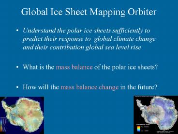
Global Ice Sheet Mapping Orbiter
- Understand the polar ice sheets sufficiently to
predict their response to global climate change
and their contribution global sea level rise - What is the mass balance of the polar ice sheets?
- How will the mass balance change in the future?
2
Mass Balance
- Ice sheet mass balance is described by the mass
continuity equation
Consistency between evaluations of the left and
right hand sides of the equation will yield a far
more reliable result
3
Ice Dynamics and Prediction
Force Balance Equations
Basal Drag (inferred)
Altimetry
Terms related to gradients in ice velocity
(InSAR) integrated over thickness
Understanding dynamics coupled with the
continuity equations yields predictions on future
changes in mass balance
4
Global Ice Thickness Mission
- Goal Measure glacier ice thickness from pole to
pole to - Determine total global volume of glaciers and ice
sheets - Estimate mass balance using ice thickness and
interferometrically derived ice velocity. - Determine basal boundary conditions from radar
reflectivity - Use ice thickness and other glaciologic data to
map derived stresses and stress gradients that
are components of the force balance equations. - Map internal structures (layers, bottom
crevasses, buried moraine bands, brine
infiltration layers) - Use spaceborne measurements of ice thickness and
other key glaciologic variables to predict
response of glaciers and ice sheets to changing
climate - Contribute technologies to planetary studies
understanding the phenomenology of radar sounding
5
Prioritized Science Requirements
- Measure ice thickness to an accuracy of 20 m or
better - Measure ice thickness every 1x1 km (airborne lt
250 m) - Measure ice thickness ranging from 100 m to 5 km
- Measure radar reflectivity from basal interfaces
(rel. 2 dB) - Obtain swath data for full 3-d mapping
- Measure internal layers to about 20 m elevation
accuracy - Pole to pole observations ice divides to ice
terminus - One time only measurement of ice thickness
- Repeat every 5-10 years for changes in basal
properties