
Latest Aerial Imagery PowerPoint PPT Presentations
All Time
Recommended

Industry Insights by Type (Vertical, Low Oblique and High Oblique), by Application (Surveillance and Monitoring, Geospatial, Conservation and Research, Construction and Development, Disaster Management, Exhibition and Entertainment, and Energy and Resource Management), by End User (Government, Civil Engineering and Archaeology, Defense, Energy and Mining, Media and Entertainment, Agriculture and Forestry, and Others)
| PowerPoint PPT presentation | free to download

Whipsmartmi.com describes potential business opportunities in the “Aerial Imaging Market”. The goal of the report is to estimate market, & future development
| PowerPoint PPT presentation | free to download

For everyone, high on the list of priorities organising a wedding is to find the best wedding photographer. Whatever the type of wedding you choose, capturing that special day in all its glory is priceless and an aspect of the day that should never be underrated. FotoZone, brings to its readers the Latest Wedding Photography Trends, hoping that we help you with only the best.
| PowerPoint PPT presentation | free to download
, the Unmanned Aerial Vehicle market was dominated by General Atomics (US), Northrop Grumman Corporation (US), Boeing (US),and DJI (China).
| PowerPoint PPT presentation | free to download

TBRC global geospatial imagery analytics market report includes agriculture, mining and manufacturing, defense and security, energy, insurance, other applications https://bit.ly/3yGxgTq
| PowerPoint PPT presentation | free to download

Title: PowerPoint Presentation Last modified by: jmahoney Created Date: 1/1/1601 12:00:00 AM Document presentation format: On-screen Show Other titles
| PowerPoint PPT presentation | free to download

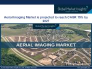
Aerial imaging market size is estimated to reach over USD 2.5 billion by 2022. Escalating demand from numerous application sectors such as commercial and forestry & agriculture is anticipated to drive the industry growth over the next few years.
| PowerPoint PPT presentation | free to download

... aerial photographs and spatial (GIS) data throughout the state of Florida. ... Imagery/ Base Maps/ Earth Cover. Inland Waters. Intelligence/ Military ...
| PowerPoint PPT presentation | free to view

Geospatial solutions collect, manage, organize, and store data pertaining to geographic information such as zip codes, addresses, or latitudinal and longitudinal coordinates to a location. This includes data accumulated by satellites, digital and analog maps, and street and aerial imagery. Some instances of geospatial solution technologies include Global Positioning Systems (GPS), Geographic Information Systems (GIS), imagery analysis, and remote sensing.
| PowerPoint PPT presentation | free to download

... (R,G,B) - Similar to Aerial Photography. Color infrared (NIR,R,G) False Colour ... Latest News ... higher resolution aerial photography is not necessary ...

Read here the latest updates on the " Imaging Technology Market Analysis " published by CMI team
| PowerPoint PPT presentation | free to view

Read here the latest updates on the " Smart Agriculture Solution Market Analysis " published by CMI team
| PowerPoint PPT presentation | free to view

Security and surveillance drones are the ideal tools for security and emergency responders to monitor a situation in real-time and respond as it happens. The high-definition imagery provided by security drones allows for accurate and real-time response. UAV/Drone security helps to minimize the risk significantly.
| PowerPoint PPT presentation | free to download
With the rapid increase in town planning, building infrastructure, energy & mining exploration, the aerial imaging market is predicted to witness notable traction in the coming years. Get sample copy of this research report @ https://www.gminsights.com/request-sample/detail/105
| PowerPoint PPT presentation | free to download

4th INTERNATIONAL CONFERENCE FOR FIRE CHIEFS IN THE CHEMICAL INDUSTRY The latest technologies being used by fire-fighters to pre-plan, train, and use in real time ...
| PowerPoint PPT presentation | free to download
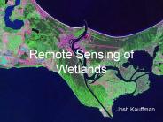
Remote Sensing of Wetlands Josh Kauffman Brief Outline Why study wetlands? Remote Sensing benefits/drawbacks The Landsat program Aerial Image Spectroscopy The future ...
| PowerPoint PPT presentation | free to download

The global powered agriculture market size reached USD 52.87 Billion in 2021 and is expected to register a revenue CAGR of 5.1% during the forecast period, according to latest analysis by Emergen Research. Increasing need for cost-effective farming and demand for better quality farming products and equipment are some key factors expected to support market revenue growth between 2022 and 2030.
| PowerPoint PPT presentation | free to download

The much awaited Seagull UAV is finally here! It is the most affordable and feature rich Sony MULTI camera controller on the market. Supports the latest Sony MULTI (Multiport) equipped cameras! More details please visit https://airsupply61.medium.com/switch-to-the-unmatchable-seagull-uav-for-high-quality-b70076450c73
| PowerPoint PPT presentation | free to download

Focused On Design Management * Components of Phase I Design Route Selection Feasibility Study of Maps, Aerial Photography and Literature Proposed Corridors Site Visit ...
| PowerPoint PPT presentation | free to view

Pilot studies for carbon stock determination in shifting cultivation areas ... Forest inventory started long ago, 1950s, with aerial photography in northern Vietnam ...
| PowerPoint PPT presentation | free to view

... performance, user-friendly interface for viewing and chipping streamed imagery. ... Save a chip' as a compliant NITF or GeoTIFF image at user-specified resolution ...
| PowerPoint PPT presentation | free to view

New developments in urban planning, urban landscape, real estate management, and so on, call for new demands for the 3D Object Model. The building models are the most important in the 3D object model. With the development of 3D data acquisition, the visualization aspect often is detail considered.
| PowerPoint PPT presentation | free to download

... complicated process of contracting several consultants to get the most out of your data. ... system and photogrammetric image processing workflow that ...
| PowerPoint PPT presentation | free to view

The roof installation process has undergone several changes with technological innovations. Moreover, the homeowners have been able to save a significant amount of money due to the technology of the roof installation process. Furthermore, the advancements are visible on the roofing materials as well.
| PowerPoint PPT presentation | free to download

In our PDF submission, we take a closer look at the Garmin GPSMAP 66i, a versatile satellite tracker that's revolutionizing the way outdoor enthusiasts navigate and communicate in remote areas. This GPSMAP 66i review highlights its exceptional features, making it the ultimate tool for adventurers, hikers, and explorers. With the Garmin GPSMAP 66i, you can experience peace of mind and stay connected even in the most isolated places. This satellite tracker combines top-notch GPS navigation with two-way messaging and an interactive SOS function, ensuring your safety and convenience during your outdoor escapades. Whether you're embarking on a backcountry hike or exploring remote areas, this innovative satellite tracker, featured in our submission, is the key to enhancing your outdoor adventures.
| PowerPoint PPT presentation | free to download

Market Size – USD 52.87 Billion in 2021, Market Growth – at a CAGR of 5.1%, Market Trends – Increasing integration of Geographic Information System software in agriculture
| PowerPoint PPT presentation | free to download

Title: NAIP Contract Process Subject: Federal contract process Author: Geoff Gabbott Last modified by: geoffrey.gabbott Document presentation format
| PowerPoint PPT presentation | free to download

The commercial drone market is poised to garner considerable growth through 2032 owing to the surging investments in drone technology by venture capital firms.
| PowerPoint PPT presentation | free to download

Real estate marketing is tough, with the competition renowned for being brutal. If you want to be successful in the business of real estate, then you need to get online to make the best first impression possible.
| PowerPoint PPT presentation | free to download

Corporate Leadership Council: Advocacy Agenda
| PowerPoint PPT presentation | free to view

Digital Maps Archives and Applications IChun Fan Institute of History and Philology Academia Sinica
| PowerPoint PPT presentation | free to view

Synthetic Aperture Radar Market is estimated to be USD 2.42 Billion in 2017 and is projected to reach USD 4.21 Billion by 2022, and at a CAGR of 11.75% during the forecast period.
| PowerPoint PPT presentation | free to download

Brian Maginnity August 2004 Are you being served ? Products (films, papers) for black & white photography Products (films, papers) for colour photography Technical ...
| PowerPoint PPT presentation | free to download

The Airborne Radars Market is estimated to grow from USD 15.8 billion in 2023 to USD 23.6 billion by 2028, at a CAGR of 8.3% from 2023 to 2028.
| PowerPoint PPT presentation | free to download

Application and logons were made available Sept 2004 ... Tsunami Damage Assessment. Process: Speckle reduction using Lee Sigma algorithm ...
| PowerPoint PPT presentation | free to view

Leveraging a Direct Readout Network To Provide Comprehensive, Near RealTime Data Products For Fire a
| PowerPoint PPT presentation | free to view

... the Philippine National Statistics Office uses 2-digit enumeration area code and maintains an Enumeration Area Reference Code (EARF) that is used for the conduct ...
| PowerPoint PPT presentation | free to download

Photogrammetry and Remote Sensing
| PowerPoint PPT presentation | free to view
Flat for sale in Dabolim - Find yourself indulging in some fine living at Adora De Goa. Lead a life that feels like a vacation at the Provident luxury affordable residential project in Goa. An affordable yet plush residence that embraces the true spirit of the state. 1 BHK Apartment in Goa, 2 BHK Flats in Goa, 3 BHK Flat in Dabolim, Flat for sale in Dabolim
| PowerPoint PPT presentation | free to download

How to be a Professional Data Collector. How to get the best accuracy possible ... Recreational Grade (Garmin, Magellian) Many claim to use WAAS for high accuracy ...
| PowerPoint PPT presentation | free to view

... News & E-Newsletter (Free publications) Clearinghouse (WALIS agency free data transfer facility) WA Atlas (Online map viewer: 400 datasets, ability to print maps) ...
| PowerPoint PPT presentation | free to download

Satellite Remote Sensing 1. Types of Remote Sensing Based on Source of Energy Platform 2. Types of Satellite 3. Types of Sensors 4. Limitations of Remote Sensing
| PowerPoint PPT presentation | free to download

Provide access to authentic geo-spatial records thro' web services and kiosks ... This Map based decision support system correlates incident reports and existing ...
| PowerPoint PPT presentation | free to view


From Reality 2010 to Future Vision 2020 Ray A. Williamson, rwilliamson@swfound.org Secure World Foundation * * * * * * Outline Vision 2020 My vision for 10 years ...
| PowerPoint PPT presentation | free to download

Challenges and Solutions for Digital Geospatial Data Preservation Jeff Essic Geospatial Data Service
| PowerPoint PPT presentation | free to download

Earth Observing, etc'
| PowerPoint PPT presentation | free to view


HyperSpectral Imaging HSI Support for GOESR HESCW Risk Reduction Activities
| PowerPoint PPT presentation | free to download

VIDEO DISPLAY HOST N. Functionality. Read bytes from a file. Convert into frames. Send out pipe ... VIDEO DISPLAY HOST 2. 8. COTS Middleware Components used. in ...
| PowerPoint PPT presentation | free to view
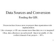
Feeding the GIS. Discussion here focuses more on projects than organization-wide implementation. Like a teenager, a GIS can consume more than data you ever imagined!
| PowerPoint PPT presentation | free to download

National Geographic. http://plasma.nationalgeographic.com/mapmachine ... National Geographic Map Links. http://www.nationalgeographic.com/maps/map_links.html ...
| PowerPoint PPT presentation | free to view

Chapter 8: Trends in DBMS 8.1 Database Support for Field Entities 8.2 Content-based Retrieval 8.3 Introduction to Spatial Data Warehouses 8.4 Summary
| PowerPoint PPT presentation | free to download
Video, i.e. time series of images. Audio data. Focus: Primarily images, ... 2. Do-it-yourself. Divide a raster data-item into smaller slices. Q? ...
| PowerPoint PPT presentation | free to download

Learn about structure of tropical protuberances & north wall of tropical IWV reservoir ... Tropical Protuberance Flight Strategy: The Figure-4 Dropsonde Pattern ...
| PowerPoint PPT presentation | free to download

Continuously Operating Reference Stations CORS
| PowerPoint PPT presentation | free to view